 Block
Gould, Oklahoma
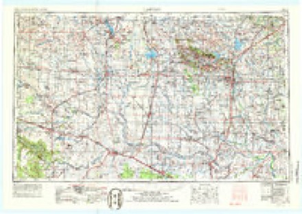
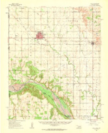
10 topographic sheets cover this place, the earliest surveyed in 1955 and the latest in 1985. It stands in the Gould census division. It lies in ZIP code area 73544. The Survey maps it on the Gould quadrangle. 103 people lived here at the 2020 count. It stands 1,631 feet above sea level.
On record in Gould
Buildings and businesses the archive holds for this place. Each opens its own page, with the source record it came from.
On the National Register 1 record
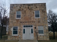 Gould Community Buildinglisted 2007
Population over time
2 figuresGould fell from 141 to 103 between 2010 and 2020. These are the recorded population figures Wikidata holds for this place, reached through the Geographic Names Information System number this page is keyed on rather than by name, so they belong to this place and not to another of the same name. Most are census counts, but not all are: an early figure may be a founding or settlement estimate, and an estimate published within five years of a census is left out. The change column is computed, and is left blank where more than 20 years separate a figure from the one before it, because a gap that long is not a change between two counts.
| Year | People | Change |
|---|---|---|
| 2010 | 141 | |
| 2020 | 103 | -38 (-27%) |
Topographic sheets covering this place
5 surveys from 10 printed sheetsMatched by testing this settlement's coordinate against the published boundary of every sheet in the United States Geological Survey's historical collection. Each opens the scanned sheet at the Survey.
- 1955 USGS Lawton quadrangle1:250000, 5 printings
- 1961 USGS Hollis quadrangle1:62500
- 1975 USGS Hollis NE quadrangle1:24000
- 1985 USGS Altus quadrangle1:100000, 2 printings
- 1985 USGS Gould quadrangle1:24000
Photographs
1 photograph, 1938Taken for the Office of War Information and the Farm Security Administration, who photographed the country between 1935 and 1944. Works of United States government photographers, with no known restriction on use. Each opens its catalogue record.
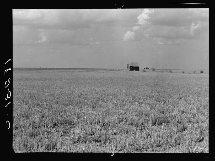
Lange, Dorothea, photographer, 1938. Library of Congress
Storms near this place
60 of 107 shownRegional context, not property-specific evidence. The National Weather Service names Gould in 107 storm reports between 1993 and 2026: 73 thunderstorm wind, 28 hail, 6 tornado. No death or injury is recorded in these reports. Each account below is quoted exactly as the forecast office filed it, from the NOAA Storm Events Database, and each date opens the federal record of that event.
| When | Event | Place named | Harm | What the report says |
|---|---|---|---|---|
| July 2015 | Thunderstorm Wind | Gould | $45,000 | Several sheds/carports lost their roofs. A camper shell and a boat were picked up and flipped. Several roofs were on the ground, porches were missing, trees were down, dumpsters were tipped over, and antennae were snapped. |
| April 2003 | Tornado (F1) | Gould | $30,000 | This is the final segment of the tornado that began in Hardeman County, Texas then moved northeast into extreme western Jackson County, Oklahoma before dissipating in Harmon County. The tornado caused F1 damage during this portion of the path. A farm located 10 miles south of Gould and 1 mile west of Highway 5 had five outbuildings destroyed and damaged the roof to a brick home. The tornado continued northeast and downed power lines along Highway 5 then dissipated approximately 1 mile east of Highway 5 at 1834 CST. |
| November 2024 | Tornado (EF1) | Gould | $15,000 | This tornado began south of Gould, along or just west of State Highway 5 and north of E1660 Road. The tornado moved to the north and then northwest, before dissipating just to the west of the city of Gould. Numerous power poles were snapped and broken along E1650 road, while several central pivot irrigation units sustained damage. |
| November 2024 | Tornado (EF1) | Gould | $5,000 | This tornado moved into southern Harmon County from far western Jackson County. Utility poles were snapped along and just north of the county line along State Highway 5. |
| April 2019 | Thunderstorm Wind | Gould | $5,000 | Power poles downed and outbuilding damage. Time estimated by radar. |
| June 1995 | Thunderstorm Wind | Gould | $5,000 | no account filed |
| May 1996 | Thunderstorm Wind | Gould | $200 | no account filed |
| July 2004 | Thunderstorm Wind | Gould | $100 | Elm tree limbs 9 to 10 inches in diameter were snapped off. |
| June 1997 | Thunderstorm Wind | Gould | $10 | Two-inch diameter tree limbs were blown from trees. |
| April 2026 | Thunderstorm Wind | Gould | - | Hollis (HOLL) Mesonet observation. |
| May 2024 | Thunderstorm Wind | Gould | - | Hollis (HOLL) Mesonet observation. |
| May 2024 | Tornado (EF0) | Gould | - | A few storm chasers observed a weak tornado southwest of Gould. This is believed to be a landspout tornado that developed under new updraft bases well south of the primary storm updraft. No damage is known to have occurred. |
| May 2024 | Hail | Gould | - | Hail size increased from ping pong ball to golf ball between 1718-1720 LST. |
| August 2023 | Thunderstorm Wind | Gould | - | Hollis (HOLL) Mesonet observation. |
| May 2022 | Thunderstorm Wind | Gould | - | Quality controlled by Mesonet staff, believed to be good data. |
| May 2019 | Tornado (EFU) | Gould | - | Multiple storm chasers observed a brief tornado estimated to be about 2 miles north-northeast of Gould. No damage was reported. |
| June 2019 | Thunderstorm Wind | Gould | - | Hollis mesonet site. |
| May 2018 | Thunderstorm Wind | Gould | - | Series of measured wind gusts of 58 to 81 mph between 7PM and 7:25PM (measured at 5 minute intervals). |
| July 2015 | Thunderstorm Wind | Gould | - | Around 8 stockade fence panels were blown down. Minor tree damage was also reported. |
| May 2015 | Thunderstorm Wind | Gould | - | No damage reported. |
| May 2015 | Thunderstorm Wind | Gould | - | Several trees blown down. |
| May 2013 | Thunderstorm Wind | Gould | - | Mesonet station at Hollis reported a gust to 69 mph. |
| May 2013 | Hail | Gould | - | Relayed by local media (Kswo). |
| April 2013 | Hail | Gould | - | No damage was reported. |
| June 2006 | Thunderstorm Wind | Gould | - | Wind gust was measured by the Oklahoma mesonet. |
| June 2006 | Thunderstorm Wind | Gould | - | Wind gust was measured by the Oklahoma mesonet. |
| May 2006 | Thunderstorm Wind | Gould | - | Wind gust was measured by the Oklahoma mesonet. |
| May 2006 | Thunderstorm Wind | Gould | - | Wind gust was measured by the Oklahoma mesonet. |
| May 2006 | Thunderstorm Wind | Gould | - | Wind gust was measured by the Oklahoma mesonet. |
| May 2005 | Hail | Gould | - | Pea to penny size hail was reported covering the ground. |
| June 2004 | Thunderstorm Wind | Gould | - | Wind was measured by the Oklahoma mesonet. |
| April 2003 | Thunderstorm Wind | Gould | - | Wind was measured by the Oklahoma mesonet. |
| April 2002 | Thunderstorm Wind | Gould | - | Wind was measured by the Oklahoma mesonet. |
| June 2002 | Thunderstorm Wind | Gould | - | Wind was measured by the Oklahoma mesonet. |
| June 2002 | Thunderstorm Wind | Gould | - | Wind was measured by the Oklahoma mesonet. |
| May 2001 | Thunderstorm Wind | Gould | - | Wind was measured by Oklahoma mesonet. |
| May 2001 | Thunderstorm Wind | Gould | - | Wind was measured by Oklahoma mesonet. |
| May 2001 | Thunderstorm Wind | Gould | - | Wind was measured by Oklahoma Mesonet. |
| May 2000 | Thunderstorm Wind | Gould | - | Measured by the Oklahoma mesonet. |
| July 1997 | Thunderstorm Wind | Gould | - | measured at the Oklahoma Mesonet site. |
| June 1997 | Thunderstorm Wind | Gould | - | measured at the Oklahoma Mesonet site |
| March 1997 | Thunderstorm Wind | Gould | - | measured at the Oklahoma Mesonet site |
| February 2023 | Thunderstorm Wind | Gould | - | no account filed |
| May 2022 | Thunderstorm Wind | Gould | - | no account filed |
| May 2022 | Thunderstorm Wind | Gould | - | no account filed |
| June 2022 | Thunderstorm Wind | Gould | - | no account filed |
| June 2022 | Thunderstorm Wind | Gould | - | no account filed |
| June 2022 | Thunderstorm Wind | Gould | - | no account filed |
| August 2021 | Thunderstorm Wind | Gould | - | no account filed |
| August 2021 | Thunderstorm Wind | Gould | - | no account filed |
| August 2021 | Thunderstorm Wind | Gould | - | no account filed |
| August 2020 | Thunderstorm Wind | Gould | - | no account filed |
| August 2020 | Thunderstorm Wind | Gould | - | no account filed |
| April 2020 | Thunderstorm Wind | Gould | - | no account filed |
| May 2019 | Thunderstorm Wind | Gould | - | no account filed |
| June 2019 | Thunderstorm Wind | Gould | - | no account filed |
| April 2019 | Hail | Gould | - | no account filed |
| April 2019 | Hail | Gould | - | no account filed |
| April 2019 | Hail | Gould | - | no account filed |
| April 2019 | Hail | Gould | - | no account filed |
Nearest settlements
The eight closest, with where each one stands in the county. Distances are straight-line, computed from the Geographic Names Information System coordinates.
Elsewhere
Matched on this settlement's Geographic Names Information System number rather than its name, so it cannot be a different place of the same name in another state.
| Wikipedia article on Gould | An encyclopaedic summary. Its text is share-alike, so it is linked here rather than copied. |
| Wikidata item Q267089 | The structured record the population and elevation above come from. Public domain (CC0). |
Provenance
This settlement is recorded in the Geographic Names Information System as feature 1093274. The sheet list is computed by point-in-boundary test against the United States Geological Survey's historical topographic inventory. Both are works of the United States government and carry no copyright under 17 U.S.C. 105.
Storms. NOAA National Centers for Environmental Information, Storm Events Database https://www.ncei.noaa.gov/stormevents/ A work of the United States government, no copyright under 17 U.S.C. 105. Narratives are quoted verbatim from the National Weather Service report and are not edited or summarised.