 Block
Hochatown, Oklahoma
15 topographic sheets cover this place, the earliest surveyed in 1902 and the latest in 1986. It stands in the Broken Bow census division. It lies in ZIP code area 74728. It stands on Stephens Gap Branch. The Survey maps it on the Old Glory Mountain quadrangle. 242 people lived here at the 2020 count. It stands 712 feet above sea level.
Topographic sheets covering this place
9 surveys from 15 printed sheetsMatched by testing this settlement's coordinate against the published boundary of every sheet in the United States Geological Survey's historical collection. Each opens the scanned sheet at the Survey.
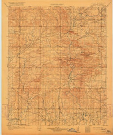
- 1902 USGS Lukfata quadrangle1:125000, 3 printings
- 1950 USGS Mcalester quadrangle1:250000, 2 printings
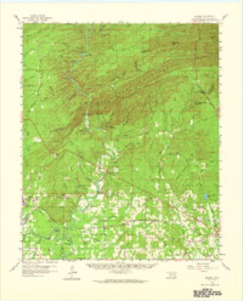
- 1959 USGS Golden quadrangle1:62500, 2 printings
- 1962 USGS Mc Alester quadrangle1:250000
- 1962 USGS McAlester quadrangle1:250000
- 1965 USGS Mc Alester quadrangle1:250000, 2 printings
- 1965 USGS McAlester quadrangle1:250000
- 1982 USGS Old Glory Mountain quadrangle1:24000
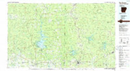
- 1986 USGS De Queen quadrangle1:100000, 2 printings
Fires near this place
376 since 1992Regional context, not property-specific evidence. The federal wildfire occurrence database lists 376 fires within 5 miles of Hochatown between 1992 and 2020, burning about 3,569 acres in total. 14 started naturally. 164 were recorded as arson. Distance is straight-line from the map coordinates, so a fire counted here may appear on a neighbouring settlement's page as well.
| Reported cause | Fires |
|---|---|
| Arson/incendiarism | 164 |
| Missing data/not specified/undetermined | 127 |
| Equipment and vehicle use | 26 |
| Debris and open burning | 22 |
| Natural | 14 |
| Recreation and ceremony | 9 |
| Smoking | 5 |
| Misuse of fire by a minor | 5 |
| Power generation/transmission/distribution | 3 |
| Railroad operations and maintenance | 1 |
The most recent of them, most recent first, with the day each was reported and the service that recorded it.
| Date | Cause | Size | Reported by | Name on the report |
|---|---|---|---|---|
| 9 September 2017 | Debris and open burning | 1.0 acres | Oklahoma Division of Forestry | not named |
| 9 September 2017 | Debris and open burning | 1.0 acres | Ouachita National Forest | EAGLE MOUNTAIN |
| 6 September 1995 | Arson/incendiarism | 2.0 acres | Talihina Agency | 0432 |
| 5 September 2014 | Missing data/not specified/undetermined | under an acre | Oklahoma Division of Forestry | not named |
| 4 September 2011 | Arson/incendiarism | under an acre | Oklahoma Division of Forestry | 10525 |
| 4 September 1995 | Missing data/not specified/undetermined | 12 acres | Oklahoma Division of Forestry | not named |
| 4 September 1995 | Missing data/not specified/undetermined | 10 acres | Oklahoma Division of Forestry | not named |
| 4 September 1995 | Missing data/not specified/undetermined | 4.0 acres | Oklahoma Division of Forestry | not named |
Settlements close enough to share some of these fires:
Storms near this place
50 since 1999Regional context, not property-specific evidence. The National Weather Service names Hochatown in 50 storm reports between 1999 and 2025: 22 hail, 17 thunderstorm wind, 8 flash flood, 2 tornado. The reports record 1 death and 1 injury. Each account below is quoted exactly as the forecast office filed it, from the NOAA Storm Events Database, and each date opens the federal record of that event.
| When | Event | Place named | Harm | What the report says |
|---|---|---|---|---|
| June 2023 | Thunderstorm Wind | Hochatown | 1 killed | A tree was downed onto an RV at Beavers Bend State Park, resulting in the fatality of a female occupant inside. |
| June 2024 | Thunderstorm Wind | Hochatown | 1 hurt | Tree downed onto a home in Hochatown, injuring one occupant. |
| April 2020 | Tornado (EF2) | Hochatown | $300,000 | An EF-2 tornado with estimated maximum winds near 125 mph touched down in a heavily wooded area along Union Valley Road, snapping and uprooting numerous trees. The tornado moved south southeast, tossing two barges over 100 yards and lifting a large portion of the roof deck of a home, causing it to collapse. The tornado then completely destroyed a single-wide manufactured home, with the base frame of the home twisted and tossed 100 yards to the east. Further to the south, another home sustained significant roof and structural damage when large gas tanks were tossed into it. The tornado then continued to snap numerous trees along Cascade Creek Road and along Wyr 20000 Road, as well as removing roofing material from another home on Union Valley Road. The tornado continued to track southeast across a heavily wooded area before crossing into Sevier County Arkansas. |
| May 2015 | Flash Flood | Hochatown | $100,000 | Water topped the Broken Bow Lake Dam southeast of Broken Bow Oklahoma. The water rapidly drained into the Mountain Fork River and the river quickly flowed out of its banks. The river completely surrounded a 2-story cabin, trapping 13 people inside including 3 children. First responders could not get to the occupants of the cabin due to the rapid nature of the water. The National Guard was called in to airlift the people out of the cabin. No injuries were reported. |
| July 2012 | Thunderstorm Wind | Hochatown | $20,000 | A tree was downed on a home in the Lake Pine Retreat area near Hochatown, Oklahoma. |
| November 2015 | Flash Flood | Hochatown | $10,000 | A truck was washed off a low water bridge crossing. The driver was able to escape and get to higher ground. |
| January 2025 | Flash Flood | Hochatown | - | Significant flooding occurred on Pickleberry Trail northwest of Hochatown. |
| May 2025 | Hail | Hochatown | - | A picture of quarter to half dollar size hail was posted to social media that fell along Sugarberry and Grape Trail southwest of Hochatown. |
| April 2025 | Flash Flood | Hochatown | - | Low water crossing of Lukfata Trail over Lukfata Creek under 3 to 5 feet of water. |
| April 2025 | Flash Flood | Hochatown | - | Low water crossing of Pickleberry Trail over Lukfata Creek under 3 to 5 feet of water. |
| February 2023 | Flash Flood | Hochatown | - | Numerous roads closed and several roads washed out with vehicles abandoned and swift water rescues needed across Northern McCurtain County. |
| March 2023 | Hail | Hochatown | - | Nickel size hail reported in the Tablerville community via social media. |
| March 2023 | Hail | Hochatown | - | Half dollar size hail reported in the Hochatown area. |
| March 2023 | Hail | Hochatown | - | Half dollar size hail reported near Broken Bow Reservoir in the Hochatown area. |
| September 2023 | Thunderstorm Wind | Hochatown | - | Trees downed along Highway 259A in Beavers Bend State Park. |
| April 2022 | Hail | Hochatown | - | Quarter size hail fell in the Hochatown community near Beavers Bend State Park. |
| May 2021 | Thunderstorm Wind | Hochatown | - | Several trees were blown down on Highway 259. |
| May 2021 | Flash Flood | Hochatown | - | Several roads were flooded in and around Hochatown State Park. Report from Park Rangers. |
| January 2020 | Flash Flood | Hochatown | - | Numerous roads were flooded and closed in and near Hochatown. |
| May 2019 | Thunderstorm Wind | Hochatown | - | Several trees were snapped and uprooted at Beavers Bend State Park in the Hochatown community. A NWS Storm Survey confirmed that this was the result of damaging straight line winds, as the trees were lying down in the same direction. |
| July 2019 | Thunderstorm Wind | Hochatown | - | Large tree limbs were downed near Hochatown. |
| May 2017 | Thunderstorm Wind | Hochatown | - | A large tree was blown down on Marina Lane near Beaver's Bend Marina. |
| April 2016 | Thunderstorm Wind | Hochatown | - | Several trees reported down on Stevens Gap Road in the Hochatown community. |
| August 2014 | Thunderstorm Wind | Hochatown | - | Trees were downed in Hochatown, Oklahoma. |
| July 2012 | Thunderstorm Wind | Hochatown | - | A tree was downed across a roadway near Broken Bow, Oklahoma. |
| April 2011 | Tornado (EF0) | Hochatown | - | The National Weather Service conducted a storm survey in McCurtain County Oklahoma and found evidence of an EF0 tornado near Hochatown. The tornado first touched down along Meadow Lake Drive in Beaver Bend State Park. Several trees were uprooted while others had their tops ripped out. The tornado continued east crossing Coyote Drive uprooting a few trees in a camping area. The tornado finally lifted along the shoreline of Lake Broken Bow. Maximum winds are estimated at 65-70 mph. |
| April 2011 | Hail | Hochatown | - | Quarter sized hail fell at the Beavers Bend State Park near Broken Bow Lake. |
| April 2011 | Hail | Hochatown | - | Another severe thunderstorm tracked across Beavers Bend State Park, producing quarter size hail near Broken Bow Lake. |
| April 2011 | Thunderstorm Wind | Hochatown | - | Several trees were reported down in the town of Hochatown at the Beavers Bend State Park. |
| May 2011 | Hail | Hochatown | - | Hail was reported at the Beavers Bend, Hochatown State Park. |
| February 2009 | Hail | Hochatown | - | Hail again was reported southwest of Hochatown, Oklahoma. |
| May 2009 | Flood | Hochatown | - | Broken Bow Lake in southeast Oklahoma crested at a pool stage of 627.3 feet on May 15th, just short of filling the flood pool and spilling across the emergency spillway of 627.5 feet. Broken Bow Lake also established a new pool stage record by besting the old mark of 626.3 feet set on April 6th, 2008. |
| February 2008 | Hail | Hochatown | - | A trained spotter reported golfball sized hail 7 miles north of Broken Bow, Oklahoma. |
| February 2008 | Thunderstorm Wind | Hochatown | - | A trained spotter reported a wind gust of 63 mph associated with a thunderstorm. The gust was measured with a hand-held anemometer. |
| May 2008 | Hail | Hochatown | - | Hail fell at the Houchatown State Park along the southern end of Broken Bow Lake. |
| August 2008 | Hail | Hochatown | - | Hail reported at the Hochatown State Park. |
| April 2007 | Hail | Hochatown | - | Hail fell at the state park. |
| April 2007 | Thunderstorm Wind | Hochatown | - | Winds estimated at the state park. |
| March 2007 | Hail | Hochatown | - | Hail fell on the southwest side of Broken Bow Lake. |
| March 2007 | Hail | Hochatown | - | Hail fell near Broken Bow Lake. |
| June 2004 | Thunderstorm Wind | Hochatown | - | Trees downed. |
| June 2001 | Thunderstorm Wind | Hochatown | - | Numerous trees toppled in Beaver Bend State Park. |
| May 1999 | Thunderstorm Wind | Hochatown | - | Wind speed measured by storm spotter. |
| June 2011 | Hail | Hochatown | - | no account filed |
| March 2008 | Hail | Hochatown | - | no account filed |
| January 2006 | Hail | Hochatown | - | no account filed |
| June 2006 | Hail | Hochatown | - | no account filed |
| June 2005 | Hail | Hochatown | - | no account filed |
| May 2003 | Hail | Hochatown | - | no account filed |
| April 1999 | Hail | Hochatown | - | no account filed |
Nearest settlements
The eight closest, with where each one stands in the county. Distances are straight-line, computed from the Geographic Names Information System coordinates.
| Map | Place | Distance | Sheets |
|---|---|---|---|
| Stephens Gap | 2.8 miles | 16 | |
| Steel Junction | 7.8 miles | 15 | |
| North Pole | 8.4 miles | 15 | |
| Broken Bow | 8.5 miles | 17 | |
| Oak Hill | 8.9 miles | 15 | |
| Glover | 9.6 miles | 15 | |
| Tiner | 9.9 miles | 17 | |
| Mount Herman | 11.1 miles | 19 |
Elsewhere
Matched on this settlement's Geographic Names Information System number rather than its name, so it cannot be a different place of the same name in another state.
| Wikipedia article on Hochatown | An encyclopaedic summary. Its text is share-alike, so it is linked here rather than copied. |
| Wikidata item Q18153027 | The structured record the population and elevation above come from. Public domain (CC0). |
Provenance
This settlement is recorded in the Geographic Names Information System as feature 1093810. The sheet list is computed by point-in-boundary test against the United States Geological Survey's historical topographic inventory. Both are works of the United States government and carry no copyright under 17 U.S.C. 105.
Wildfire. Short, Karen C. 2022. Spatial wildfire occurrence data for the United States, 1992-2020 [FPA_FOD_20221014]. 6th Edition. Fort Collins, CO: Forest Service Research Data Archive. https://doi.org/10.2737/RDS-2013-0009.6 Collected with United States Government funding and usable without additional permissions or fees.
Storms. NOAA National Centers for Environmental Information, Storm Events Database https://www.ncei.noaa.gov/stormevents/ A work of the United States government, no copyright under 17 U.S.C. 105. Narratives are quoted verbatim from the National Weather Service report and are not edited or summarised.