 Block
Holly Creek, Oklahoma
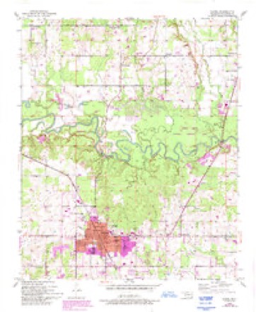
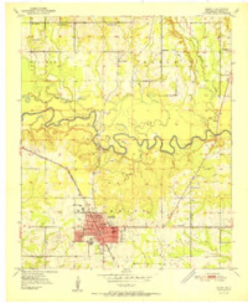
12 topographic sheets cover this place, the earliest surveyed in 1950 and the latest in 1990. It stands in the Broken Bow census division. It lies in ZIP code area 74728. The Survey maps it on the Idabel quadrangle.
Topographic sheets covering this place
6 surveys from 12 printed sheetsMatched by testing this settlement's coordinate against the published boundary of every sheet in the United States Geological Survey's historical collection. Each opens the scanned sheet at the Survey.
- 1950 USGS Idabel quadrangle1:24000, 3 printings
- 1951 USGS Idabel quadrangle1:24000, 2 printings
- 1953 USGS Texarkana quadrangle1:250000, 4 printings
- 1956 USGS Texarkana quadrangle1:250000
- 1986 USGS Idabel quadrangle1:100000
- 1990 USGS Idabel quadrangle1:100000
Fires near this place
297 since 1992Regional context, not property-specific evidence. The federal wildfire occurrence database lists 297 fires within 5 miles of Holly Creek between 1992 and 2020, burning about 1,844 acres in total. 13 started naturally. 106 were recorded as arson. Distance is straight-line from the map coordinates, so a fire counted here may appear on a neighbouring settlement's page as well.
| Reported cause | Fires |
|---|---|
| Arson/incendiarism | 106 |
| Missing data/not specified/undetermined | 76 |
| Debris and open burning | 61 |
| Equipment and vehicle use | 28 |
| Natural | 13 |
| Smoking | 5 |
| Misuse of fire by a minor | 4 |
| Recreation and ceremony | 3 |
| Railroad operations and maintenance | 1 |
The most recent of them, most recent first, with the day each was reported and the service that recorded it.
| Date | Cause | Size | Reported by | Name on the report |
|---|---|---|---|---|
| 9 September 2005 | Missing data/not specified/undetermined | under an acre | Talihina Agency | T BO JONES |
| 9 September 2005 | Arson/incendiarism | under an acre | Talihina Agency | SE496 |
| 8 September 2011 | Arson/incendiarism | 11 acres | Oklahoma Division of Forestry | 10542 |
| 8 September 2005 | Arson/incendiarism | under an acre | Talihina Agency | SE492 |
| 7 September 2017 | Arson/incendiarism | under an acre | Oklahoma Division of Forestry | not named |
| 7 September 2011 | Arson/incendiarism | 9.0 acres | Oklahoma Division of Forestry | 10538 |
| 7 September 2011 | Arson/incendiarism | under an acre | Oklahoma Division of Forestry | 10534 |
| 7 September 1999 | Arson/incendiarism | under an acre | Talihina Agency | 49 |
Settlements close enough to share some of these fires:
Mines and quarries near this place
10 of 16 shownRegional context, not property-specific evidence. The federal mineral resources record lists 16 workings within 5 miles of Holly Creek: 13 past producers, 3 producers. 3 still produce. What was taken out: Sand and Gravel, Construction, Stone, Crushed/Broken. Distance is straight-line from the map coordinates, so a quarry counted here may appear on a neighbouring settlement's page as well.
| Where | Site | Commodity | Status | Recorded |
|---|---|---|---|---|
| Idabel Plant | Stone, Crushed/Broken | Producer | ||
| Quality Rocks Inc Limestone Pit | Stone, Crushed/Broken | Producer | ||
| Unknown Limestone Pit | Stone, Crushed/Broken | Past Producer | ||
| Unknown Limestone Pit | Stone, Crushed/Broken | Past Producer | ||
| Unknown Limestone Pit | Stone, Crushed/Broken | Past Producer | ||
| Unknown Gravel Pit | Sand and Gravel, Construction | Past Producer | ||
| Unknown Gravel Pit | Sand and Gravel, Construction | Past Producer | ||
| Unknown Gravel Pit | Sand and Gravel, Construction | Past Producer | ||
| Unknown Gravel Pit | Sand and Gravel, Construction | Past Producer | ||
| Unknown Gravel Pit | Sand and Gravel, Construction | Past Producer |
Storms near this place
16 since 2003Regional context, not property-specific evidence. The National Weather Service names Holly Creek in 16 storm reports between 2003 and 2026: 6 hail, 4 flash flood, 4 thunderstorm wind, 2 tornado. The reports record 1 death. Each account below is quoted exactly as the forecast office filed it, from the NOAA Storm Events Database, and each date opens the federal record of that event.
| When | Event | Place named | Harm | What the report says |
|---|---|---|---|---|
| March 2016 | Flash Flood | Holly Creek | 1 killed | A 30 year old male drowned after his SUV drove through a low water crossing and was swept into a flooded Lukfata Creek on Tebo Jones Road south of Broken Bow. A 36 year old male passenger was able to exit the vehicle and swim to shore. |
| April 2008 | Flash Flood | Holly Creek | $10,000 | Half of a bridge was washed out on Old Military Road at Holly Creek. |
| March 2026 | Thunderstorm Wind | Holly Creek | - | A camper RV was flipped with occupants inside in the Holly Creek area between Garvin and Broken Bow along with a few homes damaged in the area. No injuries were reported. |
| May 2025 | Thunderstorm Wind | Holly Creek | - | A tree fell onto a home in the Holly Creek community. A resident cut her head while exiting the home. |
| November 2024 | Tornado (EF1) | Holly Creek | - | An EF-1 tornado with estimated maximum winds near 93 mph touched down several miles northeast of Idabel near the Little River. Storm chaser video confirmed that this weak tornado began just north of the Little River west of Highway 70 in an area of inaccessible terrain. The tornado traveled north-northeast and snapped the trunk of a hardwood tree along Tebo Jones Road, where it continued northeast, crossing Wood Turtle Lane, and downed a few large limbs along Rodeo Road before lifting just south of Bait Shop Road. |
| March 2019 | Hail | Holly Creek | - | The Holly Creek Fire Department reported quarter size hail in the Holly Creek community. |
| June 2019 | Hail | Holly Creek | - | Half dollar size hail fell just south of Broken Bow. |
| September 2019 | Flash Flood | Holly Creek | - | Tebo Jones Road southwest of Broken Bow was flooded and closed. |
| March 2015 | Hail | Holly Creek | - | Nickel size hail was reported 5 miles west southwest of Broken Bow, Oklahoma. |
| May 2015 | Thunderstorm Wind | Holly Creek | - | Trees were downed along Belpine Loop Road between Idabel and Broken Bow. |
| July 2013 | Flash Flood | Holly Creek | - | Tebo Jones Road just south of Broken Bow was barricaded and closed from heavy rainfall. |
| June 2011 | Thunderstorm Wind | Holly Creek | - | Powerlines were downed in the Holly Creek community. |
| April 2011 | Tornado (EF0) | Holly Creek | - | Multiple trees were snapped along a 9 mile track just south and east of Broken Bow, Oklahoma. A tornado touched down 5 miles southwest of Broken Bow and continued northeast crossing Hwy. 70 one mile south of Broken Bow. The storm then continued northeast ending approximately 4 miles east of Broken Bow on Hwy. 70. Damage consisted of mainly trees being snapped and uprooted. Winds were estimated at 75-85 mph. |
| December 2007 | Hail | Holly Creek | - | Penny size hail fell on the southwest side of Broken Bow, Oklahoma. |
| August 2003 | Hail | Holly Creek | - | no account filed |
| May 2003 | Hail | Holly Creek | - | no account filed |
Nearest settlements
The eight closest, with where each one stands in the county. Distances are straight-line, computed from the Geographic Names Information System coordinates.
| Map | Place | Distance | Sheets |
|---|---|---|---|
| Crossroads | 1.4 miles | 12 | |
| Hill Chapel | 3.7 miles | 11 | |
| Oak Hill | 4.4 miles | 15 | |
| Steel Junction | 4.8 miles | 15 | |
| Broken Bow | 5.4 miles | 17 | |
| Idabel | 5.7 miles | 12 | |
| Golden | 5.7 miles | 15 | |
| Garvin | 6.9 miles | 9 |
Provenance
This settlement is recorded in the Geographic Names Information System as feature 1101467. The sheet list is computed by point-in-boundary test against the United States Geological Survey's historical topographic inventory. Both are works of the United States government and carry no copyright under 17 U.S.C. 105.
Wildfire. Short, Karen C. 2022. Spatial wildfire occurrence data for the United States, 1992-2020 [FPA_FOD_20221014]. 6th Edition. Fort Collins, CO: Forest Service Research Data Archive. https://doi.org/10.2737/RDS-2013-0009.6 Collected with United States Government funding and usable without additional permissions or fees.
Mines and quarries. USGS Mineral Resources Data System (MRDS) https://mrdata.usgs.gov/mrds/ A work of the United States government, no copyright under 17 U.S.C. 105.
Storms. NOAA National Centers for Environmental Information, Storm Events Database https://www.ncei.noaa.gov/stormevents/ A work of the United States government, no copyright under 17 U.S.C. 105. Narratives are quoted verbatim from the National Weather Service report and are not edited or summarised.