 Block
Wilburton, Oklahoma
15 topographic sheets cover this place, the earliest surveyed in 1901 and the latest in 1991. It stands in the Wilburton census division. It lies in ZIP code area 74578. It stands on Cunneo Tubby Creek. The Survey maps it on the Wilburton quadrangle. 2,285 people lived here at the 2020 count. It stands 659 feet above sea level.
Research this city
On record in Wilburton
Buildings and businesses the archive holds for this place. Each opens its own page, with the source record it came from.
On the National Register 12 records
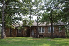 Administration Buildinglisted 2010
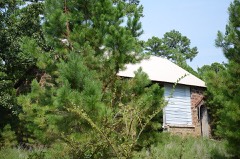 Ash Creek Schoollisted 1988
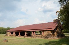 Colony Park Pavilionlisted 1988
 Mitchell Halllisted 1980
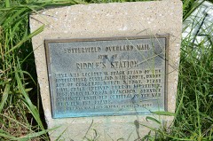 Riddle's Station Sitelisted 1972
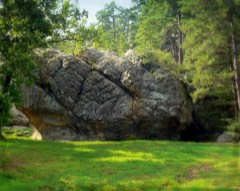 Robbers Cave State Parklisted 2002
 Rosenstein Buildinglisted 1980
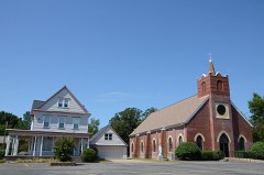 Sacred Heart Catholic Church and Rectorylisted 1980
- Bowers Schoollisted 1988
- Degnan Schoollisted 1988
- Great Western Coal and Coke Company Buildinglisted 1980
- Great Western Coal and Coke Company Mine No. 3listed 1980
Population over time
2 figuresWilburton fell from 2,843 to 2,285 between 2010 and 2020. These are the recorded population figures Wikidata holds for this place, reached through the Geographic Names Information System number this page is keyed on rather than by name, so they belong to this place and not to another of the same name. Most are census counts, but not all are: an early figure may be a founding or settlement estimate, and an estimate published within five years of a census is left out. The change column is computed, and is left blank where more than 20 years separate a figure from the one before it, because a gap that long is not a change between two counts.
| Year | People | Change |
|---|---|---|
| 2010 | 2,843 | |
| 2020 | 2,285 | -558 (-20%) |
Topographic sheets covering this place
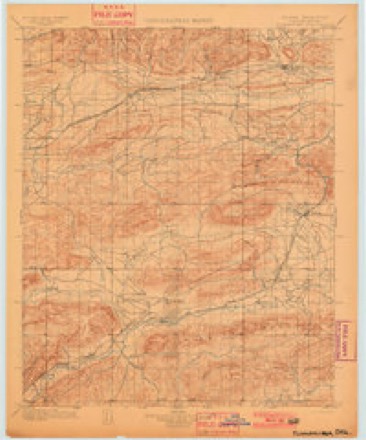
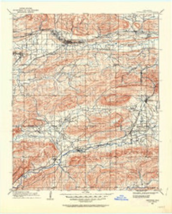
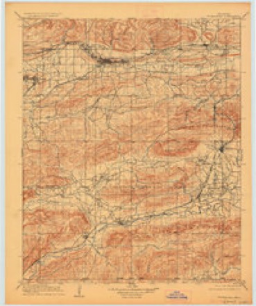
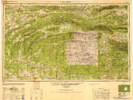
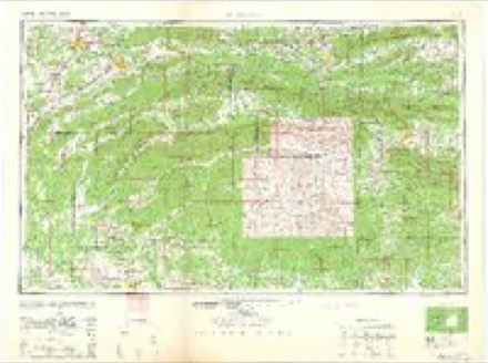
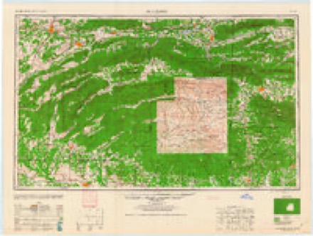
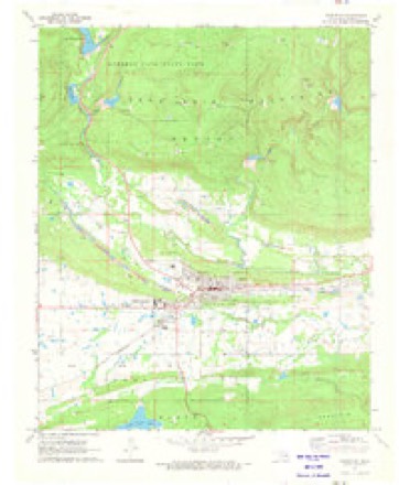
11 surveys from 15 printed sheetsMatched by testing this settlement's coordinate against the published boundary of every sheet in the United States Geological Survey's historical collection. Each opens the scanned sheet at the Survey.
- 1901 USGS Tuskahoma quadrangle1:125000
- 1908 USGS Tuskahoma quadrangle1:125000
- 1909 USGS Tuskahoma quadrangle1:125000, 3 printings
- 1950 USGS Mcalester quadrangle1:250000, 2 printings
- 1962 USGS Mc Alester quadrangle1:250000
- 1962 USGS McAlester quadrangle1:250000
- 1965 USGS Mc Alester quadrangle1:250000, 2 printings
- 1965 USGS McAlester quadrangle1:250000
- 1971 USGS Wilburton quadrangle1:24000
- 1977 USGS Wilburton quadrangle1:24000
- 1991 USGS Mc Alester quadrangle1:100000

Fires near this place
371 since 1992Regional context, not property-specific evidence. The federal wildfire occurrence database lists 371 fires within 5 miles of Wilburton between 1992 and 2020, burning about 8,349 acres in total. 6 started naturally. 139 were recorded as arson. Distance is straight-line from the map coordinates, so a fire counted here may appear on a neighbouring settlement's page as well.
| Reported cause | Fires |
|---|---|
| Arson/incendiarism | 139 |
| Missing data/not specified/undetermined | 106 |
| Debris and open burning | 80 |
| Equipment and vehicle use | 14 |
| Recreation and ceremony | 11 |
| Railroad operations and maintenance | 6 |
| Natural | 6 |
| Misuse of fire by a minor | 5 |
| Smoking | 4 |
The most recent of them, most recent first, with the day each was reported and the service that recorded it.
| Date | Cause | Size | Reported by | Name on the report |
|---|---|---|---|---|
| 7 September 2002 | Debris and open burning | under an acre | Oklahoma Division of Forestry | not named |
| 30 September 2005 | Arson/incendiarism | 10 acres | Oklahoma Division of Forestry | 20431 |
| 29 September 1994 | Missing data/not specified/undetermined | 13 acres | Oklahoma Division of Forestry | not named |
| 28 September 2016 | Missing data/not specified/undetermined | under an acre | Oklahoma Division of Forestry | not named |
| 28 September 2002 | Misuse of fire by a minor | 8.0 acres | Oklahoma Division of Forestry | not named |
| 27 September 2004 | Arson/incendiarism | 93 acres | Oklahoma Division of Forestry | 20373 |
| 23 September 2017 | Debris and open burning | 1.0 acres | Oklahoma Division of Forestry | not named |
| 23 September 2005 | Arson/incendiarism | 80 acres | Oklahoma Division of Forestry | 20428 |
Settlements close enough to share some of these fires:
Mines and quarries near this place
2 within 5 milesRegional context, not property-specific evidence. The federal mineral resources record lists 2 workings within 5 miles of Wilburton: 2 past producers. None of them still produces. What was taken out: Flagstone. Distance is straight-line from the map coordinates, so a quarry counted here may appear on a neighbouring settlement's page as well.
| Where | Site | Commodity | Status | Recorded |
|---|---|---|---|---|
| Unknown Sandstone Pit | Flagstone | Past Producer | ||
| Unknown Sandstone Pit | Flagstone | Past Producer |
Storms near this place
60 of 136 shownRegional context, not property-specific evidence. The National Weather Service names Wilburton in 136 storm reports between 1993 and 2025: 60 hail, 54 thunderstorm wind, 18 flash flood, 3 tornado. No death or injury is recorded in these reports. Each account below is quoted exactly as the forecast office filed it, from the NOAA Storm Events Database, and each date opens the federal record of that event.
| When | Event | Place named | Harm | What the report says |
|---|---|---|---|---|
| January 2000 | Thunderstorm Wind | Wilburton | $80,000 | Thunderstorm winds damaged several buildings and blew down trees across a large part of eastern Latimer County between Wilburton and Red Oak including the community of Cravens.One business in Wilburton known as The Auction House had its roof blown off and a few neighboring businesses had their plate glass windows broken. Throughout the county one mobile home and three barns were destroyed and five mobile homes and twelve barns were damaged. Numerous trees were blown down onto roads throughout the east part of the county including in the cities of Wilburton and Red Oak. |
| April 2000 | Hail | Wilburton | $50,000 | Baseball size hail fell and damaged several cars and roofs. |
| June 1999 | Thunderstorm Wind | Wilburton | $50,000 | A small-scale microburst in Wilburton caused minor damage to 20 homes and nine businesses. Two commercial buildings sustained major damage. This includes roofs that were blown off of a laundromat on OK Hwy 2 North and the Wilburton Veterans of Foreign Wars Building. Many trees were uprooted, and many power lines were blown down by the high winds. |
| April 2009 | Hail | Wilburton | $50,000 | no account filed |
| November 1998 | Thunderstorm Wind | Wilburton | $30,000 | A barn was nearly destroyed and two mobile homes were damaged just south of Wilburton. Power poles were blown down in the vicinity of US Hwy 270 and Arkla Road. Downed limbs and trees had to be removed from streets in Wilburton. The Wilburton Pizza Hut caught fire 30 minutes following the storm, though it is unknown if the fire is related to the storm. |
| April 2022 | Thunderstorm Wind | Wilburton | $25,000 | A shallow vortex, known as a gustnado, developed along the leading edge of thunderstorm outflow and damaged the roof of a church, snapped large tree limbs, and blew down a power pole. This vortex was recorded by a security camera. |
| June 2007 | Hail | Wilburton | $25,000 | no account filed |
| July 2002 | Lightning | Wilburton | $20,000 | Lightning struck a home and started a fire in the attic. Heavy smoke and water damage were common throughout the home. Six firefighters suffered heat exhaustion and smoke inhalation and two were admitted to the hospital. |
| September 2001 | Flash Flood | Wilburton | $20,000 | Heavy thunderstorm rains caused major street flooding which stalled and stranded several vehicles. Later in the evening water from an overflowing stream surrounded a house at the depth of two feet. |
| May 1997 | Tornado (F1) | Wilburton | $15,000 | no account filed |
| July 2006 | Thunderstorm Wind | Wilburton | $10,000 | Thunderstorm winds estimated at 70 miles an hour blew the canopy off a gas station and blew down numerous trees. |
| June 2005 | Thunderstorm Wind | Wilburton | $10,000 | Thunderstorm winds estimated at 60 miles an hour blew down power lines. |
| June 2023 | Thunderstorm Wind | Wilburton | $5,000 | Strong thunderstorm wind blew down several light poles, and snapped large tree limbs. |
| April 2012 | Thunderstorm Wind | Wilburton | $5,000 | Strong thunderstorm wind blew down several trees and power lines. |
| April 2004 | Thunderstorm Wind | Wilburton | $5,000 | Thunderstorm winds estimated at 60 miles an hour did some minor damage to roofs of a few houses and damaged some tin attached to barns. |
| June 2004 | Thunderstorm Wind | Wilburton | $5,000 | Thunderstorm winds estimated at 70 miles an hour blew down trees and power lines. |
| June 2003 | Thunderstorm Wind | Wilburton | $5,000 | Thunderstorm winds estimated at 70 miles an hour blew sheet metal off the roof of a barn near a rural residence west of Wilburton. |
| May 2001 | Thunderstorm Wind | Wilburton | $3,000 | A trained spotter reported a 70 mile an hour wind gust with what appeared to be a rear flank downdraft associated with a supercell thunderstorm. Damage to power poles and street signs was observed. |
| June 1996 | Thunderstorm Wind | Wilburton | $3,000 | no account filed |
| April 2020 | Thunderstorm Wind | Wilburton | $2,000 | Strong thunderstorm wind uprooted a tree and blew the roof from a carport. |
| July 2016 | Thunderstorm Wind | Wilburton | $2,000 | Strong thunderstorm wind blew down trees and power lines west of town. |
| May 2015 | Thunderstorm Wind | Wilburton | $2,000 | Numerous trees and some power lines were blown down by strong thunderstorm wind. |
| October 1997 | Thunderstorm Wind | Wilburton | $2,000 | no account filed |
| August 2006 | Thunderstorm Wind | Wilburton | $1,000 | Thunderstorm winds estimated at 60 miles an hour blew down power lines. The city of Wilburton was without power. |
| April 2003 | Thunderstorm Wind | Wilburton | $1,000 | Thunderstorm winds estimated at 60 miles an hour blew over a large fuel tank at Robbers Cave State Park. |
| May 2002 | Thunderstorm Wind | Wilburton | $1,000 | Thunderstorm winds estimated at 70 miles an hour blew a tree and power pole down. |
| April 2000 | Thunderstorm Wind | Wilburton | $500 | Thunderstorm winds blew several trees down. |
| April 1999 | Thunderstorm Wind | Wilburton | $500 | Several trees were blown down in Wilburton. |
| March 1998 | Thunderstorm Wind | Wilburton | $500 | Tree limbs down on power lines |
| May 1999 | Thunderstorm Wind | Wilburton | $200 | Numerous tree limbs were blown down in Robbers Cave State Park. |
| February 2001 | Thunderstorm Wind | Wilburton | $100 | Thunderstorm winds blew down a large sign. |
| May 2001 | Thunderstorm Wind | Wilburton | $100 | Thunderstorm winds blew down several large tree limbs at Robbers Cave State Park. |
| May 2001 | Thunderstorm Wind | Wilburton | $100 | Thunderstorm winds blew down trees. |
| May 2001 | Thunderstorm Wind | Wilburton | $100 | Thunderstorm winds blew down a large tree. |
| December 1999 | Thunderstorm Wind | Wilburton | $100 | Thunderstorm winds blew a tree down. |
| May 1997 | Thunderstorm Wind | Wilburton | $100 | no account filed |
| May 1997 | Thunderstorm Wind | Wilburton | $100 | no account filed |
| October 1997 | Thunderstorm Wind | Wilburton | $100 | no account filed |
| June 1996 | Thunderstorm Wind | Wilburton | $100 | no account filed |
| May 2025 | Flash Flood | Wilburton | - | Highway 270 was closed between Highway 2 and Highway 271 due to flooding. |
| July 2020 | Thunderstorm Wind | Wilburton | - | Strong thunderstorm wind snapped large tree limbs. |
| June 2017 | Thunderstorm Wind | Wilburton | - | Thunderstorm wind gusts were measured to 65 mph. |
| June 2017 | Flash Flood | Wilburton | - | Portions of several roads were flooded in Wilburton and Panola. |
| July 2016 | Thunderstorm Wind | Wilburton | - | Strong thunderstorm wind blew down numerous large tree limbs. |
| March 2012 | Flash Flood | Wilburton | - | Very heavy rainfall resulted in numerous roads becoming flooded across the western portion of the county. |
| June 2012 | Thunderstorm Wind | Wilburton | - | Strong thunderstorm wind blew down trees and large tree limbs on the west side of town. |
| May 2011 | Flash Flood | Wilburton | - | Law enforcement reported several roads across the county were closed due to high water. |
| March 2008 | Flash Flood | Wilburton | - | Heavy rain caused water to flow over Highway 270 east of Wilburton. In addition, secondary roads were flooded across a large part of the county. |
| March 2008 | Flash Flood | Wilburton | - | Heavy rain caused several roads across the northern part of Latimer County to be closed due to high water. |
| May 2008 | Tornado (EF0) | Wilburton | - | A storm chaser filmed a tornado northwest of town. It occurred in a remote area of the county, and thus a ground survey could not be conducted. |
| June 2007 | Flash Flood | Wilburton | - | Heavy thunderstorms rains caused a few roads in and around Wilburton to be flooded. |
| July 2007 | Flash Flood | Wilburton | - | Heavy rain caused several secondary roads in the vicinity of Wilburton to be flooded and impassable. |
| May 2007 | Flash Flood | Wilburton | - | Heavy thunderstorm rains caused a county road to be flooded. |
| April 2005 | Hail | Wilburton | - | Nickel size hail fell at Robber's Cave State Park. |
| June 2005 | Thunderstorm Wind | Wilburton | - | Thunderstorm winds estimated at 70 miles an hour blew down trees at Robbers Cave State Park. |
| March 2004 | Thunderstorm Wind | Wilburton | - | Thunderstorm winds estimated at 70 miles an hour blew down a tree. |
| June 2004 | Thunderstorm Wind | Wilburton | - | The Oklahoma mesonet site near Wilburton recorded a 63 mile an hour wind gust. |
| June 2004 | Thunderstorm Wind | Wilburton | - | Thunderstorm winds estimated at 60 miles an hour blew large tree limbs down. |
| May 2003 | Hail | Wilburton | - | Baseball size hail fell in Wilburton. Damage was done to roofs, windows and cars. An estimate of the dollar amount of the damage was unavailable. |
| May 2003 | Thunderstorm Wind | Wilburton | - | Thunderstorm winds estimated at 60 miles an hour blew down several large tree limbs. |
Nearest settlements
The eight closest, with where each one stands in the county. Distances are straight-line, computed from the Geographic Names Information System coordinates.
Elsewhere
Matched on this settlement's Geographic Names Information System number rather than its name, so it cannot be a different place of the same name in another state.
| Wikipedia article on Wilburton | An encyclopaedic summary. Its text is share-alike, so it is linked here rather than copied. |
| Wikidata item Q2740499 | The structured record the population and elevation above come from. Public domain (CC0). |
Provenance
This settlement is recorded in the Geographic Names Information System as feature 1099754. The sheet list is computed by point-in-boundary test against the United States Geological Survey's historical topographic inventory. Both are works of the United States government and carry no copyright under 17 U.S.C. 105.
Wildfire. Short, Karen C. 2022. Spatial wildfire occurrence data for the United States, 1992-2020 [FPA_FOD_20221014]. 6th Edition. Fort Collins, CO: Forest Service Research Data Archive. https://doi.org/10.2737/RDS-2013-0009.6 Collected with United States Government funding and usable without additional permissions or fees.
Mines and quarries. USGS Mineral Resources Data System (MRDS) https://mrdata.usgs.gov/mrds/ A work of the United States government, no copyright under 17 U.S.C. 105.
Storms. NOAA National Centers for Environmental Information, Storm Events Database https://www.ncei.noaa.gov/stormevents/ A work of the United States government, no copyright under 17 U.S.C. 105. Narratives are quoted verbatim from the National Weather Service report and are not edited or summarised.