 Block
From the record
One of 19 National Register listings published here for Rogers County · listed in 1982 · category: Building.
Sources: the case file at the National Archives · the National Register database, National Park Service
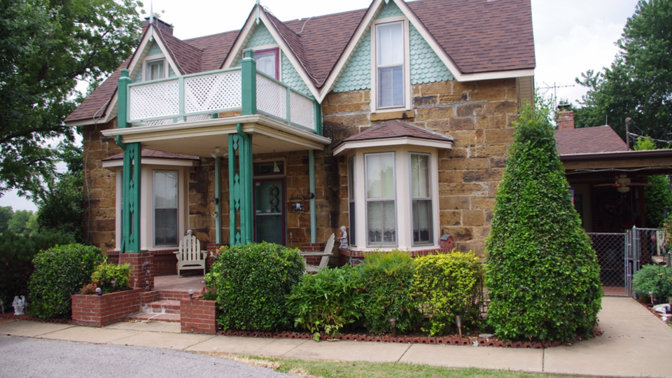
Listed on the National Register of Historic Places in 1982.
One of 19 National Register listings published here for Rogers County · listed in 1982 · category: Building.
Sources: the case file at the National Archives · the National Register database, National Park Service
Regional context, not property-specific evidence. The federal mineral resources record lists 24 workings within 5 miles of Hanes Home: 24 past producers. None of them still produces. What was taken out: Sand and Gravel, Construction, Stone, Crushed/Broken. Distance is straight-line from the map coordinates, so a quarry counted here may appear on a neighbouring settlement's page as well.
| Where | Site | Commodity | Status | Recorded |
|---|---|---|---|---|
| Unknown Limestone Pit | Stone, Crushed/Broken | Past Producer | ||
| Unknown Gravel Pit | Sand and Gravel, Construction | Past Producer | ||
| Unknown Gravel Pit | Sand and Gravel, Construction | Past Producer | ||
| Unknown Gravel Pit | Sand and Gravel, Construction | Past Producer | ||
| Unknown Gravel Pit | Sand and Gravel, Construction | Past Producer | ||
| Unknown Gravel Pit | Sand and Gravel, Construction | Past Producer | ||
| Unknown Gravel Pit | Sand and Gravel, Construction | Past Producer | ||
| Unknown Gravel Pit | Sand and Gravel, Construction | Past Producer | ||
| Unknown Gravel Pit | Sand and Gravel, Construction | Past Producer | ||
| Unknown Gravel Pit | Sand and Gravel, Construction | Past Producer |
Regional context, not property-specific evidence. The National Weather Service names Sageeyah, the town this property stands in, in 4 storm reports between 2017 and 2019: 1 tornado, 1 flash flood, 1 thunderstorm wind, 1 hail. No death or injury is recorded in these reports. Each account below is quoted exactly as the forecast office filed it, from the NOAA Storm Events Database, and each date opens the federal record of that event.
| When | Event | Place named | Harm | What the report says |
|---|---|---|---|---|
| July 2018 | Thunderstorm Wind | Sageeyah | - | Strong thunderstorm wind blew down a tree onto Highway 20. |
| May 2017 | Tornado (EF1) | Sageeyah | - | The Owasso tornado dissipated and the supercell thunderstorm that produced it cycled another tornado southeast of Oologah. The first damage from this tornado was on Northaven Road, north of the E 445 Road, where trees were damaged. From there, the tornado moved north-northeast uprooting and snapping trees. It crossed Highway 88 west of the N 4133 Road, where large tree limbs were snapped, and then dissipated north of Highway 88 where trees were uprooted just south of Lake Oologah. Based on this damage, maximum estimated wind in the tornado was 100 to 110 mph. |
| April 2017 | Flash Flood | Sageeyah | - | A portion of Highway 20 at Keetonville Hill was down to one lane due to debris in the roadway following a mud slide. |
| May 2019 | Hail | Sageeyah | - | no account filed |
No historic map-sheet match is published for this property yet. That does not mean no map exists. This record needs a coordinate-quality review before it can be joined to a sheet boundary. Browse the county's mapped places while that work is pending.
Other National Register properties close enough to walk or drive between, ordered by distance from this one. Both positions come from the same geocoding pass that matched these properties to their map sheets.
| Photograph | Property | Distance | Listed |
|---|---|---|---|
| Eastern University Preparatory School | 1.4 miles | 1982 | |
 | Maurice Meyer Barracks | 1.4 miles | 1982 |
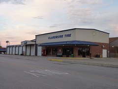 | Claremore Auto Dealership | 2.4 miles | 1995 |
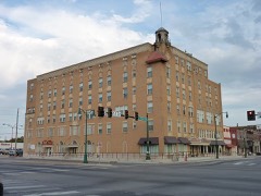 | Will Rogers Hotel | 2.5 miles | 1994 |
| Downtown Claremore Historic District | 2.6 miles | 2016 | |
| Will Rogers Memorial Library | 2.8 miles | 2023 |
| National Archives record | The nomination case file for reference 82003700 in Record Group 79. |
| Rogers County | All 19 listed properties in this county. |