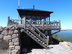
Block
From the record
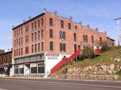
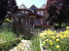
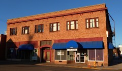
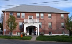
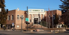
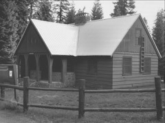
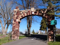
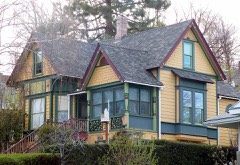
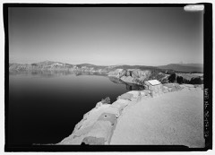
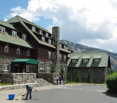
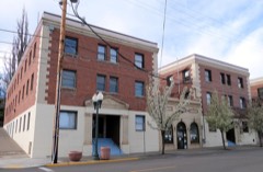
28 National Register listings published here, 1 of them a National Historic Landmark.
Sources: the National Register database, National Park Service
139 topographic sheets cover 56 settlements here, and 28 properties are on the National Register of Historic Places.
28 National Register listings published here, 1 of them a National Historic Landmark.
Sources: the National Register database, National Park Service
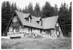
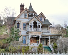
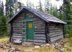
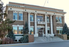
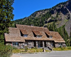
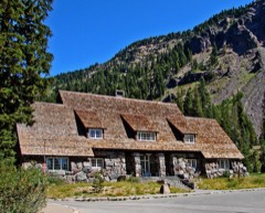
Every property in this county listed on the National Register of Historic Places, with the year it was listed and the federal nomination document.
Every wildfire the federal occurrence database records inside this county: 7,059 of them, burning about 220,905 acres. 4,308 started naturally and 231 were recorded as arson. Each settlement page carries the fires within five miles of it.
| Reported cause | Fires |
|---|---|
| Natural | 4308 |
| Recreation and ceremony | 736 |
| Debris and open burning | 537 |
| Missing data/not specified/undetermined | 438 |
| Smoking | 345 |
| Equipment and vehicle use | 242 |
| Arson/incendiarism | 231 |
| Power generation/transmission/distribution | 68 |
| Misuse of fire by a minor | 60 |
| Other causes | 40 |
| Railroad operations and maintenance | 33 |
| Fireworks | 18 |
| Firearms and explosives use | 3 |
The five largest, by the area the report gives. One of them was set deliberately.
| Date | Cause | Size | Reported by | Name on the report |
|---|---|---|---|---|
| 2 August 1992 | Misuse of fire by a minor | 30,809 acres | Fremont-Winema National Forest | LONE PINE |
| 28 June 2003 | Arson/incendiarism | 21,135 acres | Deschutes National Forest | DAVIS FIRE 0345 |
| 18 August 2008 | Natural | 21,125 acres | Rogue River-Siskiyou National Forest | MIDDLE FORK |
| 1 August 2015 | Natural | 20,840 acres | Crater Lake National Park | CRESCENT |
| 29 July 2017 | Natural | 15,825 acres | Crater Lake National Park | SPRUCE LAKE |
| 12 September 2009 | Natural | 14,560 acres | Willamette National Forest | TUMBLEBUG |
| 7 September 2020 | Missing data/not specified/undetermined | 14,473 acres | Fremont-Winema National Forest | TWO FOUR TWO |
| 15 September 1992 | Natural | 10,706 acres | Fremont-Winema National Forest | ROBINSON SPRING |
Every settlement page carries the fires within five miles of it - see the settlement index below.
The NOAA Storm Events Database holds 94 reports for this county, causing no deaths, no injuries and about $53,500 in recorded property damage. Each settlement page carries the reports that name it.
| Kind of event | Reports |
|---|---|
| Hail | 33 |
| Wildfire | 25 |
| Thunderstorm Wind | 16 |
| Flood | 7 |
| Tornado | 5 |
| Lightning | 4 |
| Flash Flood | 3 |
| Funnel Cloud | 1 |
The most serious of them, by death, then injury, then recorded damage. The accounts are quoted exactly as the forecast office filed them.
| When | Event | Place named | Harm | What the report says |
|---|---|---|---|---|
| February 2025 | Flood | Bly | $20,000 | The Sprague River near Beatty rose above minor flood stage of 8.5 ft. at 25/730 PST, peaked in minor flood stage at 26/145 PST at 9.13 ft. It then fell below flood stage at 26/1645 PST. This produced flooding of structures in the vicinity of the cities of Sprague River and Lone Pine, and widespread agricultural flooding. |
| May 1995 | Tornado (F0) | not stated | $20,000 | A small tornado, one and one-half inch hail, and heavy rain accompanied strong thunderstorms in the Klamath Falls area. The tornado ripped the roof off of a Klamath Falls School District bus barn. No one was injured. Hail from the same storm did some minor crop damage to local sugar beet fields. |
| August 2008 | Thunderstorm Wind | Klamath Falls | $10,000 | A member of the public reported that part of a barn roof was blown away, a firmly anchored car canopy was toppled, and a boat was damaged by strong gusts associated with a thunderstorm. No warning was issued for this storm. |
| May 1962 | Tornado (F1) | not stated | $2,500 | no account filed |
| August 2005 | Hail | Crescent | $1,000 | Spotter KL73 reported .5 to .75 inch hail from a thunderstorm...but not too heavy where he was. |
| June 2025 | Thunderstorm Wind | Keno | - | On 06/30/2025, an area of low pressure along the northern California coast produced numerous thunderstorms in south central Oregon and northern California. Downdraft winds associated with one thunderstorm 5 miles north of Keno in Klamath County broke off several 1 inch diameter limbs from a healthy tree. Also, 1.63 inches of rain were measured from the storm. |
| April 2023 | Flood | Beatty | - | Snowmelt caused the Sprague River near Beatty to exceed flood stage of 8.5 feet. The event began in April, on 04/29/23 at 2200 PST, and continued through 04/30/23 at 2359 PST. A peak for the month of 8.6 feet was reached on 04/30/23 at 0615 PST. |
| May 2023 | Flood | Beatty | - | Snowmelt caused the Sprague River near Beatty to exceed flood stage of 8.5 feet. The event began in April, on 04/29/23 at 2200 PST, and continued until 05/03/23 at 0000 PST. A peak of 8.9 feet was reached on 05/01/23 at 1800 PST. |
| May 2020 | Hail | Gilchrist | - | A member of the public reported 1.75 inch hail. It hailed for approximately 15 minutes, with the hail damaging vehicles. Minor street flooding and mudslides in town. |
| May 2020 | Hail | Lenz | - | Large hail damaged vehicles. This occurred at milepost 8 on the Silver Lake Highway (Oregon 31). |
| August 2020 | Hail | Pelican City | - | A member of the public reported large hail. They sent a picture of 1.0 inch hail taken next to a quarter for size estimation. The reporter said that the picture was taken after some melting had occurred. |
| August 2020 | Hail | Klamath Falls | - | A member of the public sent a picture of quarter sized hail. |
| May 2019 | Tornado (EF0) | Sprague River | - | Numerous thunderstorms developed over south central Oregon on this date. A member of the public submitted a video that showed what appeared to be a funnel cloud possibly briefly coming in contact with the ground. The video location and time was determined by radar data. |
| August 2019 | Hail | Olene | - | A member of the public reported their house was shaken by strong winds that came first from one direction, then from the opposite direction. They reported 1 inch hail with the second wind surge. The winds sounded like several freight trains. No damage to the house, but there was damage to vegetation with some large tree branches found far away from any trees. This occurred on the Lost River Ranch. The observer thought it may have been a tornado. A funnel cloud associated with another thunderstorm was reported at 1417 PDT the previous afternoon near Klamath Falls. |
| February 2017 | Flood | Bly | - | The Sprague River near Beatty exceeded flood stage (8.5 feet) at 09/1945 PST. The river crested at 9.59 feet several times between 10/1415 and 10/1515 PST. The river fell below flood stage at 11/1715 PST. |
| August 2017 | Hail | Altamont | - | The duration of the hail event was 10 minutes. |
| January 2016 | Thunderstorm Wind | (Lmt)Klamath Falls A | - | A gust to 67 mph was reported at Klamath Falls International Airport at 19/1230 PST. A garage near Klamath Falls was blown off of its foundation and deposited several hundred feet away. |
| August 2014 | Hail | West Klamath | - | Hail with diameters between 1/2 inch and 1.0 inch covered the ground to a depth of 1.0 inches. The hail duration was about 10 minutes. |
| August 2013 | Hail | Keno | - | A spotter 1 SSW Keno reported quarter size hail with accumulations up to 3 inches deep. |
| July 2013 | Hail | Chemult | - | A member of the public reported 1 inch hail at the Miller Lake Campground which caused tents to collapse at 31/1645 PST. |
| July 2013 | Hail | Crescent Lake | - | A member of the public at Crescent Lake Resort reported quarter sized (1.0 inch) hail with a thunderstorm. |
| September 2011 | Thunderstorm Wind | (Lmt)Klamath Falls A | - | Recorded at the Klamath Falls Airport ASOS. |
| September 2011 | Thunderstorm Wind | Altamont | - | Fence knocked over. |
| September 2011 | Thunderstorm Wind | Altamont | - | Garbage cans blown down street. |
| July 2010 | Hail | West Klamath | - | Trained spotter 3 miles west-northwest of Midland reported quarter size hail falling at 26/1520 PST. |
| July 2010 | Thunderstorm Wind | Altamont | - | Spotter KL106 reported a 60 mph gust at 26/1630 PST. |
| August 2010 | Hail | Crater Lake | - | The ground was covered with hail. |
| August 2009 | Thunderstorm Wind | Chiloquin | - | The wind blew over two 18 inch diameter pine trees and two large aspens. Heavy rain, no hail. |
| August 2009 | Hail | Rocky Pt | - | A fire crew 4 miles north of Fourmile lake reported 3-4 inches of rain, quarter size hail, and very little wind. |
| August 2009 | Hail | Crater Lake | - | The Crater Lake National Park cooperative observer reported quarter size hail with heavy rain. This caused mud and rock slides across the West Rim Road and the East Rim Road. East Rim Road was reopened after the removal of 12 cubic yards of material. One inch hail was also reported by a member of the public. |
| August 2009 | Hail | Crater Lake | - | This was reported by the Crater Lake National Park coop observer. |
| June 2009 | Hail | Beatty | - | A member of the public reported 1 inch hail with a thunderstorm. 0.88 inch hail was also reported at 1600 PDT 10 NM SW of Beatty with two inches of hail on the ground. |
| July 2008 | Hail | (Lmt)Klamath Falls A | - | A spotter reported 0.75 inch hail with a thunderstorm. No warnings were in effect. |
| June 2007 | Hail | Chemult | - | Holiday Village and Motel in Beaver Marsh 7 miles south of Chemult reported nickel size hailwith a thunderstorm. |
| July 2007 | Thunderstorm Wind | Bonanza | - | A spotter just north of Bonanza reported nickel size hail, winds gusting to 80 mph, numerous downed power lines, small juniper trees downed, and a 12-inch diameter limb snapped. Hail covered the ground and drifted up to 8 inches deep. |
| July 2007 | Hail | Bonanza | - | A spotter just north of Bonanza reported nickel size hail, winds gusting to 80 mph, numerous downed power lines, small juniper trees downed, and a 12-inch diameter limb snapped. Hail covered the ground and drifted up to 8 inches deep. |
| July 2007 | Thunderstorm Wind | Malin | - | The Klamath Falls Herald and News reported extensive wind, rain, and hail damage to crops around Malin and the Yonna valleys. Crop damage included 1000 to 1800 acres of strawberry root stock and several alfalfa and potato fields. No cost estimate is available at this time. |
| April 2007 | Tornado (EF0) | Keno | - | Photographic evidence was analyzed after the fact, and it was determined that cold air funnels were in the image. |
| May 2006 | Hail | Klamath Falls | - | An NWS employee driving through the area reported .5 to .75 inch hail covering the ground. |
| June 2006 | Flash Flood | South Central Portion | - | See below. |
| July 2006 | Hail | Crescent Lake | - | Reported by a member of the public 2 miles south of Crescent Lake. |
| August 2006 | Thunderstorm Wind | Klamath Falls | - | Klamath County dispatch reported multiple trees down on power lines and roads from Klamath Falls east and north to Chiloquin. |
| May 2005 | Hail | Keno | - | A spotter N of Keno reported 1.0 inch hail with a thunderstorm. |
| August 2005 | Hail | Crescent | - | The Crescent Ranger District reported large marble size hail between 1730 and 1800 PDT |
| April 2004 | Tornado (F0) | Klamath Falls Arpt | - | See below. |
| June 2004 | Thunderstorm Wind | Klamath Falls | - | No wind report of this magnitude was received, but one report came close. |
| August 2003 | Hail | Crater Lake | - | See below. |
| October 2003 | Wildfire | Countywide | - | See below. |
| September 2003 | Lightning | Countywide | - | See below. |
| September 2003 | Wildfire | Countywide | - | See below. |
| June 2002 | Lightning | Chemult | - | Chemult Ranger Station reported 0.5" hail, 0.50" rain, strong winds, and lots of lightning with thunderstorm that occurred on 08/13. |
| July 2002 | Lightning | Countywide | - | See below. |
| July 2002 | Wildfire | Countywide | - | See below. |
| July 2002 | Lightning | Countywide | - | See below. |
| September 2002 | Wildfire | Countywide | - | See below. |
| July 2001 | Thunderstorm Wind | Keno | - | See below. |
| June 2001 | Wildfire | Countywide | - | See below. |
| August 2001 | Wildfire | Countywide | - | See below. |
| August 2001 | Wildfire | Countywide | - | See below. |
| July 2000 | Wildfire | Countywide | - | See below. |
The Survey's mineral resources record lists 314 workings inside this county. 121 still produce and 193 are closed or unrecorded. Each settlement page carries the workings within five miles of it.
| Commodity | Workings |
|---|---|
| Stone | 98 |
| Stone, Crushed/Broken | 89 |
| Sand and Gravel, Construction | 40 |
| Pumice | 35 |
| Geothermal | 28 |
| Diatomite | 9 |
| Mercury | 5 |
| Clay | 4 |
| Gold | 2 |
| Gold, Silver, Mercury | 1 |
| Titanium, Metal, Iron | 1 |
| Titanium | 1 |
| Iron | 1 |
| Silver, Gold | 1 |
The least common of them first, because a county's hundredth gravel pit says nothing its first ten did not.
| Where | Site | Commodity | Status | Recorded |
|---|---|---|---|---|
| Bly Mountain Perlite Deposit | Perlite | Unknown | ||
| Klamath Hills | Gold, Silver, Mercury | Occurrence | ||
| Klamath Hills | Mercury, Silver, Gold | Prospect | ||
| Klamath Indian Reservation Placer | Titanium, Metal, Iron | Occurrence | ||
| Klamath Titanium | Titanium, Iron | Prospect | ||
| High Bar | Gold | Occurrence | 1937 | |
| Ollala | Gold | Occurrence | ||
| Brickyard | Clay | Past Producer | ||
| Klamath Falls Brickyard | Clay | Producer | ||
| Wocus Site | Clay | Past Producer | ||
| Wocus Site | Clay | Producer | ||
| Givan Ranch | Mercury | Occurrence | ||
| Givan Ranch Prospect | Mercury | Occurrence | ||
| Oregon Technical Institute | Mercury | Occurrence | Cinnabar | |
| Oregon Technical Institute | Mercury | Prospect | ||
| Chiloquin Diatiomite | Diatomite | Occurrence | ||
| Chiloquin Diatomite Deposit | Diatomite | Occurrence | ||
| Diatomaceous Earth Prospect | Diatomite | Occurrence | ||
| Green Springs Hwy | Diatomite | Past Producer | ||
| Klamath Falls Diatomite | Diatomite | Occurrence | ||
| Sprague River Diatomite | Diatomite | Occurrence | ||
| Sprague River Diatomite | Diatomite | Occurrence | ||
| Spring Creek Group | Diatomite | Occurrence | ||
| Unnamed Pit | Diatomite | Producer | ||
| Bonanza Springs | Geothermal | Producer | ||
| Bonanza Well | Geothermal | Producer | ||
| Casey | Geothermal | Producer | ||
| Colwell | Geothermal | Producer | ||
| Crystal Spring | Geothermal | Occurrence | ||
| Eagle Ridge | Geothermal | Producer | ||
| Fiegi Well | Geothermal | Producer | ||
| Frank Gaularte Well | Geothermal | Producer | ||
| Givan | Geothermal | Producer | ||
| Grye & Barney Well | Geothermal | Producer | ||
| Hardboard Spring | Geothermal | Producer | ||
| Harry Martin | Geothermal | Producer | ||
| High Bros. Warm Spring | Geothermal | Producer | ||
| Holiday | Geothermal | Producer | ||
| J. K. O'Neil Well | Geothermal | Producer | ||
| Klamath Falls Geothermal Zone | Geothermal | Producer | ||
| Klamath Hills | Geothermal | Occurrence | ||
| Klamath Hot Springs | Geothermal | Occurrence | ||
| Klamath Ice Co. Well | Geothermal | Producer | ||
| Olene Gap Hot Springs | Geothermal | Producer | ||
| Oregon Hot Spring | Geothermal | Occurrence | ||
| R. Smith Well | Geothermal | Producer | ||
| Robinson Spring | Geothermal | Occurrence | ||
| Roenicke Hot Springs | Geothermal | Producer | ||
| Smith's Hot Spring | Geothermal | Occurrence | ||
| Unnamed Hot Spring | Geothermal | Producer | ||
| Unnamed Hot Springs | Geothermal | Producer | ||
| Wilkerson's Hot Spring | Geothermal | Occurrence | ||
| Black Rock Pit | Pumice | Producer | ||
| Bly Pumice | Pumice | Past Producer | ||
| Bly Pumice | Pumice | Past Producer | ||
| Braymill Cinder Pit | Pumice | Producer | ||
| Bucket Butte Cinder Pit | Pumice | Producer | ||
| Burnt Butte Cinder Pit | Pumice | Producer | ||
| Crescent Butte | Pumice | Producer | ||
| Crescent Junction | Pumice | Past Producer | ||
| Ipswoot Butte | Pumice | Producer | ||
| Jackson Creek Cinder Pit | Pumice | Producer | ||
| Lowlands Pit | Pumice | Producer | ||
| Merrill Pit | Pumice | Producer | ||
| Merritt Creek Pit | Pumice | Producer | ||
| Mignot Site | Pumice | Past Producer | ||
| Mignot Site | Pumice | Producer | ||
| Miller Pit | Pumice | Past Producer | ||
| Miller Pit | Pumice | Producer | ||
| Paddock Butte Cinder Pit | Pumice | Producer | ||
| Parks Pumice Mining | Pumice | Past Producer | ||
| Parks Pumice Mining | Pumice | Past Producer | ||
| Pumice Pit | Pumice | Past Producer | ||
| Pumice Quarry | Pumice | Past Producer | ||
| Pumice Quarry | Pumice | Producer | ||
| Unnamed Pit | Pumice | Producer | ||
| Unnamed Pit | Pumice | Producer | ||
| Unnamed Pit | Pumice | Producer | ||
| Unnamed Pit | Pumice | Producer | ||
| Unnamed Pit | Pumice | Producer | ||
| Unnamed Pit | Pumice | Producer | ||
| Unnamed Pit | Pumice | Producer | ||
| Unnamed Pit | Pumice | Producer | ||
| Unnamed Pumice | Pumice | Prospect | ||
| Unnamed Pumice | Pumice | Prospect | ||
| Unnamed Pumice | Pumice | Producer | ||
| Wampler Cinder Pit | Pumice | Producer | ||
| Annie Creek Quarry | Sand and Gravel, Construction | Past Producer | ||
| Annie Creek Quarry | Sand and Gravel, Construction | Producer | ||
| Baker Pit | Sand and Gravel, Construction | Producer | ||
| Brown | Sand and Gravel, Construction | Past Producer | ||
| Brown Pit | Sand and Gravel, Construction | Producer | ||
| Campbell Pit | Sand and Gravel, Construction | Past Producer | ||
| Campbell Pit | Sand and Gravel, Construction | Producer | ||
| Collier State Park | Sand and Gravel, Construction | Past Producer | ||
| Collier State Park Pit | Sand and Gravel, Construction | Producer | ||
| Day School Site | Sand and Gravel, Construction | Past Producer | ||
| Day School Site | Sand and Gravel, Construction | Producer | ||
| Dodd's Hollow | Sand and Gravel, Construction | Producer | ||
| Dodd's Hollow R11e | Sand and Gravel, Construction | Past Producer | ||
| Gravel Pit | Sand and Gravel, Construction | Past Producer | ||
| Gravel Pit | Sand and Gravel, Construction | Past Producer | ||
| Gravel Pit | Sand and Gravel, Construction | Past Producer | ||
| Gravel Pit | Sand and Gravel, Construction | Past Producer | ||
| Gravel Pit | Sand and Gravel, Construction | Past Producer | ||
| Gravel Pit | Sand and Gravel, Construction | Past Producer | ||
| Gravel Pit | Sand and Gravel, Construction | Past Producer | ||
| Gravel Pit | Sand and Gravel, Construction | Past Producer | ||
| Gravel Pit | Sand and Gravel, Construction | Past Producer | ||
| Kleos Ministries Site | Sand and Gravel, Construction | Past Producer | ||
| Kleos Ministries Site | Sand and Gravel, Construction | Producer | ||
| Mp 221.1. Dalles-California Hwy | Sand and Gravel, Construction | Producer | ||
| Mp221.1 Dalles-California Hwy | Sand and Gravel, Construction | Past Producer | ||
| Pit #4 | Sand and Gravel, Construction | Past Producer | ||
| Pit No. 4 | Sand and Gravel, Construction | Producer | ||
| Pit and Plant | Sand and Gravel, Construction | Past Producer | ||
| Pit and Plant | Sand and Gravel, Construction | Past Producer | ||
| Southside Bypass | Sand and Gravel, Construction | Past Producer | ||
| Southside Bypass | Sand and Gravel, Construction | Producer | ||
| Unnamed Pit | Sand and Gravel, Construction | Producer | ||
| Unnamed Pit | Sand and Gravel, Construction | Producer | ||
| Unnamed Pit | Sand and Gravel, Construction | Producer | ||
| Unnamed Pit | Sand and Gravel, Construction | Producer | ||
| Unnamed Pit | Sand and Gravel, Construction | Producer | ||
| Unnamed Pit | Sand and Gravel, Construction | Producer | ||
| Unnamed Pit | Sand and Gravel, Construction | Producer | ||
| Unnamed Pit | Sand and Gravel, Construction | Producer | ||
| Asphalt Paving Co. Quarry | Stone, Crushed/Broken | Past Producer | ||
| Balsam Road Quarry | Stone, Crushed/Broken | Producer | ||
| Bear Butte Pit | Stone, Crushed/Broken | Producer | ||
| Beatty Pit | Stone, Crushed/Broken | Producer | ||
| Black Rock Pit | Stone, Crushed/Broken | Past Producer | ||
| Black Rock Pit | Stone, Crushed/Broken | Past Producer | ||
| Bly Millsite | Stone, Crushed/Broken | Producer | ||
| Bly Pit | Stone, Crushed/Broken | Producer | ||
| Bly Pit | Stone, Crushed/Broken | Producer | ||
| Braymill Cinder Pit | Stone, Crushed/Broken | Past Producer | ||
| Bucket Butte Cinder Pit | Stone, Crushed/Broken | Past Producer | ||
| Burnt Butte Cinder Pit | Stone, Crushed/Broken | Past Producer | ||
| Campbell Pit | Stone, Crushed/Broken | Producer | ||
| Cinder Pit | Stone, Crushed/Broken | Past Producer | ||
| Cinder Pit | Stone, Crushed/Broken | Past Producer | ||
| Cinder Pit | Stone, Crushed/Broken | Past Producer | ||
| Cinder Pit | Stone, Crushed/Broken | Past Producer | ||
| Cinders Pit | Stone, Crushed/Broken | Past Producer | ||
| Cinders Pit | Stone, Crushed/Broken | Past Producer | ||
| Cinders Pit | Stone, Crushed/Broken | Past Producer | ||
| Cliff Pit | Stone, Crushed/Broken | Producer | ||
| Crescent Butte | Stone, Crushed/Broken | Past Producer | ||
| Dairy Pit | Stone, Crushed/Broken | Past Producer | ||
| Dairy Pt | Stone, Crushed/Broken | Producer | ||
| Diary Pit | Stone, Crushed/Broken | Producer | ||
| Dinner Plate Quarry | Stone, Crushed/Broken | Producer | ||
| Fort Klamath Pit | Stone, Crushed/Broken | Producer | ||
| Harpold Quarry | Stone, Crushed/Broken | Producer | ||
| Holiday Ranch | Stone, Crushed/Broken | Producer | ||
| Ipswoot Butte | Stone, Crushed/Broken | Past Producer | ||
| Jack Creek Ridge Quarry | Stone, Crushed/Broken | Producer | ||
| Jackson Creek Cinder Pit | Stone, Crushed/Broken | Past Producer | ||
| Junction Quarry | Stone, Crushed/Broken | Producer | ||
| Klamath Falls Mill St | Stone, Crushed/Broken | Producer | ||
| Klamath Point Pit | Stone, Crushed/Broken | Past Producer | ||
| Klamath Strait Bridge | Stone, Crushed/Broken | Producer | ||
| Lone Pine Pit & Plant | Stone, Crushed/Broken | Past Producer | ||
| Long Lake Quarry | Stone, Crushed/Broken | Producer | ||
| Lowland Pit | Stone, Crushed/Broken | Past Producer | ||
| Lundgren Site | Stone, Crushed/Broken | Producer | ||
| Macdonald Site | Stone, Crushed/Broken | Producer | ||
| Merrill Pit | Stone, Crushed/Broken | Past Producer | ||
| Merritt Creek Pit | Stone, Crushed/Broken | Past Producer | ||
| Paddock Butte Cinder Pit | Stone, Crushed/Broken | Past Producer | ||
| Rad Rock Quarry | Stone, Crushed/Broken | Past Producer | ||
| Russell Site | Stone, Crushed/Broken | Producer | ||
| Sand Creek Quarry | Stone, Crushed/Broken | Producer | ||
| Shady Pine Crusher & Wash Plant | Stone, Crushed/Broken | Producer | ||
| Shot Gun Quarry | Stone, Crushed/Broken | Producer | ||
| Spring Creek Hill | Stone, Crushed/Broken | Producer | ||
| Stukel Mountain | Stone, Crushed/Broken | Producer | ||
| Stukel Mountain | Stone, Crushed/Broken | Producer | ||
| Summers Quarry | Stone, Crushed/Broken | Producer | ||
| Summers Quarry | Stone, Crushed/Broken | Producer | ||
| Unnamed Pit | Stone, Crushed/Broken | Producer | ||
| Unnamed Pit | Stone, Crushed/Broken | Producer | ||
| Unnamed Pit | Stone, Crushed/Broken | Producer | ||
| Unnamed Pit | Stone, Crushed/Broken | Producer | ||
| Unnamed Pit | Stone, Crushed/Broken | Producer | ||
| Unnamed Pit | Stone, Crushed/Broken | Producer | ||
| Unnamed Pit | Stone, Crushed/Broken | Producer | ||
| Unnamed Pit | Stone, Crushed/Broken | Producer | ||
| Unnamed Pit | Stone, Crushed/Broken | Producer | ||
| Unnamed Pit | Stone, Crushed/Broken | Producer | ||
| Unnamed Pit | Stone, Crushed/Broken | Producer | ||
| Unnamed Pit | Stone, Crushed/Broken | Producer | ||
| Unnamed Pit | Stone, Crushed/Broken | Producer | ||
| Unnamed Pit | Stone, Crushed/Broken | Producer | ||
| Unnamed Pit | Stone, Crushed/Broken | Producer | ||
| Unnamed Pit | Stone, Crushed/Broken | Producer | ||
| Unnamed Pit | Stone, Crushed/Broken | Producer | ||
| Unnamed Pit | Stone, Crushed/Broken | Producer | ||
| Unnamed Pit | Stone, Crushed/Broken | Past Producer | ||
| Unnamed Pit | Stone, Crushed/Broken | Producer | ||
| Unnamed Pit | Stone, Crushed/Broken | Producer | ||
| Unnamed Quarry | Stone, Crushed/Broken | Past Producer | ||
| Unnamed Quarry | Stone, Crushed/Broken | Past Producer | ||
| Unnamed Quarry | Stone, Crushed/Broken | Past Producer | ||
| Unnamed Quarry | Stone, Crushed/Broken | Past Producer | ||
| Unnamed Quarry | Stone, Crushed/Broken | Past Producer | ||
| Unnamed Quarry | Stone, Crushed/Broken | Past Producer | ||
| Unnamed Quarry | Stone, Crushed/Broken | Past Producer | ||
| Unnamed Quarry | Stone, Crushed/Broken | Past Producer | ||
| Unnamed Quarry | Stone, Crushed/Broken | Past Producer | ||
| Unnamed Quarrylamath Falls 15-Min.. | Stone, Crushed/Broken | Past Producer | ||
| Walker Pit | Stone, Crushed/Broken | Producer | ||
| Wampler Cinder Pit | Stone, Crushed/Broken | Past Producer | ||
| Whitlatch Pit | Stone, Crushed/Broken | Producer | ||
| Wocus Pit | Stone, Crushed/Broken | Producer | ||
| Angle Butte Pit & Plant | Stone | Past Producer | ||
| Angle Butte Pit & Plant | Stone | Past Producer | ||
| Asphalt Paving Co. Quarry | Stone | Past Producer | ||
| Baker Pit | Stone | Past Producer | ||
| Balsam Drive Quarry | Stone | Past Producer | ||
| Balsam Drive Quarry | Stone | Past Producer | ||
| Balsam Road Quarry | Stone | Past Producer | ||
| Basalt Quarry | Stone | Past Producer | ||
| Basalt Quarry | Stone | Past Producer | ||
| Basalt Quarry | Stone | Past Producer | ||
| Basalt Quarry | Stone | Past Producer | ||
| Basalt Quarry | Stone | Past Producer | ||
| Basalt Quarry | Stone | Past Producer | ||
| Basalt Quarry | Stone | Past Producer | ||
| Basalt Quarry | Stone | Past Producer | ||
| Bear Butte | Stone | Past Producer | ||
| Beatty | Stone | Past Producer | ||
| Black Rock | Stone | Past Producer | ||
| Bly | Stone | Past Producer | ||
| Bly | Stone | Past Producer | ||
| Bly Mtn | Stone | Past Producer | ||
| Bly Mtn Pit | Stone | Past Producer | ||
| Bly Pit & Plant | Stone | Past Producer | ||
| Bly Pit & Plant | Stone | Past Producer | ||
| Campbell | Stone | Past Producer | ||
| Cathedral Pit | Stone | Past Producer | ||
| Cathedral Pit | Stone | Past Producer | ||
| Cliff | Stone | Past Producer | ||
| Dairy | Stone | Past Producer | ||
| Dairy | Stone | Past Producer | ||
| Dairy Pit | Stone | Past Producer | ||
| Dinner Plate Quarry | Stone | Past Producer | ||
| Fort Klamath | Stone | Past Producer | ||
| Harpold Quarry | Stone | Past Producer | ||
| Holiday Pit and Plant | Stone | Past Producer | ||
| Holiday Pit and Plant | Stone | Past Producer | ||
| Holiday Ranch | Stone | Past Producer | ||
| Horse Glades Pit & Plant | Stone | Past Producer | ||
| Horse Glades Pit & Plant | Stone | Past Producer | ||
| Jack Creek Ridge Quarry | Stone | Past Producer | ||
| Junction Quarry | Stone | Past Producer | ||
| Keno | Stone | Past Producer | ||
| Keno Pit | Stone | Past Producer | ||
| Klamath Point Pit | Stone | Past Producer | ||
| Klamath Strait Bridge | Stone | Past Producer | ||
| Lone Pine Pit & Plant | Stone | Past Producer | ||
| Long Lake Quarry | Stone | Past Producer | ||
| Lundgren Site | Stone | Past Producer | ||
| Macdonald Site | Stone | Past Producer | ||
| Mineral Springs | Stone | Past Producer | ||
| Mineral Springs Pit | Stone | Past Producer | ||
| Pearce Point | Stone | Past Producer | ||
| Pearce Point Pit | Stone | Past Producer | ||
| Quarry | Stone | Past Producer | ||
| Quarry | Stone | Past Producer | ||
| Quarry | Stone | Past Producer | ||
| Quarry | Stone | Past Producer | ||
| Quarry | Stone | Past Producer | ||
| Quarry | Stone | Past Producer | ||
| Quarry | Stone | Past Producer | ||
| Quarry | Stone | Past Producer | ||
| Quarry | Stone | Past Producer | ||
| Quarry | Stone | Past Producer | ||
| Quarry | Stone | Past Producer | ||
| Quarry | Stone | Past Producer | ||
| Quarry | Stone | Past Producer | ||
| Quarry | Stone | Past Producer | ||
| Quarry | Stone | Past Producer | ||
| Quarry | Stone | Past Producer | ||
| Quarry | Stone | Past Producer | ||
| Quarry | Stone | Past Producer | ||
| Quarry | Stone | Past Producer | ||
| Quarry | Stone | Past Producer | ||
| Quarry | Stone | Past Producer | ||
| Quarry | Stone | Past Producer | ||
| Quarry | Stone | Past Producer | ||
| Quarry | Stone | Past Producer | ||
| Quarry | Stone | Past Producer | ||
| Russell Site | Stone | Past Producer | ||
| Sand Creek Quarry | Stone | Past Producer | ||
| Shady Pine | Stone | Past Producer | ||
| Shot Gun Quarry | Stone | Past Producer | ||
| Spock Timber Sale Pit | Stone | Past Producer | ||
| Spock Timber Sale Pit | Stone | Past Producer | ||
| Spring Creek Hill | Stone | Past Producer | ||
| Stukel Mountain | Stone | Past Producer | ||
| Stukel Mountain | Stone | Past Producer | ||
| Stukel Mtn Access Quarry | Stone | Past Producer | ||
| Stukel Mtn Access Quarry | Stone | Past Producer | ||
| Stukel Mtn Pit & Plant | Stone | Past Producer | ||
| Stukel Mtn Pit & Plant | Stone | Producer | ||
| Summers Quarry | Stone | Past Producer | ||
| Summers Quarry | Stone | Past Producer | ||
| Three Mile Rock | Stone | Past Producer | ||
| Three Mile Rock Pit | Stone | Past Producer | ||
| Walker | Stone | Past Producer | ||
| Whitlatch | Stone | Past Producer | ||
| Wocus | Stone | Past Producer |
Named settlements recorded in the Geographic Names Information System, each with the topographic sheets covering it. Villages, hamlets and abandoned places alike. Each is shown with the nearest named watercourse or landform and the survey quadrangle it falls on.
Klamath Falls census division · 97601 · Near Plum Valley · Wocus quadrangle
18 sheets, 1889 to 1991
Klamath Falls census division · 97601 · By Algoma Incline · Modoc Point quadrangle
19 sheets, 1889 to 1998
No longer a settlement
Chiloquin census division · 97621 · On Brown Creek · Beatty quadrangle
20 sheets, 1889 to 1998
Langell Valley census division · 97603 · On Simms Creek · Bonanza quadrangle
18 sheets, 1889 to 1991
No longer a settlement
Langell Valley census division · 97622 · On Fishhole Creek · Bly quadrangle
19 sheets, 1889 to 2004
Yonna Valley-Poe Valley census division · 97623 · Near Yonna Valley · Bonanza quadrangle
18 sheets, 1889 to 1991
Keno census division · 97627 · On Spencer Creek · Spencer Creek quadrangle
19 sheets, 1891 to 1998
No longer a settlement
Chiloquin census division · 97624 · On Sprague River · Chiloquin quadrangle
20 sheets, 1889 to 1998
Keno census division · 97601 · Spencer Creek quadrangle
19 sheets, 1891 to 1998
No longer a settlement
Crescent Lake census division · 97733 · On Crescent Butte · Crescent quadrangle
16 sheets, 1935 to 1999
Crescent Lake census division · 97733 · On Cold Spring Creek · Odell Lake quadrangle
17 sheets, 1930 to 1986
Keno census division · 97601 · Crystal Spring quadrangle
19 sheets, 1891 to 1998
No longer a settlement
Klamath Falls census division · 97603 · Near Miller Hill · Klamath Falls quadrangle
21 sheets, 1889 to 1991
Chiloquin census division · 97626 · On Annie Creek · Fort Klamath quadrangle
20 sheets, 1889 to 1998
Crescent Lake census division · 97737 · Near Crescent Butte · Crescent quadrangle
16 sheets, 1935 to 1999
Langell Valley census division · 97623 · On Cys Branch · Goodlow Mountain quadrangle
19 sheets, 1889 to 2004
Yonna Valley-Poe Valley census division · 97623 · On Wildhorse Creek · Yonna quadrangle
20 sheets, 1889 to 1998
Langell Valley census division · 97623 · Near Hamaker Canyon · Bryant Mountain quadrangle
18 sheets, 1889 to 1991
Chiloquin census division · 97624 · On Agency Creek · Agency Lake quadrangle
20 sheets, 1889 to 1998
Klamath Falls census division · 97601 · On Link River · Klamath Falls quadrangle
21 sheets, 1889 to 1991
Keno census division · 97601 · On Dry Creek · Lake of the Woods North quadrangle
19 sheets, 1891 to 1998
Langell Valley census division · 97623 · Langell Valley quadrangle
18 sheets, 1889 to 1991
Langell Valley census division · 97623 · Near Wolf Flat · Lorella quadrangle
19 sheets, 1889 to 2004
Klamath Falls census division · 97601 · Near Spring Lake Valley · Klamath Falls quadrangle
21 sheets, 1889 to 1991
No longer a settlement
Klamath Falls census division · 97603 · Near Miller Island · Klamath Falls quadrangle
21 sheets, 1889 to 1991
Chiloquin census division · 97624 · By Modoc Point · Modoc Point quadrangle
19 sheets, 1889 to 1998
Crescent Lake census division · 97733 · On Resort Creek · Odell Lake quadrangle
17 sheets, 1930 to 1986
Keno census division · 97601 · Keno quadrangle
18 sheets, 1889 to 1991
No longer a settlement
Keno census division · Mule Hill quadrangle
19 sheets, 1891 to 2001
No longer a settlement
Keno census division · On Recreation Creek · Pelican Bay quadrangle
19 sheets, 1891 to 1998
No longer a settlement
Keno census division · On Recreation Creek · Pelican Bay quadrangle
19 sheets, 1891 to 1998
Klamath Falls census division · 97601 · Near Payne Canyon · Howard Bay quadrangle
18 sheets, 1889 to 1991
Klamath Falls census division · 97601 · Near King Cabin Canyon · Wocus quadrangle
18 sheets, 1889 to 1991
Chiloquin census division · 97639 · Sprague River West quadrangle
20 sheets, 1889 to 1998
Klamath Falls census division · 97601 · Klamath Falls quadrangle
21 sheets, 1889 to 1991
Klamath Falls census division · 97601 · Near Rabbit Flat · Wocus quadrangle
18 sheets, 1889 to 1991
Langell Valley census division · 97623 · On Miller Creek · Bryant Mountain quadrangle
18 sheets, 1889 to 1991
No longer a settlement
Klamath Falls census division · 97601 · Near Spring Lake Valley · Klamath Falls quadrangle
21 sheets, 1889 to 1991
No longer a settlement
Merrill census division · 97633 · Lost River quadrangle
18 sheets, 1889 to 1991
No longer a settlement
Yonna Valley-Poe Valley census division · 97623 · On Wildhorse Creek · Yonna quadrangle
20 sheets, 1889 to 1998
The vanished settlements of Klamath County: the places named above that are no longer on the map.