 Block
From the record
84 National Register listings published here.
Sources: the National Register database, National Park Service
85 topographic sheets cover 27 settlements here, and 84 properties are on the National Register of Historic Places.
84 National Register listings published here.
Sources: the National Register database, National Park Service
Every property in this county listed on the National Register of Historic Places, with the year it was listed and the federal nomination document.
| Photograph | Property | Type | Listed | Reference |
|---|---|---|---|---|
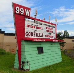 | 99W Drive-in Theatre | site | 2014 | 14000401 |
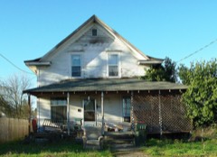 | Avery House | building | 1987 | 87000329 |
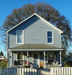 | Baxter House | building | 1987 | 87000331 |
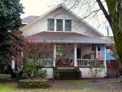 | Berry-Sigler Investment Property | building | 1987 | 87000368 |
 | Henry Bertram Sr. House | building | 1988 | 88000080 |
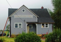 | Briedwell School | building | 1988 | 88001156 |
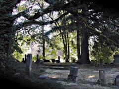 | Brookside Cemetery | site | 1987 | 87000332 |
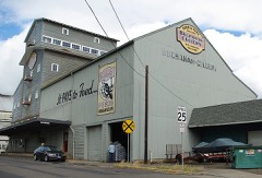 | Buchanan Cellers Mill | building | 2012 | 11001065 |
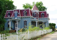 | John Marion Bunn House | building | 1979 | 79002152 |
| Cain House | building | 1987 | 87000333 | |
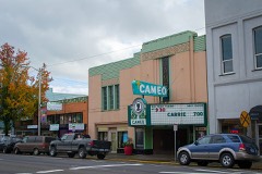 | Cameo Theatre | building | 2018 | 100003055 |
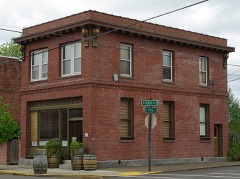 | Carlton State and Savings Bank | building | 1988 | 88000082 |
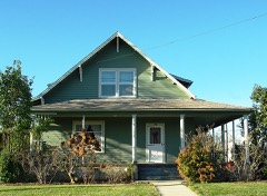 | Carter-Goodrich House | building | 1987 | 87000334 |
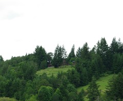 | Asa F. Cate Farm Ensemble | building | 1990 | 90000285 |
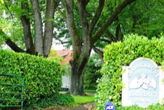 | Joseph and Virginia Chambers Farmstead | building | 1992 | 92000136 |
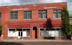 | S. C. Commercial Club-Stuckey Building | building | 1987 | 87000335 |
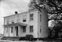 | Amos Cook House | building | 1974 | 74001726 |
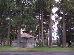 | Courthouse Square | site | 1987 | 87000336 |
| Dayton Common School | building | 1987 | 87000338 | |
 | Dayton High School | building | 1987 | 87000339 |
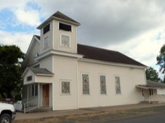 | Dayton Methodist Episcopal Church | building | 1987 | 87000340 |
| Diehl-Seitters House | building | 1987 | 87000344 | |
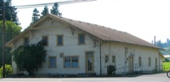 | Dundee Woman's Club Hall | building | 1986 | 86001241 |
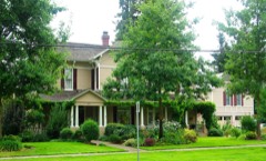 | Jesse Edwards House | building | 1980 | 80003393 |
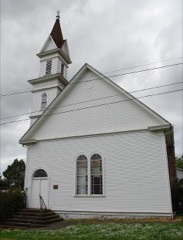 | Evangelical Church of Lafayette | building | 2002 | 02001278 |
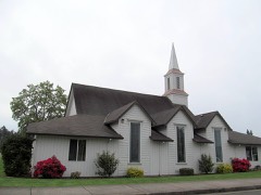 | Evangelical United Brethren Church | building | 1987 | 87000346 |
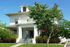 | Frank W. Fenton House | building | 1983 | 83002180 |
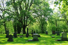 | Fernwood Pioneer Cemetery | site | 1994 | 94000809 |
| First Baptist Church | building | 1979 | 79002151 | |
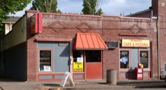 | Carl Fischer Meats | building | 1987 | 87000348 |
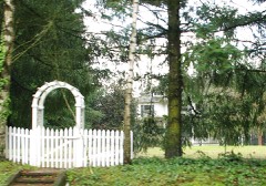 | Alfred P. Fletcher Farmhouse | building | 1980 | 80003392 |
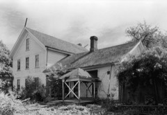 | Francis Fletcher House | building | 1975 | 75001601 |
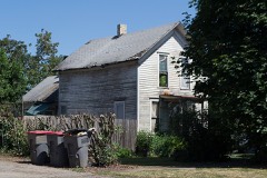 | Fletcher-Stretch House | building | 1987 | 87000349 |
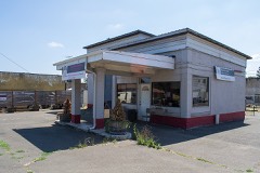 | Foster Oil Company | building | 1987 | 87000356 |
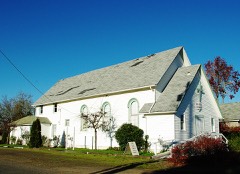 | Free Methodist Church | building | 1987 | 87000357 |
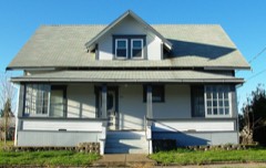 | Gabriel-Filer House | building | 1987 | 87000358 |
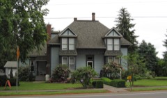 | Gabriel-Will House | building | 1987 | 87000359 |
| Levi Hagey House | building | 1974 | 74001727 | |
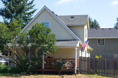 | Harrington House | building | 1987 | 87000360 |
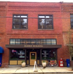 | Harris Building | building | 1987 | 87000363 |
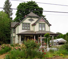 | William Hibbert House | building | 1978 | 78002329 |
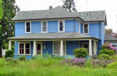 | Hole House | building | 1987 | 87000367 |
| Hughes Flying Boat (H-4 Hercules) | structure | 2024 | 100009992 | |
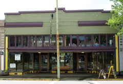 | J.C. Penney Building | building | 2007 | 07000555 |
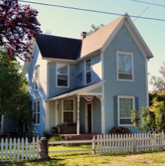 | Jessen-Goodrich House | building | 1987 | 87000370 |
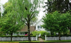 | James M. and Paul R. Kelty House | building | 1982 | 82003756 |
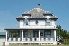 | Dr. Andrew Kershaw House | building | 1989 | 89000122 |
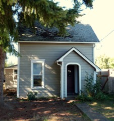 | Krietz House | building | 1987 | 87000372 |
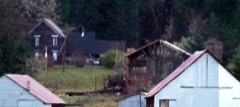 | Lamson Ranch | building | 2013 | 13000483 |
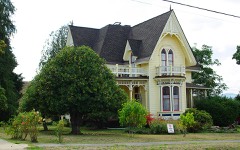 | Lee Laughlin House | building | 1979 | 79002153 |
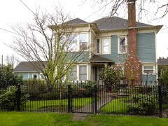 | Lewis-Shippy House | building | 1987 | 87000373 |
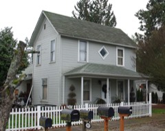 | Londershausen House | building | 1987 | 87000383 |
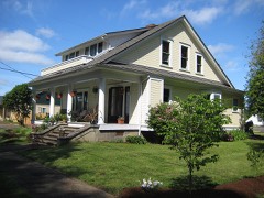 | Londershausen House | building | 1987 | 87000384 |
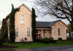 | Mabee-Mayberry House | building | 1987 | 87000385 |
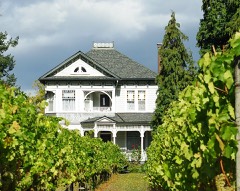 | Joseph Mattey House | building | 1977 | 77001118 |
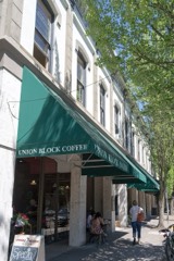 | McMinnville Downtown Historic District | district | 1987 | 87001366 |
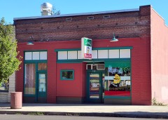 | McNamar Building | building | 1987 | 87000386 |
| McNish House | building | 1987 | 87000388 | |
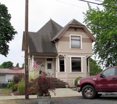 | Mellinger House | building | 1987 | 87000389 |
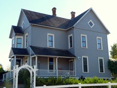 | Mellinger-Ponnay House | building | 1987 | 87000390 |
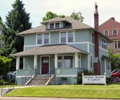 | Methodist Episcopal Parsonage | building | 1987 | 87000393 |
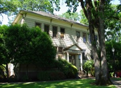 | Minthorn Hall | building | 1997 | 97000581 |
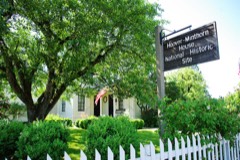 | Dr. Henry J. Minthorn House (Herbert Hoover House) | building | 2003 | 75001602 |
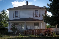 | Monahan House | building | 1987 | 87000395 |
| Morse House | building | 1987 | 87000398 | |
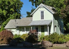 | Morse House | building | 1987 | 87000396 |
| Nichols House | building | 1987 | 87000400 | |
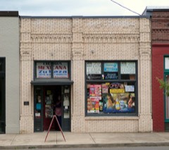 | Oregon Mutual Merchant Fire Insurance Association Office | building | 1987 | 87000402 |
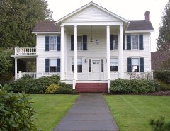 | Palmer House | building | 1987 | 87000403 |
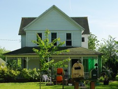 | William Albert and Anna May Bristow Parrish Farmstead | building | 2000 | 00000803 |
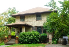 | Paulson-Gregory House | building | 1999 | 99000355 |
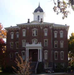 | Pioneer Hall, Linfield College | building | 1978 | 78002330 |
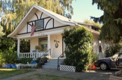 | Curtis W. Powell House | building | 1987 | 87000404 |
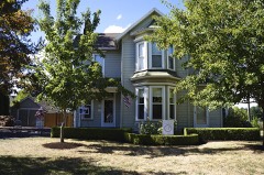 | Rippey House | building | 1987 | 87000405 |
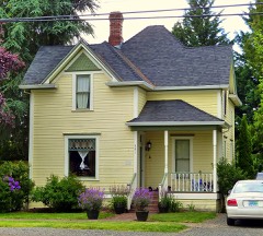 | Sigler House | building | 1987 | 87000406 |
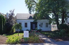 | Andrew Smith House | building | 1976 | 76001591 |
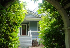 | John T. Smith House | building | 1984 | 84000493 |
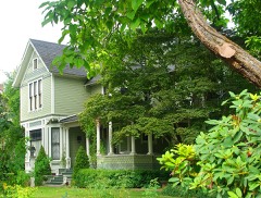 | Charles K. Spaulding House | building | 1994 | 94001022 |
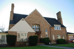 | Jack Spence House | building | 1986 | 86000295 |
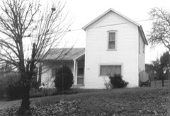 | Dr. Stuart House | building | 1987 | 87000408 |
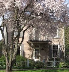 | Travelers Home | building | 1982 | 82003757 |
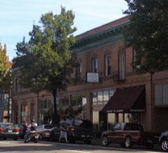 | Union Block | building | 2000 | 00000450 |
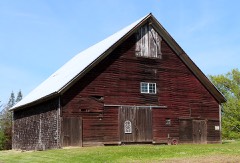 | John B. Wennerberg Barn | building | 2018 | 100002598 |
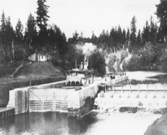 | Yamhill River Lock and Dam | structure | 1991 | 91000799 |
Every wildfire the federal occurrence database records inside this county: 385 of them, burning about 829 acres. 23 started naturally and 11 were recorded as arson. Each settlement page carries the fires within five miles of it.
| Reported cause | Fires |
|---|---|
| Recreation and ceremony | 92 |
| Equipment and vehicle use | 89 |
| Debris and open burning | 89 |
| Missing data/not specified/undetermined | 26 |
| Natural | 23 |
| Smoking | 18 |
| Misuse of fire by a minor | 11 |
| Arson/incendiarism | 11 |
| Other causes | 11 |
| Fireworks | 9 |
| Power generation/transmission/distribution | 5 |
| Firearms and explosives use | 1 |
The five largest, by the area the report gives. None of them was recorded as arson.
| Date | Cause | Size | Reported by | Name on the report |
|---|---|---|---|---|
| 19 August 2015 | Recreation and ceremony | 215 acres | Northwest Oregon District | WILLAMINA CREEK |
| 6 September 2002 | Natural | 117 acres | Forest Grove District | DUPEE VALLEY FIRE |
| 15 August 2010 | Equipment and vehicle use | 74 acres | Forest Grove District | GARRISH VALLEY FIRE |
| 16 October 1999 | Debris and open burning | 48 acres | Forest Grove District | FOX RIDGE FIRE |
| 30 April 2019 | Debris and open burning | 24 acres | Northwest Oregon District | HIGH HEAVEN |
| 21 August 2018 | Equipment and vehicle use | 22 acres | Oregon Department of Forestry Salem Headquarters | POVERTY FIRE |
| 26 August 1992 | Equipment and vehicle use | 20 acres | Forest Grove District | MUDDY VALLEY |
| 10 August 1992 | Missing data/not specified/undetermined | 20 acres | Forest Grove District | PANTHER CREEK |
Every settlement page carries the fires within five miles of it - see the settlement index below.
The NOAA Storm Events Database holds 34 reports for this county, causing no deaths, no injuries and about $12,500,006 in recorded property damage. Each settlement page carries the reports that name it.
| Kind of event | Reports |
|---|---|
| Heavy Rain | 14 |
| Funnel Cloud | 6 |
| Flood | 6 |
| Tornado | 4 |
| Lightning | 2 |
| Thunderstorm Wind | 1 |
| Dust Devil | 1 |
The most serious of them, by death, then injury, then recorded damage. The accounts are quoted exactly as the forecast office filed them.
| When | Event | Place named | Harm | What the report says |
|---|---|---|---|---|
| December 2007 | Flood | Mc Minnville | $9,600,000 | The South Yamhill River flooded near McMinnville, where flood damage was mainly limited to parks. Damage was done to several bridges and roads throughout the county. The town of Willamina had minor flood damage, and 120 homes along with businesses and churches were damaged in Sheridan. NOTE: Damage estimates are for the entire Yamhill county. |
| January 2012 | Flood | Lafayette | $2,000,000 | Heavy rain combined with snowmelt runoff caused the South Yamhill River at McMinnville to overflow its banks and flood low lying areas. The South Yamhill River crested at 54 feet on January 19th at 3 pm PST, 4 feet above flood stage. |
| December 2015 | Heavy Rain | Mc Minnville | $749,000 | Heavy rain resulted in urban flooding in McMinnville with standing water reported in town. High water closed several roads in the area including Highway 99. |
| December 2015 | Heavy Rain | Sheridan | $146,000 | The Oregon State route 22 was closed due to erosion (sinkhole) from heavy rain. Oregon state route 153 was closed due to high water on the roads between mile markers 1 and 6. |
| April 1984 | Tornado (F0) | not stated | $2,500 | no account filed |
| May 1971 | Tornado (F0) | not stated | $2,500 | no account filed |
| December 1993 | Tornado (F2) | not stated | $6 | The powerful storm that caused high winds across Oregon also spawned the most powerful tornado in the state in many years. The tornado occurred as the coldfront associated with a deep surface low along the coast moved across the Willamette Valley in mid-afternoon. The tornado touched down southeast of Newburg and heavily damaged a dairy farm, toppling large trees, killing six veal calves, and destroying calf shelters. The tornado then proceeded northeasterly to a horseranch, where roofs were blown off some small buildings and extensive damage was done by flying debris, including some very large trees that were snapped off and uprooted. The tornado next damaged the roof of a house and some nearby structures and then crossed the Willamette River. Passing motorists reported seeing the funnel sucking water up from the river. After uprooting more trees and damaging a mobile home, the tornado apparently skipped a few miles northeast where it touched down near a mobile home park and caused extensive damage to mobile homes there. Near the northern end of the twisters path a tree at least 24 inches in diameter was snapped off six feet above ground and, along with other debris, hit a two story home and moved it off its foundation. Incredibly, no one was injured. |
| October 2025 | Funnel Cloud | Unionvale | - | A Utility partner shared webcam imagery of a funnel cloud that appeared to last for around ten minutes with a thunderstorm that moved east-northeastward between McMinnville, OR and Unionvale, OR. Based on the webcam imagery alone, there are no clear signs of debris being lofted or wind damage occurring at the surface. |
| April 2024 | Dust Devil | Mc Minnville | - | Swirling winds moved over a business and produced damage to a sky light on the business rooftop and a ventilation system on the rooftop. The location was estimated. |
| December 2020 | Flood | Bellevue | - | Road closure due to high water on OR-153. |
| February 2017 | Flood | Mc Minnville | - | Heavy rain caused the South Yamhill River near McMinnville to flood. The river crested at 50.15 feet, which is 0.15 feet above flood stage. |
| November 2016 | Flood | Mc Minnville | - | Heavy rain resulted in flooding of the South Yamhill River at McMinnville. The South Yamhill River reached flood stage at 1253 AM on November 26th, and crested at 51.8 feet at 700 AM on November 26th. The river dropped below flood stage at 655 PM on November 27. |
| November 2015 | Funnel Cloud | Mc Minnville | - | A funnel Cloud was observed near the Evergreen Vineyards in McMinnville. |
| October 2014 | Funnel Cloud | Newberg | - | A member of the public noticed a cold core funnel in Newberg Oregon in the afternoon, that showed rotation for a few minutes. |
| June 2013 | Tornado (EF1) | Mc Minnville | - | A tornado touched down near the intersection of 14th St. and NE Kirby St. in McMinnville Oregon. Several 8-10 inch diameter trees were snapped at this location. The tornado continued Southeast for one block through a residential neighborhood with some tree damage noted. The tornado lifted a camper and deposited it over a chain link fence in a nearby industrial area and lofted 300 pound trellises. This damage was consistent with EF1 wind speeds. The tornado dissipated as it moved Southeast of 11th Ave and Lafayette. Some straight line wind damage was noted at a nearby park after this time. |
| November 2009 | Funnel Cloud | Mc Minnville | - | A funnel cloud was reportedly spotted over the Riverbend Landfill near McMinneville, but stayed aloft and never touched down. Small hail was reported to accompany this storm. NWS WSR-88D Doppler radar indicated many convective showers around the area. |
| January 2007 | Heavy Rain | Mc Minnville | - | A total accumulation of 1.52 inches was reported. |
| December 2007 | Heavy Rain | Williams | - | Storm total precipitation was 9.51 inches at the Rye Mountain RAWS. |
| December 2007 | Heavy Rain | Mc Minnville | - | Storm total precipitation was 3.50 inches. |
| November 2006 | Heavy Rain | Mc Minnville | - | Recorded a 5-day total of 5.6 inches. |
| November 2006 | Heavy Rain | Mc Minnville | - | Recorded a 5-day total of 10.4 inches at Haskins Dam. |
| August 2004 | Heavy Rain | Countywide | - | A series of unseasonably strong Pacific frontal systems dumped heavy rain over the Pacific NW from August 21-26. Heaviest amounts were over the Northern Oregon Cascade Mountains, where 10 to 12 inches of rain fell. Heavy showers and thunderstorms dumped one inch of rain in 20 minutes in the Gresham area on August 25. The Coast Range had 2 to 4 inches of rain, while rainfall totals in low elevations ranged from around 1 to 3 inches. |
| August 2001 | Heavy Rain | Countywide | - | An unseasonably wet weather system brought heavy rain to Northwest Oregon. Storm totals from the Coast Range were in the 2 to 4 inch range, while along the coast totals were in the 1 to 3 inch range. In the Cascades, storm totals ranged from 0.75 inches to 2 inches. In the western valleys amounts ranged from 0.5 inches to 1.75 inches. There were no reports of damages. |
| January 2006 | Flood | Mc Minnville | - | no account filed |
| January 2004 | Heavy Rain | Countywide | - | no account filed |
| May 2004 | Lightning | Yamhill | - | no account filed |
| May 2004 | Lightning | Yamhill | - | no account filed |
| December 2003 | Heavy Rain | Countywide | - | no account filed |
| January 2003 | Heavy Rain | Countywide | - | no account filed |
| March 2003 | Heavy Rain | Countywide | - | no account filed |
| March 2003 | Heavy Rain | Countywide | - | no account filed |
| April 2003 | Funnel Cloud | Newberg | - | no account filed |
| April 2003 | Funnel Cloud | Mc Minnville | - | no account filed |
| September 2002 | Thunderstorm Wind | Newberg | - | no account filed |
The Survey's mineral resources record lists 117 workings inside this county. 44 still produce and 73 are closed or unrecorded. Each settlement page carries the workings within five miles of it.
| Commodity | Workings |
|---|---|
| Stone | 45 |
| Stone, Crushed/Broken | 38 |
| Sand and Gravel, Construction | 26 |
| Clay | 4 |
| Iron, Titanium, Metal, Aluminum | 1 |
| Silver, Copper, Gold | 1 |
| Silver | 1 |
| Copper, Gold | 1 |
| Aluminum | 1 |
| Titanium, Iron | 1 |
The least common of them first, because a county's hundredth gravel pit says nothing its first ten did not.
| Where | Site | Commodity | Status | Recorded |
|---|---|---|---|---|
| Bauxite Yamhill | Iron, Titanium, Metal, Aluminum | Occurrence | ||
| Kindell Weir Prospect | Silver, Copper, Gold | Occurrence | ||
| Kindell Weir Prospect | Silver, Copper, Gold | Prospect | ||
| Yamhill Bauxite Deposit | Aluminum, Titanium, Iron | Prospect | ||
| Ceramco Clay Mine | Clay | Past Producer | ||
| Ceramco Clay Mine | Clay | Producer | ||
| Grande Ronde Clay Deposit | Clay | Past Producer | ||
| Grande Ronde Clay Deposit | Clay | Producer | ||
| Camp Chodrick | Sand and Gravel, Construction | Past Producer | ||
| Camp Chodrick Pit | Sand and Gravel, Construction | Producer | ||
| Coffee Island Bar | Sand and Gravel, Construction | Past Producer | ||
| Coffee Island Bar | Sand and Gravel, Construction | Producer | ||
| Coffey Island Bar | Sand and Gravel, Construction | Past Producer | ||
| Coffey Island Bar | Sand and Gravel, Construction | Producer | ||
| Dayton Sand and Gravel | Sand and Gravel, Construction | Past Producer | ||
| Dayton Sand and Gravel | Sand and Gravel, Construction | Producer | ||
| Dorsey Pit | Sand and Gravel, Construction | Past Producer | ||
| Dorsey Pit | Sand and Gravel, Construction | Producer | ||
| Freshauer Bar | Sand and Gravel, Construction | Past Producer | ||
| Freshauer Bar | Sand and Gravel, Construction | Producer | ||
| Gravel Pit | Sand and Gravel, Construction | Past Producer | ||
| Gravel Pit | Sand and Gravel, Construction | Past Producer | ||
| Gravel Pit | Sand and Gravel, Construction | Past Producer | ||
| Newberg River Rock | Sand and Gravel, Construction | Past Producer | ||
| Newberg River Rock Products | Sand and Gravel, Construction | Producer | ||
| Pen Farm | Sand and Gravel, Construction | Past Producer | ||
| Pen Farm Pit | Sand and Gravel, Construction | Producer | ||
| Penland Bar | Sand and Gravel, Construction | Past Producer | ||
| Penland Bar | Sand and Gravel, Construction | Producer | ||
| Penland Bar Pit | Sand and Gravel, Construction | Past Producer | ||
| Penland Bar Pit | Sand and Gravel, Construction | Producer | ||
| Unnamed Pit | Sand and Gravel, Construction | Producer | ||
| Unnamed Pit | Sand and Gravel, Construction | Producer | ||
| Unnamed Pit | Sand and Gravel, Construction | Producer | ||
| A. Anderson Quarry | Stone, Crushed/Broken | Producer | ||
| Agency Creek Quarry | Stone, Crushed/Broken | Past Producer | ||
| Anderson Quarry | Stone, Crushed/Broken | Producer | ||
| Bowyer Quarry | Stone, Crushed/Broken | Producer | ||
| Chehalem Mountain Pit | Stone, Crushed/Broken | Producer | ||
| Crabtree Traprock Quarry | Stone, Crushed/Broken | Producer | ||
| Laurelwood Quarry | Stone, Crushed/Broken | Producer | ||
| Lower Agency Creek Quarry | Stone, Crushed/Broken | Past Producer | ||
| Mcdowell Quarry | Stone, Crushed/Broken | Producer | ||
| Mendenhall Quarry | Stone, Crushed/Broken | Producer | ||
| Neberg/Fogarty Quarry | Stone, Crushed/Broken | Producer | ||
| Pekkola Quarry | Stone, Crushed/Broken | Producer | ||
| Renne Quarry | Stone, Crushed/Broken | Producer | ||
| Scoggins Dam Pit | Stone, Crushed/Broken | Producer | ||
| Sohrweild Quarry | Stone, Crushed/Broken | Producer | ||
| Starr Quarry | Stone, Crushed/Broken | Producer | ||
| Timmons Quarry | Stone, Crushed/Broken | Producer | ||
| Tschanz Quarry | Stone, Crushed/Broken | Producer | ||
| Unnamed Pit | Stone, Crushed/Broken | Producer | ||
| Unnamed Pit | Stone, Crushed/Broken | Producer | ||
| Unnamed Pit | Stone, Crushed/Broken | Producer | ||
| Unnamed Pit | Stone, Crushed/Broken | Producer | ||
| Unnamed Pit | Stone, Crushed/Broken | Producer | ||
| Unnamed Pit | Stone, Crushed/Broken | Producer | ||
| Unnamed Pit | Stone, Crushed/Broken | Producer | ||
| Unnamed Quarry | Stone, Crushed/Broken | Past Producer | ||
| Unnamed Quarry | Stone, Crushed/Broken | Past Producer | ||
| Unnamed Quarry | Stone, Crushed/Broken | Past Producer | ||
| Unnamed Quarry | Stone, Crushed/Broken | Past Producer | ||
| Unnamed Quarry | Stone, Crushed/Broken | Past Producer | ||
| Unnamed Quarry | Stone, Crushed/Broken | Past Producer | ||
| Unnamed Quarry | Stone, Crushed/Broken | Past Producer | ||
| Unnamed Quarry | Stone, Crushed/Broken | Past Producer | ||
| Unnamed Quarry | Stone, Crushed/Broken | Past Producer | ||
| Unnamed Quarry | Stone, Crushed/Broken | Producer | ||
| Unnamed Quarry | Stone, Crushed/Broken | Past Producer | ||
| Van De Walle Quarry | Stone, Crushed/Broken | Producer | ||
| Williams Pit | Stone, Crushed/Broken | Producer | ||
| A Anderson | Stone | Past Producer | ||
| Agency Creek Quarry | Stone | Past Producer | ||
| Anderson Quarry | Stone | Past Producer | ||
| Basalt Quarry | Stone | Past Producer | ||
| Bowyer Quarry | Stone | Past Producer | ||
| C. C. Meisel Co | Stone | Past Producer | ||
| Chehalem Mountain | Stone | Past Producer | ||
| Laurelwood Quarry | Stone | Past Producer | ||
| Lower Agency Creek Quarry | Stone | Past Producer | ||
| Mcdowell Quarry | Stone | Past Producer | ||
| Mendelhall Quarry | Stone | Past Producer | ||
| Muhs Quarry | Stone | Past Producer | ||
| Newberg/Fogarty Quarry | Stone | Past Producer | ||
| Pekkola Quarry | Stone | Past Producer | ||
| Quarry | Stone | Past Producer | ||
| Quarry | Stone | Past Producer | ||
| Quarry | Stone | Past Producer | ||
| Quarry | Stone | Past Producer | ||
| Quarry | Stone | Past Producer | ||
| Quarry | Stone | Past Producer | ||
| Quarry | Stone | Past Producer | ||
| Quarry | Stone | Past Producer | ||
| Quarry | Stone | Past Producer | ||
| Quarry | Stone | Past Producer | ||
| Quarry | Stone | Past Producer | ||
| Quarry | Stone | Past Producer | ||
| Quarry | Stone | Past Producer | ||
| Quarry | Stone | Past Producer | ||
| Quarry | Stone | Past Producer | ||
| Quarry | Stone | Past Producer | ||
| Renne Quarry | Stone | Past Producer | ||
| Renne Quarry | Stone | Past Producer | ||
| Renne Quarry | Stone | Producer | ||
| Rex Pit | Stone | Producer | ||
| Rex Quarry | Stone | Past Producer | ||
| Scoggins Dam | Stone | Past Producer | ||
| Sohrweild Quarry | Stone | Past Producer | ||
| Starr Quarry | Stone | Past Producer | ||
| Stephens Quarry | Stone | Past Producer | ||
| Stephens Quarry | Stone | Producer | ||
| Timmons Quarry | Stone | Past Producer | ||
| Traprock Quarry | Stone | Past Producer | ||
| Tschanz Quarry | Stone | Past Producer | ||
| Van De Walle Quarry | Stone | Past Producer | ||
| Williams Pit | Stone | Past Producer |
Named settlements recorded in the Geographic Names Information System, each with the topographic sheets covering it. Villages, hamlets and abandoned places alike. Each is shown with the nearest named watercourse or landform and the survey quadrangle it falls on.
Dayton-Amity census division · 97101 · On Ash Swale · Amity quadrangle
21 sheets, 1924 to 1980
Dayton-Amity census division · 97114 · On Palmer Creek · Dayton quadrangle
22 sheets, 1924 to 1980
Newberg census division · 97119 · Near Ribbon Ridge · Laurelwood quadrangle
17 sheets, 1941 to 1980
No longer a settlement
Carlton census division · 97148 · On Fairchild Creek · Fairdale quadrangle
16 sheets, 1942 to 1980
No longer a settlement
Sheridan census division · 97347 · On Agency Creek · Grand Ronde quadrangle
15 sheets, 1942 to 1980
Dayton-Amity census division · 97304 · On Canyon Creek · Mission Bottom quadrangle
22 sheets, 1924 to 1980
Newberg census division · 97127 · On Millican Creek · Dayton quadrangle
22 sheets, 1924 to 1980
Carlton census division · 97148 · On Stag Hollow Creek · Carlton quadrangle
16 sheets, 1941 to 1980
McMinnville census division · 97128 · On North Branch Cozine Creek · McMinnville quadrangle
21 sheets, 1924 to 1980
Sheridan census division · 97347 · On Elmer Creek · Midway quadrangle
14 sheets, 1942 to 1980
Newberg census division · 97132 · On Harvey Creek · Newberg quadrangle
21 sheets, 1916 to 1982
Newberg census division · 97132 · Near Parrett Mountain · Newberg quadrangle
21 sheets, 1916 to 1982
McMinnville census division · 97128 · On South Yamhill River · McMinnville quadrangle
21 sheets, 1924 to 1980
Newberg census division · 97132 · On Bronson Creek · Dundee quadrangle
16 sheets, 1941 to 1980
Dayton-Amity census division · 97114 · On Warner Creek · Dayton quadrangle
22 sheets, 1924 to 1980
Dayton-Amity census division · 97101 · On Johnson Creek · McMinnville quadrangle
21 sheets, 1924 to 1980
Sheridan census division · 97396 · On Willamina Creek · Sheridan quadrangle
17 sheets, 1942 to 1980
Carlton census division · 97148 · On Stag Hollow Creek · Carlton quadrangle
16 sheets, 1941 to 1980
The vanished settlements of Yamhill County: the places named above that are no longer on the map.