 Block
Pendleton, Oregon
12 topographic sheets cover this place, the earliest surveyed in 1935 and the latest in 1983. It stands in the Pendleton census division. It lies in ZIP code area 97801. It stands on Nelson Creek. The Survey maps it on the Pendleton quadrangle. 17,107 people lived here at the 2020 count. It stands 1,200 feet above sea level.
Research this city
On record in Pendleton
Buildings and businesses the archive holds for this place. Each opens its own page, with the source record it came from.
On the National Register 12 of 17 shown
 Bowman Hotellisted 1980
 William J. and Lodema Clarke Houselisted 1997
 Ellis-Hampton Houselisted 1986
 Empire Blocklisted 1982
 Hamley and Company Leather Goods Storelisted 1982
 Johnson-Ellis Houselisted 1986
 LaDow Blocklisted 1992
 Masonic Templelisted 1982
 Matlock-Brownfield Buildinglisted 1982
 Milarkey Buildinglisted 1982
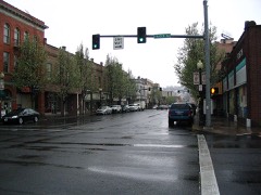 South Main Street Commercial Historic Districtlisted 1986
 Umatilla County Librarylisted 1997
Population over time
16 figuresPendleton grew from 243 to 17,107 between 1870 and 2020. These are the recorded population figures Wikidata holds for this place, reached through the Geographic Names Information System number this page is keyed on rather than by name, so they belong to this place and not to another of the same name. Most are census counts, but not all are: an early figure may be a founding or settlement estimate, and an estimate published within five years of a census is left out. The change column is computed, and is left blank where more than 20 years separate a figure from the one before it, because a gap that long is not a change between two counts.
| Year | People | Change |
|---|---|---|
| 1870 | 243 | |
| 1880 | 703 | +460 (+189%) |
| 1890 | 2,506 | +1,803 (+256%) |
| 1900 | 4,406 | +1,900 (+76%) |
| 1910 | 4,460 | +54 (+1%) |
| 1920 | 6,837 | +2,377 (+53%) |
| 1930 | 6,621 | -216 (-3%) |
| 1940 | 8,847 | +2,226 (+34%) |
| 1950 | 11,774 | +2,927 (+33%) |
| 1960 | 14,434 | +2,660 (+23%) |
| 1970 | 13,197 | -1,237 (-9%) |
| 1980 | 14,521 | +1,324 (+10%) |
| 1990 | 15,126 | +605 (+4%) |
| 2000 | 16,354 | +1,228 (+8%) |
| 2010 | 16,612 | +258 (+2%) |
| 2020 | 17,107 | +495 (+3%) |
Topographic sheets covering this place
5 surveys from 12 printed sheetsMatched by testing this settlement's coordinate against the published boundary of every sheet in the United States Geological Survey's historical collection. Each opens the scanned sheet at the Survey.
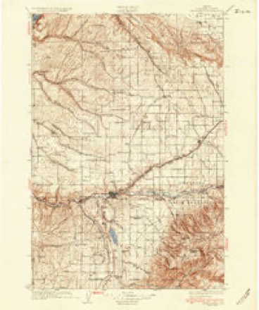
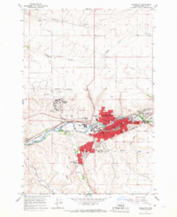
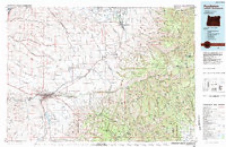
- 1935 USGS Pendleton quadrangle1:125000, 3 printings
- 1953 USGS Pendleton quadrangle1:250000, 4 printings
- 1956 USGS Pendleton quadrangle1:250000
- 1966 USGS Pendleton quadrangle1:24000, 3 printings
- 1983 USGS Pendleton quadrangle1:100000
What the histories say of this town
1,607 words1 chapter about Pendleton from the published histories of the county, public domain and reproduced complete.
| Chapter | From | Length |
|---|---|---|
| Historic Sketches of Walla Walla, Whitman, Columbia and Garfield Count | Historic Sketches of Walla Walla, Whitman, Columbia and Garfield Counties, Washington Territory, and Umatilla County, Oregon (1882) | 1,607 words |
Fires near this place
96 since 1992Regional context, not property-specific evidence. The federal wildfire occurrence database lists 96 fires within 5 miles of Pendleton between 1992 and 2020, burning about 2,242 acres in total. 3 started naturally. 6 were recorded as arson. Distance is straight-line from the map coordinates, so a fire counted here may appear on a neighbouring settlement's page as well.
| Reported cause | Fires |
|---|---|
| Debris and open burning | 22 |
| Equipment and vehicle use | 18 |
| Missing data/not specified/undetermined | 12 |
| Power generation/transmission/distribution | 11 |
| Railroad operations and maintenance | 11 |
| Arson/incendiarism | 6 |
| Recreation and ceremony | 5 |
| Natural | 3 |
| Smoking | 3 |
| Fireworks | 3 |
| Other causes | 2 |
The most recent of them, most recent first, with the day each was reported and the service that recorded it.
| Date | Cause | Size | Reported by | Name on the report |
|---|---|---|---|---|
| 9 September 2005 | Power generation/transmission/distribution | under an acre | Umatilla Agency | POWERPOLE |
| 9 September 1995 | Railroad operations and maintenance | under an acre | Umatilla Agency | UPRR7 |
| 7 September 2006 | Other causes | under an acre | Umatilla Agency | HAYSTACK |
| 5 September 2019 | Natural | 63 acres | Umatilla Agency | TUTUILLA CREEK |
| 4 September 2018 | Debris and open burning | 5.8 acres | Umatilla Agency | LLYOD ROAD |
| 3 September 2003 | Debris and open burning | 3.0 acres | Umatilla Agency | MCCOY |
| 24 September 1999 | Equipment and vehicle use | 100 acres | Umatilla Agency | DOGSLEEP |
| 18 September 2014 | Power generation/transmission/distribution | 225 acres | Umatilla Agency | ELIZABETHAN |
Settlements close enough to share some of these fires:
Mines and quarries near this place
10 of 34 shownRegional context, not property-specific evidence. The federal mineral resources record lists 34 workings within 5 miles of Pendleton: 29 past producers, 5 producers. 5 still produce. What was taken out: Stone, Stone, Crushed/Broken, Sand and Gravel, Construction. Distance is straight-line from the map coordinates, so a quarry counted here may appear on a neighbouring settlement's page as well.
| Where | Site | Commodity | Status | Recorded |
|---|---|---|---|---|
| 404 Quarry | Sand and Gravel, Construction | Past Producer | Sedimentary | |
| 404 Quarry | Sand and Gravel, Construction | Producer | ||
| Gravel Pit | Sand and Gravel, Construction | Past Producer | ||
| Mission Pit | Sand and Gravel, Construction | Past Producer | ||
| Mission Pit | Sand and Gravel, Construction | Producer | ||
| Pendleton Mission | Sand and Gravel, Construction | Past Producer | ||
| Pendleton Mission Pit | Sand and Gravel, Construction | Producer | ||
| Pendleton Ready Mix | Sand and Gravel, Construction | Past Producer | ||
| Sand & Gravel Plant | Sand and Gravel, Construction | Past Producer | ||
| Boggotti Pit | Stone, Crushed/Broken | Past Producer |
Storms near this place
27 since 1995Regional context, not property-specific evidence. The National Weather Service names Pendleton in 27 storm reports between 1995 and 2020: 15 thunderstorm wind, 3 lightning, 3 funnel cloud, 3 hail. No death or injury is recorded in these reports. Each account below is quoted exactly as the forecast office filed it, from the NOAA Storm Events Database, and each date opens the federal record of that event.
| When | Event | Place named | Harm | What the report says |
|---|---|---|---|---|
| April 2019 | Flood | Pendleton | $5,000,000 | A combination of high flows from rain and snow melt coming out of the Blue Mountains and record releases out of McKay Reservoir produced field and roadside flooding downstream of Pendleton through Echo, Hermiston and Umatilla. A footbridge at Umatilla was damaged by the high flows and erosion. |
| June 2008 | Thunderstorm Wind | Pendleton | $50,000 | Semi-truck and pickup with camper were flipped over on Interstate 84. |
| July 1995 | Thunderstorm Wind | Pendleton | $15,000 | Thunderstorm winds toppled an old concrete and wood wall in Pendleton, crushing several cars under the falling debris. Tall trees were also blown down in SE Pendleton. |
| June 2008 | Thunderstorm Wind | Pendleton | $7,000 | Damage to roof and dozens of large branches downed. Two trees uprooted near the Pendleton High School. |
| May 2010 | Thunderstorm Wind | Pendleton | $5,000 | Shingles blown off roof during thunderstorm. |
| May 2009 | Thunderstorm Wind | Pendleton | $5,000 | Downed tree branches caused power outage. A 20 foot tall lilac bush was uprooted and shingles were torn off roofs. |
| June 2008 | Thunderstorm Wind | Pendleton | $5,000 | Umatilla Electric Coop reports trees blown down on power lines in several locations between Pendleton and Nolin. |
| July 1995 | Thunderstorm Wind | Pendleton | $5,000 | An area of vigorous thunderstorms hit the Pendleton area in mid-afternoon. Trees were blown down and visibility at the airport was reduced to one-quarter mile in blowing dust by winds gusting to 55 mph. |
| May 1995 | Thunderstorm Wind | Pendleton | $5,000 | Thunderstorm wind blew sheets of metal roofing off of a gas station at U.S. Highway 30 and Airport Road. No injuries were reported. |
| February 2000 | Heavy Rain | Pendleton | $4,000 | Steady rain fell all day and washed mud and other debris on several city streets. Both Coombs Canyon and Adams Roads were briefly closed as maintenance crews unplugged some drains. This rain, which totaled 0.93 inches at the Pendleton Airport, also washed out a section of Wildhorse Road near Weston. |
| August 2004 | Lightning | Pendleton | $1,000 | no account filed |
| May 2011 | Lightning | Pendleton | $500 | Lightning struck the attic of a residence and blew out the power and sent sheetrock flying off the walls downstairs. The lightning also struck a bathroom vent on the neighbor's house. |
| June 2017 | Thunderstorm Wind | Pendleton | - | Measured gust to 64 mph by the ASOS at the Pendleton airport. |
| May 2015 | Thunderstorm Wind | Pendleton | - | Public reported trees snapped or uprooted due to high winds from a thunderstorm. |
| April 2013 | Thunderstorm Wind | Pendleton | - | Downed trees, damage to a home, power lines down, and a barn destroyed. |
| September 2013 | Thunderstorm Wind | Pendleton | - | Gust of 64 mph was measured by the weather station at the Pendleton WFO. |
| September 2013 | Thunderstorm Wind | Pendleton | - | Three foot diameter tree split from high winds, part of the tree fell onto a pickup truck bed. |
| April 2011 | Funnel Cloud | Pendleton | - | Public reported a shaft of rotation along with a wall cloud in a thunderstorm. |
| April 2010 | Hail | Pendleton | - | Dime size hail reported. |
| May 2000 | Funnel Cloud | Pendleton | - | A small funnel cloud that descended a couple hundred feet from a thunderstorm was observed from the National Weather Service forecast office by an off duty forecaster. This funnel lasted for around 15 seconds. |
| August 1997 | Thunderstorm Wind | Pendleton | - | Thunderstorm wind gusted to 59 mph at the Pendleton Airport. |
| May 1997 | Lightning | Pendleton | - | A power pole cought fire and caused power and cable TV outages in southeast Pendleton. |
| May 2020 | Hail | Pendleton | - | no account filed |
| May 2016 | Thunderstorm Wind | Pendleton | - | no account filed |
| March 2014 | Flood | Pendleton | - | no account filed |
| August 2004 | Funnel Cloud | Pendleton | - | no account filed |
| May 2000 | Hail | Pendleton | - | no account filed |
Nearest settlements
The eight closest, with where each one stands in the county. Distances are straight-line, computed from the Geographic Names Information System coordinates.
| Map | Place | Distance | Sheets |
|---|---|---|---|
| Glendale | 2.7 miles | 12 | |
| Riverside | 2.7 miles | 11 | |
| Pendair Heights | 3.1 miles | 12 | |
| Green Meadows | 3.9 miles | 10 | |
| Rieth | 4.5 miles | 12 | |
| Fulton | 4.5 miles | 11 | |
| Mission | 5.6 miles | 11 | |
| Tutuilla | 5.8 miles | 11 |
Elsewhere
Matched on this settlement's Geographic Names Information System number rather than its name, so it cannot be a different place of the same name in another state.
| Wikipedia article on Pendleton | An encyclopaedic summary. Its text is share-alike, so it is linked here rather than copied. |
| Wikidata item Q944507 | The structured record the population and elevation above come from. Public domain (CC0). |
Provenance
This settlement is recorded in the Geographic Names Information System as feature 1125283. The sheet list is computed by point-in-boundary test against the United States Geological Survey's historical topographic inventory. Both are works of the United States government and carry no copyright under 17 U.S.C. 105.
Wildfire. Short, Karen C. 2022. Spatial wildfire occurrence data for the United States, 1992-2020 [FPA_FOD_20221014]. 6th Edition. Fort Collins, CO: Forest Service Research Data Archive. https://doi.org/10.2737/RDS-2013-0009.6 Collected with United States Government funding and usable without additional permissions or fees.
Mines and quarries. USGS Mineral Resources Data System (MRDS) https://mrdata.usgs.gov/mrds/ A work of the United States government, no copyright under 17 U.S.C. 105.
Storms. NOAA National Centers for Environmental Information, Storm Events Database https://www.ncei.noaa.gov/stormevents/ A work of the United States government, no copyright under 17 U.S.C. 105. Narratives are quoted verbatim from the National Weather Service report and are not edited or summarised.