Block
From the record
43 National Register listings published here · the county-history sources tell 1 story.
Sources: the county history on the Internet Archive · the National Register database, National Park Service
86 topographic sheets cover 49 settlements here, and 43 properties are on the National Register of Historic Places.
43 National Register listings published here · the county-history sources tell 1 story.
Sources: the county history on the Internet Archive · the National Register database, National Park Service
Among them: War With The Snakes, Bannocks And Pah Utes. These passages come from the identified county-history source books. Each inset names its own source and opens the exact section it comes from.
In the month of June, 1878, a large band of Bannock Indians, under the leadership of Buffalo Horn, began murdering settlers and destroying their property in the southern portion of Idaho and Oregon in the vicinity of Snake river. Buffalo Horn was a celebrated warrior, who had the year before aided the government against Chief Joseph and his band of hostile Nez Perces.
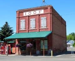
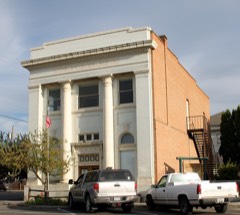
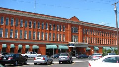
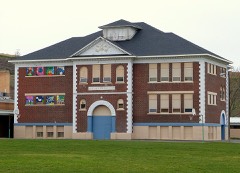
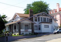
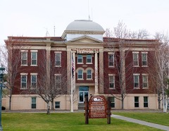
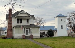
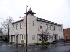
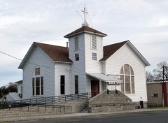
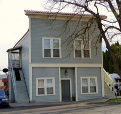
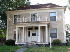
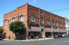
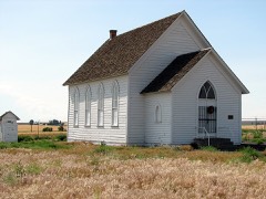
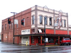
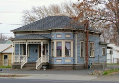
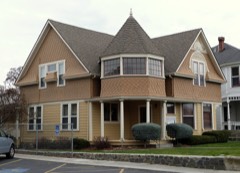
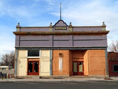
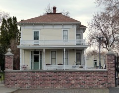
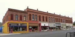
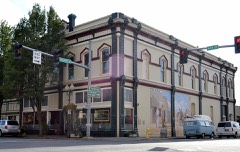
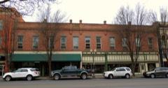
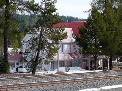
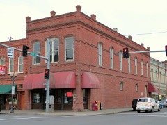
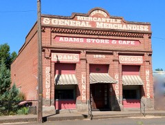
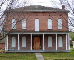
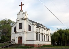
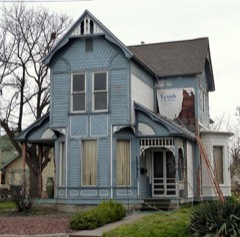
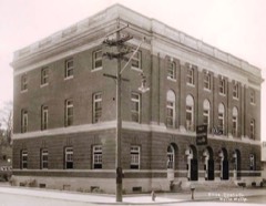
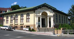
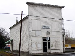
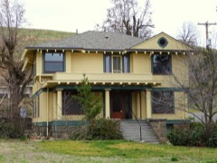
Every property in this county listed on the National Register of Historic Places, with the year it was listed and the federal nomination document.
Every wildfire the federal occurrence database records inside this county: 1,902 of them, burning about 184,008 acres. 884 started naturally and 47 were recorded as arson. Each settlement page carries the fires within five miles of it.
| Reported cause | Fires |
|---|---|
| Natural | 884 |
| Recreation and ceremony | 214 |
| Equipment and vehicle use | 205 |
| Debris and open burning | 179 |
| Missing data/not specified/undetermined | 166 |
| Railroad operations and maintenance | 56 |
| Arson/incendiarism | 47 |
| Smoking | 44 |
| Power generation/transmission/distribution | 43 |
| Misuse of fire by a minor | 24 |
| Other causes | 20 |
| Fireworks | 19 |
| Firearms and explosives use | 1 |
The five largest, by the area the report gives. None of them was recorded as arson.
| Date | Cause | Size | Reported by | Name on the report |
|---|---|---|---|---|
| 14 August 1996 | Natural | 50,633 acres | Umatilla National Forest | TOWER |
| 7 September 2020 | Missing data/not specified/undetermined | 12,756 acres | Pilot Rock Rural Fire Protection District | EAST FORK BUTTER CREEK |
| 29 July 2018 | Missing data/not specified/undetermined | 12,377 acres | McNary National Wildlife Refuge | LAKE WALLULA |
| 10 August 1994 | Natural | 11,081 acres | Umatilla National Forest | BOUNDARY |
| 13 August 2001 | Natural | 9,230 acres | Pendleton Unit | BRIDGE CREEK |
| 13 September 2015 | Equipment and vehicle use | 8,988 acres | McNary National Wildlife Refuge | STATE LINE |
| 7 September 2011 | Missing data/not specified/undetermined | 8,212 acres | Wallowa-Whitman National Forest | CACTUS MOUNTAIN |
| 28 July 2006 | Equipment and vehicle use | 8,000 acres | McNary National Wildlife Refuge | HATCH GRADE |
Every settlement page carries the fires within five miles of it - see the settlement index below.
The NOAA Storm Events Database holds 263 reports for this county, causing 1 death, 5 injuries and about $54,534,500 in recorded property damage. Each settlement page carries the reports that name it.
| Kind of event | Reports |
|---|---|
| Thunderstorm Wind | 110 |
| Hail | 89 |
| Flood | 15 |
| Funnel Cloud | 11 |
| Lightning | 10 |
| Tornado | 9 |
| Flash Flood | 8 |
| Heavy Rain | 6 |
| Wildfire | 5 |
The most serious of them, by death, then injury, then recorded damage. The accounts are quoted exactly as the forecast office filed them.
| When | Event | Place named | Harm | What the report says |
|---|---|---|---|---|
| February 2020 | Flood | Milton Freewater | 1 killed, $39,700,000 | Umatilla County There was record flooding along the entire reach of the Umatilla River. There was extensive damage to areas along the river, including homes, roads including Interstate 84, railroads as well as other public facilities such as parks and sports complexes. Along the upper reaches of the river, roads were washed out with homes damaged or destroyed. One resident was swept away by flood waters and died. A number of residents had to be evacuated via helicopter or 4 wheeler with 70 homes on the Umatilla Indian Reservation damaged. The Riverview Mobile Home Park at Pendleton was inundated. There was minimal to no damage through Pendleton, due to the levee, but the Bob White Baseball field had extensive damage as water overtopped a low wall. Adjacent to Pendleton, the levee was damaged and overtopped with water flowing through the Keystone RV Manufacturing plant and the Colby Pipe Company. Several bridges and roads downstream from Reith to Echo were damaged or washed out with a number of homes damaged. Downstream from Echo to the confluence of Columbia River, the river rose out of the banks and flooded Interstate 84 between Highway 395 and Highway 208. Several semi-trucks were stranded in the flood waters with extensive damage to the highway. Numerous pastures and buildings along the river through Stanfield were flooded with extensive damage to Oxbow Park in Hermiston and to a sports complex in Umatilla. There was extensive flooding as well as on the Walla Walla River from the headwaters through Milton Freewater and on the upper reaches of Mill Creek. Numerous levees along the Umatilla and Walla Walla Rivers were damaged or overtopped including near Milton Freewater, several locations on the Umatilla Indian Reservation and adjacent to Pendleton. Damage is estimated at 1.3 million dollars to private property on the Umatilla Indian Reservation, with damage for public infrastructure for the entire county at 39.7 million dollars.||Umatilla at Pendleton Flood stage is 12.3 feet. The river rose above flood stage on February 6th 1230 pm, crested at 19.18 feet on February 6th at 10 pm, then fell below flood stage on February 8th at 11am. This was a record peak flow of 19,400 cfs. Highway 11(major access way to Pendleton) was closed due to water flowing over the road. Several bridges and roads downstream from Reith to Echo were damaged or washed out with a number of homes damaged. Umatilla near Gibbon Flood Stage is 7.0 feet. The river rose above flood stage on February 6th, at 2 am, crested at 12.14 feet on February 6th, at 130 pm, then fell below flood stage on February 8th at 645 pm. This was a record peak flow of 13,900 cfs. There was extensive damage along the upstream portions of the river with over 70 homes damaged, roads and railroad tracks washed out, levee damaged or washed out. |
| August 1991 | Thunderstorm Wind | not stated | 5 hurt | no account filed |
| April 2019 | Flood | Sparks | $9,000,000 | McKay Creek, with headwaters in the Blue Mountains saw significant rises with record inflows recorded at McKay Reservoir in Pendleton. This resulted in increased releases from the McKay Dam, with flooding downstream along the creek through Pendleton. Teams were out in partnership with Team Rubicon and surveyed 102 homes in the McKay area. Nine homes reported flooded basements, twenty-eight homes reported subfloor or foundation flooding and sixty-five homes had water encroachment on the property. Over ninety homes had actively sandbagged their property. |
| April 2019 | Flood | Pendleton | $5,000,000 | A combination of high flows from rain and snow melt coming out of the Blue Mountains and record releases out of McKay Reservoir produced field and roadside flooding downstream of Pendleton through Echo, Hermiston and Umatilla. A footbridge at Umatilla was damaged by the high flows and erosion. |
| April 2005 | Flash Flood | Hermiston | $170,000 | no account filed |
| July 2012 | Flash Flood | Apex | $100,000 | Heavy rainfall caused flood waters and mud to flow into Helix and damage 16 roads, yards, homes, and basements. |
| July 2012 | Flash Flood | Apex | $100,000 | Heavy rainfall caused flood waters and mud to flow into Helix and damage 16 roads, yards, homes, and basements. |
| April 2012 | Thunderstorm Wind | Hermiston | $50,000 | Thunderstorm winds downed a large elm tree onto a house and deck. |
| July 2012 | Thunderstorm Wind | Stanfield | $50,000 | A gustnado within an outflow area destroyed a farm shed, uprooted and broke off several large trees, damaged wheat and an irrigation wheel line. |
| May 2009 | Tornado (EF1) | Cayuse | $50,000 | Storm observed by farm workers at Ruggs Ranch. One hundred foot section of workshop metal roof torn off and carried up to 1/2 mile. Fifty-gallon drums thrown up to 1/4 mile. Trees uprooted and limbs down. Wooden plank driven through metal building. |
| June 2008 | Thunderstorm Wind | Pendleton | $50,000 | Semi-truck and pickup with camper were flipped over on Interstate 84. |
| June 2008 | Thunderstorm Wind | (Meh)Meacham | $50,000 | Twelve inch diameter tree broke off and fell against house. Many other tree limbs downed. |
| July 2010 | Thunderstorm Wind | Hermiston | $40,000 | A microburst tore the roof from a barn, downed 3 trees, and damaged others. |
| October 2003 | Wildfire | Echo | $40,000 | High winds in the Echo area contributed to a wildfire which ignited a haystack, consisting of 2,000 tons of alfalfa. Two flatbed truck trailers were also destroyed by the flames. The fire was caused by a controlled burn earlier in the day next to an irrigation ditch. The property damage from this event is estimated at $40,000. |
| August 2001 | Thunderstorm Wind | Meacham | $15,000 | Winds from a dry microburst knocked over 15 trees and damaged a motorhome at Emigrant Springs State Park, located at 4000 feet in the Blue Mountains. An ASOS site 4 miles away in Meacham recorded a peak wind gust of 46 mph associated with this storm. |
| July 1995 | Thunderstorm Wind | Pendleton | $15,000 | Thunderstorm winds toppled an old concrete and wood wall in Pendleton, crushing several cars under the falling debris. Tall trees were also blown down in SE Pendleton. |
| April 2019 | Flood | Ukiah | $10,000 | A levy along Camas Creek in Ukiah was damaged with flooding of several outbuildings on properties in Ukiah, several homes were surrounded with water. |
| April 2006 | Thunderstorm Wind | Hermiston | $10,000 | Thunderstorm winds caused a tree to fall through a mobile home. The winds also downed power lines. |
| July 2001 | Thunderstorm Wind | Hermiston | $10,000 | Estimated wind gusts between 50 and 60 mph broke large limbs off many trees around Hermiston. |
| August 2001 | Thunderstorm Wind | Weston | $10,000 | Thunderstorm winds downed several trees and many large branches, knocking out electricity for around 8 hours. Several residents reported broken windows due to flying debris. |
| June 2008 | Thunderstorm Wind | Pendleton | $7,000 | Damage to roof and dozens of large branches downed. Two trees uprooted near the Pendleton High School. |
| August 2019 | Thunderstorm Wind | (Pdt)Pendleton Arpt | $6,000 | Damage to metal exterior of home. Time estimated from radar. |
| March 2011 | Thunderstorm Wind | Stanfield | $5,000 | Resident observed a gustnado moving from south to north which took shingles off the roof, lifted and blew a trampoline 500 feet, and damaged a barn. |
| May 2010 | Thunderstorm Wind | Pendleton | $5,000 | Shingles blown off roof during thunderstorm. |
| May 2009 | Thunderstorm Wind | Pendleton | $5,000 | Downed tree branches caused power outage. A 20 foot tall lilac bush was uprooted and shingles were torn off roofs. |
| June 2008 | Thunderstorm Wind | Pendleton | $5,000 | Umatilla Electric Coop reports trees blown down on power lines in several locations between Pendleton and Nolin. |
| June 2008 | Thunderstorm Wind | Pendleton Arpt | $5,000 | New metal roof blown loose and rattling up and down on house located on Airport Hill. |
| July 1995 | Thunderstorm Wind | Pendleton | $5,000 | An area of vigorous thunderstorms hit the Pendleton area in mid-afternoon. Trees were blown down and visibility at the airport was reduced to one-quarter mile in blowing dust by winds gusting to 55 mph. |
| May 1995 | Thunderstorm Wind | Pendleton | $5,000 | Thunderstorm wind blew sheets of metal roofing off of a gas station at U.S. Highway 30 and Airport Road. No injuries were reported. |
| August 1994 | Thunderstorm Wind | .5 SE Pilot Rock | $5,000 | Winds associated with a severe thunderstorm damaged the roof, chimney, and TV antenna on a house near Pilot Rock, about 12 miles south of Pendleton. |
| February 2000 | Heavy Rain | Pendleton | $4,000 | Steady rain fell all day and washed mud and other debris on several city streets. Both Coombs Canyon and Adams Roads were briefly closed as maintenance crews unplugged some drains. This rain, which totaled 0.93 inches at the Pendleton Airport, also washed out a section of Wildhorse Road near Weston. |
| April 2011 | Lightning | Ferndale | $2,000 | Lightning hit a white birch tree and a house on Stiller Lane in Milton-Freewater. The tree was split and bark and wooden shrapnel shot in all directions, some of it lodging in the siding of a house. Lightning also traveled through the TV cable and destroyed the resident's TV. |
| May 2009 | Hail | Thorn Hollow | $1,000 | Hail up to golf ball size punched holes in vinyl siding. |
| June 2008 | Thunderstorm Wind | Ukiah | $1,000 | Power line down due to strong wind. |
| June 2006 | Lightning | Hermiston | $1,000 | Lightning struck a cottonwood tree outside of a home and damaged 2 televisions, 4 telephones, and 2 mirrors. |
| August 2004 | Lightning | Pendleton | $1,000 | no account filed |
| August 1999 | Thunderstorm Wind | Ukiah | $1,000 | no account filed |
| May 2011 | Lightning | Pendleton | $500 | Lightning struck the attic of a residence and blew out the power and sent sheetrock flying off the walls downstairs. The lightning also struck a bathroom vent on the neighbor's house. |
| April 2026 | Thunderstorm Wind | Nolin | - | A mesoscale low with embedded storms moving northeast across the Blue Mountain foothills produced strong wind gusts in the region, with a 61 mph gust measured by the mesonet station OD185 at 1713 PDT, and a 58 mph gust measured by the KPDT ASOS at 1706 PDT on the 1st. |
| April 2026 | Flood | Bingham Spgs | - | The Umatilla County Emergency Manager reported that water over Bingham Road east of Gibbon, with flood waters depositing debris and sediment. |
| May 2025 | Funnel Cloud | Hermiston | - | A member of the public provided a photo of a funnel cloud that occurred near the the town of Hermiston. Social media posts from local newspapers also provided other images of the funnel cloud taken around the Hermiston area. Location is estimated from radar and orientation of discernable landmarks in the photos. |
| March 2024 | Tornado (EF0) | Blue Mtn | - | At least one, possibly multiple landspouts were observed by a member of the public west of Highway 11 between Athena and Milton Freewater. Pictures taken show one well defined landspout and another much smaller landspout within it's vicinity. |
| August 2024 | Hail | Myrick | - | A social media report indicated hail up to the size of 0.88 inches fell in Milton-Freewater between 0600 to 0620 PDT. |
| August 2024 | Thunderstorm Wind | Hermiston Arpt | - | Pendleton and Hermiston ASOS reported wind gusts of 68 and 60 mph, respectively. |
| June 2023 | Tornado (EF0) | State Line | - | Social media reports including several photos showed a landspout had spun up in the farm fields east of Milton-Freewater, OR. |
| May 2023 | Thunderstorm Wind | Mission | - | Mesonet station OD191, 2 miles WSW of Mission, reported a wind gust of 62 mph from the outflow boundary of a deteriorating thunderstorm at 2220 PDT. |
| May 2022 | Hail | (Meh)Meacham | - | A public report 4 miles north northwest of Meacham, OR reported a thunderstorm that was producing 1.5 inch hail stones near exit 234 along I-84 in northeast OR at 1540 PST. A trained spotter 6 miles south southwest of Thorn Hollow, OR also reported hail that ranged in size from 0.75 to 1 inches and accumulated up to 1.5 inches deep at 1540 PST. |
| May 2022 | Flood | Mission | - | A trained spotter 9 miles west of Meacham, OR reported water covering county roadways making them impassable at 0900 PST on May 29th. A public Facebook report from 8 miles east northeast of Pilot Rock, OR had video of flooding over Popcorn Ln along Mckay Creek, making the road impassable at 0900 PST on May 29th. A NWS Employee reporting 4 miles south of Mission, OR reported water covering the intersection of Lloyd Rd. and Market Rd due to flooding along the Pattawa Creek at 1013 PST on May 29th. Another report 4 miles east southeast of Pilot Rock, OR reported 2.06 inches of rainfall over an 18 hour period, with water over Stewart Creek Rd and other local roads at PST on May 29th. |
| May 2022 | Hail | Sparks | - | Public reports about 10 miles south of Pendleton, OR reported a thunderstorm that was producing hail between the sizes of 1 inch to 1.25 inches between 1700 PST and 1730 PST. |
| May 2022 | Tornado (EF1) | Bingham Spgs | - | At 1244 PST, a tornado spun up 7 miles east southeast of Weston, OR along OR Highway 204 and moved east crossing OR Highway 204 3 times before veering left about 1.9 miles from it's start point. The tornado continued east north east for 0.80 miles across a draw north of OR Hwy 204, following parallel to Lower Basket Mountain Rd for about 0.8 miles before dissipating. Many trees were either uprooted or snapped while covering the highway and other roads. Several residences saw roof damage, including failure and uplifting of a partial roof that was transported 300 feet. A farm outbuilding was also heavily damaged where the roof and walls had collapsed. |
| August 2022 | Thunderstorm Wind | Milton Freewater | - | A NWS Storm Survey conducted the day after the event revealed areas of isolated down trees and tree branches, where one of the downed trees had landed on a home. There was also an area of corn crops that had been blown over in a unidirectional manner. |
| August 2022 | Thunderstorm Wind | Milton Freewater | - | A downburst occurred from a strong thunderstorm that affected several unoccupied, parked mobile homes. One of the mobile homes was lifted 30 feet into a neighboring mobile home, destroying the lifted mobile home. Other mobile homes suffered some roof and other structural damage, as evidenced from broken glass and insulation around the site. |
| July 2022 | Hail | Ukiah | - | Hail stones up to the diameter of 1.5 inches was reported near the Drift Fence Campground. The same thunderstorm had also produced 1 inch sized hail in the neighboring Grant county. |
| July 2022 | Hail | Lehman | - | Hail stones up to 1 inch in diameter were measured at the Indian Lake Campground. |
| June 2022 | Tornado (EFU) | Barnhart | - | The Pendleton Airport air traffic controller relayed a report from a pilot travelling south of the airfield that debris and dust was being picked up by a small tornado. A funnel cloud was observed by NWS personnel and by the public shortly before the relayed report. |
| June 2021 | Hail | State Line | - | Social media report 15 miles ENE of Milton-Freewater, OR indicated a thunderstorm produced hail up to 1.75 inches just after 12 am PDT on June 15th. |
| May 2020 | Thunderstorm Wind | Cayuse | - | Minor tree damage reported. |
| May 2020 | Thunderstorm Wind | Umatilla | - | Trees and powerlines down. Roof damage reported. |
| May 2020 | Flood | Ukiah | - | The most significant flooding was reported in Pilot Rock along Birch Creek where some homes were flooded. Minor flood was reported along McKay Creek in Pendleton due to outflow from the Dam. Flooding was also reported in and around Ukiah. The Umatilla at Gibbon and Pendleton both reached flood stage cresting at 8.3 and 12.4 feet respectively. |
| May 2020 | Thunderstorm Wind | Hermiston | - | Numerous trees and tree limbs down. One quarter mile visibility in blowing dust. |
The Survey's mineral resources record lists 412 workings inside this county. 91 still produce and 321 are closed or unrecorded. Each settlement page carries the workings within five miles of it.
| Commodity | Workings |
|---|---|
| Sand and Gravel, Construction | 245 |
| Stone, Crushed/Broken | 75 |
| Stone | 68 |
| Gold | 12 |
| Geothermal | 5 |
| Mercury | 2 |
| Uranium | 2 |
| Clay | 2 |
| Gold, Silver | 1 |
| Silica | 1 |
| Silver | 1 |
The least common of them first, because a county's hundredth gravel pit says nothing its first ten did not.
| Where | Site | Commodity | Status | Recorded |
|---|---|---|---|---|
| Gold Prospect | Gold, Silver | Occurrence | ||
| Sand Station Deposit | Silica, Sand and Gravel, Construction | Past Producer | ||
| Unnamed Prospect | Gold, Silver | Unknown | ||
| Clay Pit | Clay | Past Producer | ||
| Red Chief Prospect | Mercury | Past Producer | ||
| Red Chief Prospect | Mercury | Unknown | ||
| Unnamed Pit | Clay | Producer | ||
| Uranium Occurrence | Uranium | Occurrence | Allanite | |
| Uranium Occurrence | Uranium | Unknown | ||
| Bingham Springs | Geothermal | Producer | ||
| Hermiston City Well | Geothermal | Producer | ||
| Hideaway Springs | Geothermal | Occurrence | ||
| Lehman Hot Springs | Geothermal | Occurrence | ||
| Unnamed Well | Geothermal | Producer | ||
| Big Twin Rock | Gold | Occurrence | ||
| Big Twin Rock | Gold | Occurrence | ||
| Gold Mine | Gold | Past Producer | ||
| Gold Prospect | Gold | Occurrence | ||
| Gold Prospect | Gold | Occurrence | ||
| Hard Luck Placer Claim | Gold | Occurrence | ||
| Little Fawn Placer | Gold | Occurrence | ||
| Little Fawn Placer Claim | Gold | Occurrence | ||
| Unnamed Gold Property | Gold | Occurrence | ||
| Unnamed Prospect | Gold | Occurrence | ||
| Unnamed Prospect | Gold | Unknown | ||
| Anderson/Sumac | Stone | Past Producer | ||
| Barnhart Pit #1 | Stone | Past Producer | ||
| Barnhart Pit #2 | Stone | Past Producer | ||
| Barnhart Pit No.1 | Stone | Past Producer | ||
| Basalt Quarry | Stone | Past Producer | ||
| Basalt Quarry | Stone | Past Producer | ||
| Bensel Road Quarry | Stone | Past Producer | ||
| Boggotti | Stone | Past Producer | ||
| Butter Creek Site | Stone | Past Producer | ||
| Catron Pit | Stone | Past Producer | ||
| Cayuse Quarry | Stone | Past Producer | ||
| Cold Springs | Stone | Past Producer | ||
| Coombs Canyon | Stone | Past Producer | ||
| Doherty Sheep Ranch | Stone | Past Producer | ||
| Duff | Stone | Past Producer | ||
| German Hall | Stone | Past Producer | ||
| Hard Luck Placer | Stone | Past Producer | ||
| Hat Rock | Stone | Past Producer | ||
| Job 75 | Stone | Past Producer | ||
| Kenney Pit | Stone | Past Producer | ||
| Kulm | Stone | Past Producer | ||
| Leverenz | Stone | Past Producer | ||
| Mccormmach | Stone | Past Producer | ||
| Meacham | Stone | Past Producer | ||
| Mf Pit and Plant | Stone | Past Producer | ||
| North Fork Tuff | Stone | Past Producer | ||
| North Fork Tuff | Stone | Past Producer | ||
| North Juniper | Stone | Past Producer | ||
| Pendleton Pit | Stone | Past Producer | ||
| Pilot Rock | Stone | Past Producer | ||
| Quarry | Stone | Past Producer | ||
| Quarry | Stone | Past Producer | ||
| Quarry | Stone | Past Producer | ||
| Quarry | Stone | Past Producer | ||
| Quarry | Stone | Past Producer | ||
| Quarry | Stone | Past Producer | ||
| Quarry | Stone | Past Producer | ||
| Quarry | Stone | Past Producer | ||
| Quarry | Stone | Past Producer | ||
| Quarry | Stone | Past Producer | ||
| Quarry | Stone | Past Producer | ||
| Quarry | Stone | Past Producer | ||
| Quarry | Stone | Past Producer | ||
| Quarry | Stone | Past Producer | ||
| Quarry | Stone | Past Producer | ||
| Quarry | Stone | Past Producer | ||
| Quarry | Stone | Past Producer | ||
| Quarry | Stone | Past Producer | ||
| Quarry | Stone | Past Producer | ||
| Quarry | Stone | Past Producer | ||
| Quarry | Stone | Past Producer | ||
| Quarry | Stone | Past Producer | ||
| Quarry | Stone | Past Producer | ||
| Quarry | Stone | Past Producer | ||
| Quarry | Stone | Past Producer | ||
| Quarry | Stone | Past Producer | ||
| Quarry | Stone | Past Producer | ||
| Quarry | Stone | Past Producer | ||
| Quarry | Stone | Past Producer | ||
| Reser Quarry | Stone | Past Producer | ||
| Rohrmann Quarry | Stone | Past Producer | ||
| Schubert Pit | Stone | Past Producer | ||
| Stnaughn | Stone | Past Producer | ||
| Struve | Stone | Past Producer | ||
| Struve Pit | Stone | Past Producer | ||
| Summit Road Quarry | Stone | Past Producer | ||
| Thornhollow | Stone | Past Producer | ||
| Wayland Pit | Stone | Past Producer | ||
| Anderson/Sumac | Stone, Crushed/Broken | Producer | ||
| Barnhart No.2 | Stone, Crushed/Broken | Producer | ||
| Barnhart Pit No. 1 | Stone, Crushed/Broken | Past Producer | ||
| Bensel Road Quarry | Stone, Crushed/Broken | Producer | ||
| Blue Mtn Station | Stone, Crushed/Broken | Producer | ||
| Boggotti Pit | Stone, Crushed/Broken | Past Producer | ||
| Butter Creek Site | Stone, Crushed/Broken | Producer | ||
| Casper Quarry | Stone, Crushed/Broken | Producer | ||
| Catron Pit | Stone, Crushed/Broken | Producer | ||
| Cayuse Quarry | Stone, Crushed/Broken | Producer | ||
| Cold Springs | Stone, Crushed/Broken | Producer | ||
| Coombs Canyon Pit | Stone, Crushed/Broken | Producer | ||
| Diagonal Quarry | Stone, Crushed/Broken | Producer | ||
| Doherty Sheep Ranch Pit | Stone, Crushed/Broken | Producer | ||
| Duff Pit | Stone, Crushed/Broken | Producer | ||
| Emigrant Hill | Stone, Crushed/Broken | Past Producer | ||
| German Hall Pit | Stone, Crushed/Broken | Past Producer | ||
| Hat Rock Quarry | Stone, Crushed/Broken | Producer | ||
| Hoeft | Stone, Crushed/Broken | Producer | ||
| Job 75 | Stone, Crushed/Broken | Past Producer | ||
| Kenney Pit | Stone, Crushed/Broken | Producer | ||
| Komen Pit | Stone, Crushed/Broken | Producer | ||
| Kulm Pit | Stone, Crushed/Broken | Producer | ||
| Leverenz Pit | Stone, Crushed/Broken | Producer | ||
| Mccormmach Pit | Stone, Crushed/Broken | Producer | ||
| Meacham Pit | Stone, Crushed/Broken | Producer | ||
| Meacham Quarry | Stone, Crushed/Broken | Producer | ||
| Meacham Rock Products Pit | Stone, Crushed/Broken | Producer | ||
| Mf Pit and Plant | Stone, Crushed/Broken | Producer | ||
| Mp 52.1 Pendleton/Jd | Stone, Crushed/Broken | Producer | ||
| Narkaus Pit | Stone, Crushed/Broken | Producer | ||
| North Juniper | Stone, Crushed/Broken | Producer | ||
| Nye Junction Quarry | Stone, Crushed/Broken | Producer | ||
| Pendleton Pit | Stone, Crushed/Broken | Past Producer | ||
| Pilot Rock Pit | Stone, Crushed/Broken | Producer | ||
| Reser Quarry | Stone, Crushed/Broken | Producer | ||
| Rohrmann Quarry | Stone, Crushed/Broken | Producer | ||
| Schubert Pit | Stone, Crushed/Broken | Producer | ||
| Squaw Creek Pit | Stone, Crushed/Broken | Producer | ||
| Struve Pit | Stone, Crushed/Broken | Producer | ||
| Struve Pit | Stone, Crushed/Broken | Producer | ||
| Summit Road Quarry | Stone, Crushed/Broken | Producer | ||
| Thornhollow Pit | Stone, Crushed/Broken | Producer | ||
| Unnamed Pit | Stone, Crushed/Broken | Producer | ||
| Unnamed Pit | Stone, Crushed/Broken | Producer | ||
| Unnamed Pit | Stone, Crushed/Broken | Producer | ||
| Unnamed Pit | Stone, Crushed/Broken | Past Producer | ||
| Unnamed Pit | Stone, Crushed/Broken | Producer | ||
| Unnamed Pit | Stone, Crushed/Broken | Producer | ||
| Unnamed Pit | Stone, Crushed/Broken | Producer | ||
| Unnamed Pit | Stone, Crushed/Broken | Producer | ||
| Unnamed Pit | Stone, Crushed/Broken | Producer | ||
| Unnamed Quarry | Stone, Crushed/Broken | Past Producer | ||
| Unnamed Quarry | Stone, Crushed/Broken | Past Producer | ||
| Unnamed Quarry | Stone, Crushed/Broken | Past Producer | ||
| Unnamed Quarry | Stone, Crushed/Broken | Past Producer | ||
| Unnamed Quarry | Stone, Crushed/Broken | Past Producer | ||
| Unnamed Quarry | Stone, Crushed/Broken | Past Producer | ||
| Unnamed Quarry | Stone, Crushed/Broken | Past Producer | ||
| Unnamed Quarry | Stone, Crushed/Broken | Past Producer | ||
| Unnamed Quarry | Stone, Crushed/Broken | Past Producer | ||
| Unnamed Quarry | Stone, Crushed/Broken | Past Producer | ||
| Unnamed Quarry | Stone, Crushed/Broken | Past Producer | ||
| Unnamed Quarry | Stone, Crushed/Broken | Past Producer | ||
| Unnamed Quarry | Stone, Crushed/Broken | Past Producer | ||
| Unnamed Quarry | Stone, Crushed/Broken | Past Producer | ||
| Unnamed Quarry | Stone, Crushed/Broken | Past Producer | ||
| Unnamed Quarry | Stone, Crushed/Broken | Past Producer | ||
| Unnamed Quarry | Stone, Crushed/Broken | Past Producer | ||
| Unnamed Quarry | Stone, Crushed/Broken | Past Producer | ||
| Unnamed Quarry | Stone, Crushed/Broken | Past Producer | ||
| Unnamed Quarry | Stone, Crushed/Broken | Past Producer | ||
| Unnamed Quarry | Stone, Crushed/Broken | Past Producer | ||
| Unnamed Quarry | Stone, Crushed/Broken | Past Producer | ||
| Wayland Pit | Stone, Crushed/Broken | Producer | ||
| 404 Quarry | Sand and Gravel, Construction | Past Producer | Sedimentary | |
| 404 Quarry | Sand and Gravel, Construction | Producer | ||
| Baker Pit | Sand and Gravel, Construction | Past Producer | ||
| Baker Pit | Sand and Gravel, Construction | Producer | ||
| Bannister | Sand and Gravel, Construction | Past Producer | ||
| Bannister Pit | Sand and Gravel, Construction | Producer | ||
| Blue Mtn Station | Sand and Gravel, Construction | Past Producer | Sedimentary | |
| Bonney Pit | Sand and Gravel, Construction | Past Producer | ||
| Bonney Pit | Sand and Gravel, Construction | Past Producer | ||
| Bonney Pit | Sand and Gravel, Construction | Producer | ||
| Bonney Pit | Sand and Gravel, Construction | Past Producer | ||
| Borrow Pit | Sand and Gravel, Construction | Past Producer | ||
| C & B Pit | Sand and Gravel, Construction | Past Producer | Sedimentary | |
| C & B Pit | Sand and Gravel, Construction | Past Producer | ||
| Canal Road Pit | Sand and Gravel, Construction | Past Producer | Sedimentary | |
| Canal Road Pit | Sand and Gravel, Construction | Producer | ||
| Casper Pit | Sand and Gravel, Construction | Past Producer | Sedimentary | |
| Casper Pit | Sand and Gravel, Construction | Producer | ||
| Casper Quarry | Sand and Gravel, Construction | Past Producer | Sedimentary | |
| County Line | Sand and Gravel, Construction | Past Producer | Sedimentary | |
| County Line | Sand and Gravel, Construction | Producer | ||
| Cristley Pit | Sand and Gravel, Construction | Past Producer | ||
| Cristley Pit | Sand and Gravel, Construction | Producer | ||
| Diagonal Quarry | Sand and Gravel, Construction | Past Producer | Sedimentary | |
| Eastside Pit | Sand and Gravel, Construction | Past Producer | ||
| Eastside Pit | Sand and Gravel, Construction | Past Producer | Sedimentary | |
| Eastside Pit | Sand and Gravel, Construction | Producer | ||
| Eastside Pit | Sand and Gravel, Construction | Producer | ||
| Emigrant Hill | Sand and Gravel, Construction | Past Producer | Sedimentary | |
| Gravel Pit | Sand and Gravel, Construction | Past Producer | Sedimentary | |
| Gravel Pit | Sand and Gravel, Construction | Past Producer | Sedimentary | |
| Gravel Pit | Sand and Gravel, Construction | Past Producer | Sedimentary | |
| Gravel Pit | Sand and Gravel, Construction | Past Producer | Sedimentary | |
| Gravel Pit | Sand and Gravel, Construction | Past Producer | Sedimentary | |
| Gravel Pit | Sand and Gravel, Construction | Past Producer | Sedimentary | |
| Gravel Pit | Sand and Gravel, Construction | Past Producer | Sedimentary | |
| Gravel Pit | Sand and Gravel, Construction | Past Producer | Sedimentary | |
| Gravel Pit | Sand and Gravel, Construction | Past Producer | Sedimentary | |
| Gravel Pit | Sand and Gravel, Construction | Past Producer | Sedimentary | |
| Gravel Pit | Sand and Gravel, Construction | Past Producer | Sedimentary | |
| Gravel Pit | Sand and Gravel, Construction | Past Producer | Sedimentary | |
| Gravel Pit | Sand and Gravel, Construction | Past Producer | Sedimentary | |
| Gravel Pit | Sand and Gravel, Construction | Past Producer | Sedimentary | |
| Gravel Pit | Sand and Gravel, Construction | Past Producer | Sedimentary | |
| Gravel Pit | Sand and Gravel, Construction | Past Producer | Sedimentary | |
| Gravel Pit | Sand and Gravel, Construction | Past Producer | Sedimentary | |
| Gravel Pit | Sand and Gravel, Construction | Past Producer | Sedimentary | |
| Gravel Pit | Sand and Gravel, Construction | Past Producer | Sedimentary | |
| Gravel Pit | Sand and Gravel, Construction | Past Producer | Sedimentary | |
| Gravel Pit | Sand and Gravel, Construction | Past Producer | Sedimentary | |
| Gravel Pit | Sand and Gravel, Construction | Past Producer | Sedimentary | |
| Gravel Pit | Sand and Gravel, Construction | Past Producer | Sedimentary | |
| Gravel Pit | Sand and Gravel, Construction | Past Producer | Sedimentary | |
| Gravel Pit | Sand and Gravel, Construction | Past Producer | Sedimentary | |
| Gravel Pit | Sand and Gravel, Construction | Past Producer | Sedimentary | |
| Gravel Pit | Sand and Gravel, Construction | Past Producer | Sedimentary | |
| Gravel Pit | Sand and Gravel, Construction | Past Producer | Sedimentary | |
| Gravel Pit | Sand and Gravel, Construction | Past Producer | Sedimentary | |
| Gravel Pit | Sand and Gravel, Construction | Past Producer | Sedimentary | |
| Gravel Pit | Sand and Gravel, Construction | Past Producer | Sedimentary | |
| Gravel Pit | Sand and Gravel, Construction | Past Producer | Sedimentary | |
| Gravel Pit | Sand and Gravel, Construction | Past Producer | Sedimentary | |
| Gravel Pit | Sand and Gravel, Construction | Past Producer | Sedimentary | |
| Gravel Pit | Sand and Gravel, Construction | Past Producer | Sedimentary | |
| Gravel Pit | Sand and Gravel, Construction | Past Producer | Sedimentary | |
| Gravel Pit | Sand and Gravel, Construction | Past Producer | ||
| Gravel Pit | Sand and Gravel, Construction | Past Producer | ||
| Gravel Pit | Sand and Gravel, Construction | Past Producer | Sedimentary | |
| Gravel Pit | Sand and Gravel, Construction | Past Producer | Sedimentary | |
| Gravel Pit | Sand and Gravel, Construction | Past Producer | Sedimentary | |
| Gravel Pit | Sand and Gravel, Construction | Past Producer | Sedimentary | |
| Gravel Pit | Sand and Gravel, Construction | Past Producer | Sedimentary | |
| Gravel Pit | Sand and Gravel, Construction | Past Producer | Sedimentary | |
| Gravel Pit | Sand and Gravel, Construction | Past Producer | Sedimentary | |
| Gravel Pit | Sand and Gravel, Construction | Past Producer | Sedimentary | |
| Gravel Pit | Sand and Gravel, Construction | Past Producer | Sedimentary | |
| Gravel Pit | Sand and Gravel, Construction | Past Producer | Sedimentary | |
| Gravel Pit | Sand and Gravel, Construction | Past Producer | Sedimentary | |
| Gravel Pit | Sand and Gravel, Construction | Past Producer | Sedimentary | |
| Gravel Pit | Sand and Gravel, Construction | Past Producer | Sedimentary | |
| Gravel Pit | Sand and Gravel, Construction | Past Producer | Sedimentary | |
| Gravel Pit | Sand and Gravel, Construction | Past Producer | Sedimentary | |
| Gravel Pit | Sand and Gravel, Construction | Past Producer | Sedimentary | |
| Gravel Pit | Sand and Gravel, Construction | Past Producer | Sedimentary | |
| Gravel Pit | Sand and Gravel, Construction | Past Producer | Sedimentary | |
| Gravel Pit | Sand and Gravel, Construction | Past Producer | Sedimentary | |
| Gravel Pit | Sand and Gravel, Construction | Past Producer | Sedimentary | |
| Gravel Pit | Sand and Gravel, Construction | Past Producer | Sedimentary | |
| Gravel Pit | Sand and Gravel, Construction | Past Producer | Sedimentary | |
| Gravel Pit | Sand and Gravel, Construction | Past Producer | Sedimentary | |
| Gravel Pit | Sand and Gravel, Construction | Past Producer | ||
| Gravel Pit | Sand and Gravel, Construction | Past Producer | ||
| Gravel Pit | Sand and Gravel, Construction | Past Producer | ||
| Gravel Pit | Sand and Gravel, Construction | Past Producer | Sedimentary | |
| Gravel Pit | Sand and Gravel, Construction | Past Producer | Sedimentary | |
| Gravel Pit | Sand and Gravel, Construction | Past Producer | Sedimentary | |
| Gravel Pit | Sand and Gravel, Construction | Past Producer | Sedimentary | |
| Gravel Pit | Sand and Gravel, Construction | Past Producer | ||
| Gravel Pit | Sand and Gravel, Construction | Past Producer | ||
| Gravel Pit | Sand and Gravel, Construction | Past Producer | Sedimentary | |
| Gravel Pit | Sand and Gravel, Construction | Past Producer | ||
| Gravel Pit | Sand and Gravel, Construction | Past Producer | Sedimentary | |
| Gravel Pit | Sand and Gravel, Construction | Past Producer | Sedimentary | |
| Gravel Pit | Sand and Gravel, Construction | Past Producer | Sedimentary | |
| Gravel Pit | Sand and Gravel, Construction | Past Producer | Sedimentary | |
| Gravel Pit | Sand and Gravel, Construction | Past Producer | Sedimentary | |
| Gravel Pit | Sand and Gravel, Construction | Past Producer | Sedimentary | |
| Grubbs Pit | Sand and Gravel, Construction | Past Producer | ||
| Grubbs Pit | Sand and Gravel, Construction | Producer | ||
| Havanna | Sand and Gravel, Construction | Past Producer | Sedimentary | |
| Havanna Pit | Sand and Gravel, Construction | Producer | ||
| Hermiston Pit | Sand and Gravel, Construction | Past Producer | ||
| Hermiston Pit | Sand and Gravel, Construction | Producer | ||
| Hinkle Pit | Sand and Gravel, Construction | Past Producer | ||
| Hinkle Pit | Sand and Gravel, Construction | Producer | ||
| Hoeft | Sand and Gravel, Construction | Past Producer | Sedimentary | |
| Humbert Quarry | Sand and Gravel, Construction | Past Producer | ||
| Humbert Quarry | Sand and Gravel, Construction | Producer | ||
| Kalal Site | Sand and Gravel, Construction | Past Producer | ||
| Kalal Site | Sand and Gravel, Construction | Producer | ||
| Komen Pit | Sand and Gravel, Construction | Past Producer | Sedimentary | |
| Logsdon Pit | Sand and Gravel, Construction | Past Producer | Sedimentary | |
| Logsdon Pit | Sand and Gravel, Construction | Producer | ||
| Louis Pit | Sand and Gravel, Construction | Past Producer | ||
| Louis Pit | Sand and Gravel, Construction | Producer | ||
| Meacham Quarry | Sand and Gravel, Construction | Past Producer | Sedimentary | |
| Meacham Rock Product | Sand and Gravel, Construction | Past Producer | Sedimentary | |
| Mission Pit | Sand and Gravel, Construction | Past Producer | ||
| Mission Pit | Sand and Gravel, Construction | Producer | ||
| Mp 179.1 Old Oregon Trail | Sand and Gravel, Construction | Past Producer | Sedimentary | |
| Mp 179.1 Old Oregon Trail | Sand and Gravel, Construction | Producer | ||
| Mp 183 Columbia River | Sand and Gravel, Construction | Past Producer | Sedimentary | |
| Mp 183 Columbia River | Sand and Gravel, Construction | Producer | ||
| Mp 34.6 | Sand and Gravel, Construction | Past Producer | Sedimentary | |
| Mp 34.6 | Sand and Gravel, Construction | Producer | ||
| Mp 52.1 Pendleton/Jd | Sand and Gravel, Construction | Past Producer | Sedimentary | |
| Narkaus Pit | Sand and Gravel, Construction | Past Producer | Sedimentary | |
| Nye Junction Quarry | Sand and Gravel, Construction | Past Producer | Sedimentary | |
| Pendleton Mission | Sand and Gravel, Construction | Past Producer | ||
| Pendleton Mission Pit | Sand and Gravel, Construction | Producer | ||
| Pendleton Ready Mix | Sand and Gravel, Construction | Past Producer | ||
| Ransier Pit | Sand and Gravel, Construction | Past Producer | ||
| Ransier Pit | Sand and Gravel, Construction | Producer | ||
| Rogers Pit | Sand and Gravel, Construction | Past Producer | ||
| Rogers Pit | Sand and Gravel, Construction | Producer | ||
| Sampson | Sand and Gravel, Construction | Past Producer | ||
| Sampson Pit | Sand and Gravel, Construction | Producer | ||
| Sand & Gravel Plant | Sand and Gravel, Construction | Past Producer | ||
| Sand Pit | Sand and Gravel, Construction | Past Producer | ||
| Sand Pit | Sand and Gravel, Construction | Past Producer | ||
| Sand Station | Sand and Gravel, Construction | Occurrence | ||
| Snipes Mountain | Sand and Gravel, Construction | Past Producer | Sedimentary | |
| Snipes Mountain | Sand and Gravel, Construction | Producer | ||
| Squaw Creek | Sand and Gravel, Construction | Past Producer | Sedimentary | |
| Terney Pit | Sand and Gravel, Construction | Past Producer | ||
| Terney Pit | Sand and Gravel, Construction | Producer | ||
| Umatilla Pit | Sand and Gravel, Construction | Past Producer | Sedimentary | |
| Umatilla Pit | Sand and Gravel, Construction | Past Producer | Sedimentary | |
| Umatilla Pit | Sand and Gravel, Construction | Past Producer | ||
| Umatilla Pit | Sand and Gravel, Construction | Producer | ||
| Umatilla Pit | Sand and Gravel, Construction | Producer | ||
| Umatilla Pit | Sand and Gravel, Construction | Producer | ||
| Unnamed Pit | Sand and Gravel, Construction | Past Producer | ||
| Unnamed Pit | Sand and Gravel, Construction | Past Producer | ||
| Unnamed Pit | Sand and Gravel, Construction | Past Producer | ||
| Unnamed Pit | Sand and Gravel, Construction | Past Producer | ||
| Unnamed Pit | Sand and Gravel, Construction | Past Producer | ||
| Unnamed Pit | Sand and Gravel, Construction | Past Producer | ||
| Unnamed Pit | Sand and Gravel, Construction | Past Producer | ||
| Unnamed Pit | Sand and Gravel, Construction | Past Producer | ||
| Unnamed Pit | Sand and Gravel, Construction | Past Producer | ||
| Unnamed Pit | Sand and Gravel, Construction | Past Producer | ||
| Unnamed Pit | Sand and Gravel, Construction | Past Producer | ||
| Unnamed Pit | Sand and Gravel, Construction | Past Producer | ||
| Unnamed Pit | Sand and Gravel, Construction | Past Producer | ||
| Unnamed Pit | Sand and Gravel, Construction | Past Producer | ||
| Unnamed Pit | Sand and Gravel, Construction | Past Producer | ||
| Unnamed Pit | Sand and Gravel, Construction | Past Producer | ||
| Unnamed Pit | Sand and Gravel, Construction | Producer | ||
| Unnamed Pit | Sand and Gravel, Construction | Past Producer | ||
| Unnamed Pit | Sand and Gravel, Construction | Past Producer | ||
| Unnamed Pit | Sand and Gravel, Construction | Past Producer | ||
| Unnamed Pit | Sand and Gravel, Construction | Past Producer | ||
| Unnamed Pit | Sand and Gravel, Construction | Past Producer | ||
| Unnamed Pit | Sand and Gravel, Construction | Past Producer | ||
| Unnamed Pit | Sand and Gravel, Construction | Past Producer | ||
| Unnamed Pit | Sand and Gravel, Construction | Past Producer | ||
| Unnamed Pit | Sand and Gravel, Construction | Past Producer | ||
| Unnamed Pit | Sand and Gravel, Construction | Past Producer | ||
| Unnamed Pit | Sand and Gravel, Construction | Past Producer | ||
| Unnamed Pit | Sand and Gravel, Construction | Past Producer | ||
| Unnamed Pit | Sand and Gravel, Construction | Past Producer | ||
| Unnamed Pit | Sand and Gravel, Construction | Producer | ||
| Unnamed Pit | Sand and Gravel, Construction | Past Producer | ||
| Unnamed Pit | Sand and Gravel, Construction | Past Producer | ||
| Unnamed Pit | Sand and Gravel, Construction | Past Producer | ||
| Unnamed Pit | Sand and Gravel, Construction | Past Producer | ||
| Unnamed Pit | Sand and Gravel, Construction | Past Producer | ||
| Unnamed Pit | Sand and Gravel, Construction | Past Producer | ||
| Unnamed Pit | Sand and Gravel, Construction | Past Producer | ||
| Unnamed Pit | Sand and Gravel, Construction | Past Producer | ||
| Unnamed Pit | Sand and Gravel, Construction | Past Producer | ||
| Unnamed Pit | Sand and Gravel, Construction | Past Producer | ||
| Unnamed Pit | Sand and Gravel, Construction | Past Producer | ||
| Unnamed Pit | Sand and Gravel, Construction | Past Producer | ||
| Unnamed Pit | Sand and Gravel, Construction | Past Producer | ||
| Unnamed Pit | Sand and Gravel, Construction | Past Producer | ||
| Unnamed Pit | Sand and Gravel, Construction | Producer | ||
| Unnamed Pit | Sand and Gravel, Construction | Producer | ||
| Unnamed Pit | Sand and Gravel, Construction | Past Producer | ||
| Unnamed Pit | Sand and Gravel, Construction | Past Producer | ||
| Unnamed Pit | Sand and Gravel, Construction | Past Producer | ||
| Unnamed Pit | Sand and Gravel, Construction | Past Producer | ||
| Unnamed Pit | Sand and Gravel, Construction | Past Producer | ||
| Unnamed Pit | Sand and Gravel, Construction | Past Producer | ||
| Unnamed Pit | Sand and Gravel, Construction | Past Producer | ||
| Unnamed Pit | Sand and Gravel, Construction | Past Producer | ||
| Unnamed Pit | Sand and Gravel, Construction | Past Producer | ||
| Unnamed Pit | Sand and Gravel, Construction | Past Producer | ||
| Unnamed Pit | Sand and Gravel, Construction | Past Producer | ||
| Unnamed Pit | Sand and Gravel, Construction | Past Producer | ||
| Unnamed Pit | Sand and Gravel, Construction | Past Producer | ||
| Unnamed Pit | Sand and Gravel, Construction | Past Producer | ||
| Unnamed Pit | Sand and Gravel, Construction | Producer | ||
| Unnamed Prit | Sand and Gravel, Construction | Past Producer | ||
| Westland Pit | Sand and Gravel, Construction | Past Producer | Sedimentary | |
| Westland Pit | Sand and Gravel, Construction | Producer | ||
| Weston Pit | Sand and Gravel, Construction | Past Producer | Sedimentary | |
| Weston Pit | Sand and Gravel, Construction | Producer | ||
| Wink Pit | Sand and Gravel, Construction | Past Producer | Sedimentary | |
| Wink Pit | Sand and Gravel, Construction | Producer |
The part of each published history that is about one town: 4 chapters, each reproduced complete.
| Town | Chapter | From | Length |
|---|---|---|---|
| Echo | Historic Sketches of Walla Walla, Whitman, Columbia and Garfield Count | Historic Sketches of Walla Walla, Whitman, Columbia and Garfield Counties, Washington Territory, and Umatilla County, Oregon (1882) | 1,082 words |
| Pendleton | Historic Sketches of Walla Walla, Whitman, Columbia and Garfield Count | Historic Sketches of Walla Walla, Whitman, Columbia and Garfield Counties, Washington Territory, and Umatilla County, Oregon (1882) | 1,607 words |
| Umatilla | Historic Sketches of Walla Walla, Whitman, Columbia and Garfield Count | Historic Sketches of Walla Walla, Whitman, Columbia and Garfield Counties, Washington Territory, and Umatilla County, Oregon (1882) | 9,348 words |
| Weston | Historic Sketches of Walla Walla, Whitman, Columbia and Garfield Count | Historic Sketches of Walla Walla, Whitman, Columbia and Garfield Counties, Washington Territory, and Umatilla County, Oregon (1882) | 1,862 words |
One book written about this county, cut here where the book itself is cut, at its printed chapters: 2 chapters in all. Every chapter is public domain, machine-read from the scan and reproduced complete. A chapter already given under one of the county's towns is not repeated in this list.
| Chapter | Length |
|---|---|
| Chapter 28: River, Railway and Other Transportation | 12,154 words |
| Chapter 40: Umatilla County, Oregon | 70,705 words in 5 parts |
Named settlements recorded in the Geographic Names Information System, each with the topographic sheets covering it. Villages, hamlets and abandoned places alike. Each is shown with the nearest named watercourse or landform and the survey quadrangle it falls on.
Pilot Rock census division · 97880 · Ukiah quadrangle
10 sheets, 1953 to 1995
No longer a settlement
Athena census division · 97813 · Near Waterman Gulch · Athena quadrangle
8 sheets, 1953 to 1983
Pilot Rock census division · 97810 · On Rock Creek · Bingham Springs quadrangle
10 sheets, 1953 to 1995
Hermiston-Umatilla census division · 97838 · On Butter Creek · Hermiston quadrangle
15 sheets, 1908 to 1993
Umatilla Reservation census division · 97801 · On Moonshine Creek · Cayuse quadrangle
10 sheets, 1935 to 1983
Hermiston-Umatilla census division · 97838 · Near Umatilla Butte · Umatilla quadrangle
15 sheets, 1908 to 1993
Milton-Freewater census division · 97862 · On Little Walla Walla River · Milton-Freewater quadrangle
8 sheets, 1953 to 1983
Hermiston-Umatilla census division · 97838 · In Cold Springs Canyon · Hat Rock quadrangle
14 sheets, 1908 to 1993
Hermiston-Umatilla census division · 97838 · On Cold Springs Wash · Hat Rock quadrangle
14 sheets, 1908 to 1993
Milton-Freewater census division · 97862 · On East Crockett Branch · Milton-Freewater quadrangle
8 sheets, 1953 to 1983
Hermiston-Umatilla census division · 97826 · Near Alkali Canyon · Echo quadrangle
11 sheets, 1908 to 1984
Milton-Freewater census division · 97862 · On East Crockett Branch · Milton-Freewater quadrangle
8 sheets, 1953 to 1983
Umatilla Reservation census division · 97810 · On Meacham Creek · Gibbon quadrangle
9 sheets, 1953 to 1995
Pendleton census division · 97801 · On Tutuilla Creek · Pendleton quadrangle
12 sheets, 1935 to 1983
Pendleton census division · 97801 · McKay Reservoir quadrangle
10 sheets, 1935 to 1983
Hermiston-Umatilla census division · 97838 · On Hermiston Butte · Hermiston quadrangle
15 sheets, 1908 to 1993
Pilot Rock census division · 97880 · Lehman Springs quadrangle
10 sheets, 1953 to 1995
Hermiston-Umatilla census division · 97875 · On Butter Creek · Hermiston quadrangle
15 sheets, 1908 to 1993
Pendleton census division · 97835 · Near Middle Fork Cold Springs Canyon · Holdman quadrangle
10 sheets, 1935 to 1983
Umatilla Reservation census division · 97801 · On Spring Creek · Mission quadrangle
11 sheets, 1935 to 1983
Pilot Rock census division · 97880 · On Warm Spring Creek · Lehman Springs quadrangle
10 sheets, 1953 to 1995
Umatilla Reservation census division · 97868 · On North Fork McKay Creek · Bassey Creek quadrangle
9 sheets, 1953 to 1996
Pilot Rock census division · 97859 · On Tod Creek · Meacham quadrangle
10 sheets, 1953 to 1995
Milton-Freewater census division · 97862 · Near Columbia Heights · Milton-Freewater quadrangle
8 sheets, 1953 to 1983
Umatilla Reservation census division · 97801 · On Spring Creek · Mission quadrangle
11 sheets, 1935 to 1983
Pendleton census division · 97826 · Near Speare Canyon · Nolin quadrangle
11 sheets, 1908 to 1984
Hermiston-Umatilla census division · 97838 · Ordnance quadrangle
13 sheets, 1908 to 1993
No longer a settlement
Pendleton census division · 97801 · On McKay Creek · Pendleton quadrangle
12 sheets, 1935 to 1983
Pendleton census division · 97801 · On Nelson Creek · Pendleton quadrangle
12 sheets, 1935 to 1983
Pilot Rock census division · 97868 · On West Birch Creek · Pilot Rock quadrangle
8 sheets, 1953 to 1979
Pendleton census division · 97801 · On Birch Creek · Pendleton quadrangle
12 sheets, 1935 to 1983
Umatilla Reservation census division · 97801 · Near Gopher Flats · Mission quadrangle
11 sheets, 1935 to 1983
Milton-Freewater census division · 97862 · On East Ford · Milton-Freewater quadrangle
8 sheets, 1953 to 1983
Milton-Freewater census division · 97886 · On Morning Creek · Tollgate quadrangle
10 sheets, 1953 to 1995
Umatilla Reservation census division · 97801 · On South Patawa Creek · Table Rock quadrangle
11 sheets, 1935 to 1983
Umapine census division · 97862 · On Johnson Creek · Milton-Freewater quadrangle
8 sheets, 1953 to 1983
Hermiston-Umatilla census division · 97882 · On Umatilla River · Umatilla quadrangle
15 sheets, 1908 to 1993
The vanished settlements of Umatilla County: the places named above that are no longer on the map.