 Block
Block
Brookville, Ohio
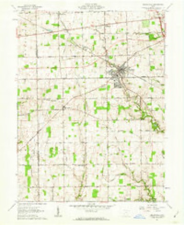
10 topographic sheets cover this place, the earliest surveyed in 1905 and the latest in 1986. It stands in Clay Township. It lies in ZIP code area 45309. The Survey maps it on the Brookville quadrangle. 5,989 people lived here at the 2020 count. It stands 1,030 feet above sea level.
Population over time
2 figuresBrookville grew from 5,884 to 5,989 between 2010 and 2020. These are the recorded population figures Wikidata holds for this place, reached through the Geographic Names Information System number this page is keyed on rather than by name, so they belong to this place and not to another of the same name. Most are census counts, but not all are: an early figure may be a founding or settlement estimate. The change column is computed, and is left blank where more than 20 years separate a figure from the one before it, because a gap that long is not a change between two counts.
| Year | People | Change |
|---|---|---|
| 2010 | 5,884 | |
| 2020 | 5,989 | +105 (+2%) |
Then and now
1905 to 1986The same ground, surveyed 81 years apart. Drag the handle to wipe between them. Both sheets are United States Geological Survey originals; neither has been altered.

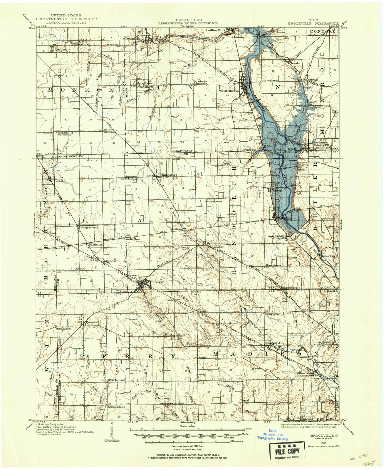
Topographic sheets covering this place
10 sheetsMatched by testing this settlement's coordinate against the published boundary of every sheet in the United States Geological Survey's historical collection. Each opens the scanned sheet at the Survey.
- 1905 USGS Brookville quadrangle1:62500
- 1953 USGS Cincinnati quadrangle1:250000
- 1953 USGS Cincinnati quadrangle1:250000
- 1953 USGS Cincinnati quadrangle1:250000
- 1957 USGS Cincinnati quadrangle1:250000
- 1961 USGS Brookville quadrangle1:24000
- 1961 USGS Brookville quadrangle1:24000
- 1961 USGS Brookville quadrangle1:24000
- 1986 USGS Dayton quadrangle1:100000
- 1986 USGS Dayton quadrangle1:100000






In the county-history sources
18,834 words on this townshipThe History of Montgomery County, Ohio, Containing a History of the County;, published 1882 names this settlement in its chapter on Clay Township. These are the passages that mention it, exactly as the scans read.
The first schoolhouse of which we have been able to get any know lea was one that stood in the northwest corner of the southwest quarter of Sectu 13, on the present site of the cemetery there. It was built about the ye 1815, and was constructed of unhewn logs. Within, in the way of beam apparatus, was an improvised brick furnace or stove located in the centi Slabs were used as desks and for seats or benches. The first schoolmaster the house and the first teacher of the township was a German, by name Jol: Holsmiller. Not long after the erection of this house, was built another Section 26 on the Michael Baker land, about one mile northeast of the prese village of Brookville. A few years later, another house was built near t. center of Section 34. This was probably about the year 1820. All of the, houses were built on the same plan, which did not differ from the usually ru log schoolhouse of pioneer times, full descriptions of which will be found els where in this work. In these schools were taught no German, nor geograph
Passage source: The History of Montgomery County, Ohio, Containing a History of the County;, published 1882.
Brookville, the principal village, located in the southern part of the tow ship, on the Dayton and Western l'oad, was surveyed and platted by Jar Frees April 13, 1850, for Jacob Flory, the proprietor of fifteen lot9. In 188 a dry goods store was kept on the site of the village, by Warren Estabroo for whom it was afterward named. Joseph Mikesell was an earlier marcha on the same site. Additions were made by one Root, and by Noah and Ben min Baker. The village is pleasantly situated on the west branch of W< Creek, and is about 250 feet higher than the city of Dayton. From this v lage diverge in almost every direction good and free turnpikes, which t township in general is well supplied with. The first funeral sermon preach where now is the village was under a forest tree, standing on the present s, of the house of G. Stonebarger. In 1852, the Methodist Chiuch was erectc and the house dedicated by Rev. A. B. Wambaugh. A little later, the Lutln an Church was erected by the Presbyterian congregation, which is now lost sig of. Of the three warehouses now located here, one was built in the year 1852, Benjamin Baker. C. Burlin was the physician of 1853. The post office was < tablished in 1855, with Moses Wagaman as Postmaster. The present incumbent L. S. Smith. This same year, the first regular hotel of the village was built, G.B. Adams. This became an independent school district in 1873, and the f lowing year the village was incorporated (September 9, 1874). James Smi was the first Mayor. James Stewart is now the Village Mayor. The sehoi house is a large two-story brick, with four apartments. The teachers £ Samuel Minich. Laura Duckwall, Silas Fox and Minnie Smith. In 1879, t largest and most commodious church edifice was built by the United Brethnl Rev. Mi'. Miller was the first, and is still their Pastor. Revs. Mr. Grow a! Michael Kaufman officiated respectively in the Lutheran and Methodist Church The physicians are Drs. J. C. Conner, A. Dove, C. Gish, William Mundhenk a Moses Pretzinger. The Village Justice is L. S. Smith, and J. Smith is t telegraph operator and ticket and freight agent. The Brookville hotel is k( by Charles Riley; the " Eureka" by Noah Baker; and the "Eagle" by J. Hidinger. Other business enterprises are as follows: A steam flour iug-mi two saw-mills, a large carriage manufactory, owned and operated by H Gagle; a wagon-maker shop, carried on by John Siebert; drygoods andgroce establishments, carried on by Richard Riley, H. Albert and Samuel Barn two tin shops, by David Ivinsie and Stephen Ellen; one saddler shop and c barber shop, two drug stores, kept by William Sanford and Moses Pretzing and two houses where are kept agricultural implements. Jacob Overhalser a R. Roller are the blacksmiihs. The population now numbers 565. It is c of the voting precincts.
Passage source: The History of Montgomery County, Ohio, Containing a History of the County;, published 1882.
The population of Brookville, the principal village of the township, is 5( being a gain of 165 in the last decade. Of Phillipsburg it is 232, being a g< of 45 in the last ten years ; of South Arlington it is 149, being a gain 25 since 1870 ; of Dodson it is 77, being a gain of 30 in the last decade ; Bachman it is 66, being a loss of one in the last ten years. At this rate decline, this village will be " wiped out" of existence in 660 years ; of Wen^j Lawn, it is 41, a clear gain in the last ten years.
Passage source: The History of Montgomery County, Ohio, Containing a History of the County;, published 1882.
Machine-read from a century-old scan, so expect the errors a machine makes: misspelled names, dropped words, stray characters.
Read the whole chapter on Clay Township - it names this place 22 more 22 times.
Specimens collected near this place
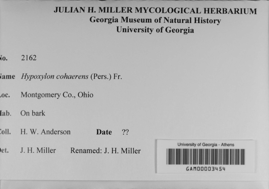
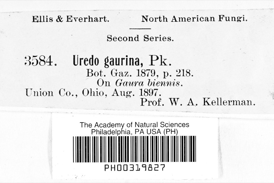
12 of 397 shownRegional context, not property-specific evidence. Museums hold 397 specimens collected within 10 miles of Brookville between 1897 and 1974: 381 Animalia, 7 Fungi, 5 Plantae, 3 Protozoa, 1 Unrecorded. 12 distinct Species records are shown. Collected by Allen, John, Arden R. Gaufin, BOYER AND DUELLMAN and others. Each is a physical object with a catalogue number, and each entry opens the museum's record. This is what was collected and kept, not a survey of what lives here - nothing can be concluded from a species being absent.
| Image | Species | Year | Collected by | Where, as recorded |
|---|---|---|---|---|
 | Hypoxylon cohaerens (Pers.) Fr. | 1897 | H. W. Anderson | |
 | Uredo | 1897 | Prof. W.A. Kellerman | |
 | Ferrissia rivularis (Say, 1817) | 1904 | Allen, John | Brookville |
 | Porella platyphylloidea (Schwein.) Lindb. | 1912 | Braun, Lucy E. | |
| Septoria glumarum Pass. | 1918 | Paxton G. E. | New Lebanon | |
| unnamed | 1922 | Edwin E. Honey | "The Shades". | |
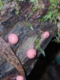 | Lycogala Adanson, 1763 | 1922 | Edwin E. Honey | "The Shades". |
 | Puccinia peridermiospora (Ellis & Tracy) Arthur | 1922 | Edwin E. Honey | "The Shades," Waveland |
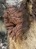 | Stemonitis Roth, 1787 | 1922 | Edwin E. Honey | "The Shades". |
 | Trichia Haller, 1768 | 1922 | not recorded | "The Shades," Waveland |
| Volutellonectria J.Luo & W.-Y.Zhuang, 2012 | 1922 | Edwin E. Honey | "The Shades," Waveland | |
| Sialia sialis (Linnaeus, 1758) | 1927 | Langelier, Gustave | LOCNM: Kingsville |
All 397 specimens within 10 miles, at the Global Biodiversity Information Facility.
Mines and quarries near this place
2 within 5 milesRegional context, not property-specific evidence. The federal mineral resources record lists 2 workings within 5 miles of Brookville: 1 past producer, 1 plant. 1 still produces. What was taken out: Limestone, General, Stone, Crushed/Broken. Distance is straight-line from the map coordinates, so a quarry counted here may appear on a neighbouring settlement's page as well.
| Where | Site | Commodity | Status | Recorded |
|---|---|---|---|---|
| Phillipsburg Quarry | Limestone, General | Past Producer | Sedimentary | |
| Phillipsburg-#421 | Stone, Crushed/Broken | Plant |
Storms near this place
20 since 1997Regional context, not property-specific evidence. The National Weather Service names Brookville in 20 storm reports between 1997 and 2024: 9 thunderstorm wind, 8 hail, 2 flash flood, 1 flood. No death or injury is recorded in these reports. Each account below is quoted exactly as the forecast office filed it, from the NOAA Storm Events Database, and each date opens the federal record of that event.
| When | Event | Place named | Harm | What the report says |
|---|---|---|---|---|
| February 2008 | Thunderstorm Wind | Brookville | $20,000 | Siding and shingles were blown off a home along West Brook Road, and an adjacent 40 lb. metal swing set was thrown 300-500 yards. A barn had its roof removed. |
| April 2001 | Thunderstorm Wind | Brookville | $10,000 | A thunderstorm produced strong winds which damaged several homes and barns. Trees and power lines were also downed as well as a camper overturned. One inch hail also occurred. |
| May 2001 | Thunderstorm Wind | Brookville | $3,000 | Several trees knocked down. |
| June 2016 | Thunderstorm Wind | Brookville | $2,000 | Trees were reported down. |
| July 2003 | Thunderstorm Wind | Brookville | $2,000 | Large limbs were downed. |
| July 2023 | Thunderstorm Wind | Brookville | $1,000 | A large tree was downed. |
| January 2012 | Flood | Brookville | $1,000 | Some roads were reported flooded due to high water caused by heavy rain. |
| March 2022 | Thunderstorm Wind | Brookville | $500 | Several large tree limbs were downed along Upper Lewisburg Salem Road as well as Brookville Salem Road. |
| February 2019 | Flash Flood | Brookville | - | Numerous roads were closed due to flooding. |
| July 2006 | Flash Flood | Brookville | - | Numerous roads were flooded in the northwest part of the county. |
| May 2004 | Hail | Brookville | - | Trees were also downed in Brookville. |
| July 2024 | Hail | Brookville | - | no account filed |
| June 2018 | Hail | Brookville | - | no account filed |
| June 2018 | Hail | Brookville | - | no account filed |
| June 2018 | Hail | Brookville | - | no account filed |
| March 2012 | Hail | Brookville | - | no account filed |
| May 2011 | Hail | Brookville | - | no account filed |
| August 2010 | Thunderstorm Wind | Brookville | - | no account filed |
| June 2009 | Hail | Brookville | - | no account filed |
| March 1997 | Thunderstorm Wind | Brookville | - | no account filed |
Nearest settlements
The eight closest, with where each one stands in the county. Distances are straight-line, computed from the Geographic Names Information System coordinates.
Elsewhere
Matched on this settlement's Geographic Names Information System number rather than its name, so it cannot be a different place of the same name in another state.
| Wikipedia article on Brookville | An encyclopaedic summary. Its text is share-alike, so it is linked here rather than copied. |
| Wikidata item Q1925076 | The structured record the population and elevation above come from. Public domain (CC0). |
Provenance
This settlement is recorded in the Geographic Names Information System as feature 1056728. The sheet list is computed by point-in-boundary test against the United States Geological Survey's historical topographic inventory. Both are works of the United States government and carry no copyright under 17 U.S.C. 105.
Specimens. Global Biodiversity Information Facility (GBIF), https://www.gbif.org/. Only records licensed CC0 or CC BY are used. Records licensed CC BY-NC are excluded because this site carries advertising. Images are checked individually and any whose licence is non-commercial, no-derivatives or unreadable is refused.
Mines and quarries. USGS Mineral Resources Data System (MRDS) https://mrdata.usgs.gov/mrds/ A work of the United States government, no copyright under 17 U.S.C. 105.
Storms. NOAA National Centers for Environmental Information, Storm Events Database https://www.ncei.noaa.gov/stormevents/ A work of the United States government, no copyright under 17 U.S.C. 105. Narratives are quoted verbatim from the National Weather Service report and are not edited or summarised.