 Block
Block
Pyrmont, Ohio
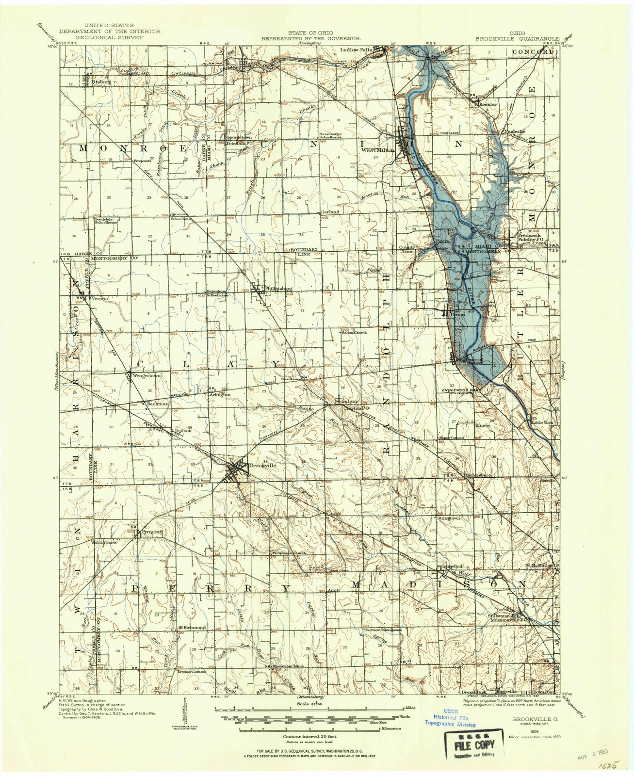
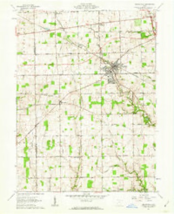
10 topographic sheets cover this place, the earliest surveyed in 1905 and the latest in 1986. It stands in Perry Township. It lies in ZIP code area 45309. The Survey maps it on the Brookville quadrangle.
Then and now
1905 to 1986The same ground, surveyed 81 years apart. Drag the handle to wipe between them. Both sheets are United States Geological Survey originals; neither has been altered.

Topographic sheets covering this place
10 sheetsMatched by testing this settlement's coordinate against the published boundary of every sheet in the United States Geological Survey's historical collection. Each opens the scanned sheet at the Survey.
- 1905 USGS Brookville quadrangle1:62500
- 1953 USGS Cincinnati quadrangle1:250000
- 1953 USGS Cincinnati quadrangle1:250000
- 1953 USGS Cincinnati quadrangle1:250000
- 1957 USGS Cincinnati quadrangle1:250000
- 1961 USGS Brookville quadrangle1:24000
- 1961 USGS Brookville quadrangle1:24000
- 1961 USGS Brookville quadrangle1:24000
- 1986 USGS Dayton quadrangle1:100000
- 1986 USGS Dayton quadrangle1:100000






In the county-history sources
26,494 words on this townshipThe History of Montgomery County, Ohio, Containing a History of the County;, published 1882 names this settlement in its chapter on Perry Township. These are the passages that mention it, exactly as the scans read.
On the high ground sugar, beech, hickory, walnut, ash and others, and in th lower land swamp maple, scrub oak, prickly ash, etc. The whole of the towr ship was originally a dense forest, only broken by the channels of the creeks These are quite numerous, and from their beds large quantities of gravel ai obtained for macadamizing the highways. They also furnish a few very goo mill-sites, some of which were early occupied by saw mills. Along the ban! of these creeks in early days a dense undergrowth of willow, prickly ash an spicewood flourished, making it almost impossible to cross only in the patl kept open by the wild animals as they came to drink. The name-bearin creeks are Wolf Creek, running across the northeast corner of the townshi] Bear Creek, running from the center to the southeastern corner; Little Twii running from north to south, west of the center; Tom's Bun, in the south we: corner, and Leslie's Run, which was so named because a man bearing the r am of Leslie was drowned in it. These each have numerous branches, but c course they bear no names and play a very unimportant part in the township history. The D., II. & W. Railway runs across the northeastern corner, and is tl only railroad in the township. But with turnpike roads it is well suppliei Of these, the first one was the Eaton Pike, built in 1840. It is a part of 01 continuous pike extending from Cumberland, Md. , to Indianapolis, Ind., ar forms the southern boundary of the township. The next was the Wolf (free Pike, built in 1848-49, and running from Brookville, in Clay Township, Dayton. The first road in Pyrmont was the "old Sled road," built in tl spring of 1812. The above dates are those of piking these roads; some them were established before the township was formed. We see by the o records that the Dayton and Eaton road was established in 1805; a road fro Salem south seventeen miles to Germantown in 1808, and others in 1811, 181 1815 and 1819, until, now, the country is almost a network of roads.
Passage source: The History of Montgomery County, Ohio, Containing a History of the County;, published 1882.
He died about 1850 or 1851, his wife having died a few years previous to his death. William remained with his father till his majority. Was married, February 10, 1827, j to Jane Campbell, a native of Warren County; by her he had seven children; five dow living - Bethany, Samuel, Naomi, Joshua and William. His wife died October .'7, 1848. On October 18, 1849, was celebrated his marriage with Jane Smith, daughter of John and Phebe Clemmer, he a native of Pennsylvania, and she of Virginia; by this second marriage, they had five children - George, Charles Edgar, Eliza Jane, j Josiah and Hiram. Mr. Mills followed farming as an occupation, and has always j| resided in Perry Township ; has labored industriously in his younger days, and was reasonably prosperous in his life, accumulated a good competency, and, as old age and infirmity came upon him, he retired to Pyrmont, and, in 1879, gave up all active labor, where he hopes to pass the remainder of his days free from the toils of life. Mr. Mills and wife are members of the United Brethren Church, and have been Christian workers for many years. Our subject grew up to maturity under his father's care, brought up to farm labor; receiving a good education, and, at eighteen years of age, became a teacher and taught school four winters, since which he has given his attention to farming. Was married, October ?4, 1878, to Martha Dell, daughter of Levi W. and Sarah E. (Sodders) Mundhenk, he a native of this county, and she of Greene County; they are parents of three children - Clarence Willie, Lizzie Forest and Martha Dell.
Passage source: The History of Montgomery County, Ohio, Containing a History of the County;, published 1882.
1 ited Brethren and Methodists built a little frame church on Bixler and ' ank's farms. There were about fifty of them in all. This church was in frtion 13. In 1860, the Lutherans bought a lot of Bixler's heirs and built a rick church at a cost of $2,000, in which they still worship. There are now s,enty-five members. In 1880, they bought six and twelve one hundredths acres ground for $612 (across from the church), of Adam Harmon, which they con - v ted into a graveyard. But few bodies have as yet been interred there, the first Mai being that of a daughter of Rev. Graws, a Lutheran minister at Brookv e. In 1872, a German Baptist Church was built on the Eversole farm in *- tion 35, for the accommodation of a few of the older members of the neighbort >d who could not travel so far to church, the ground being donated byr Mr. Ever- sole. There are other churches in the township, built recently, with no re<mk preaching, of which we give no history. Of those in Pyrmont we will treat unde that head. ,
Passage source: The History of Montgomery County, Ohio, Containing a History of the County;, published 1882.
Machine-read from a century-old scan, so expect the errors a machine makes: misspelled names, dropped words, stray characters.
Read the whole chapter on Perry Township - it names this place 20 more 20 times.
Specimens collected near this place
12 of 221 shownRegional context, not property-specific evidence. Museums hold 221 specimens collected within 10 miles of Pyrmont between 1897 and 1972: 208 Animalia, 5 Fungi, 4 Plantae, 3 Protozoa, 1 Unrecorded. 12 distinct Species records are shown. Collected by Allen, John, Braun, Lucy E., Coovert, G. A. (Gary A.) and others. Each is a physical object with a catalogue number, and each entry opens the museum's record. This is what was collected and kept, not a survey of what lives here - nothing can be concluded from a species being absent.
| Image | Species | Year | Collected by | Where, as recorded |
|---|---|---|---|---|
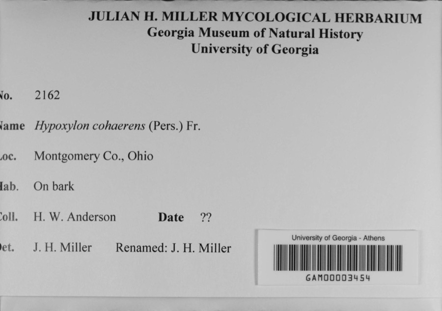 | Hypoxylon cohaerens (Pers.) Fr. | 1897 | H. W. Anderson | |
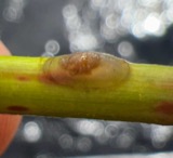 | Ferrissia rivularis (Say, 1817) | 1904 | Allen, John | Brookville |
 | Porella platyphylloidea (Schwein.) Lindb. | 1912 | Braun, Lucy E. | |
| Septoria glumarum Pass. | 1918 | Paxton G. E. | New Lebanon | |
| unnamed | 1922 | Edwin E. Honey | "The Shades". | |
 | Lycogala Adanson, 1763 | 1922 | Edwin E. Honey | "The Shades". |
 | Puccinia peridermiospora (Ellis & Tracy) Arthur | 1922 | Edwin E. Honey | "The Shades," Waveland |
 | Stemonitis Roth, 1787 | 1922 | Edwin E. Honey | "The Shades". |
 | Trichia Haller, 1768 | 1922 | not recorded | "The Shades," Waveland |
| Volutellonectria J.Luo & W.-Y.Zhuang, 2012 | 1922 | Edwin E. Honey | "The Shades," Waveland | |
 | Bombus citrinus (Smith, 1854) | 1929 | Zeisert, E. E. | Montgomery Co., OH, Montgomery, Ohio, United States |
 | Bombus fervidus (Fabricius, 1798) | 1929 | Zeisert, E. E. | Montgomery Co., OH, Montgomery, Ohio, United States |
All 221 specimens within 10 miles, at the Global Biodiversity Information Facility.
Storms near this place
3 since 2019Regional context, not property-specific evidence. The National Weather Service names Pyrmont in 3 storm reports between 2019 and 2025: 2 thunderstorm wind, 1 tornado. The reports record 166 injuries. Each account below is quoted exactly as the forecast office filed it, from the NOAA Storm Events Database, and each date opens the federal record of that event.
| When | Event | Place named | Harm | What the report says |
|---|---|---|---|---|
| May 2019 | Tornado (EF4) | Pyrmont | 166 hurt, $500,000,000 | The tornado initially touched down just west of Brookville and areas on the south side of Brookville sustained heavy damage, consistent with high-end EF2 wind speeds. Numerous homes suffered significant roof damage and removal, including exterior wall collapse and complete garage destruction. ||The tornado then carved a path east through Trotwood where damage consistent with EF2 wind speeds was widespread and some homes sustained damage consistent with EF3 wind speeds. Structures here again featured roof removal and exterior wall collapse. This was particularly true on the south side of Westbrook Road. A large number of homes and apartment complexes were impacted further east in Trotwood, with most of this damage consistent with high-end EF2 wind speeds.||The highest winds were estimated to have occurred in a corridor from eastern Trotwood (between Shiloh Springs Road and Westbrook Road), then southeast between Shiloh Springs Road and Turner Road, into areas along the Stillwater River/Riverside Drive area. Embedded within this zone was higher-end EF3 damage. Areas near Riverside Drive and the Stillwater River exhibited damage consistent with wind speeds of 170 mph, or lower-end EF4 damage. This damage included well-built apartment buildings that sustained complete roof and exterior wall removal. In addition, significant tree devastation was found along the Stillwater River, east of Riverside Drive, that included numerous trees that were debarked and nubbed down to the trunk.||The tornado continued southeast through Dayton and Northridge, and crossed I-75 into the Old North Dayton Area, where heavy damage continued to homes and businesses. As the tornado entered Riverside, damage began to lessen in intensity, but plenty of damage consistent with EF1 wind speeds was noted. The tornado continued further to the southeast, causing damage in a subdivision north of Burkhardt Road. The roof of an apartment building on Dodge Court was removed. This is the final known damage caused by this tornado.||An 86 year old woman died (indirect) on September 1st, 2019, in part due to injuries suffered when she was trapped in her home during the tornado. |
| June 2022 | Thunderstorm Wind | Pyrmont | $3,000 | A few trees were downed on North Sulphur Springs Road. |
| April 2025 | Thunderstorm Wind | Pyrmont | $1,000 | A large pine tree was downed. |
Nearest settlements
The eight closest, with where each one stands in the county. Distances are straight-line, computed from the Geographic Names Information System coordinates.
| Map | Place | Distance | Sheets |
|---|---|---|---|
| Little Richmond | 2.7 miles | 10 | |
| Dodson | 2.8 miles | 10 | |
| Brookville | 3.1 miles | 10 | |
| Bachman | 3.5 miles | 10 | |
| Kreitzer Corner | 3.7 miles | 10 | |
| Arlington | 4.2 miles | 10 | |
| Wengerlawn | 4.3 miles | 10 | |
| Airhill | 5.0 miles | 13 |
Elsewhere
Matched on this settlement's Geographic Names Information System number rather than its name, so it cannot be a different place of the same name in another state.
| Wikipedia article on Pyrmont | An encyclopaedic summary. Its text is share-alike, so it is linked here rather than copied. |
| Wikidata item Q7263615 | The structured record the population and elevation above come from. Public domain (CC0). |
Provenance
This settlement is recorded in the Geographic Names Information System as feature 1049107. The sheet list is computed by point-in-boundary test against the United States Geological Survey's historical topographic inventory. Both are works of the United States government and carry no copyright under 17 U.S.C. 105.
Specimens. Global Biodiversity Information Facility (GBIF), https://www.gbif.org/. Only records licensed CC0 or CC BY are used. Records licensed CC BY-NC are excluded because this site carries advertising. Images are checked individually and any whose licence is non-commercial, no-derivatives or unreadable is refused.
Storms. NOAA National Centers for Environmental Information, Storm Events Database https://www.ncei.noaa.gov/stormevents/ A work of the United States government, no copyright under 17 U.S.C. 105. Narratives are quoted verbatim from the National Weather Service report and are not edited or summarised.