 Block
Block
Catawba, Ohio
12 topographic sheets cover this place, the earliest surveyed in 1907 and the latest in 1986. It stands in Pleasant Township. It lies in ZIP code area 43044. The Survey maps it on the South Vienna quadrangle. 245 people lived here at the 2020 count. It stands 1,237 feet above sea level.
Population over time
2 figuresCatawba fell from 272 to 245 between 2010 and 2020. These are the recorded population figures Wikidata holds for this place, reached through the Geographic Names Information System number this page is keyed on rather than by name, so they belong to this place and not to another of the same name. Most are census counts, but not all are: an early figure may be a founding or settlement estimate. The change column is computed, and is left blank where more than 20 years separate a figure from the one before it, because a gap that long is not a change between two counts.
| Year | People | Change |
|---|---|---|
| 2010 | 272 | |
| 2020 | 245 | -27 (-10%) |
Then and now
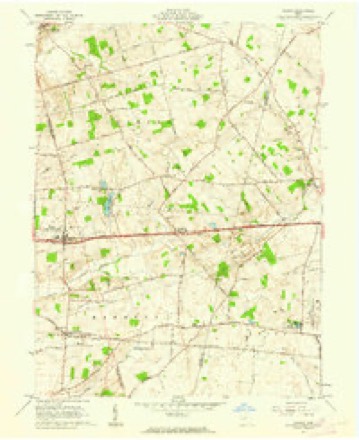
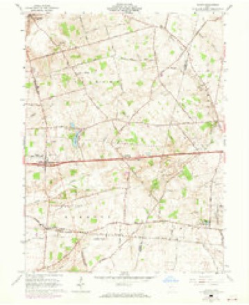
1907 to 1986The same ground, surveyed 79 years apart. Drag the handle to wipe between them. Both sheets are United States Geological Survey originals; neither has been altered.

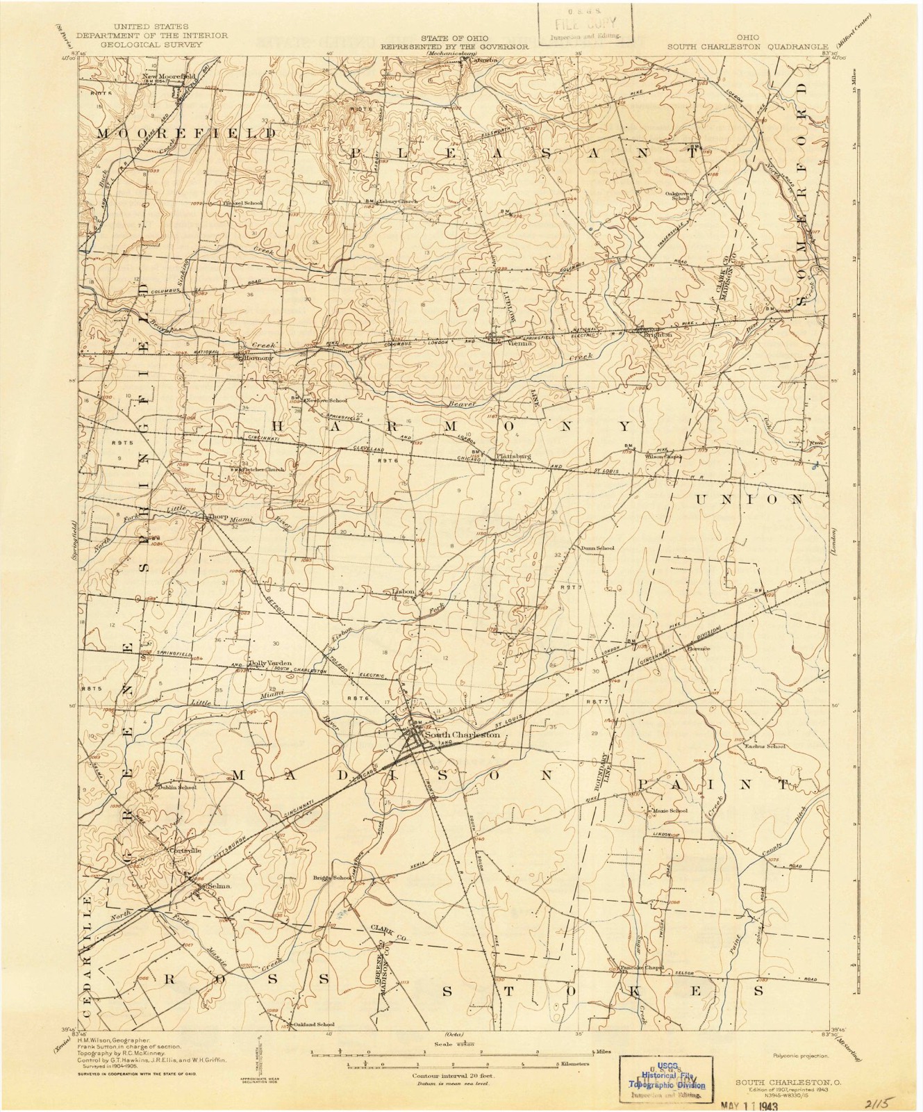
Topographic sheets covering this place
12 sheetsMatched by testing this settlement's coordinate against the published boundary of every sheet in the United States Geological Survey's historical collection. Each opens the scanned sheet at the Survey.
- 1907 USGS South Charleston quadrangle1:62500
- 1907 USGS South Charleston quadrangle1:62500
- 1947 USGS Columbus quadrangle1:250000
- 1961 USGS Columbus quadrangle1:250000
- 1961 USGS Vienna quadrangle1:24000
- 1961 USGS Vienna quadrangle1:24000
- 1961 USGS Vienna quadrangle1:24000
- 1962 USGS Columbus quadrangle1:250000
- 1967 USGS Columbus quadrangle1:250000
- 1967 USGS Columbus quadrangle1:250000
- 1986 USGS Springfield quadrangle1:100000
- 1986 USGS Springfield quadrangle1:100000







What happened here
An account from the chapter on Pleasant township, The inset identifies its exact source book and publication year.
Wmorgh Stench
WMORGH STENCH, The subject of this biography was born ih Chek County, Ohio, May 22, 1888. His opportanities for leerning were quite imited, being those of the common school, supplomented by woshort nttendance upon the Springtield High School, aud Gundry aid acon's Commercial College, in Cinehiawti. In the super of 1845, wlien seventeen yenrs old, lo liad a narrow esenpe from being killed, being caught Tn the couring of a threshing mactino, nnd having Hoth of his limbs and dete arm broken.
In the county-history sources
39,567 words on this townshipThe History of Clark County Ohio,, published 1881 names this settlement in its chapter on Pleasant Township. These are the passages that mention it, exactly as the scans read.
As uear as we can ascertain the first paper in Springfield, advocating the principles of the Democratie party, was issued during the year 1839, under the title of Mad River Democrat. It was continued a few weeks over a year, when its publication ceased, on account of embarrassment by debt of its editor and propietor, J. H. Nichols, who absconded in the winter of 1839-40. During a part of the year 1839, W. A. Rogers, Esq., edited the Springfield (Ohio) Pioneer.
Passage source: The History of Clark County Ohio,, published 1881.
It has a circulation of 103,000 copies, and goes twice a month into every State and Territory in the Union. Over five tons of paper are used on each edition. This journal has had rapid development, and bids fair to outrank any journal of its kind in the country.
Passage source: The History of Clark County Ohio,, published 1881.
The ninth annual report rd the net increase in the number of volumes for the year ending March 1, 1881, to be 639, making a total of 6,139 volumes, while the increase in the circulation for the same time has been 7,328 volumes - the entire circulation for the year being 94,899 volumes, a daily average of 194. Number of patrons enrolled, 3,033. Total amount received from the city for current expenses was $3,227.59, leaving a balance after expenses were paid of $108.84. The patronage of the reading room, supplied with a fair list of leading periodicals and papers, also showed a similar increase of patronage. The present Board of Trustees are E. W. Mullikin, President; E. L. Buchwalter, Vice President; G. W. Winger, Secretary; James L. Rodgers, Treasurer; and Amos Whiteley and W. A. Scott, Executive Committee.
Passage source: The History of Clark County Ohio,, published 1881.
Machine-read from a century-old scan, so expect the errors a machine makes: misspelled names, dropped words, stray characters.
Read the whole chapter on Pleasant Township - it names this place 23 more 23 times.
Specimens collected near this place
12 of 283 shownRegional context, not property-specific evidence. Museums hold 283 specimens collected within 10 miles of Catawba between 1893 and 1974: 282 Animalia, 1 Plantae. 12 distinct Species records are shown. Collected by B. Montgomery, L. Alward & P. Alward, Binkley, L. E. (Lowell), E. F. M. Wilcox and others. Each is a physical object with a catalogue number, and each entry opens the museum's record. This is what was collected and kept, not a survey of what lives here - nothing can be concluded from a species being absent.
| Image | Species | Year | Collected by | Where, as recorded |
|---|---|---|---|---|
 | Chara vulgaris L. | 1893 | E. F. M. Wilcox | Springfield |
 | Palpomyia subasper (Coquillett, 1901) | 1914 | Marion W. Boesel | Catawba |
 | Atrichopogon fusculus (Coquillett, 1901) | 1925 | E. H. | Catawba |
| Atrichopogon websteri (Coquillett, 1901) | 1925 | E. H. | Catawba | |
| Forcipomyia Meigen, 1818 | 1925 | W. S. H. | Catawba | |
| Palpomyia Meigen, 1818 | 1925 | not recorded | Catawba | |
| Probezzia Kieffer, 1906 | 1925 | not recorded | Catawba | |
| Probezzia infuscata Malloch, 1915 | 1925 | not recorded | Catawba | |
| Jenkinshelea albaria (Coquillett, 1895) | 1926 | not recorded | Catawba | |
 | Pseudacris crucifer (Wied-Neuwied, 1838) | 1927 | Thomas, E. S. (Edward S.) | Near South Vienna, Clark Co., Ohio |
 | Rana catesbeiana Shaw, 1802 | 1927 | Thomas, E. S. (Edward S.) | Near South Vienna, Clark Co., Ohio |
 | Catostomus commersonnii commersonnii (Lacepède, 1803) | 1930 | MB Trautman | Beaver Creek, trib of Buck Creek, Western Harmony Twp |
All 283 specimens within 10 miles, at the Global Biodiversity Information Facility.
Mines and quarries near this place
1 within 5 milesRegional context, not property-specific evidence. The federal mineral resources record lists 1 working within 5 miles of Catawba: 1 plant. All of them still produce. What was taken out: Sand and Gravel, Construction. Distance is straight-line from the map coordinates, so a quarry counted here may appear on a neighbouring settlement's page as well.
| Where | Site | Commodity | Status | Recorded |
|---|---|---|---|---|
| Roberts Pit & Mill | Sand and Gravel, Construction | Plant |
Storms near this place
8 since 2001Regional context, not property-specific evidence. The National Weather Service names Catawba in 8 storm reports between 2001 and 2019: 5 thunderstorm wind, 1 hail, 1 flash flood, 1 flood. No death or injury is recorded in these reports. Each account below is quoted exactly as the forecast office filed it, from the NOAA Storm Events Database, and each date opens the federal record of that event.
| When | Event | Place named | Harm | What the report says |
|---|---|---|---|---|
| April 2019 | Thunderstorm Wind | Catawba | $17,000 | Siding damage was reported to a house and a barn, along with some roof damage. Five trees were snapped off above the ground. Finally, a deck received some damage. |
| July 2006 | Thunderstorm Wind | Catawba | $15,000 | A mobile home and a pole barn sustained structural damage from straight line winds estimated at 70 mph. |
| July 2003 | Thunderstorm Wind | Catawba | $15,000 | Numerous trees and powerlines were downed. A number of trailer park homes sustained heavy roof damage. |
| July 2017 | Thunderstorm Wind | Catawba | $3,000 | Several trees were downed in the vicinity of County Line Road and State Route 4. |
| May 2011 | Flash Flood | Catawba | $2,000 | One and a half feet of water was reported over a road due to heavy rainfall. |
| September 2016 | Thunderstorm Wind | Catawba | $500 | A tree was downed on Runyon Road. |
| August 2017 | Flood | Catawba | - | Six inches of water was reported flowing across County Line Road. County Line Road and State Route 4 were closed due to high water. |
| May 2001 | Hail | Catawba | - | Hail reported covering the ground |
Nearest settlements
The eight closest, with where each one stands in the county. Distances are straight-line, computed from the Geographic Names Information System coordinates.
| Map | Place | Distance | Sheets |
|---|---|---|---|
| Lakeview Acres | 4.1 miles | 14 | |
| Sylvan Shores | 4.4 miles | 12 | |
| Plateau Acres | 4.7 miles | 14 | |
| South Vienna | 5.0 miles | 12 | |
| Mumper Estates | 5.0 miles | 14 | |
| New Moorefield | 5.1 miles | 14 | |
| Hollandia View | 5.3 miles | 14 | |
| Brighton | 5.7 miles | 12 |
Elsewhere
Matched on this settlement's Geographic Names Information System number rather than its name, so it cannot be a different place of the same name in another state.
| Wikipedia article on Catawba | An encyclopaedic summary. Its text is share-alike, so it is linked here rather than copied. |
| Wikidata item Q1844924 | The structured record the population and elevation above come from. Public domain (CC0). |
Provenance
This settlement is recorded in the Geographic Names Information System as feature 1056775. The sheet list is computed by point-in-boundary test against the United States Geological Survey's historical topographic inventory. Both are works of the United States government and carry no copyright under 17 U.S.C. 105.
Specimens. Global Biodiversity Information Facility (GBIF), https://www.gbif.org/. Only records licensed CC0 or CC BY are used. Records licensed CC BY-NC are excluded because this site carries advertising. Images are checked individually and any whose licence is non-commercial, no-derivatives or unreadable is refused.
Mines and quarries. USGS Mineral Resources Data System (MRDS) https://mrdata.usgs.gov/mrds/ A work of the United States government, no copyright under 17 U.S.C. 105.
Storms. NOAA National Centers for Environmental Information, Storm Events Database https://www.ncei.noaa.gov/stormevents/ A work of the United States government, no copyright under 17 U.S.C. 105. Narratives are quoted verbatim from the National Weather Service report and are not edited or summarised.