 Block
Block
Sylvan Shores, Ohio
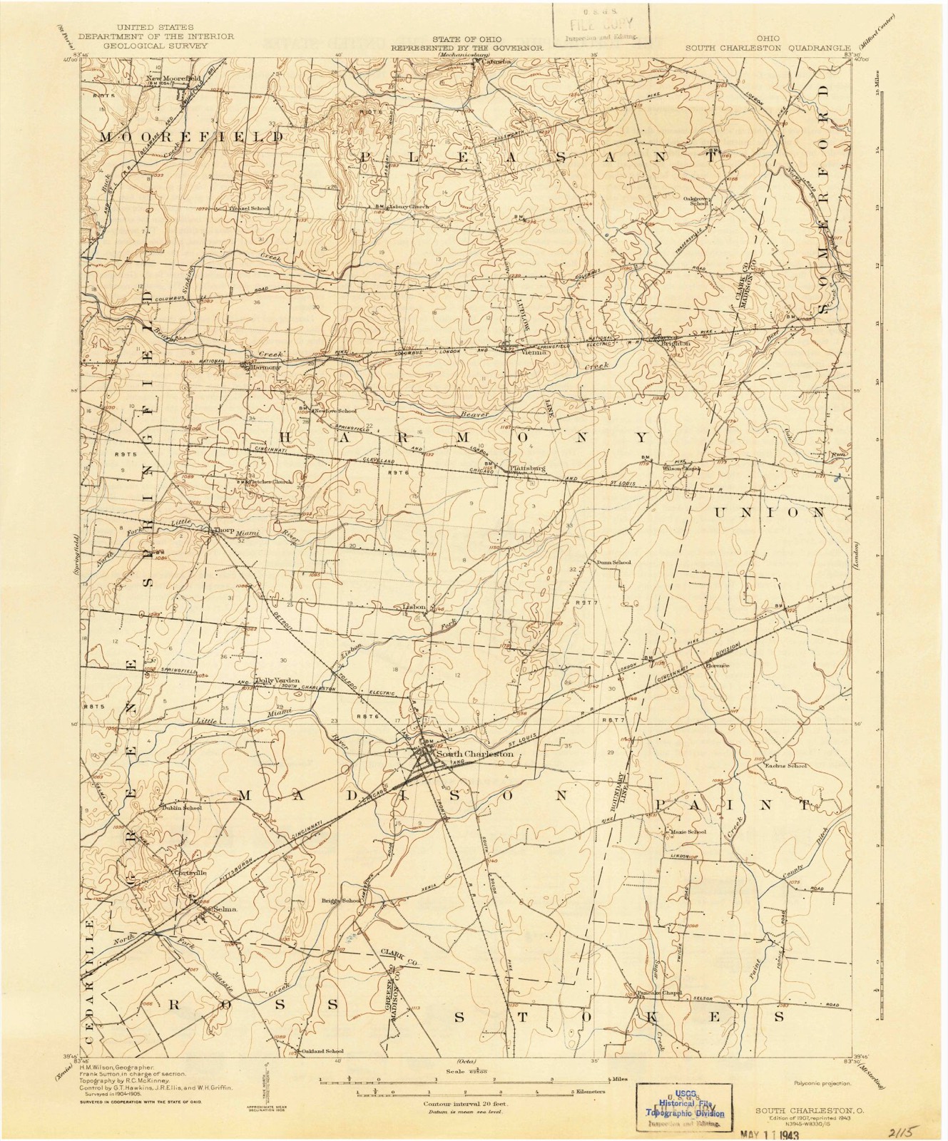
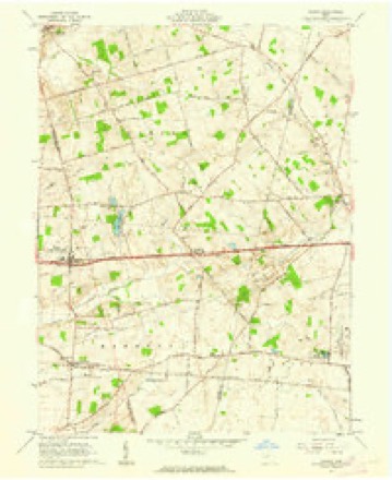
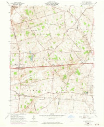
12 topographic sheets cover this place, the earliest surveyed in 1907 and the latest in 1986. It stands in Pleasant Township. It lies in ZIP code area 45369. The Survey maps it on the South Vienna quadrangle.
Then and now
1907 to 1986The same ground, surveyed 79 years apart. Drag the handle to wipe between them. Both sheets are United States Geological Survey originals; neither has been altered.

Topographic sheets covering this place
12 sheetsMatched by testing this settlement's coordinate against the published boundary of every sheet in the United States Geological Survey's historical collection. Each opens the scanned sheet at the Survey.
- 1907 USGS South Charleston quadrangle1:62500
- 1907 USGS South Charleston quadrangle1:62500
- 1947 USGS Columbus quadrangle1:250000
- 1961 USGS Columbus quadrangle1:250000
- 1961 USGS Vienna quadrangle1:24000
- 1961 USGS Vienna quadrangle1:24000
- 1961 USGS Vienna quadrangle1:24000
- 1962 USGS Columbus quadrangle1:250000
- 1967 USGS Columbus quadrangle1:250000
- 1967 USGS Columbus quadrangle1:250000
- 1986 USGS Springfield quadrangle1:100000
- 1986 USGS Springfield quadrangle1:100000







What happened here
An account from the chapter on Pleasant township, in the words of 1881.
Wmorgh Stench
WMORGH STENCH, The subject of this biography was born ih Chek County, Ohio, May 22, 1888. His opportanities for leerning were quite imited, being those of the common school, supplomented by woshort nttendance upon the Springtield High School, aud Gundry aid acon's Commercial College, in Cinehiawti. In the super of 1845, wlien seventeen yenrs old, lo liad a narrow esenpe from being killed, being caught Tn the couring of a threshing mactino, nnd having Hoth of his limbs and dete arm broken.
In the 1881 county history
39,567 words on this townshipThe county history of 1881 has no passage naming this settlement, which was common for the smaller places. Its township is covered in full.
The chapter on Pleasant Township covers the township.
Read the chapter on Pleasant Township - 39,567 words.
Specimens collected nearby
12 of 269 shownMuseums hold 269 specimens collected within 10 miles of Sylvan Shores between 1914 and 1974: 269 Animalia. 12 distinct Species records are shown. Collected by B. Montgomery, L. Alward & P. Alward, Binkley, L. E. (Lowell), David G. Furth and others. Each is a physical object with a catalogue number, and each entry opens the museum's record. This is what was collected and kept, not a survey of what lives here - nothing can be concluded from a species being absent.
| Image | Species | Year | Collected by | Where, as recorded |
|---|---|---|---|---|
 | Palpomyia subasper (Coquillett, 1901) | 1914 | Marion W. Boesel | Catawba |
 | Atrichopogon fusculus (Coquillett, 1901) | 1925 | E. H. | Catawba |
| Atrichopogon websteri (Coquillett, 1901) | 1925 | E. H. | Catawba | |
| Forcipomyia Meigen, 1818 | 1925 | W. S. H. | Catawba | |
| Palpomyia Meigen, 1818 | 1925 | not recorded | Catawba | |
| Probezzia Kieffer, 1906 | 1925 | not recorded | Catawba | |
| Probezzia infuscata Malloch, 1915 | 1925 | not recorded | Catawba | |
| Jenkinshelea albaria (Coquillett, 1895) | 1926 | not recorded | Catawba | |
 | Pseudacris crucifer (Wied-Neuwied, 1838) | 1927 | Thomas, E. S. (Edward S.) | Near South Vienna, Clark Co., Ohio |
 | Rana catesbeiana Shaw, 1802 | 1927 | Thomas, E. S. (Edward S.) | Near South Vienna, Clark Co., Ohio |
 | Catostomus commersonnii commersonnii (Lacepède, 1803) | 1930 | MB Trautman | Beaver Creek, trib of Buck Creek, Western Harmony Twp |
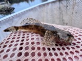 | Cottus bairdii Girard, 1850 | 1930 | MB Trautman | Beaver Creek, trib of Buck Creek, Western Harmony Twp |
All 269 specimens within 10 miles, at the Global Biodiversity Information Facility.
Nearest settlements
The eight closest, with where each one stands in the county. Distances are straight-line, computed from the Geographic Names Information System coordinates.
| Map | Place | Distance | Sheets |
|---|---|---|---|
| South Vienna | 1.4 miles | 12 | |
| Brighton | 1.7 miles | 12 | |
| Hollandia View | 2.9 miles | 14 | |
| Plattsburg | 3.2 miles | 12 | |
| Lakeview Acres | 3.8 miles | 14 | |
| Catawba | 4.4 miles | 12 | |
| Harmony | 5.7 miles | 14 | |
| Lisbon | 5.9 miles | 12 |
Provenance
This settlement is recorded in the Geographic Names Information System as feature 1051416. The sheet list is computed by point-in-boundary test against the United States Geological Survey's historical topographic inventory. Both are works of the United States government and carry no copyright under 17 U.S.C. 105.
Specimens. Global Biodiversity Information Facility (GBIF), https://www.gbif.org/. Only records licensed CC0 or CC BY are used. Records licensed CC BY-NC are excluded because this site carries advertising. Images are checked individually and any whose licence is non-commercial, no-derivatives or unreadable is refused.