 Block
Block
Mason, Ohio
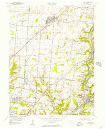
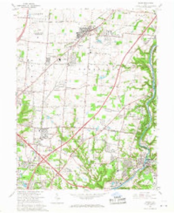
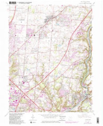
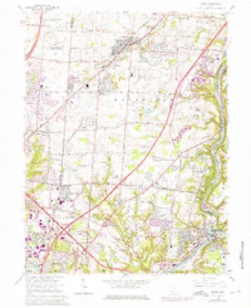
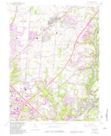
15 topographic sheets cover this place, the earliest surveyed in 1904 and the latest in 1986. It stands in Mason City. It lies in ZIP code area 45040. It stands on Pine Run. The Survey maps it on the Mason quadrangle. 34,792 people lived here at the 2020 count. It stands 810 feet above sea level.
Research this city
This curated hub for Warren County, Ohio brings together the page's documented record links, visible map or image evidence where published, and routes to related local records.
What is documented here?
Use the page's provenance and linked records to distinguish the source material from the site's navigation and summaries.
How should I cite it?
Open the original record, preserve its repository and identifier, then use the citation tool for this page as a path back to the source.
Where should I go next?
Follow the county or state hub for related places and records, then use the guide for a source-aware research sequence.
Population over time
2 figuresMason grew from 30,712 to 34,792 between 2010 and 2020. These are the recorded population figures Wikidata holds for this place, reached through the Geographic Names Information System number this page is keyed on rather than by name, so they belong to this place and not to another of the same name. Most are census counts, but not all are: an early figure may be a founding or settlement estimate. The change column is computed, and is left blank where more than 20 years separate a figure from the one before it, because a gap that long is not a change between two counts.
| Year | People | Change |
|---|---|---|
| 2010 | 30,712 | |
| 2020 | 34,792 | +4,080 (+13%) |
Then and now
1904 to 1986The same ground, surveyed 82 years apart. Drag the handle to wipe between them. Both sheets are United States Geological Survey originals; neither has been altered.

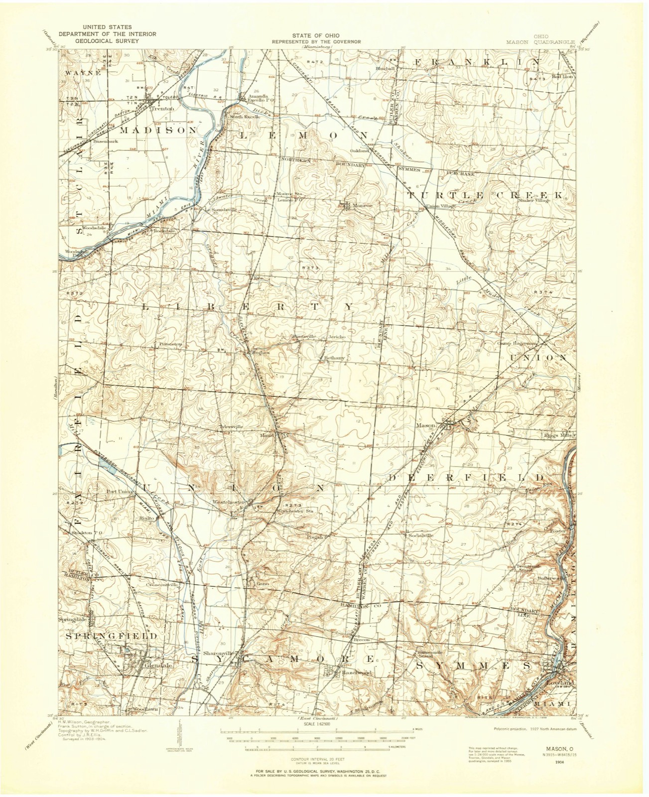
Topographic sheets covering this place
15 sheetsMatched by testing this settlement's coordinate against the published boundary of every sheet in the United States Geological Survey's historical collection. Each opens the scanned sheet at the Survey.
- 1904 USGS Mason quadrangle1:62500
- 1906 USGS Mason quadrangle1:62500
- 1906 USGS Mason quadrangle1:62500
- 1953 USGS Cincinnati quadrangle1:250000
- 1953 USGS Cincinnati quadrangle1:250000
- 1953 USGS Cincinnati quadrangle1:250000
- 1955 USGS Mason quadrangle1:24000
- 1957 USGS Cincinnati quadrangle1:250000
- 1965 USGS Mason quadrangle1:24000
- 1965 USGS Mason quadrangle1:24000
- 1965 USGS Mason quadrangle1:24000
- 1965 USGS Mason quadrangle1:24000
- 1986 USGS Cincinnati quadrangle1:100000
- 1986 USGS Cincinnati quadrangle1:100000
- 1986 USGS Cincinnati quadrangle1:100000







Photographs
8 photographs, 2016Taken for the Office of War Information and the Farm Security Administration, who photographed the country between 1935 and 1944. Works of United States government photographers, with no known restriction on use. Each opens its catalogue record.

Highsmith, Carol M, 2016. Library of Congress

Highsmith, Carol M, 2016. Library of Congress

Highsmith, Carol M, 2016. Library of Congress

Highsmith, Carol M, 2016. Library of Congress

Highsmith, Carol M, 2016. Library of Congress

Highsmith, Carol M, 2016. Library of Congress

Highsmith, Carol M, 2016. Library of Congress

Highsmith, Carol M, 2016. Library of Congress
Specimens collected nearby
12 of 3,494 shownMuseums hold 3,494 specimens collected within 10 miles of Mason between 1850 and 1974: 2,727 Animalia, 643 Fungi, 82 Plantae, 38 Protozoa, 2 Chromista, 2 Unrecorded. 12 distinct Species records are shown. Collected by 14529, A. Gaufin, A. H. W. Povah and others. Each is a physical object with a catalogue number, and each entry opens the museum's record. This is what was collected and kept, not a survey of what lives here - nothing can be concluded from a species being absent.
| Image | Species | Year | Collected by | Where, as recorded |
|---|---|---|---|---|
 | Ipomoea lacunosa L. | 1877 | Joseph Francis James | Loveland |
 | Puccinia rubella (Pers. ex J.F.Gmel.) Arthur | 1878 | James, F. | Loveland |
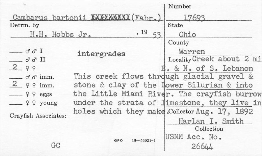 | Cambarus bartonii (Fabricius, 1798) | 1892 | H. Smith | Creek About 2 Mile NE Of South Lebanon |
 | Fomes applanatus (Pers.) Fr. | 1850 | James D. L. | Loveland |
 | Eragrostis cilianensis (All.) Vignolo ex Janch. | 1877 | James, J.F. | Loveland |
 | Polyporus hirsutus (Wulfen) Fr. | 1877 | James D. L. | Loveland |
 | Rumex altissimus Wood | 1877 | J. F. James | Loveland. |
 | Colinus virginianus virginianus (Linnaeus, 1758) | 1878 | Collector(s): unknown | Foster Point |
 | Fomes scutellatus (Schwein.) Cooke | 1878 | James D. L. | Loveland |
 | Justicia americana (L.) Vahl | 1878 | Lloyd, Curtis Gates | Loveland |
 | Polyporus adustus (Willd.) Fr. | 1879 | James D. L. | Loveland |
 | Polyporus cinnabarinus (Jacq.) Fr. | 1879 | James D. L. | Loveland |
All 3,494 specimens within 10 miles, at the Global Biodiversity Information Facility.
Mines and quarries nearby
5 within 5 milesThe federal mineral resources record lists 5 workings within 5 miles of Mason: 4 producers, 1 plant. All of them still produce. What was taken out: Sand and Gravel, Construction. Distance is straight-line from the map coordinates, so a quarry counted here may appear on a neighbouring settlement's page as well.
| Where | Site | Commodity | Status | Recorded |
|---|---|---|---|---|
| Clark Pit & Mill | Sand and Gravel, Construction | Plant | ||
| Dravo South Lebanon Plant | Sand and Gravel, Construction | Producer | ||
| Mason Pit & Mill | Sand and Gravel, Construction | Producer | ||
| Turtlecreek Pit | Sand and Gravel, Construction | Producer | ||
| Watson Pit | Sand and Gravel, Construction | Producer |
Storms nearby
58 since 1996The National Weather Service names Mason in 58 storm reports between 1996 and 2025: 30 thunderstorm wind, 15 hail, 9 flash flood, 2 flood. The reports record 1 injury. Each account below is quoted exactly as the forecast office filed it, from the NOAA Storm Events Database, and each date opens the federal record of that event.
| When | Event | Place named | Harm | What the report says |
|---|---|---|---|---|
| August 2001 | Flash Flood | Mason | 1 hurt | Several inches of rain in less than 1 hour caused flooded roads around Maineville. Also, cars were submerged in water and a woman was swept through a drain pipe at the Tennis Masters Series tournament in Mason. She was injured but survived. |
| September 2003 | Thunderstorm Wind | Mason | $4,000,000 | An intense microburst caused extensive damage to homes and businesses across the southern part of the county. Several buildings sustained major damage along Mason-Montgomery Road. Up to fifty windows were blown out at Kings Junior High School. Portions of the roof were damaged and a wall was blown in at the junior high school as well. Numerous buses near the junior high school were severely damaged by flying debris and a nearby shed was destroyed. The fifty foot marquee at Kings Island Amusement Park was blown down and completely destroyed. 36 homes suffered roof damage in Kings Mills. In South Lebanon, a small church and 75 homes sustained damage, including five that were severely damaged. Fifteen vehicles were struck by fallen trees. Trees and power poles were downed in a widespread area. Maximum wind speeds were estimated between 80 and 100 mph. |
| July 2001 | Flash Flood | Mason | $604,000 | One hundred homes sustained damage with two destroyed from high water. A resident lost six cars when water flooded his garage. Several roads across county sustained minor damage. Total estimate of public assistance is 603,916. |
| March 2025 | Tornado (EF0) | Mason | $215,000 | The tornado initially began in Butler County at 1952EST, near the intersection of Tylersville Road and Lady Anne Drive. The tornado traveled east and entered Warren County along Butler Warren Road, between Tyler Court and Clover Drive at 1953EST. From here, the tornado continued due east and affected numerous subdivisions along a narrow path through the central part of Mason. The majority of the damage in these areas included uprooted trees and broken tree limbs, along with minor roof and siding damage to several homes. ||The tornado crossed I-71, near the Kings Mills exit, and caused a few trailers to be overturned at an RV Resort. As the tornado continued east, it downed numerous trees along Kings Mills Road and through the town of Kings Mills. The tornado then crossed the Little Miami River and continued to cause sporadic tree and minor house damage in a narrow path across the subdivisions along both side of State Route 48. One house to the east of State Route 48 suffered a partial wall collapse of its garage. ||The tornado continued east along U.S. Route 22, causing spotty tree and home damage before ending just west of the Little Miami Junior High School. |
| July 1997 | Flash Flood | Mason | $100,000 | A thunderstorm dropped around 5 inches of rain in just over 2 hours over parts of the county. Several houses were flooded, several roads were flooded including Interstate 71 around Kings Mills, and 135 cars were damaged due to flooding in the parking lot of the King's Island Amusement park. |
| June 2009 | Flash Flood | Mason | $20,000 | Multiple vehicles were stuck in high water and numerous roads were flooded due to the rainfall. |
| June 2000 | Thunderstorm Wind | Mason | $18,000 | Numerous large trees were blown down in downtown Mason. A large tree was also knocked down across Red Lion and Crosley Roads just east of Springboro. |
| June 2021 | Thunderstorm Wind | Mason | $15,000 | A healthy tree snapped and fell on top of a car. |
| November 2000 | Thunderstorm Wind | Mason | $15,000 | Numerous trees and power lines knocked down across the county from winds that were measured up to 75 mph in Lebanon. Some of the trees and limbs fell across roads. |
| June 2000 | Thunderstorm Wind | Mason | $10,000 | Two large trees were downed on Mason/Montgomery road. Damage to road signs and portions of the downtown area was also reported in the city of Mason. |
| August 2008 | Thunderstorm Wind | Mason | $6,000 | A couple of power poles were downed, and an awning was blown off of a house and onto a vehicle, causing minor damage. |
| March 2025 | Thunderstorm Wind | Mason | $5,000 | Multiple trees had large branches broken off and a home sustained shingle damage. |
| May 2018 | Thunderstorm Wind | Mason | $5,000 | A tree fell onto a car in the 5400 block of Brewer Road. |
| July 2012 | Thunderstorm Wind | Mason | $5,000 | Scattered trees were reported down in Mason and the Deerfield Township area due to damaging thunderstorm winds. |
| August 2005 | Thunderstorm Wind | Mason | $5,000 | A tree fell on a garage in Deerfield Township, causing minor damage. |
| July 2004 | Thunderstorm Wind | Mason | $5,000 | Trees were knocked down. |
| June 2003 | Thunderstorm Wind | Mason | $5,000 | Trees were downed across the southern part of the county. |
| May 2002 | Thunderstorm Wind | Mason | $5,000 | Several trees were knocked down. |
| May 2001 | Flash Flood | Mason | $5,000 | Torrential rainfall caused roads to flood in Mason. |
| June 1997 | Flash Flood | Mason | $5,000 | Persistent heavy rainfall caused creeks to overflow their banks along Mason-Morrow road. |
| June 2000 | Thunderstorm Wind | Mason | $4,000 | Several trees were knocked down. |
| July 2018 | Thunderstorm Wind | Mason | $3,000 | Several trees were downed. |
| July 2006 | Thunderstorm Wind | Mason | $3,000 | Several trees were knocked down near the intersection of Tylersville and Butler-Warren Roads. |
| June 2001 | Flash Flood | Mason | $3,000 | High water on roadways in Mason and Deerfield Township |
| July 1997 | Thunderstorm Wind | Mason | $3,000 | Trees downed. |
| May 2009 | Hail | Mason | $3,000 | no account filed |
| February 2002 | Hail | Mason | $3,000 | no account filed |
| May 2024 | Thunderstorm Wind | Mason | $2,000 | A few pine trees were snapped. |
| October 2014 | Thunderstorm Wind | Mason | $2,000 | Minor roof damage occurred to an apartment building. |
| July 2006 | Hail | Mason | $2,000 | A few trees were downed as well. |
| June 2022 | Thunderstorm Wind | Mason | $1,000 | A large tree was downed on Butler Warren Road. |
| June 2021 | Thunderstorm Wind | Mason | $1,000 | A tree was downed across Brewer Road near the intersection with Crooked Tree Drive. |
| May 2018 | Thunderstorm Wind | Mason | $1,000 | A tree was downed. |
| July 2013 | Flash Flood | Mason | $1,000 | Roads were closed in the Mason area due to high water caused by heavy rainfall. |
| December 2013 | Thunderstorm Wind | Mason | $1,000 | Two trees were reported down due to thunderstorm winds. |
| June 2012 | Thunderstorm Wind | Mason | $1,000 | A large tree was reported down due to damaging thunderstorm winds. |
| June 2010 | Thunderstorm Wind | Mason | $1,000 | A ten inch diameter tree broke in half due to damaging thunderstorm winds. |
| June 2010 | Thunderstorm Wind | Mason | $1,000 | Power poles and lines were down due to damaging thunderstorm winds. |
| August 2010 | Thunderstorm Wind | Mason | $1,000 | Two trees were reported down due to damaging thunderstorm winds. |
| October 2010 | Thunderstorm Wind | Mason | $1,000 | Two trees were reported down due to damaging thunderstorm winds. |
| May 2020 | Flood | Mason | - | High water was reported on Bethany Road. |
| November 2017 | Flash Flood | Mason | - | Hamilton Road and Mason Montgomery Road were closed due to flowing water. High water was also reported near Columbia Road and Irwin Simpson Road. |
| July 2013 | Heavy Rain | Mason | - | There was ponding of water that occurred on several roadways in the Mason area due to poor drainage during heavy rainfall. |
| April 2011 | Thunderstorm Wind | Mason | - | The wind gust was estimated. |
| June 2007 | Flood | Mason | - | High water extended from the center divider into both northbound and southbound lanes of Interstate 71 between mile markers 21 and 24. |
| July 2023 | Hail | Mason | - | no account filed |
| April 2020 | Hail | Mason | - | no account filed |
| April 2020 | Hail | Mason | - | no account filed |
| April 2020 | Hail | Mason | - | no account filed |
| April 2020 | Hail | Mason | - | no account filed |
| April 2013 | Hail | Mason | - | no account filed |
| April 2013 | Hail | Mason | - | no account filed |
| July 2012 | Thunderstorm Wind | Mason | - | no account filed |
| March 2012 | Hail | Mason | - | no account filed |
| March 2011 | Hail | Mason | - | no account filed |
| August 2000 | Hail | Mason | - | no account filed |
| July 1997 | Hail | Mason | - | no account filed |
| May 1996 | Hail | Mason | - | no account filed |
Nearest settlements
The eight closest, with where each one stands in the county. Distances are straight-line, computed from the Geographic Names Information System coordinates.
| Map | Place | Distance | Sheets |
|---|---|---|---|
| Stokes (historical) | 1.6 miles | 16 | |
| Shadow Lake Village | 3.0 miles | 16 | |
| Socialville | 3.0 miles | 15 | |
| Hageman | 3.2 miles | 16 | |
| Kings Mills | 3.3 miles | 14 | |
| Miltomson | 3.4 miles | 15 | |
| Landen | 3.6 miles | 15 | |
| Twenty Mile Stand | 4.0 miles | 15 |
Elsewhere
Matched on this settlement's Geographic Names Information System number rather than its name, so it cannot be a different place of the same name in another state.
| Wikipedia article on Mason | An encyclopaedic summary. Its text is share-alike, so it is linked here rather than copied. |
| Wikidata item Q986779 | The structured record the population and elevation above come from. Public domain (CC0). |
Provenance
This settlement is recorded in the Geographic Names Information System as feature 1061481. The sheet list is computed by point-in-boundary test against the United States Geological Survey's historical topographic inventory. Both are works of the United States government and carry no copyright under 17 U.S.C. 105.
Specimens. Global Biodiversity Information Facility (GBIF), https://www.gbif.org/. Only records licensed CC0 or CC BY are used. Records licensed CC BY-NC are excluded because this site carries advertising. Images are checked individually and any whose licence is non-commercial, no-derivatives or unreadable is refused.
Mines and quarries. USGS Mineral Resources Data System (MRDS) https://mrdata.usgs.gov/mrds/ A work of the United States government, no copyright under 17 U.S.C. 105.
Storms. NOAA National Centers for Environmental Information, Storm Events Database https://www.ncei.noaa.gov/stormevents/ A work of the United States government, no copyright under 17 U.S.C. 105. Narratives are quoted verbatim from the National Weather Service report and are not edited or summarised.