 Block
Block
Monroeville, Ohio
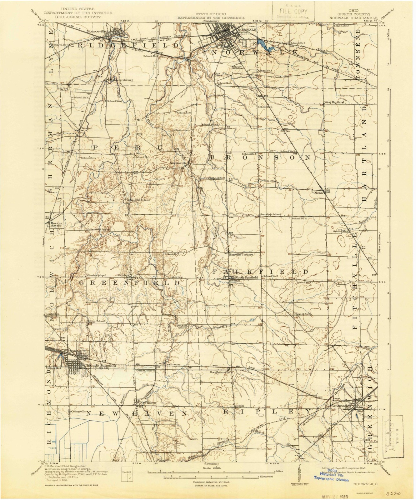
12 topographic sheets cover this place, the earliest surveyed in 1915 and the latest in 1986. It stands in Ridgefield Township. It lies in ZIP code area 44847. It stands on Frink Run. The Survey maps it on the Monroeville quadrangle. 1,300 people lived here at the 2020 count. It stands 709 feet above sea level.
Population over time
2 figuresMonroeville fell from 1,400 to 1,300 between 2010 and 2020. These are the recorded population figures Wikidata holds for this place, reached through the Geographic Names Information System number this page is keyed on rather than by name, so they belong to this place and not to another of the same name. Most are census counts, but not all are: an early figure may be a founding or settlement estimate. The change column is computed, and is left blank where more than 20 years separate a figure from the one before it, because a gap that long is not a change between two counts.
| Year | People | Change |
|---|---|---|
| 2010 | 1,400 | |
| 2020 | 1,300 | -100 (-7%) |
Then and now
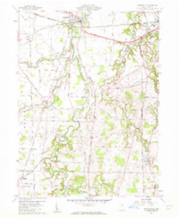
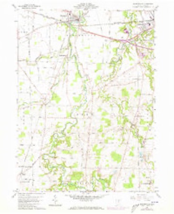
1915 to 1986The same ground, surveyed 71 years apart. Drag the handle to wipe between them. Both sheets are United States Geological Survey originals; neither has been altered.

Topographic sheets covering this place
12 sheetsMatched by testing this settlement's coordinate against the published boundary of every sheet in the United States Geological Survey's historical collection. Each opens the scanned sheet at the Survey.
- 1915 USGS Norwalk quadrangle1:62500
- 1915 USGS Norwalk quadrangle1:62500
- 1944 USGS Norwalk quadrangle1:62500
- 1956 USGS Toledo quadrangle1:250000
- 1956 USGS Toledo quadrangle1:250000
- 1956 USGS Toledo quadrangle1:250000
- 1956 USGS Toledo quadrangle1:250000
- 1960 USGS Monroeville quadrangle1:24000
- 1960 USGS Monroeville quadrangle1:24000
- 1961 USGS Toledo quadrangle1:250000
- 1986 USGS Lorain quadrangle1:100000
- 1986 USGS Lorain quadrangle1:100000







In the county-history sources
2,210 words on this townshipHistory of Huron County Ohio Its Progress and Development, published 1909 names this settlement in its chapter on Ridgefield Township. These are the passages that mention it, exactly as the scans read.
The first school house in the township was erected on lot number two hundred and seventy-two, in Monroeville village. It was, doubtless, built of logs, but the date of its construction, the writer could not ascertain. George Burt was the first teacher and he was paid ten dollars per month for his services.
Passage source: History of Huron County Ohio Its Progress and Development, published 1909.
Machine-read from a century-old scan, so expect the errors a machine makes: misspelled names, dropped words, stray characters.
Read the whole chapter on Ridgefield Township - it names this place 2 more 2 times.
Photographs
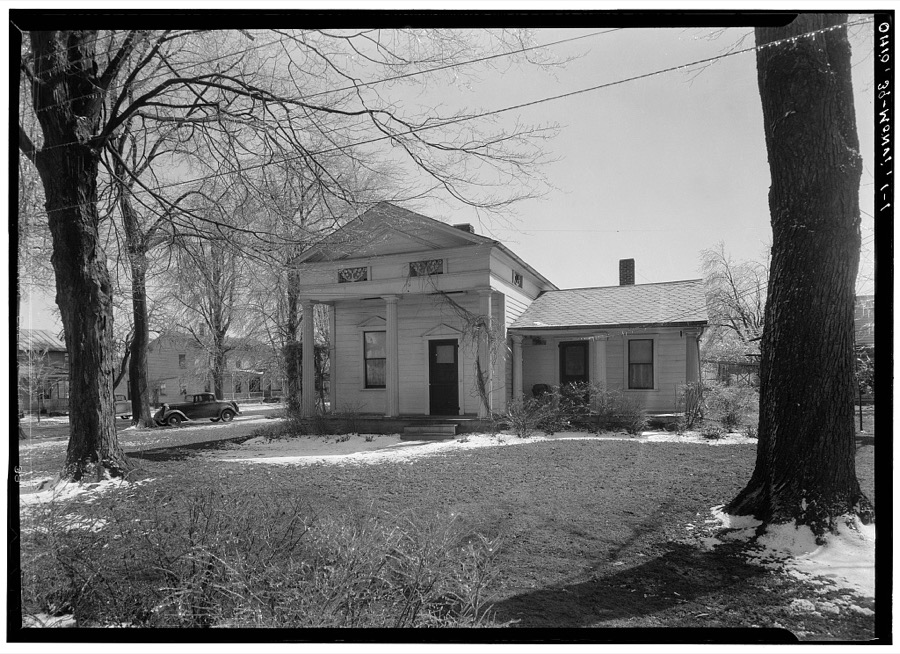
1 photograph,Taken for the Office of War Information and the Farm Security Administration, who photographed the country between 1935 and 1944. Works of United States government photographers, with no known restriction on use. Each opens its catalogue record.
Unattributed, . Library of Congress
Specimens collected near this place
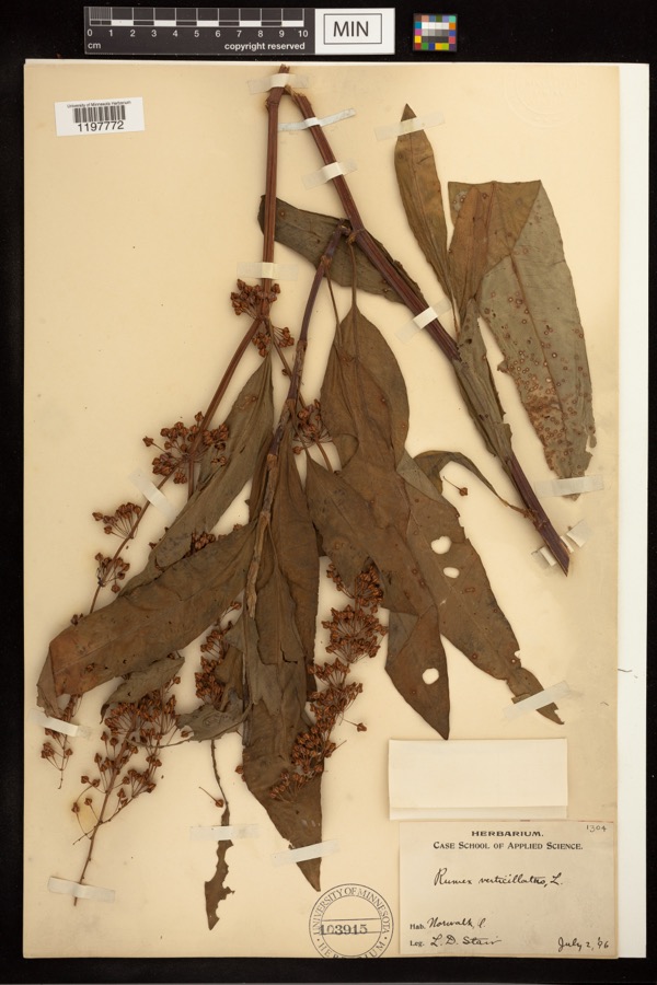
12 of 379 shownRegional context, not property-specific evidence. Museums hold 379 specimens collected within 10 miles of Monroeville between 1893 and 1975: 308 Animalia, 66 Plantae, 5 Fungi. 12 distinct Species records are shown. Collected by A. Woolman, B Zahuranec & party, Baumgartner, L. and others. Each is a physical object with a catalogue number, and each entry opens the museum's record. This is what was collected and kept, not a survey of what lives here - nothing can be concluded from a species being absent.
| Image | Species | Year | Collected by | Where, as recorded |
|---|---|---|---|---|
 | Rumex verticillatus L. | 1896 | Stair, L. D. | |
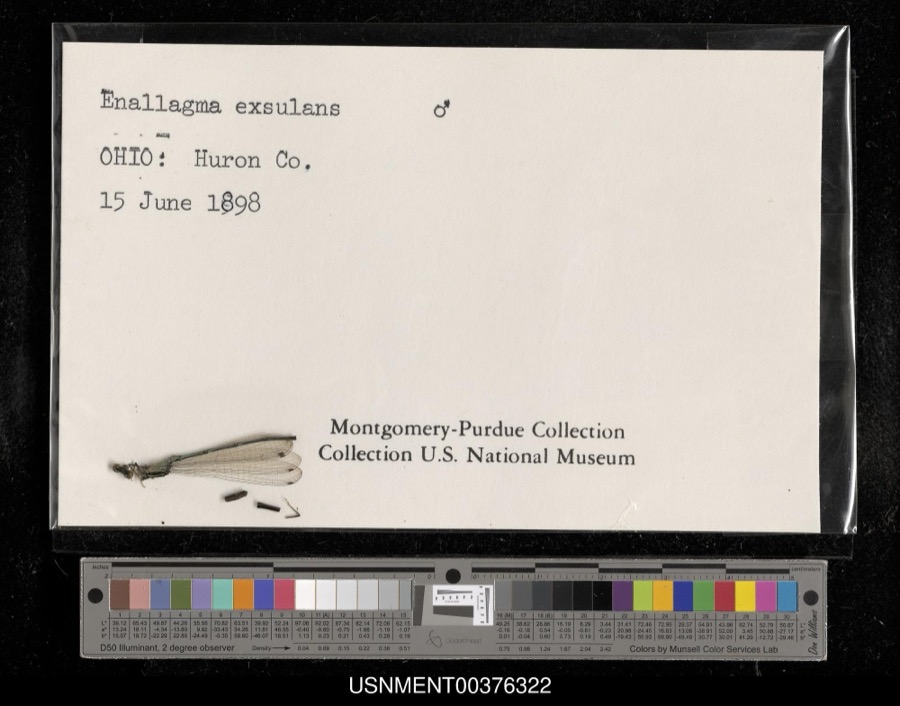 | Enallagma exsulans (Hagen, 1861) | 1898 | [Not Stated] | [Not Stated] |
 | Campostoma anomalum (Rafinesque, 1820) | 1893 | A. Woolman | Ohio, Huron River, Monroeville |
 | Dryopteris carthusiana (Vill.) H.P.Fuchs | 1893 | Collector(s): Edwin Lincoln Moseley | Milan, Huron River |
 | Etheostoma caeruleum Storer, 1845 | 1893 | not recorded | Ohio, Monroeville, Huron River |
 | Etheostoma flabellare Rafinesque, 1819 | 1893 | not recorded | Ohio, Monroeville, Huron River |
 | Etheostoma nigrum Rafinesque, 1820 | 1893 | not recorded | Ohio, Monroeville, Huron River |
 | Hypentelium nigricans (Lesueur, 1817) | 1893 | not recorded | Ohio, Monroeville, Huron River |
 | Lithobates pipiens (Schreber, 1782) | 1893 | not recorded | Monroeville, Huron River |
 | Notropis whipplei (Girard, 1856) | 1893 | A. Woolman | Ohio, Huron River, Monroeville |
 | Noturus flavus Rafinesque, 1818 | 1893 | A. Woolman | Ohio, Huron River, Monroeville |
 | Bidens laevis (L.) Britton, Sterns & Poggenb. | 1894 | Collector(s): Edwin Lincoln Moseley | Huron River, Milan |
All 379 specimens within 10 miles, at the Global Biodiversity Information Facility.
Mines and quarries near this place
2 within 5 milesRegional context, not property-specific evidence. The federal mineral resources record lists 2 workings within 5 miles of Monroeville: 1 past producer, 1 producer. 1 still produces. What was taken out: Sand and Gravel, Construction. Distance is straight-line from the map coordinates, so a quarry counted here may appear on a neighbouring settlement's page as well.
| Where | Site | Commodity | Status | Recorded |
|---|---|---|---|---|
| Price Sand and Gravel Pit | Sand and Gravel, Construction | Past Producer | Sedimentary | |
| Price Sand and Gravel Pit | Sand and Gravel, Construction | Producer |
Storms near this place
26 since 1996Regional context, not property-specific evidence. The National Weather Service names Monroeville in 26 storm reports between 1996 and 2023: 12 thunderstorm wind, 10 hail, 3 tornado, 1 flash flood. The reports record 1 injury. Each account below is quoted exactly as the forecast office filed it, from the NOAA Storm Events Database, and each date opens the federal record of that event.
| When | Event | Place named | Harm | What the report says |
|---|---|---|---|---|
| September 2000 | Tornado (F2) | Monroeville | 1 hurt, $250,000 | A tornado touched down north of Monroeville along State Route 99 near Mead Road. The tornado traveled east for 2.5 miles along State Route 113 and dissipated in Erie County near the corner of Higbee and Livengood Roads. The tornado was not on the ground the entire length and had a damage path approximately 100 yards in width. A mobile home, small outbuilding, barn, garage and a camper were destroyed in Huron County. An adult male inside the mobile home was slightly injured. The damage path of the tornado was clearly visible through corn fields and debris from the destroyed buildings was strewn along the path and in some case thrown well outside the path. Ears of corn were found shucked, apparently by the tornado. Several hundred trees were downed along the damage path. |
| June 2023 | Tornado (EF2) | Monroeville | $270,000 | This tornado began about two miles south of Monroeville, near Townline Road 198 and Sand Hill Road, where trees were damaged. The tornado moved southeastward, damaged additional trees, and caused EF0 to EF1-level damage to two barns and outbuildings. The greatest damage from the tornado occurred in vicinity of Snyder Road and Peru Center Road. This is where several residences sustained EF1 to EF2-level damage and the tornado's estimated peak winds reached 115 mph. A piece of slate roofing was lifted off a building north of Snyder Road and impaled a tree to the southeast. An outbuilding was destroyed completely and material from this structure was lofted a quarter mile southeast into a residence before eventually settling into a tree line. About ten buildings in total sustained damage, including one residence that was shifted off its foundation.||Damage to additional trees and outbuildings occurred as the tornado persisted farther southeastward across Peru Center Road, toward Townline Road 131 and OH-61. As the tornado reached Hanville Corners Road and Townline Road 113, several outbuildings and silos were damaged heavily with twisted debris lofted in various directions. The tornado continued farther southeast toward OH-162 and Ridge Road, where it caused heavy damage to a barn before the tornado dissipated west of the village of North Fairfield. |
| May 2011 | Tornado (EF1) | Monroeville | $250,000 | An EF1 tornado touched down in a cemetery on the southeast side of Monroeville. This tornado then continued east on the ground for about eight miles before lifting near the intersection of Tiger Road and North Greenwich Milan Road on the southeast side of Norwalk. The path was parallel and just south of U.S. Route 20 for several miles. Around a dozen homes and businesses were damaged by this tornado. A couple of the buildings lost large sections of roofing with some of damage caused by fallen trees. The tornado also leveled a large barn as it crossed Halfway Road. Several dozen trees were also downed along the damage path which was no more than 50 yards in width. |
| April 2004 | Hail | Monroeville | $75,000 | Penny to quarter size hail was observed six miles west of Monroeville in Bellvue. Hail completely covered the ground at some locations on the east side of town. Many cars were damaged in this area. |
| April 2011 | Thunderstorm Wind | Monroeville | $40,000 | Thunderstorm winds overturned a semi tractor trailer on US Route 20. |
| June 2005 | Thunderstorm Wind | Monroeville | $15,000 | A roof was blown off a barn. |
| July 2001 | Thunderstorm Wind | Monroeville | $10,000 | Thunderstorm winds downed a few trees six miles northwest of Monroeville on Friedley Avenue in Bellevue. A power pole was also knocked down. |
| June 2013 | Thunderstorm Wind | Monroeville | $6,000 | Amateur radio reported a 40 inch circumference tree was uprooted on Route 99 near Monroeville. Trained spotters reported tree damage continued east to Norwalk where tree branches were down. |
| May 2006 | Thunderstorm Wind | Monroeville | $6,000 | Several trees, along with power lines, were reported down near Bellevue. |
| March 2017 | Thunderstorm Wind | Monroeville | $5,000 | A line of thunderstorms moved across northern Huron County knocking trees down in Monroeville and Wakeman. |
| April 2003 | Thunderstorm Wind | Monroeville | $5,000 | Thunderstorm winds downed several large tree limbs northwest of Monroeville near Bellvue. |
| July 2002 | Thunderstorm Wind | Monroeville | $5,000 | Thunderstorm winds downed a tree in Monroeville and several large limbs west of Monroeville. |
| June 1998 | Thunderstorm Wind | Monroeville | $3,000 | Power lines were downed. |
| September 2015 | Thunderstorm Wind | Monroeville | $2,000 | Thunderstorm winds downed a tree and a large limb south of Monroeville. |
| March 2020 | Hail | Monroeville | - | Trained spotter reported 0.5 diameter to nickel-size hail 2 miles SW of Monroeville. |
| March 2020 | Hail | Monroeville | - | Trained spotter reported penny-size to quarter-size hail 2 miles SW of Monroeville. |
| July 2018 | Thunderstorm Wind | Monroeville | - | Thunderstorm wind gusts were estimated to be at least 60 mph. |
| March 2012 | Hail | Monroeville | - | Quarter sized hail was observed. |
| May 2007 | Hail | Monroeville | - | Penny size hail was observed. |
| April 2006 | Hail | Monroeville | - | Penny size hail was observed. |
| May 2006 | Hail | Monroeville | - | Penny size hail was observed. |
| July 2000 | Hail | Monroeville | - | no account filed |
| July 2000 | Hail | Monroeville | - | no account filed |
| July 2000 | Hail | Monroeville | - | no account filed |
| January 1998 | Flash Flood | Monroeville | - | no account filed |
| November 1996 | Thunderstorm Wind | Monroeville | - | no account filed |
Nearest settlements
The eight closest, with where each one stands in the county. Distances are straight-line, computed from the Geographic Names Information System coordinates.
| Map | Place | Distance | Sheets |
|---|---|---|---|
| Standardsburg | 1.9 miles | 12 | |
| Hunts Corners | 3.4 miles | 12 | |
| Key Estates | 4.0 miles | 13 | |
| Pontiac | 4.1 miles | 12 | |
| Norwalk | 4.3 miles | 12 | |
| Strongs Ridge | 5.5 miles | 18 | |
| Peru | 5.9 miles | 12 | |
| East Norwalk | 7.0 miles | 13 |
Elsewhere
Matched on this settlement's Geographic Names Information System number rather than its name, so it cannot be a different place of the same name in another state.
| Wikipedia article on Monroeville | An encyclopaedic summary. Its text is share-alike, so it is linked here rather than copied. |
| Wikidata item Q2226047 | The structured record the population and elevation above come from. Public domain (CC0). |
Provenance
This settlement is recorded in the Geographic Names Information System as feature 1065046. The sheet list is computed by point-in-boundary test against the United States Geological Survey's historical topographic inventory. Both are works of the United States government and carry no copyright under 17 U.S.C. 105.
Specimens. Global Biodiversity Information Facility (GBIF), https://www.gbif.org/. Only records licensed CC0 or CC BY are used. Records licensed CC BY-NC are excluded because this site carries advertising. Images are checked individually and any whose licence is non-commercial, no-derivatives or unreadable is refused.
Mines and quarries. USGS Mineral Resources Data System (MRDS) https://mrdata.usgs.gov/mrds/ A work of the United States government, no copyright under 17 U.S.C. 105.
Storms. NOAA National Centers for Environmental Information, Storm Events Database https://www.ncei.noaa.gov/stormevents/ A work of the United States government, no copyright under 17 U.S.C. 105. Narratives are quoted verbatim from the National Weather Service report and are not edited or summarised.