 Block
Block
Rockford, Ohio
12 topographic sheets cover this place, the earliest surveyed in 1914 and the latest in 1986. It stands in Dublin Township. It lies in ZIP code area 45882. The Survey maps it on the Rockford quadrangle. 1,051 people lived here at the 2020 count. It stands 814 feet above sea level.
Population over time
2 figuresRockford fell from 1,120 to 1,051 between 2010 and 2020. These are the recorded population figures Wikidata holds for this place, reached through the Geographic Names Information System number this page is keyed on rather than by name, so they belong to this place and not to another of the same name. Most are census counts, but not all are: an early figure may be a founding or settlement estimate. The change column is computed, and is left blank where more than 20 years separate a figure from the one before it, because a gap that long is not a change between two counts.
| Year | People | Change |
|---|---|---|
| 2010 | 1,120 | |
| 2020 | 1,051 | -69 (-6%) |
Then and now
1914 to 1986The same ground, surveyed 72 years apart. Drag the handle to wipe between them. Both sheets are United States Geological Survey originals; neither has been altered.

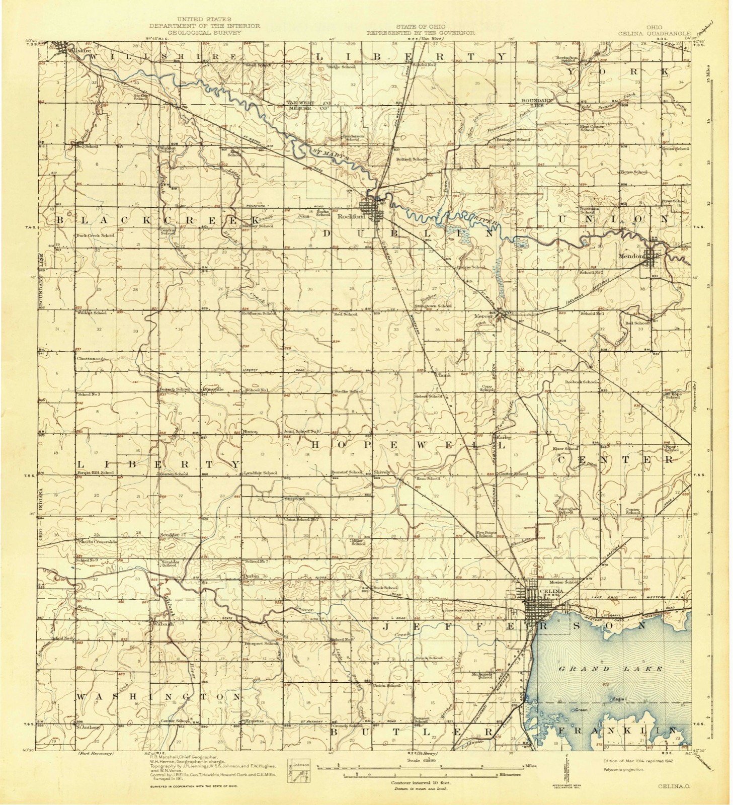
Topographic sheets covering this place
12 sheetsMatched by testing this settlement's coordinate against the published boundary of every sheet in the United States Geological Survey's historical collection. Each opens the scanned sheet at the Survey.
- 1914 USGS Celina quadrangle1:62500
- 1944 USGS Celina quadrangle1:62500
- 1953 USGS Muncie quadrangle1:250000
- 1953 USGS Muncie quadrangle1:250000
- 1953 USGS Muncie quadrangle1:250000
- 1953 USGS Muncie quadrangle1:250000
- 1953 USGS Muncie quadrangle1:250000
- 1956 USGS Muncie quadrangle1:250000
- 1960 USGS Rockford quadrangle1:24000
- 1986 USGS Lima quadrangle1:100000
- 1986 USGS Lima quadrangle1:100000
- 1986 USGS Lima quadrangle1:100000









In the county-history sources
5,852 words on this townshipHistory of Mercer County, Ohio, and Representative Citizens, published 1907 names this settlement in its chapter on Dublin Township. These are the passages that mention it, exactly as the scans read.
The township has two railroads. The Cincinnati Northern, which has for its southern terminus, Cincinnati and for its northern, Jackson, Michigan, passes through Rockford, which is the market for the entire northern part of the county and the only town of any importance in the township. A branch of the Cincinnati, Hamilton & Dayton Railway passes through Mercer, a settlement in the southeastern corner of the township. This section of the county is, therefore, afforded good shipping facilities. The first railroad built in the township was the old Toledo, Delphos & Burlington Railroad, a narrow-gauge line, from Delphos to Rockford by the way of Mercer, with the main line running from Delphos to Dayton, via Celina. In a few years, however, the branch froni Mercer to Rockford was abandoned. Tbe main line at a later date was absorbed by the Cincinnati, Hamilton & Dayton Railway and became a standard-gauge road.
Passage source: History of Mercer County, Ohio, and Representative Citizens, published 1907.
During tbe War of 1812, before this section had been opened for settlement by the whites and, indeed, before the formation of the county, there was an Indian village on the St. Mary's River in this township known as Old-town, which was near where the present village of Rockford is now located. Among the Indians having lodges here were: Anthony Shane,
Passage source: History of Mercer County, Ohio, and Representative Citizens, published 1907.
Louis Godfrey, the Crescent, Labadie and Rushville. These Indians were alwavs friendly and rendered every possible service to the government. Grants of land near the present village of Rockford were made to several of these Indians. Among these was a grant of one section of land on the banks of tbe St. Mary's River, at Shane's Crossing (now Rockford) to Anthony Shane; six sections of land on the north side of the St. Mary s River, above the reservation of Shane, to Louis Godfrey ; one section on the north side of the St. Mary's River, and below the section granted to the Crescent, to the chief, Charlie; one section on the St. Mary's, below the section granted to Gharlie, to Peter Labadie; and to Alexander T. Godfrey and Richard Godfrey, adopted children of the Pottawatomie tribe, one section of the tract ceded to the United States by the Pottawatomies, Ottawas and Chippewas. At the special request of the two Godfreys, they were given the right to choose and locate said section of land within said tract after a survey should be made; they finally located it within the present limits of Dublin township. These lands have all since passed into the hands of the whites either by gift or purchase. L. G. Roebuck was given a tract of land by Godfrey on account of his being a namesake. The remainder of the Godfrey grant was purchased by William B. Hedges, one of the earliest permanent settlers of this section, who at a very early period clerked for a French trader named Anthony Madore, who had established a trading post at Shane's Crossing, which was the first store of any kind in the township. When the first settlers came, they found Anthony Shane on his reservation, occupying a double log house on the north side of the river, a short distance from the present site of Rockford. Louis Godfrey lived at this time on the north bank of the St. Mary's River in the Indian village Old-town, located about a mile and a half up the river from Shane's Crossing. Other Indians, also, at this time occupied lodges upon the reservations in the township.
Passage source: History of Mercer County, Ohio, and Representative Citizens, published 1907.
Machine-read from a century-old scan, so expect the errors a machine makes: misspelled names, dropped words, stray characters.
Read the whole chapter on Dublin Township - it names this place 24 more 24 times.
Specimens collected near this place
12 of 69 shownRegional context, not property-specific evidence. Museums hold 69 specimens collected within 10 miles of Rockford between 1840 and 1967: 67 Animalia, 2 Plantae. 12 distinct Species records are shown. Collected by Clark, C. F. (Clarence F.), H. Price, Hubbell, T. H. and others. Each is a physical object with a catalogue number, and each entry opens the museum's record. This is what was collected and kept, not a survey of what lives here - nothing can be concluded from a species being absent.
| Image | Species | Year | Collected by | Where, as recorded |
|---|---|---|---|---|
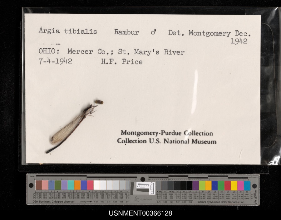 | Argia tibialis (Rambur, 1842) | 1942 | H. Price | St. Mary's River |
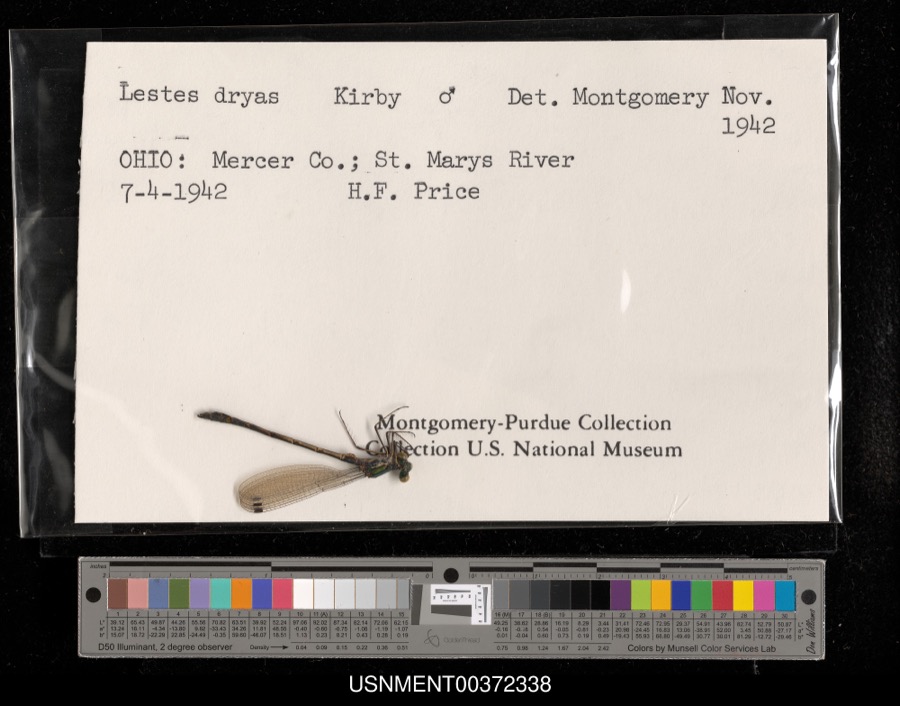 | Lestes dryas Kirby, 1890 | 1942 | H. Price | St. Mary's River |
 | Silene virginica L. | 1840 | J. Wolle, D. Blum | |
 | Aphredoderus sayanus (Gilliams, 1824) | 1893 | P. Kirsch | St. Marys River, Rockford, Ohio |
 | Pomoxis sparoides (Lacepède, 1801) | 1893 | P. H. Kirsch | St. Mary's River |
 | Orthotylus ramus Knight, 1927 | 1918 | R. Hussey | [Not Stated] |
 | Perlesta lagoi Stark, 1989 | 1918 | not recorded | |
_BHL4428170.jpg) | Ceuthophilus uhleri Scudder, 1862 | 1921 | Hubbell, T. H. | Mercer Co., OH |
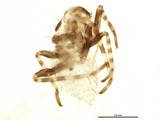 | Phytocoris husseyi Knight, 1923 | 1921 | R. Hussey | Mendon |
 | Ceuthophilus latens Scudder, 1862 | 1932 | Hubbell, T. H. | Mercer Co., OH |
 | Bombus pensylvanicus (De Geer, 1773) | 1935 | not recorded | |
 | Ameiurus melas melas (Rafinesque, 1820) | 1941 | Clark, C. F. (Clarence F.) | Little Beaver Creek, Sec 6 of Jefferson township, ~5.4 mi E of Wabash, Jefferson township |
All 69 specimens within 10 miles, at the Global Biodiversity Information Facility.
Mines and quarries near this place
2 within 5 milesRegional context, not property-specific evidence. The federal mineral resources record lists 2 workings within 5 miles of Rockford: 1 past producer, 1 producer. 1 still produces. What was taken out: Limestone, General, Stone, Crushed/Broken. Distance is straight-line from the map coordinates, so a quarry counted here may appear on a neighbouring settlement's page as well.
| Where | Site | Commodity | Status | Recorded |
|---|---|---|---|---|
| Rockford Stone Quarry | Limestone, General | Past Producer | Sedimentary | |
| Rockford Stone Quarry | Stone, Crushed/Broken | Producer |
Storms near this place
36 since 1999Regional context, not property-specific evidence. The National Weather Service names Rockford in 36 storm reports between 1999 and 2023: 13 thunderstorm wind, 10 flood, 7 hail, 4 flash flood. No death or injury is recorded in these reports. Each account below is quoted exactly as the forecast office filed it, from the NOAA Storm Events Database, and each date opens the federal record of that event.
| When | Event | Place named | Harm | What the report says |
|---|---|---|---|---|
| July 2003 | Flash Flood | Rockford | $2,000,000 | Major flooding continued across the northern part of the county, with more snadbaggin in Rockford. Forty additional homes were evacuated in and around Rockford. Numerous roads remained flooded and closed. |
| July 2003 | Flash Flood | Rockford | $300,000 | Roads across the northern part of the county remained flooded and closed with several bridges washed out. The Saint Marys River flooded into town, forcing sixty evacuations as many homes and businesses were submerged in two to three feet of standing water. Sandbagging took place in an effort to keep more water from entering the town with creeks and streams continuing to rise. |
| July 2003 | Flash Flood | Rockford | $200,000 | Serious flooding continued across much of the county. Sandbagging continued in Rockford, with fifty more homes evacuated. Water from Grand lake Saint Marys spilled over US Route 127 south of Celina. US Route 127 and US Route 33 were flooded and closed to the north and west of Rockford. |
| June 2013 | Tornado (EF0) | Rockford | $40,000 | The tornado briefly touched down to the West of River Train Road. Ten percent of a large aluminum barn was removed and had four garage doors blown out. Some of the debris from this building caused collateral impact damage to surrounding structures on both north and south facing aspects. A large dent occurred near the top of the southwest side of a grain silo. Another aluminum building incurred siding damage and a second story window was blown in from the south. This property was surrounded by farmland and no additional damage was noted in the area. Based on the damage surveyed, the maximum wind speed from this tornado was estimated to be 75 miles per hour. |
| February 2008 | Flood | Rockford | $30,000 | A dozen homes were evacuated with sandbagging occurring on the south side of Celina near Grand Lake St. Marys. Numerous roads were flooded and closed, including several roads along the St. Marys River near Mendon. Many homes sustained basement flooding. |
| June 2006 | Tornado (F0) | Rockford | $20,000 | A small tornado briefly touched down near the intersection of US Route 127 and Shelley Road. A barn was destroyed and a few trees were knocked down. |
| June 2007 | Thunderstorm Wind | Rockford | $6,000 | A truck stop near the intersection of US Routes 33 and 127 sustained minor roof damage. Power lines were also downed. |
| July 2023 | Thunderstorm Wind | Rockford | $5,000 | A tree fell onto a house along State Route 118. |
| June 2012 | Thunderstorm Wind | Rockford | $5,000 | A church steeple was knocked over and power lines were downed due to thunderstorm winds. |
| July 1999 | Thunderstorm Wind | Rockford | $5,000 | Trees and electrical poles downed. |
| June 2008 | Thunderstorm Wind | Rockford | $3,000 | Large trees were uprooted. |
| March 2006 | Thunderstorm Wind | Rockford | $3,000 | A semi truck was blown over along US Route 33 near Rockford. |
| August 2002 | Thunderstorm Wind | Rockford | $3,000 | Trees and large limbs were knocked down across town. |
| June 2022 | Thunderstorm Wind | Rockford | $2,000 | A pole was downed on Purdy Road. |
| October 2013 | Thunderstorm Wind | Rockford | $2,000 | Large tree limbs were downed in the northern portion of Mercer County due to thunderstorm winds. |
| July 2023 | Thunderstorm Wind | Rockford | $1,000 | A tree was downed on North Main Street in Rockford. |
| June 2022 | Thunderstorm Wind | Rockford | $1,000 | A tree was downed near the intersection of State Route 707 and Now Road. |
| August 2014 | Thunderstorm Wind | Rockford | $1,000 | One tree was knocked down in Rockford due to strong winds. |
| July 2010 | Flash Flood | Rockford | $1,000 | Water was over a roadway due to heavy rain that caused the flash flooding. |
| June 2017 | Thunderstorm Wind | Rockford | $500 | Several tree limbs, seven to eight inches in diameter, were knocked down in the Rockford area. |
| June 2015 | Flood | Rockford | - | U.S. 33 closed from the Rockford Coporation limits to Township Line Road due to high water. |
| June 2015 | Flood | Rockford | - | Road closed due to flooding at the intersection of Highways 118 and 707. |
| June 2015 | Flood | Rockford | - | Township Line Road closed due to high water between U.S. Route 33 and the county line. |
| June 2015 | Flood | Rockford | - | Route 127 closed between Route 707 and Shelly Road due to high water. |
| June 2015 | Flood | Rockford | - | Frysinger Road closed between U.S. Route 33 and Shelly Road due to high water. |
| June 2015 | Flood | Rockford | - | Erastus Durbin Road closed between Rockford West Road and Manley Road. |
| June 2015 | Flood | Rockford | - | Ohio State Route 117 closed between Route 118 and 127 due to flooding. |
| June 2015 | Flood | Rockford | - | Jordan Road was closed between Lee Road and Rockford West Road due to flooding. |
| June 2015 | Flood | Rockford | - | River Trail Road closed between Blackloon Road and County Line Road. |
| June 2017 | Hail | Rockford | - | no account filed |
| May 2011 | Hail | Rockford | - | no account filed |
| April 2011 | Hail | Rockford | - | no account filed |
| June 2009 | Hail | Rockford | - | no account filed |
| June 2009 | Hail | Rockford | - | no account filed |
| July 2004 | Hail | Rockford | - | no account filed |
| August 2003 | Hail | Rockford | - | no account filed |
Nearest settlements
The eight closest, with where each one stands in the county. Distances are straight-line, computed from the Geographic Names Information System coordinates.
| Map | Place | Distance | Sheets |
|---|---|---|---|
| Mercer | 4.0 miles | 13 | |
| Tama | 4.1 miles | 13 | |
| Bursville | 6.1 miles | 12 | |
| Earley (historical) | 6.1 miles | 14 | |
| Hinton | 6.2 miles | 13 | |
| Shively | 6.3 miles | 13 | |
| Mendon | 6.8 miles | 13 | |
| Brehm (historical) | 7.0 miles | 13 |
Elsewhere
Matched on this settlement's Geographic Names Information System number rather than its name, so it cannot be a different place of the same name in another state.
| Wikipedia article on Rockford | An encyclopaedic summary. Its text is share-alike, so it is linked here rather than copied. |
| Wikidata item Q2668552 | The structured record the population and elevation above come from. Public domain (CC0). |
Provenance
This settlement is recorded in the Geographic Names Information System as feature 1061624. The sheet list is computed by point-in-boundary test against the United States Geological Survey's historical topographic inventory. Both are works of the United States government and carry no copyright under 17 U.S.C. 105.
Specimens. Global Biodiversity Information Facility (GBIF), https://www.gbif.org/. Only records licensed CC0 or CC BY are used. Records licensed CC BY-NC are excluded because this site carries advertising. Images are checked individually and any whose licence is non-commercial, no-derivatives or unreadable is refused.
Mines and quarries. USGS Mineral Resources Data System (MRDS) https://mrdata.usgs.gov/mrds/ A work of the United States government, no copyright under 17 U.S.C. 105.
Storms. NOAA National Centers for Environmental Information, Storm Events Database https://www.ncei.noaa.gov/stormevents/ A work of the United States government, no copyright under 17 U.S.C. 105. Narratives are quoted verbatim from the National Weather Service report and are not edited or summarised.