 Block
Block
Salesville, Ohio
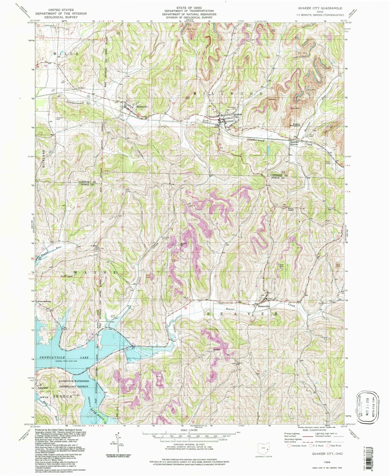
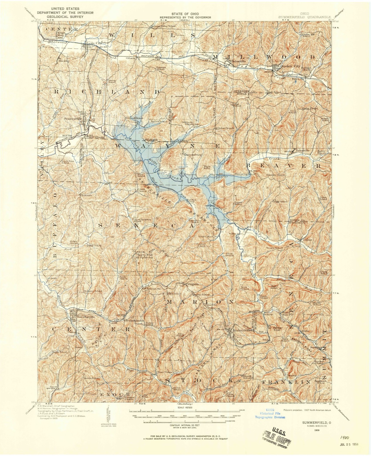
12 topographic sheets cover this place, the earliest surveyed in 1909 and the latest in 1994. It stands in Millwood Township. It lies in ZIP code area 43778. The Survey maps it on the Quaker City quadrangle. 123 people lived here at the 2020 count. It stands 866 feet above sea level.
Population over time
2 figuresSalesville fell from 129 to 123 between 2010 and 2020. These are the recorded population figures Wikidata holds for this place, reached through the Geographic Names Information System number this page is keyed on rather than by name, so they belong to this place and not to another of the same name. Most are census counts, but not all are: an early figure may be a founding or settlement estimate. The change column is computed, and is left blank where more than 20 years separate a figure from the one before it, because a gap that long is not a change between two counts.
| Year | People | Change |
|---|---|---|
| 2010 | 129 | |
| 2020 | 123 | -6 (-5%) |
Then and now
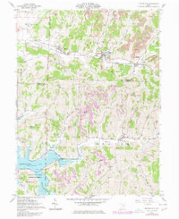
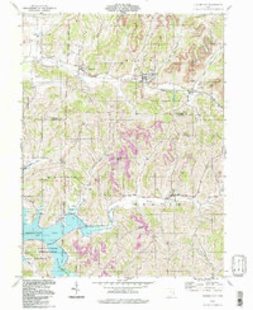
1909 to 1994The same ground, surveyed 85 years apart. Drag the handle to wipe between them. Both sheets are United States Geological Survey originals; neither has been altered.
Topographic sheets covering this place
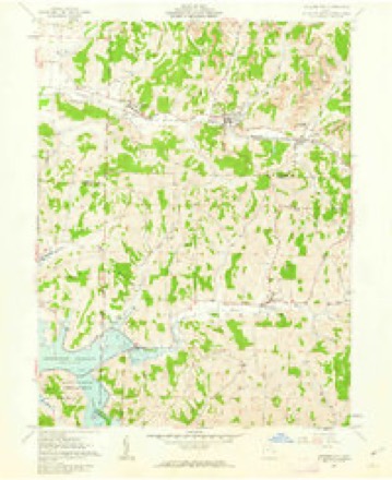
12 sheetsMatched by testing this settlement's coordinate against the published boundary of every sheet in the United States Geological Survey's historical collection. Each opens the scanned sheet at the Survey.
- 1909 USGS Summerfield quadrangle1:62500
- 1911 USGS Summerfield quadrangle1:62500
- 1949 USGS Clarksburg quadrangle1:250000
- 1956 USGS Clarksburg quadrangle1:250000
- 1956 USGS Clarksburg quadrangle1:250000
- 1961 USGS Clarksburg quadrangle1:250000
- 1961 USGS Quaker City quadrangle1:24000
- 1961 USGS Quaker City quadrangle1:24000
- 1980 USGS Senecaville quadrangle1:100000
- 1980 USGS Senecaville Lake quadrangle1:100000
- 1988 USGS Clarksburg quadrangle1:250000
- 1994 USGS Quaker City quadrangle1:24000





In the county-history sources
3,156 words on this townshipPortrait and Biographical Record of Guernsey County, Ohio, Containing Biographical Sketches of Prominent and Representative Citizens of the County, Together with Biographies and Portraits of All the Presidents of the United States, published 1895 names this settlement in its chapter on Millwood Township. These are the passages that mention it, exactly as the scans read.
In August, 1828, a camp-meeting was held on the land of one Casper Overley, two and a-half miles north of Salesville, in the vicinity of the Methodist Episcopal Chapel, called Miller's Meeting-house, under the auspices of the United Brethren Church. On Sunday the attendance was yaty large. The Rev. John Crum, Presiding Elder, addressed the congregation at the afternoon service. He had proceeded half-way in his discourse, and had the entire attention of his audience, when during a solemn silence a tremendous voice shouted, "Salvation!" followed instantl}' by a strange sound, likened by all who heard it to the snort of a frightened horse. The minister was taken by surprise and stopped preaching. All eyes were turned to the spot whence the sound seemed to proceed, and were fixed on a stranger of odd appearance seated about midway in the congregation. He sat steadfastly in his seat, with a countenance of marked solemnity, and totally unmoved by the excitement he had produced. That stranger was Joseph C. Dylks, the noted "Leatherwood God." The shout and snort of Dylks are described by every one who heard them as imparting to all within their sound both awe and fear. Some of the men jumped to their feet, women shrieked, and" every cheek blanched. No one had seen him enter. Dylks appeared to be between forty-five and fifty years old, five feet eight inches tall, and as straight as an arrow, with large flashing eyes and a mass of hair that reached nearly to the middie of his back. His face was pale and tinged with melancholy. His acquaintance was sought by members of the congregation, and he visited much among them, and sometimes led at the meetings in the temple. In three Weeks he quietly made proselytes and then announced himself "GocL" Strange to say, so man3' believed that the Dylksites got possession of the temple. Religious fanaticism never spread faster, and even Rev. Samuel Davis and Rev. John Mason were led astray. Dylks' star, however, which had rushed to the zenith so rapidly, shortly began to wane. The unbelievers called for a miracle as evidence of his truth, but as none came they grew bolder, and as he had stated that no one could take a single hair from his head, he was knocked down by a party and a handful of hair removed. He was then taken before Esquire Omstot at Washington, but managed to escape and ran out of the Esquire's oflSce and up the pike, followed by a shower of stones thrown by the angry mob. He was afterward concealed bysome who believed him to be their "God," and, strange to say, proselytes were more numerous than ever. In October, however, he left with three of the better class of his converts on a journey to Philadelphia, whither he promised to bring down from heaven the "Celestial City." When near Philadelphia he disappeared and they returned home. He was never seen afterward, but tbe Dylksitcs never lost their faith in him.
Passage source: Portrait and Biographical Record of Guernsey County, Ohio, Containing Biographical Sketches of Prominent and Representative Citizens of the County, Together with Biographies and Portraits of All the Presidents of the United States, published 1895.
Machine-read from a century-old scan, so expect the errors a machine makes: misspelled names, dropped words, stray characters.
Fires near this place
25 since 2003Regional context, not property-specific evidence. The federal wildfire occurrence database lists 25 fires within 5 miles of Salesville between 2003 and 2020, burning about 43 acres in total. 1 started naturally. 1 was recorded as arson. Distance is straight-line from the map coordinates, so a fire counted here may appear on a neighbouring settlement's page as well.
| Reported cause | Fires |
|---|---|
| Debris and open burning | 15 |
| Missing data/not specified/undetermined | 4 |
| Equipment and vehicle use | 2 |
| Natural | 1 |
| Other causes | 1 |
| Arson/incendiarism | 1 |
| Recreation and ceremony | 1 |
The most recent of them, most recent first, with the day each was reported and the service that recorded it.
| Date | Cause | Size | Reported by | Name on the report |
|---|---|---|---|---|
| 5 June 2013 | Equipment and vehicle use | under an acre | Ohio Department of Natural Resources | not named |
| 9 May 2015 | Debris and open burning | under an acre | Ohio Department of Natural Resources | 1212 |
| 31 May 2020 | Arson/incendiarism | under an acre | Ohio Department of Natural Resources | 16078 |
| 11 May 2015 | Natural | 1.0 acres | Ohio Department of Natural Resources | 1301 |
| 4 April 2020 | Missing data/not specified/undetermined | under an acre | Ohio Department of Natural Resources | 16082 |
| 27 April 2013 | Debris and open burning | 1.5 acres | Ohio Department of Natural Resources | not named |
| 2 April 2003 | Debris and open burning | under an acre | Ohio Department of Natural Resources | not named |
| 17 April 2009 | Debris and open burning | under an acre | Ohio Department of Natural Resources | not named |
Settlements close enough to share some of these fires:
Specimens collected near this place
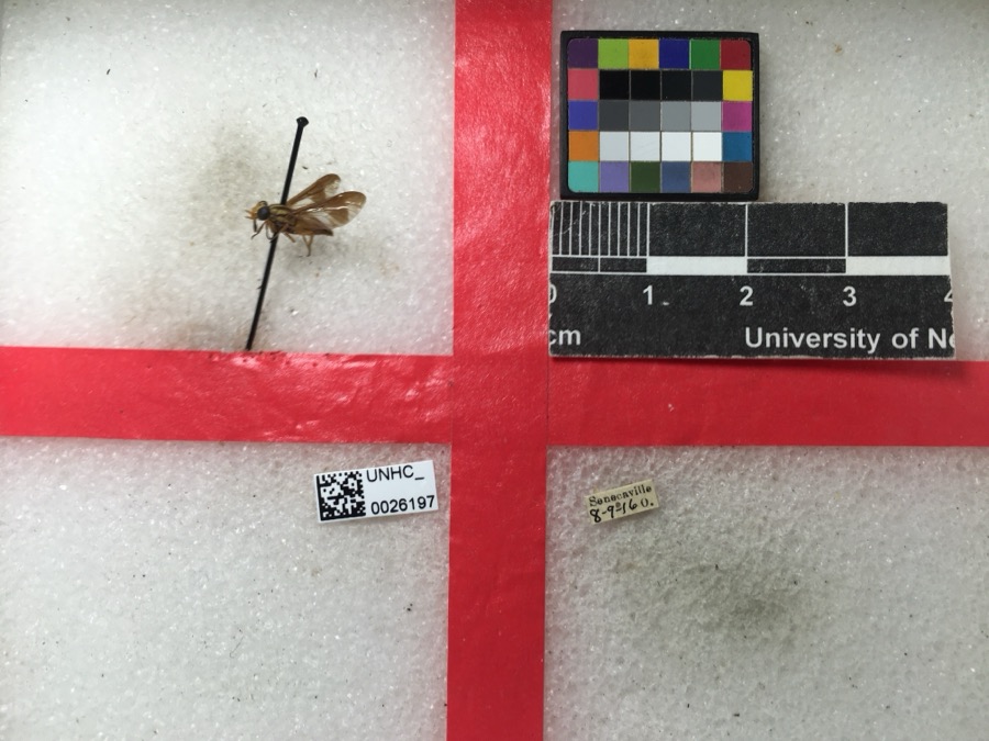
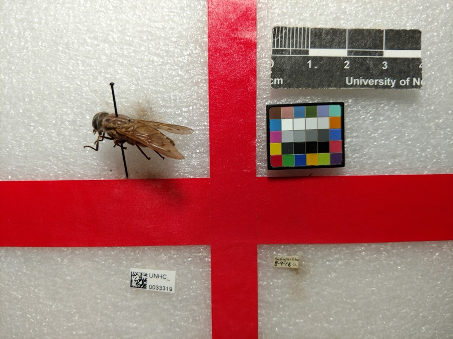
12 of 103 shownRegional context, not property-specific evidence. Museums hold 103 specimens collected within 10 miles of Salesville between 1887 and 1975: 74 Animalia, 29 Plantae. 12 distinct Species records are shown. Collected by Adams, W. (William), Trautman, M. B. (Milton Bernard) et al., Adams, W.; Adams, S., Borror, K. G. (Kathy G.) and others. Each is a physical object with a catalogue number, and each entry opens the museum's record. This is what was collected and kept, not a survey of what lives here - nothing can be concluded from a species being absent.
| Image | Species | Year | Collected by | Where, as recorded |
|---|---|---|---|---|
 | Chrysops vittatus Wiedemann, 1821 | 1916 | not recorded | |
 | Tabanus sulcifrons Osten Sacken, 1878 | 1916 | not recorded | |
 | Blephilia hirsuta (Pursh) Benth. | 1887 | Koenig, A. | near Temperanceville |
| Apidae | 1916 | not recorded | ||
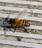 | Apis mellifera Linnaeus, 1758 | 1916 | not recorded | |
 | Cuclotogaster heterographus (Nitzsch, 1866) | 1916 | P. R. Lowry | |
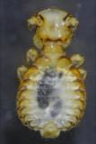 | Goniodes Nitzsch, 1818 | 1916 | P. R. Lowry | |
 | Haematopinus suis (Linnaeus, 1758) | 1916 | P. R. Lowry | |
 | Melissodes bimaculatus (Lepeletier, 1825) | 1916 | not recorded | |
 | Campostoma anomalum (Rafinesque, 1820) | 1925 | CL & LC Hubbs | Trib to Salt Fork of Wills Creek, just above Middlebourne; Muskingum system |
 | Etheostoma nigrum Rafinesque, 1820 | 1925 | CL & LC Hubbs | Trib to Salt Fork of Wills Creek, just above Middlebourne; Muskingum system |
 | Luxilus cornutus (Mitchill, 1817) | 1925 | CL & LC Hubbs | Trib to Salt Fork of Wills Creek, just above Middlebourne; Muskingum system |
All 103 specimens within 10 miles, at the Global Biodiversity Information Facility.
Mines and quarries near this place
1 within 5 milesRegional context, not property-specific evidence. The federal mineral resources record lists 1 working within 5 miles of Salesville: 1 producer. All of them still produce. What was taken out: Sand and Gravel, Construction. Distance is straight-line from the map coordinates, so a quarry counted here may appear on a neighbouring settlement's page as well.
| Where | Site | Commodity | Status | Recorded |
|---|---|---|---|---|
| Miller Pit | Sand and Gravel, Construction | Producer |
Storms near this place
7 since 1998Regional context, not property-specific evidence. The National Weather Service names Salesville in 7 storm reports between 1998 and 2026: 4 thunderstorm wind, 3 hail. No death or injury is recorded in these reports. Each account below is quoted exactly as the forecast office filed it, from the NOAA Storm Events Database, and each date opens the federal record of that event.
| When | Event | Place named | Harm | What the report says |
|---|---|---|---|---|
| April 2015 | Thunderstorm Wind | Salesville | $5,000 | Law enforcement reported trees down. |
| June 2012 | Thunderstorm Wind | Salesville | $5,000 | Trained spotter reported trees down. |
| September 2019 | Thunderstorm Wind | Salesville | - | A 911 Call Center reported several trees down. |
| July 2003 | Thunderstorm Wind | Salesville | - | Large tree branches blown down. |
| March 2026 | Hail | Salesville | - | no account filed |
| June 2012 | Hail | Salesville | - | no account filed |
| June 1998 | Hail | Salesville | - | no account filed |
Nearest settlements
The eight closest, with where each one stands in the county. Distances are straight-line, computed from the Geographic Names Information System coordinates.
| Map | Place | Distance | Sheets |
|---|---|---|---|
| Quaker City | 2.0 miles | 12 | |
| New Gottingen | 3.3 miles | 13 | |
| Spencer Station | 3.5 miles | 12 | |
| Gibson | 4.1 miles | 13 | |
| Echo Point | 4.2 miles | 13 | |
| Seneca Lake Estates | 4.4 miles | 13 | |
| East Shore Cottage Area | 4.5 miles | 13 | |
| Hickory Grove Cottage Area | 4.6 miles | 13 |
Elsewhere
Matched on this settlement's Geographic Names Information System number rather than its name, so it cannot be a different place of the same name in another state.
| Wikipedia article on Salesville | An encyclopaedic summary. Its text is share-alike, so it is linked here rather than copied. |
| Wikidata item Q2673143 | The structured record the population and elevation above come from. Public domain (CC0). |
Provenance
This settlement is recorded in the Geographic Names Information System as feature 1049147. The sheet list is computed by point-in-boundary test against the United States Geological Survey's historical topographic inventory. Both are works of the United States government and carry no copyright under 17 U.S.C. 105.
Wildfire. Short, Karen C. 2022. Spatial wildfire occurrence data for the United States, 1992-2020 [FPA_FOD_20221014]. 6th Edition. Fort Collins, CO: Forest Service Research Data Archive. https://doi.org/10.2737/RDS-2013-0009.6 Collected with United States Government funding and usable without additional permissions or fees.
Specimens. Global Biodiversity Information Facility (GBIF), https://www.gbif.org/. Only records licensed CC0 or CC BY are used. Records licensed CC BY-NC are excluded because this site carries advertising. Images are checked individually and any whose licence is non-commercial, no-derivatives or unreadable is refused.
Mines and quarries. USGS Mineral Resources Data System (MRDS) https://mrdata.usgs.gov/mrds/ A work of the United States government, no copyright under 17 U.S.C. 105.
Storms. NOAA National Centers for Environmental Information, Storm Events Database https://www.ncei.noaa.gov/stormevents/ A work of the United States government, no copyright under 17 U.S.C. 105. Narratives are quoted verbatim from the National Weather Service report and are not edited or summarised.