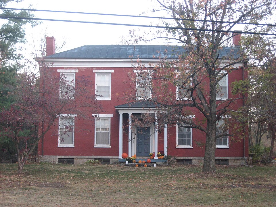
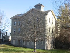
Listed on the National Register of Historic Places in
2000. A historic map-sheet match is not published yet. The record needs a coordinate-quality review before it can be joined to a sheet boundary.
From the record
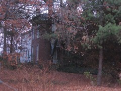
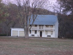
“Thomas Miller House is a registered historic building near Elizabethtown, Ohio, listed in the National Register on November 2, 2000.”
Wikipedia article Thomas Miller House, CC BY-SA 4.0.
one of 314 National Register listings in Hamilton County · listed in 2000 · category: Building · one of 9 National Historic Landmarks in Hamilton County.
National Register reference number.00001294- the number the National Park Service assigned this property when it was listed, and the key its nomination file is catalogued under at the National Archives.
What happened here
An account from the chapter on Whitewater township, The inset identifies its exact
source book and publication year.
Before manufacturing can fairly begin in a new country, commerce and exchange must provide for the wants of a community in many directions. Local trade sets in as soon as there is anything to buy or sell, be it only a fish hooked from the water, or venison shot .in the forest. When Demand calls ''Hello!'' Supply answers ''Here I am.'' The Cincinnati pioneers in 1789 wanted seed-corn, and corn for hominy and bread, and immediately corn-meal came from Lexington, down the Licking, in canoes.
Whitewater lies in range one of township one,and range one of township three, with a fractional section (thirtyone) belonging to range two, township two and three other bits of sections along the Great Miami belonging to other ranges or townships. It includes nineteen full and fourteen fractional sections, or fourteen thousand three hundred and twenty square acres. It is bounded on the west by Dearborn county, Indiana, and for the breadth of two miles at the northward by Harrison township, Hamilton county, on the north by Harrison and Crosby townships ; on the east and south by the Great Miami, beyond which lie the townships of Colerain and Miami. The township does not touch the Ohio river, although it approaches within a mile of it, at the lower part of Guard's island. The Great Miami has an exceedingly tortuous course along the front of this township, requiring about sixteen miles for its course, while the air-line distance between the point where it first touches the township and that where it makes its exit, is but ten and one-half miles. This is the extreme diagonal of the township ; its greatest length is six and one-half miles, being on its western line; its greatest width the same, on a line of latitude passing a little below Miamitown, from that deviating to a point at the southwest corner. The Whitewater river comes in from Harrison township, on the western side of section five, and flows in a southerly course four and one-half miles, reaching the Great Miami near the southeast corner of section twenty. Nearly two miles from its entrance it receives the waters of the Dry fork of Whitewater, which enters at the southeast corner of Harrison township, flows southward in a crooked course two miles, then westward two miles to the Whitewater. Another, but smaller tributary, heading in the border of Indiana, intersects sections eighteen, seventeen and twenty, and reaches the Whitewater near the railroad crossing. Two or three very pretty tributaries also enter the Great Miami from the side of this township. From time to time this river has changed its bed in the flow of the ages, and old channels are plainly to be seen, especially in the lower part of its course, as that south of Elizabethtown. The streams are generally well bridged at the desirable points ; and the Whitewater, at a point on the road from Elizabethtown northeastward, has the finest suspension bridge, exclusively belonging to this county. A notable pioneer ferry was kept across the Great Miami, a short distance from Cleves. A mile from the mouth of this stream, at the extreme southwestern corner of the township, about half a section of land is isolated by an irregular arc of water connecting at each end with the river, and probably one of its oldest channels - ^which takes the name Guard's island, from the old Guard family of pioneers. From this northeast and north for several miles the island is low, and part of it much subject to inundations. It is very fertile, however, some of it yielding, after more than two generations of culture, its hundred bushels of corn per acre with tolerable regularity. In the north of the township some of the characteristic hills of Hamilton county appear.
Their subsistence was secured from the rivers and the forests, and the truck patch cultivated with a hoe, producing an abundant crop of corn, potatoes, beans and pumpkins. In the spring of the year they luxuriated on wild onions fried in opossum fat and omelets made of wild turkey eggs, accompanied by delicious beverage known as spice-wood tea. The sugar-tree supplied them with sap; but for the want of kettles they manulactured but limited supplies of sugar and molasses. When kettles were obtamed (brought to the North Bend on flatboats from Redstone, Old Fort, and bartered for buckskins, venison and peltries), the sugar and molasses made in the spring supplies them through the year, and the surplus was exchanged for goods at the traders' stores at the Bend, or Fort Washington. In these squatter times when kettles had been obtained, salt, a very scarce and necessary article, was manufactured at the "lick" a mile west of where Elizabethtown now stands. The well was sixteen feet deep and the supply of salt water enabled the boilers to produce a bushel a day, which could be sold at four dollars, hot from the kettles.
Regional context, not property-specific
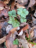
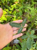
evidence. Museums hold 635 specimens
collected within 10 miles of Miller, Thomas, House between 1835 and
1975: 285 Fungi, 190 Animalia, 154 Plantae, 5 Unrecorded, 1 Chromista. 12 distinct Species records are shown.
Collected by A. P. Morgan, A. R. Gaufin, A.P. Morgan and others. Each is a
physical object with a catalogue
number, and each entry opens the museum's record. This is what was
collected and kept, not a survey of what lives here - nothing can be
concluded from a species being absent.
In America boerali prope Fernbank, ad ripas fluminis Ohio, prope North-Bend (Kentucky). | Fernbank - ad ripas fluminis Ohio, prope ''North Bend.'' [=In northern America, near Fernbank, beside the Ohio River, near North Bend (Kentucky).]
Regional context, not property-specific
evidence. The federal mineral resources record lists
15 workings within 5 miles of Miller, Thomas, House: 8 past producers, 6 producers, 1 plant.
7 still produce. What was taken out: Sand and Gravel, Construction. Distance is straight-line from the
map coordinates, so a quarry counted here may appear on a neighbouring
settlement's page as well.
Regional context, not property-specific
evidence. The National Weather Service names
Elizabethtown, the town this property stands in, in 5 storm reports between 1996 and 2020: 3 thunderstorm wind, 1 hail, 1 flash flood.
No death or injury is recorded in these reports. Each account below is quoted exactly as the forecast office
filed it, from the NOAA Storm Events Database, and each date
opens the federal record of that event.
No historic map-sheet match is published
for this property yet. That does not mean no map exists. This record needs
a coordinate-quality review before it can be joined to a sheet boundary.
Browse the county's mapped places while that work is
pending.
From the nomination file
8,081 words on record
When this property was proposed for the
National Register, someone wrote the case for it: what the building is,
and why it matters. That document is a federal record in the public domain.
It is quoted below word for word, never summarised. The text was read off the scanned case file by machine, so the
occasional stray character is the recogniser's and the 1970s
typewriter's.
Statement of significance
Areas of Significance (Enter categories from instructions) - A Property is associated with events that have made a significant contribution to the broad patterns of our - B Property is associated with the lives of persons X C Property embodies the distinctive characteristics of a type, period,or method of construction or represents the work of a master, or possesses high artistic values, or represents a significant and distinguishable entity whose components lack c. 1830-36 Property has yielded, or is likely to yield information (Mark "X" in all the boxes that apply.) -A owned by a religious institution or used for religious Significant Person - B removed from its original location. - D a cemetery. -E a reconstructed building, object, or structure. - F a commemorative property.
within the past 50 years. Narrative Statement of Significance (Explain the significance of the property on one or more continuation sheets.) 9.
Quoted from the National Register nomination
for reference 00001294, 44 pages, held by the National Archives in Record
Group 79. See the
catalogue record.
Listed places nearby
6 within 8 miles
Other National Register properties close
enough to walk or drive between, ordered by distance from this one. Both
positions come from the same geocoding pass that matched these properties
to their map sheets.
Listing record. National Park Service National Register of Historic Places, listed-properties dataset, current to 2026-05-22.
Map join. Address geocoded through the United States Census geocoder, then tested against the published boundary of every sheet in the USGS Historical Topographic Map Collection.
How this page is made. Listing fields come from federal records; map-sheet coverage is a labelled coordinate-to-boundary calculation, not a source-field claim.
Specimens. Global Biodiversity Information Facility (GBIF), https://www.gbif.org/. Only records licensed CC0 or CC BY are used. Records licensed CC BY-NC are excluded because this site carries advertising. Images are checked individually and any whose licence is non-commercial, no-derivatives or unreadable is refused.
Mines and quarries. USGS Mineral Resources Data System (MRDS) https://mrdata.usgs.gov/mrds/ A work of the United States government, no copyright under 17 U.S.C. 105.
Storms. NOAA National Centers for Environmental Information, Storm Events Database https://www.ncei.noaa.gov/stormevents/ A work of the United States government, no copyright under 17 U.S.C. 105. Narratives are quoted verbatim from the National Weather Service report and are not edited or summarised.
 Block
Block