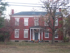
Listed on the National Register of Historic Places in
1976. A historic map-sheet match is not published yet. The record needs a coordinate-quality review before it can be joined to a sheet boundary.
From the record
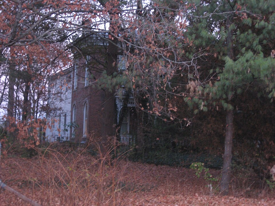
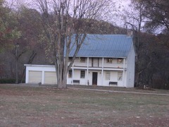
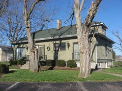
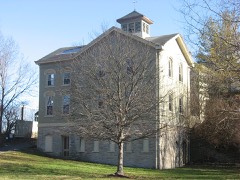
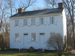
“Roudebush Farm is a historic farmstead located southeast of Harrison in northwestern Hamilton County, Ohio, United States. It was established in the 1850s with the construction of a small frame residence.”
Wikipedia article Roudebush Farm, CC BY-SA 4.0.
one of 314 National Register listings in Hamilton County · listed in 1976 · category: Building · one of 9 National Historic Landmarks in Hamilton County.
National Register reference number.76001449- the number the National Park Service assigned this property when it was listed, and the key its nomination file is catalogued under at the National Archives.
This township had its origin in the manifest need of a new municipality for the convenience of the increasing population in the northwestern part of the county, which in 1853 caused the erection by the county commissioners of Harrison from Crosby and Whitewater townships. It is the northernmost township of the county. Its boundary lines are wholly artificial, and begin on the dry fork of Whitewater, at the southeast quarter of section thirty-three, in range one, township three; thence westward three miles to the county and State line; thence north six miles to the Butler county line; thence east three miles to the northeast corner of section four; thence south to the place of beginning. Dearborn county, Indiana, lies next to the westward; Butler county on the north; four miles of Crosby and two miles of Whitewater townships on the east; and Whitewater township on the south.
Harrison lies altogether upon Congress land, in the west half of the third township, range one. It thus contains eighteen sections of land, which cover a little more territory than so many exactly full sections, by reason of some divergence of meridian lines in the easternmost tier, making some of them a little broader than should be. The central and western tiers are beautifully regular squares, appropriately exact. The acres of the township number eleven thousand one hundred and forty-seven.
Regional context, not property-specific
evidence. Museums hold 479 specimens
collected within 10 miles of Roudebush Farm between 1835 and
1975: 214 Fungi, 209 Animalia, 37 Plantae, 17 Protozoa, 2 Unrecorded. 12 distinct Species records are shown.
Collected by A. P. Morgan, A. R. Gaufin, A.P. Morgan and others. Each is a
physical object with a catalogue
number, and each entry opens the museum's record. This is what was
collected and kept, not a survey of what lives here - nothing can be
concluded from a species being absent.
In America boerali prope Fernbank, ad ripas fluminis Ohio, prope North-Bend (Kentucky). | Fernbank - ad ripas fluminis Ohio, prope ''North Bend.'' [=In northern America, near Fernbank, beside the Ohio River, near North Bend (Kentucky).]
Regional context, not property-specific
evidence. The federal mineral resources record lists
28 workings within 5 miles of Roudebush Farm: 15 past producers, 9 producers, 4 plants.
13 still produce. What was taken out: Sand and Gravel, Construction. Distance is straight-line from the
map coordinates, so a quarry counted here may appear on a neighbouring
settlement's page as well.
Regional context, not property-specific
evidence. The National Weather Service names
Harrison, the town this property stands in, in 25 storm reports between 1994 and 2025: 14 thunderstorm wind, 7 hail, 2 flash flood, 1 heavy rain.
No death or injury is recorded in these reports. Each account below is quoted exactly as the forecast office
filed it, from the NOAA Storm Events Database, and each date
opens the federal record of that event.
Damage occurred to the roof of an apartment complex on Harrison Avenue between Walnut and State Streets. The loss of some insulation was also reported.
Three trees were downed in Harrison. Several tree limbs up to four inches in diameter and street signs were knocked down near White Oak. Siding was peeled off of a few homes.
No historic map-sheet match is published
for this property yet. That does not mean no map exists. This record needs
a coordinate-quality review before it can be joined to a sheet boundary.
Browse the county's mapped places while that work is
pending.
From the nomination file
2,809 words on record
When this property was proposed for the
National Register, someone wrote the case for it: what the building is,
and why it matters. That document is a federal record in the public domain.
It is quoted below word for word, never summarised. The text was read off the scanned case file by machine, so the
occasional stray character is the recogniser's and the 1970s
typewriter's.
Description of the property
story, two room frame structure with a cellar under both rooms. This rooms on the second floor.The facade is divided into five bays. All of the windows are round arch, double hung, two-over-two with stone The formal parlor, which was decorated in 1875 is still in perfect and furnishing, it is quite unique. small rear addition; the building still retains much of its mid-nineteenth CONDITION UNEXPOSED preserved. hewn.
DATE DESCRIPTION XUNALTERED FAIR The buildings located on the Roudebush Farm consist of the farm house, CHECK ONE Throughout the interior of the house much of the original woodwork is The one room school house located just south of the house has been LMOVED the original one story section of the house was expanded to include two X.EXCELLENT by a one-bay porch, identical to the larger porch on the facade.The light, surrounded-by stone trim:and. the door has two.narrow windows with -GOOD still exists in the cellar, in what was the original kitchen. Because this is not a restoration, but the original room This entrance is protected century character.
an L-shaped configuration.Sometime after the brick section was built and joins with the original house at the southwest corner resulting in The original bell and an original shutter are still farm house, pre-dates the Civil War. section was built in 1859 and is still standing.A massive fireplace the brick section of the house was built.It is rectangular in shape entrance identical to the facade entrance. and railing. in the family's possession. The barn located to the east of the It has a one story deep stone bays with rounded arch windows.On the north end there is a side in place. The north and south ends of the house are divided into3 -RUINS In 1870, AREAS OF
Statement of significance
The house is distinguished by its Italianate stone trim and ornate intact formal parlor with all furnishings, dating from the 1870's, and and in that year, he and his wife Emeline built their frame home and unaltered and many of the original furnishings are still intact. The formal parlor-is still exactly the way it was, when decorated in 1875, including the original carpet and silk wallpaper. MAR 1 7 1976 1700-1799 barn. COMMUNICATIONS ARCHEOLOGY-HISTORIC AGRICULTURE LAW SIGNIFICANCE RECEIVED TRANSPORTATION ART PERIOD THEATER INDUSTRY REGISTER NATIONAL LITERATURE 1900- RELIGION _EXPLORATION/SETTLEMENT POLITICS/GOVERNMENT _ENGINEERING MUSIC XARCHITECTURE _COMMERCE X1800-1899 _CONSERVATION Upon his death _PREHISTORIC original to the house.
INVENTION Campbell and Kilby Roads to the local school board and a one room -1400-1499 Shortly after the Civil War they donated the lot at the corner of -1500-1599 -1600-1699 -PHILOSOPHY -ECONOMICS -MILITARY _COMMUNITY PLANNING The Roudebush farm is a well preserved nineteenth century farm house. Emeline Roudebush to their daughter, Jane. Upon her death in 1935, in 1967nthe property passed to his daughter, Nancy Ann Roudebush McGary. BUILDER/ARCHITECT Hammand Roudebush ARCHEOLUGY-PREHISTORIC The building and land reverted back 1830.At the age of 4,he traveled to Ohio with his parents where he Because the house has always been in the familyre the house remains
Quoted from the National Register nomination
for reference 76001449, 32 pages, held by the National Archives in Record
Group 79. See the
catalogue record.
Listed places nearby
6 within 8 miles
Other National Register properties close
enough to walk or drive between, ordered by distance from this one. Both
positions come from the same geocoding pass that matched these properties
to their map sheets.
Listing record. National Park Service National Register of Historic Places, listed-properties dataset, current to 2026-05-22.
Map join. Address geocoded through the United States Census geocoder, then tested against the published boundary of every sheet in the USGS Historical Topographic Map Collection.
How this page is made. Listing fields come from federal records; map-sheet coverage is a labelled coordinate-to-boundary calculation, not a source-field claim.
Specimens. Global Biodiversity Information Facility (GBIF), https://www.gbif.org/. Only records licensed CC0 or CC BY are used. Records licensed CC BY-NC are excluded because this site carries advertising. Images are checked individually and any whose licence is non-commercial, no-derivatives or unreadable is refused.
Mines and quarries. USGS Mineral Resources Data System (MRDS) https://mrdata.usgs.gov/mrds/ A work of the United States government, no copyright under 17 U.S.C. 105.
Storms. NOAA National Centers for Environmental Information, Storm Events Database https://www.ncei.noaa.gov/stormevents/ A work of the United States government, no copyright under 17 U.S.C. 105. Narratives are quoted verbatim from the National Weather Service report and are not edited or summarised.
 Block
Block