Listed on the National Register of Historic Places in
2001. A historic map-sheet match is not published yet. The record needs a coordinate-quality review before it can be joined to a sheet boundary.
From the record
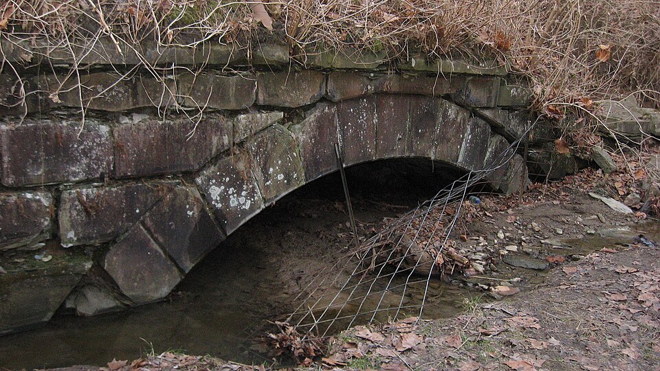
“The Cincinnati and Whitewater Canal Tunnel is a historic abandoned canal tunnel in the southwestern corner of the U.S. state of Ohio. Located within the village of Cleves near Cincinnati, it was constructed in 1837 as part of the Whitewater Canal system.”
Wikipedia article Cincinnati and Whitewater Canal Tunnel, CC BY-SA 4.0.
one of 314 National Register listings in Hamilton County · listed in 2001 · category: Structure · one of 9 National Historic Landmarks in Hamilton County.
National Register reference number.01000562- the number the National Park Service assigned this property when it was listed, and the key its nomination file is catalogued under at the National Archives.
The township lies in fractional ranges one and two, town one of each. It has but nine full sections, all of them in range two, and none in the peninsula below North Bend and Cleves; but has twenty-two fractional sections, and thus secures a very respectable amount of territory. Its acres count up fourteen thousand and fiftyseven. Its extreme length is on the eastern border and for about three-fourths of a mile in the interior - just six sections, this strip being included between the .same parallels which bound Green township on the north and south. The shortest length is between the point of the elbow of the Great Miami, at the south end of Cleves, and the Ohio river about two-thirds of a mile. The greatest breadth is on a line crossing the township east and west from the northernmost point in the great bend of the Ohio, from which North Bend is named, not quite six miles; the shortest is on the extreme north line, between the Great Miami and the northeast corner of the township - three-quarters of a mile. From the east line of the township to the meridian drawn from the southwest corner that is, the State line, the distance is over seven miles, and from the southwest corner - the extreme end of the peninsula - to the northeast corner is just ten miles. Miami is thus seen to be a very singularly shaped township, deeply indented on the south side by the Ohio river, and on the north and west in several places by the windings of the Great Miami.
Within Miami township the Ohio receives from the northward th? waters of Muddy creek and the west fork of Muddy, the latter of which lies altogether in the southeastern part of this township; also Indian creek, which enters the river at North Bend station, and several minor streams. Along the northwestern borders of the township flows the South fork of Taylor's creek, leaving the township at the northwest corner, just opposite to which, at the northwest corner, the main stream of Taylor's creek, flowing down from Colerain township, discharges its waters. A mile due north of Cleves Jordan creek debouches also into the Great Miami, after flowing nearly three-fourths of the way across the township. One or two petty and probably unnamed brooks are also affluents of this river on the Miami side. Beside this river, above Cleves, the valley is wide and low, yielding great crops of corn in favorable seasons; below Cleves Ritenhouse Hill, Fort Hill, and the general ridge between the two rivers close down pretty closely upon the banks of the streams, until their junction is neared, when the country again becomes low and flat, and subject in part to frequent overflow. The highlands continue along the Ohio to the southeast boundaries of the township; but have ample room at the foot for the tracks of the railroads, a fine wagon road, and the sites of several villages and railway stations. They afford many picturesque views up and down the river, and across to the Kentucky shore; and some of the finest suburban residences in the county, as that of Dr. Warder near North Bend, have consequently been located upon these heights. The general character of the hill country of Hamilton county is maintained to the northward and westward until the valley of the Great Miami is reached - much broken and diversified, however, by the numerous streams that cut through and down the hills. Across them, from the direction of Cincinnati, comes in the Cleves turnpike, having the village of that name on the west for its terminus. There is a singular scarcity of north and south roads in the township, but a sufficiency of highways, with a general direction of east and west. The Ohio & Mississippi, and the Cincinnati, Indianapolis, St. Louis & Chicago railroads run parallel to each other and to the bank of the Ohio in this township until just past North Bend station, where the track of the latter diverges rapidly to the northward, passes under the ridge between North Bend and Cleves by a tunnel, and leaves the township, going westward, by a bridge over the Great Miami, half a mile northwest of Cleves. The Ohio & Mississippi continues its course along the Ohio beyond North Bend about five miles, to a point about half a mile above the mouth of the Great Miami, when it passes into Indiana.
Regional context, not property-specific
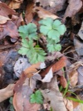
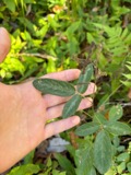
evidence. Museums hold 1,043 specimens
collected within 10 miles of Cincinnati and Whitewater Canal Tunnel between 1835 and
1975: 449 Fungi, 349 Animalia, 210 Plantae, 27 Protozoa, 7 Unrecorded, 1 Chromista. 12 distinct Species records are shown.
Collected by A Schwartz, A. P. Morgan, A. R. Gaufin and others. Each is a
physical object with a catalogue
number, and each entry opens the museum's record. This is what was
collected and kept, not a survey of what lives here - nothing can be
concluded from a species being absent.
In America boerali prope Fernbank, ad ripas fluminis Ohio, prope North-Bend (Kentucky). | Fernbank - ad ripas fluminis Ohio, prope ''North Bend.'' [=In northern America, near Fernbank, beside the Ohio River, near North Bend (Kentucky).]
Regional context, not property-specific
evidence. The federal mineral resources record lists
21 workings within 5 miles of Cincinnati and Whitewater Canal Tunnel: 13 past producers, 6 producers, 2 plants.
8 still produce. What was taken out: Sand and Gravel, Construction. Distance is straight-line from the
map coordinates, so a quarry counted here may appear on a neighbouring
settlement's page as well.
Regional context, not property-specific
evidence. The National Weather Service names
Cleves, the town this property stands in, in 12 storm reports between 1997 and 2018: 6 hail, 4 thunderstorm wind, 2 flash flood.
No death or injury is recorded in these reports. Each account below is quoted exactly as the forecast office
filed it, from the NOAA Storm Events Database, and each date
opens the federal record of that event.
No historic map-sheet match is published
for this property yet. That does not mean no map exists. This record needs
a coordinate-quality review before it can be joined to a sheet boundary.
Browse the county's mapped places while that work is
pending.
From the nomination file
11,674 words on record
When this property was proposed for the
National Register, someone wrote the case for it: what the building is,
and why it matters. That document is a federal record in the public domain.
It is quoted below word for word, never summarised. The text was read off the scanned case file by machine, so the
occasional stray character is the recogniser's and the 1970s
typewriter's.
Statement of significance
Applicable National Register Criteria (Mark "x" in one or more boxes for the criteria qualifying the property for National Property is associated with events that have made a significant contribution to the broad patterns of Property is associated with the lives of persons significant in our past. Property embodies the distinctive characteristics of a type, period, or method of construction or represents the work of a master, or possesses high artistic values, or represents a significant and Property has yielded, or is likely to yield information important in prehistory or history. _A owned by a religious institution or used for religious purposes. B removed from its original location. C a birthplace or a grave. D a cemetery. E a reconstructed building, object or structure.
F a commemorative property. _G less than 50 years of age or achieved significance within the past 50 years. Areas of Significance (Enter categories from instructions) foundation roof Register listing) our history. Transportation and Engineering distinguishable entity whose components lack individual distinction. Criteria Considerations (Mark"X"in all the boxes that apply.) Other:Brick Lined Canal Tunnel with Sandstone Portal Form 10-900 OMB No. 10024-4018 (Rev. 10-90) U. S. Department of the Interior Cincinnati and Whitewater Canal Tunnel NAME OF PROPERTY National Park Service Hamilton County, Ohio LOCATION Significant Dates_built 1837, 1846 Significant Person (Complete if Criterion B is marked above) S. and H. Howard & Company (Contractor).
Narrative Statement of Significance (Explain the significance of the property on one or more continuation sheets.) 9.
Quoted from the National Register nomination
for reference 01000562, 38 pages, held by the National Archives in Record
Group 79. See the
catalogue record.
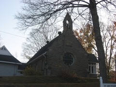
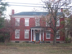
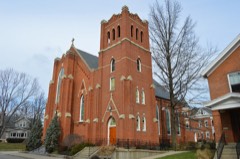
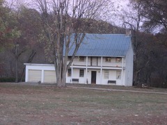
Listed places nearby
6 within 8 miles
Other National Register properties close
enough to walk or drive between, ordered by distance from this one. Both
positions come from the same geocoding pass that matched these properties
to their map sheets.
Listing record. National Park Service National Register of Historic Places, listed-properties dataset, current to 2026-05-22.
Map join. Address geocoded through the United States Census geocoder, then tested against the published boundary of every sheet in the USGS Historical Topographic Map Collection.
How this page is made. Listing fields come from federal records; map-sheet coverage is a labelled coordinate-to-boundary calculation, not a source-field claim.
Specimens. Global Biodiversity Information Facility (GBIF), https://www.gbif.org/. Only records licensed CC0 or CC BY are used. Records licensed CC BY-NC are excluded because this site carries advertising. Images are checked individually and any whose licence is non-commercial, no-derivatives or unreadable is refused.
Mines and quarries. USGS Mineral Resources Data System (MRDS) https://mrdata.usgs.gov/mrds/ A work of the United States government, no copyright under 17 U.S.C. 105.
Storms. NOAA National Centers for Environmental Information, Storm Events Database https://www.ncei.noaa.gov/stormevents/ A work of the United States government, no copyright under 17 U.S.C. 105. Narratives are quoted verbatim from the National Weather Service report and are not edited or summarised.
 Block
Block