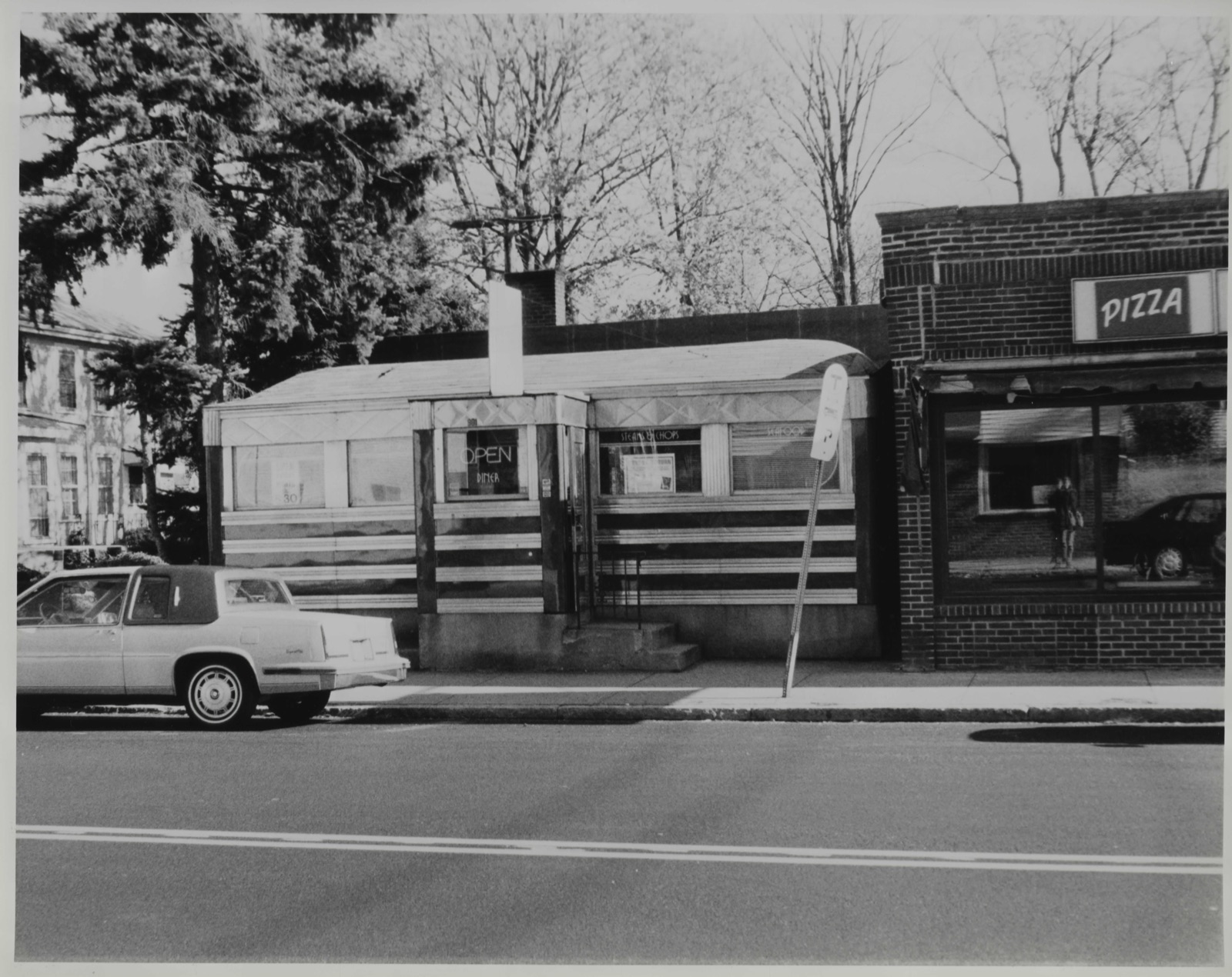
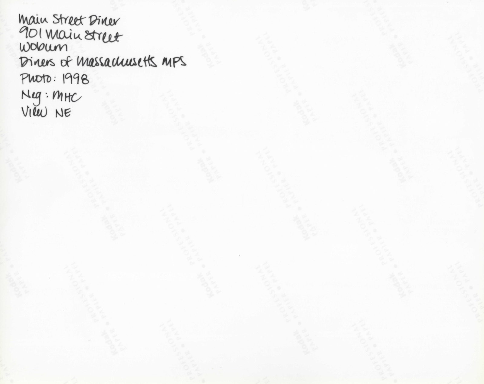
Photographs from the nomination case file, National Park Service records.
Jack's Diner
Listed on the National Register of Historic Places in
2000. A historic map-sheet match is not published yet. The record needs a coordinate-quality review before it can be joined to a sheet boundary.
From the record
“Eff'orts to create a public opinion in favor of such an institution had been made by several citizens since 1S50. Winn off'ered to give % 300 to found a library, provided the town would raise as much more.”
History of Middlesex County, Massachusetts : Containing Carefully Prepared Histories of Every City and Town in the County (1880). Machine-read text.
one of 1100 National Register listings in Middlesex County · listed in 2000 · category: Building · one of 3 National Historic Landmarks in Middlesex County.
National Register reference number.00001340- the number the National Park Service assigned this property when it was listed, and the key its nomination file is catalogued under at the National Archives.
Another matter of much interest required early attention, namely, the settlement of the boundary between Charlestown and Woburn. This had never been defined. Negotiations were opened from time to time, the initiative always being taken by Woburn until 1650, when the lines were finally established and entered upon the records of Charlesto\\Ti. A'early coeval with the settlement of Rev. T. Carter as minister, the first meeting-house was built. Of this structure little or nothing is known. Johnson, in his history, alludes to it as standing in a " small plain wliere four streets meet." The location is with good reason believed to have been at the easterly end of the Common, near where the soldiers' monument now stands. The house could not have been otherwise than a very plain affair, witliout tower or steeple. Humble as it was, it served the purpose of a place of public worship for about thirty years. A new one was voted by the town in 1671 and completed in 1673. It stood on the sharp spur east of the Common wliich is still known as Mceting-iiouse Hill. It was never dedicated, as tiie Puritan methods were in o])position to all rites and ceremonies in religious matters. This meeting-house was not divided into pews, as became the fashion in after years, - only tlie minister's and the deacons' wives having the privilege of pews allowed them. Thirty or forty years subsecpiently special permission was given to a newcomer from Boston to build a pew at his own cost. This led to requests of the same sort from other persons aristocratically inclined, which being granted, caused such an outbreak of feeling as to induce tiie town autiiorities to revoke tiie order. A committee was appointed to "seat the ])eople," and each person was assigned a regular place. In doing tiiis, reference was to be had to " estate, office, and age." Privilege was, therefore, recognized in the matter of position, if not in the form of pews. This meetinghouse, with one or two enlargements, served the religious uses of the town for eighty years, or until 1753. Rev. Thomas Carter occupied its pulpit for a few years, though for the larger part of his ministry he had preached in the one built about the time of his ordination. In 1678 his growing age and infirmities led the tf)Wii to consider the matter of providing iiim a colleague. An invitation Avas given to the Rev. Jabez Fox to become his associate. Tliis was accepted, and the two clergymen labored together harmoniously and satisfactorily to their people for six years, wlien Rev. Mr. Carter died, in the seventy-fourth year of his age and the forty-second of his ministry. Mr. Carter was born in England, and received his degree at St. Jolin's College, Cambridge. He was emiiientiv a good paslor, sound in doetriiie, and ready witli tender consolal ion and sympathizing words to meet the sjiiritual needs of his people. In illustralion of one of the customs of the town, now hap])ilv remitlcd lo the darkest corners of socici v, I he lolliiuing bill, I'liuiid on the town records, niiling u, th,'
Rev. Jabez Fox, associate pastor, now became the sole minister of the church. He continued in his position for twenty-four years, laboring successfully to promote the general interests of the parish. During the ministry of Rev. Mr. Carter, or from 1613 to 1675, Woburn had steadily increased in population, the land had been partially subdued, good crops were gathered, a better class of houses than those built at first had been erected, and some of those industries started which have since made the town so well known. The number of inhabitants cannot be given with accuracy, as no recorded census was taken till nearly a century later; but from the rates levied by the county, and the laws respecting the establishment of grammar schools, it is probable that the population was not far from 500. But this general prosperity Avas soon to receive a serious check on account of the outbreak of the Indian wars. King Philip, who had heretofore been in accord with the colonists, and had agreed by solemn treaty to live with them on amicable terms, now became restive under the restraints imposed by the compact, as well as moved by an ambition to rid the land of an alien race which seemed likely soon to become its sole possessors. He brought into combination his own and two or three other powerful tribes, and began a murderous assault upon all the exposed frontiers. Woburn was too near the central towns of the colony to receive much harm by the direct invasion of the wily enemy. Small raiding parties appeared in two or three instances in the town or its immediate vicinity, and although little loss was incurred by the burning of dwellings or destruction of crops, four persons were killed. This, however, was but a small portion of the suffering and Iiardship that befell Woburn in common with all tiie towns of New England. To carry on a vigorous and successful w'ar, the taxes of the people were enormously increased.
Regional context, not property-specific
evidence. The
federal wildfire occurrence database
lists 34 fires within 5 miles of Jack's Diner between
2015 and 2020, burning about 21 acres in total. None started naturally. 1 was recorded as arson.
Distance is straight-line from the map coordinates, so a fire counted
here may appear on a neighbouring settlement's page as well.
Reported cause
Fires
Missing data/not specified/undetermined
14
Debris and open burning
10
Recreation and ceremony
6
Equipment and vehicle use
2
Arson/incendiarism
1
Railroad operations and maintenance
1
The most recent of
them, most recent first, with the day each was reported and the service
that recorded it.
Regional context, not property-specific
evidence. Museums hold 1,478 specimens
collected within 10 miles of Jack's Diner between 1898 and
1975: 653 Animalia, 499 Plantae, 286 Fungi, 17 Bacteria, 9 Unrecorded, 9 Protozoa, 5 Chromista. 12 distinct Species records are shown.
Collected by ?, A B Seymour, A B. Proper and others. Each is a
physical object with a catalogue
number, and each entry opens the museum's record. This is what was
collected and kept, not a survey of what lives here - nothing can be
concluded from a species being absent.
Regional context, not property-specific
evidence. The federal mineral resources record lists
17 workings within 5 miles of Jack's Diner: 10 past producers, 4 producers, 3 plants.
7 still produce. What was taken out: Sand and Gravel, Construction, Stone, Crushed/Broken, Peat, Clay. Distance is straight-line from the
map coordinates, so a quarry counted here may appear on a neighbouring
settlement's page as well.
Regional context, not property-specific
evidence. The National Weather Service names
Woburn, the town this property stands in, in 14 storm reports between 1996 and 2025: 6 thunderstorm wind, 3 hail, 2 flash flood, 2 flood.
No death or injury is recorded in these reports. Each account below is quoted exactly as the forecast office
filed it, from the NOAA Storm Events Database, and each date
opens the federal record of that event.
Large trees and power lines were downed by thunderstorm winds, causing several road closures. Wires were downed on a roof on Conn Street. A phone pole on Marlboro Road was downed by thunderstorm winds.
Heavy rain associated with Tropical Storm Hanna ranged from 2.28 inches to 3.64 inches. This resulted in flooding of the Woburn Police Department garage. Newspapers reported that as many as ten vehicles were towed from flood waters on Route 9 under the 126 overpass. This is a frequent problem in Framingham when it rains.
No historic map-sheet match is published
for this property yet. That does not mean no map exists. This record needs
a coordinate-quality review before it can be joined to a sheet boundary.
Browse the county's mapped places while that work is
pending.
From the nomination file
3,760 words on record
When this property was proposed for the
National Register, someone wrote the case for it: what the building is,
and why it matters. That document is a federal record in the public domain.
It is quoted below word for word, never summarised. The text was read off the scanned case file by machine, so the
occasional stray character is the recogniser's and the 1970s
typewriter's.
Statement of significance
Applicable National Register Criteria (Mark "x" in one or more boxes for the criteria qualifying the property for National Register listing.) XA Property is associated with events that have made a significant contribution to the broad patterns of our history. _ B Property is associated with the lives of persons significant in our past. X C Property embodies the distinctive characteristics of a type, period, or method of construction or represents the work of a master, or possesses high artistic values, or represents a significant and distinguishable entity whose components lack individual distinction. - D Property has yielded, or is likely to yield, information important in prehistory or history.
Criteria Considerations (Mark "x" in all the boxes that apply.) Property is: _A owned by religious institution or used for religious purposes. _ B removed from its original location. _ C a birthplace or grave. _ D a cemetery. _E a reconstructed building, object, or structure. _ F a commemorative property. X G less than 50 years of age or achieved significance within the past 50 years.
Middlesex County, Massachusetts County and State Areas of Significance (Enter categories from instructions) Architecture Commerce Period of Significance 1952 Significant Dates N/A Significant Person (Complete if Criterion B is marked above) N/A Cultural Affiliation N/A Architect/Builder Worcester Lunch Car Company Narrative Statement of Significance (Explain the significance of the property on one or more continuation sheets.) 9.
Quoted from the National Register nomination
for reference 00001340, 14 pages, held by the National Archives in Record
Group 79. See the
catalogue record.
Listed places nearby
6 within 8 miles
Other National Register properties close
enough to walk or drive between, ordered by distance from this one. Both
positions come from the same geocoding pass that matched these properties
to their map sheets.
Listing record. National Park Service National Register of Historic Places, listed-properties dataset, current to 2026-05-22.
Map join. Address geocoded through the United States Census geocoder, then tested against the published boundary of every sheet in the USGS Historical Topographic Map Collection.
How this page is made. Listing fields come from federal records; map-sheet coverage is a labelled coordinate-to-boundary calculation, not a source-field claim.
Wildfire. Short, Karen C. 2022. Spatial wildfire occurrence data for the United States, 1992-2020 [FPA_FOD_20221014]. 6th Edition. Fort Collins, CO: Forest Service Research Data Archive. https://doi.org/10.2737/RDS-2013-0009.6 Collected with United States Government funding and usable without additional permissions or fees.
Specimens. Global Biodiversity Information Facility (GBIF), https://www.gbif.org/. Only records licensed CC0 or CC BY are used. Records licensed CC BY-NC are excluded because this site carries advertising. Images are checked individually and any whose licence is non-commercial, no-derivatives or unreadable is refused.
Mines and quarries. USGS Mineral Resources Data System (MRDS) https://mrdata.usgs.gov/mrds/ A work of the United States government, no copyright under 17 U.S.C. 105.
Storms. NOAA National Centers for Environmental Information, Storm Events Database https://www.ncei.noaa.gov/stormevents/ A work of the United States government, no copyright under 17 U.S.C. 105. Narratives are quoted verbatim from the National Weather Service report and are not edited or summarised.
 Block
Block