BlockBefore
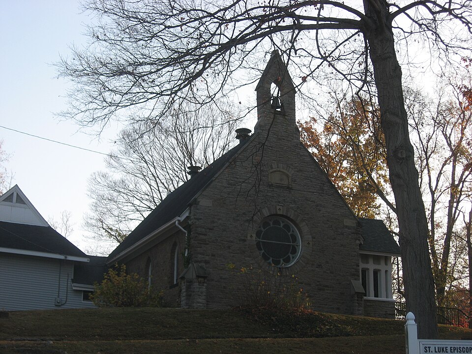
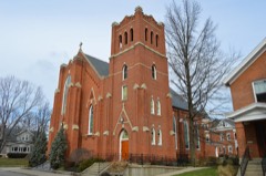
Photograph of Episcopal Church of the Resurrection
Photograph by Nyttend, Public domain. Via Wikimedia Commons.

Episcopal Church of the Resurrection

Listed on the National Register of Historic Places in 1977. A historic map-sheet match is not published yet. The record needs a coordinate-quality review before it can be joined to a sheet boundary.

From the record

“Luke's Episcopal Church, formerly the Episcopal Church of the Resurrection, is a historic Episcopal church in the Sayler Park neighborhood of Cincinnati, Ohio, United States. Designed in the 1870s by master architect Samuel Hannaford, it has been named a historic site.”

Wikipedia article St. Luke's Episcopal Church (Cincinnati, Ohio), CC BY-SA 4.0.

one of 314 National Register listings in Hamilton County · listed in 1977 · category: Building · one of 9 National Historic Landmarks in Hamilton County.

Sources: the Wikipedia article · the case file at the National Archives · the National Register database, National Park Service · the Wikipedia article

The listing

  • What is counted as historic. The nomination lists 1 building as contributing to the listing.
  • Address. 7346--48 Kirkwood La., Cincinnati, 45233
  • When was it listed? 1977-04-13
  • Category. building
  • Also known as. Hannaford, Samuel, & Sons TR
  • Township. Cincinnati city
  • Architect. Samuel Hannaford
  • National Register reference number. 77001064 - the number the National Park Service assigned this property when it was listed, and the key its nomination file is catalogued under at the National Archives.

The ground it stands on

1,616 words

The chapter on Cincinnati City in ... History of Cincinnati, Ohio, with Illustrations and Biographical Sketches, published 1881 names Cincinnati. This is what it says, exactly as the scans read.

The reader looks forward to this, the first history of Cincinnati that has yet found itself in print. The writers look back across its half-century of chapters and the century of years embraced by its annals, and have, chiefest of all, to regret many unavoidable errors, both of omission and commission. The more important of these, it is hoped, will appear in our page of errata; but there are still many, doubtless, that have escaped the compilers' attention. In a few cases, discrepancies appear between their statements and those of an extract immediately following. In those instances they must assure the reader that the former rest upon an authority believed to be superior to the other in regard to the matter in hand; but time and space could not always be taken for the discussion and settlement of points concerning which there are variant reports. In all really important matters, they believe the history will be found quite trustworthy, especially when corrected from the page of errata.

Passage source: ... History of Cincinnati, Ohio, with Illustrations and Biographical Sketches, published 1881.

Within the decade whose annals have just been passed in review, fell the birth of Cincinnati township, to which was entrusted, for almost twelve years, the government of Cincinnati village, which it of course contained. The township was created, after Columbia, by the court of general quarter sessions of the peace, which then had jurisdiction in these matters, in 1791. To the time of the erection of these townships, the whole county, which contained but a few hundred white inhabitants, was most conveniently governed as one municipality.

Passage source: ... History of Cincinnati, Ohio, with Illustrations and Biographical Sketches, published 1881.

Machine-read from a century-old scan, so expect the errors a machine makes: misspelled names, dropped words, stray characters.

Read the whole chapter on Cincinnati City - 1,616 words on its settlement, mills, schools and churches.

Specimens collected near this property

12 of 2,384 shown

Regional context, not property-specific evidence. Museums hold 2,384 specimens collected within 10 miles of Episcopal Church of the Resurrection between 1820 and 1975: 950 Fungi, 747 Animalia, 574 Plantae, 92 Protozoa, 11 Unrecorded, 10 Chromista. 12 distinct Species records are shown. Collected by A Schwartz, A. Braun, A. F. Braun and others. Each is a physical object with a catalogue number, and each entry opens the museum's record. This is what was collected and kept, not a survey of what lives here - nothing can be concluded from a species being absent.

Image SpeciesYear Collected by Where, as recorded
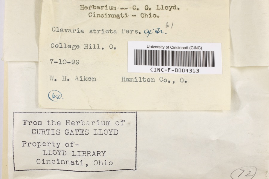
Specimen of Clavaria striata Pers.Clavaria striata Pers.1899Aiken, Walter H.College Hill
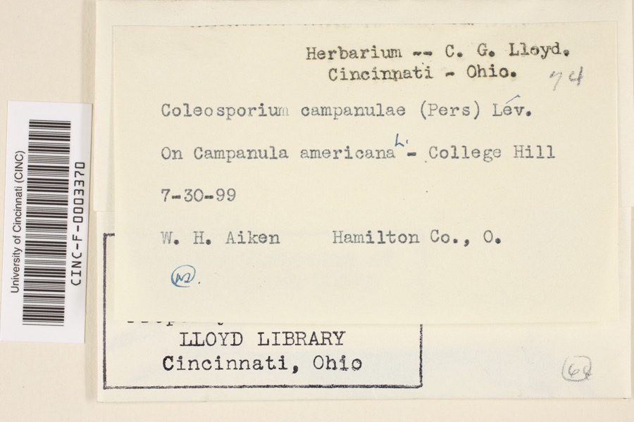
Specimen of Coleosporium campanulae (Pers.) Tul.Coleosporium campanulae (Pers.) Tul.1899Aiken, Walter H.College Hill
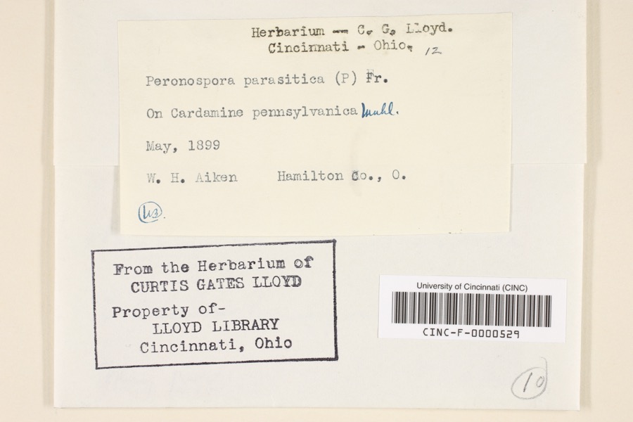
Specimen of Peronospora parasitica (Pers.) De BaryPeronospora parasitica (Pers.) De Bary1899Aiken, Walter H.Hamilton County, Ohio
A photograph of the species Atrichum angustatum, not of this specimenAtrichum angustatum (Brid.) Bruch & Schimp.1820T. G. Leaprobably Cincinnatti
A photograph of the species Barbula unguiculata, not of this specimenBarbula unguiculata Hedw.1820T. G. Leaprobably Cincinnatti
A photograph of the species Equisetum arvense, not of this specimenEquisetum arvense L.1834Short, Charles Wilkins; Lea, Thomas G.Cincinnati
A photograph of the species Carex davisii, not of this specimenCarex davisii Schwein. & Torr.1835Frankin ditione Miami civitatis Ohio
A photograph of the species Mentha arvensis, not of this specimenMentha arvensis var. glabrata (Benth.) Fernald1835Collector unspecifiedMiami.
A photograph of the species Sanicula canadensis, not of this specimenSanicula canadensis L.1835Frankin ditione Miami civitatis Ohio
A photograph of the species Silphium terebinthinaceum, not of this specimenSilphium terebinthinaceum Jacq.1835Short, C.W.near Cincinnati
A photograph of the species Cryptotaenia canadensis, not of this specimenCryptotaenia canadensis (L.) DC.1836Sanders, AlfredCincinnati
A photograph of the species Delphinium consolida, not of this specimenDelphinium consolida L.1836Sanders, AlfredCincinnati

All 2,384 specimens within 10 miles, at the Global Biodiversity Information Facility.

Mines and quarries near this property

10 of 15 shown

Regional context, not property-specific evidence. The federal mineral resources record lists 15 workings within 5 miles of Episcopal Church of the Resurrection: 9 past producers, 5 producers, 1 plant. 6 still produce. What was taken out: Sand and Gravel, Construction, Salt. Distance is straight-line from the map coordinates, so a quarry counted here may appear on a neighbouring settlement's page as well.

Where SiteCommodity StatusRecorded
Cargill Salt TerminalSaltPast Producer
Cincinnati Salt ServiceSaltPast Producer
Cincinnati WarehouseSaltPast Producer
Ashcraft Main PitSand and Gravel, ConstructionProducer
Bunnell Gravel Pit Number 1Sand and Gravel, ConstructionPast ProducerSedimentary
Cleves Plant Number 6 and PitSand and Gravel, ConstructionPast ProducerSedimentary
Eaton Sand and Gravel PitSand and Gravel, ConstructionPast ProducerSedimentary
Eaton Sand and Gravel PitSand and Gravel, ConstructionProducer
Hooven PitSand and Gravel, ConstructionPast ProducerSedimentary
Hoover PitSand and Gravel, ConstructionPast Producer

Every working recorded in Hamilton County

Storms near this property

60 of 70 shown

Regional context, not property-specific evidence. The National Weather Service names Cincinnati, the town this property stands in, in 70 storm reports between 1994 and 2025: 25 thunderstorm wind, 17 hail, 14 flash flood, 7 flood. The reports record 1 injury. Each account below is quoted exactly as the forecast office filed it, from the NOAA Storm Events Database, and each date opens the federal record of that event.

WhenEvent Place namedHarm What the report says
March 2001LightningCincinnati1 hurtA woman was injured when lightning struck the building and went through electronic equipment into her phone headset.
March 2017FloodCincinnati$100,000Dozens of basements were flooding across Hamilton County due to high water.
November 2017Flash FloodCincinnati$100,000Numerous roads were flooded throughout the Cincinnati area and some basements were flooded. Flooding also caused some damage at Reading High School and Whitaker Elementary School.
February 2000LightningCincinnati$100,000Lightning struck a home causing a fire in the attic, which spread toward the second floor before being extinguished. Significant fire and water damage occurred to the home.
August 2000LightningCincinnati$80,000Lightning struck a home causing a fire on the second floor.
January 1997Thunderstorm WindCincinnati$70,000no account filed
July 1994Thunderstorm WindCincinnati$50,000Trees were downed. Ceiling tiles were ripped from a parking garage and at least one car was damaged.
January 1997LightningCincinnati$50,000no account filed
July 1996LightningCincinnati$50,000no account filed
July 1998LightningCincinnati$40,000Lightning struck a home causing a fire, which caused significant damage.
April 2024Flash FloodCincinnati$30,000Three units of apartments along MLK Drive had to be evacuated due to high water. Rushing water also caused damage to some roads in Columbia Township.
September 2018Flash FloodCincinnati$30,000High water was reported on several roads in the downtown Cincinnati area and the near West Side. A retaining wall collapsed onto a roadway near the intersection of State Avenue and Ernst Street and a building was flooded on Poplar Street. Also, an apartment basement flooded on Linn Street and one resident needed to be rescued.
November 2013Thunderstorm WindCincinnati$20,000Two trees fell on two cars due to thunderstorm winds.
June 2019Flash FloodCincinnati$15,000High water was reported at I-471 and I-71.
December 2006Thunderstorm WindCincinnati$15,000Trees and power lines were knocked down across the Cincinnati metro area.
June 2017FloodCincinnati$10,000There were reports of lingering high water on roadways and some roads remained closed.|Also, there were reports of some basement flooding in homes.
July 2015Thunderstorm WindCincinnati$10,000Numerous trees and power lines were downed throughout downtown Cincinnati.
July 2012Flash FloodCincinnati$10,000Vehicles were reported trapped in high water due to heavy rainfall near Gest Street and Dalton Avenue.
September 2000Thunderstorm WindCincinnati$10,000Trees downed across Cincinnati.
June 2008Thunderstorm WindCincinnati$8,000Trees were knocked down across the county.
July 2020Thunderstorm WindCincinnati$7,000A large tree fell onto a carport and a garage on Considine Lane.
May 2020Flash FloodCincinnati$5,000A person had to be rescued from their car due to swift moving high water.
October 2010Thunderstorm WindCincinnati$5,000A roof was partially torn off of an apartment building due to damaging thunderstorm winds.
April 2002Thunderstorm WindCincinnati$5,000Several trees were knocked down throughout the Clifton area.
July 2001Thunderstorm WindCincinnati$5,000Thunderstorm winds knocked down trees.
April 2000Thunderstorm WindCincinnati$5,000Trees and power lines downed. One tree fell across a car.
June 1997Flash FloodCincinnati$5,000Numerous roads flooded due to persistent heavy rainfall.
May 1996Thunderstorm WindCincinnati$5,000no account filed
June 1996Thunderstorm WindCincinnati$5,000no account filed
July 2006Thunderstorm WindCincinnati$4,000Trees and powerlines were downed just north of downtown.
May 2002Flash FloodCincinnati$4,000High water occurred on River Road near the Krohn Conservancy.
February 2011Thunderstorm WindCincinnati$3,000Numerous trees were reported down due to damaging thunderstorm winds.
January 2008Thunderstorm WindCincinnati$3,000Large trees were knocked down.
March 2007FloodCincinnati$3,000Several roads were flooded and closed throughout the Cincinnati metro area.
October 2007HailCincinnati$3,000Hail ranging from penny to quarter sized occurred from downtown Cincinnati north and east into the Norwood area.
July 2001Thunderstorm WindCincinnati$3,000Large limbs were knocked down.
July 1997Thunderstorm WindCincinnati$3,000Trees downed.
June 2010Flash FloodCincinnati$2,000Some neighborhoods had flooded streets due to heavy rainfall.
June 2010Flash FloodCincinnati$2,000High water was reported over Interstate 74 and Interstate 75.
August 2010Thunderstorm WindCincinnati$2,000A couple of trees and some power lines were reported down across the northern part of the city.
July 2017Thunderstorm WindCincinnati$1,000A tree was downed between Sycamore and Main Streets.
July 2015Thunderstorm WindCincinnati$1,000A large tree was downed.
March 2012Flash FloodCincinnati$1,000The second report of flash flooding due to heavy rain in Hamilton County was water rushing across roads in and around the downtown area.
April 2011Thunderstorm WindCincinnati$1,000Large tree branches were broken due to damaging thunderstorm winds.
April 2011Heavy RainCincinnati$1,000A portion of Interstate 471 had high water on it due to heavy rainfall.
December 2011FloodCincinnati$1,000Several roads were reported closed across the county due to flooding caused by heavy rain.
August 2025FloodCincinnati-Water was flowing down the Elsinore Place Steps.
March 2023HailCincinnati-Nickel sized hail was reported in Mt. Auburn.
March 2019FloodCincinnati-Part of eastbound U.S. 50 was closed due to high water at the Freeman Avenue exit.
September 2018FloodCincinnati-Central Parkway was closed due to high water.
April 2015HailCincinnati-Dime size hail fell at the intersection of Lehmann and Radcliffe Roads.
June 2009HailCincinnati-Several reports were received from in and around Cincinnati of three quarters to one inch hail.
May 2002Flash FloodCincinnati-Heavy rain caused street flooding through the city.
May 2002Flash FloodCincinnati-High water deposited debris at the intersection of Glenview and Kirby Roads.
October 1999HailCincinnati-Report taken from the Spring Grove section of Cincinnati.
July 1998Flash FloodCincinnati-Several hours of heavy rainfall caused water to flood across many of the city roads.
June 2016HailCincinnati-no account filed
April 2015HailCincinnati-no account filed
May 2012HailCincinnati-no account filed
July 2012HailCincinnati-no account filed

Every storm recorded in Hamilton County

Newspapers printed here

0 digitised pages

14 papers published in this town, digitised by the Library of Congress and free to read: 0 issues, 0 pages. Every page is searchable, so a name or a street can be looked for directly in what the town printed about itself at the time.

Map coverage status

No historic map-sheet match is published for this property yet. That does not mean no map exists. This record needs a coordinate-quality review before it can be joined to a sheet boundary. Browse the county's mapped places while that work is pending.

From the nomination file

2,369 words on record

When this property was proposed for the National Register, someone wrote the case for it: what the building is, and why it matters. That document is a federal record in the public domain. It is quoted below word for word, never summarised. The text was read off the scanned case file by machine, so the occasional stray character is the recogniser's and the 1970s typewriter's.

Description of the property

end. Though lower in height than the original structure, the roofline CONDITION DATE UNEXPOSED DETERIORATED XALTERED XEXCELLENT FAIR side is occupied by a projecting gable-roofed, enclosed entrance.The door The original church is a rectangular, one-story structure built of rock-faced is rock-faced stone. The passage has two Gothic-arched windows.The parish room is square in CHECK ONE _UNALTERED is Gothic arched.Square wood members are used to frame the upper portion the gable.The parapet gable roof extends upward and frames an arched opening to the passagway to the church. Late in the 19th century a small stone addition was made at the north LMOVED - GOOD arched windows. The east side has three windows, the first bay of the east has the same steep pitch.

To the west a frame, one-story "Parish Room" windows. The east side has a rear exterior doorway in addition to the was built.It connects to the rear addition by an enclosed stone walkway. plan and has a gable roof.A pent roof extends from beneath the north and -RUINS AREAS OF

Statement of significance

a prominent, local nineteenth century architect. Charles W. Short (1851-1926) laid out the town of Fernbank in 1875. He His sons, John Cleves Short and Charles W. Short, Jr. erected the Episcopal Hannaford an important local architect most noted for his design of City Hall in Cincinnati, a Romanesque revival building (NR). The contractor was While the structure suggests the quaintness of rural church architecture, the 1600-1699 1877 1400-1499 ART ENGINEERING PHILOSOPHY ARCHEOLOGY-HISTORIC LAW COMMERCE AGRICULTURE RELIGION PERIOD THEATER 1900- SCIENCE SIGNIFICANCE ECONOMICS SCULPTURE INDUSTRY PREHISTORIC MILITARY _CONSERVATION New York City.

- EXPLORATION/SETTLEMENT _COMMUNICATIONS _TRANSPORTATION Mr.C.W.Megness and the stone work was done by a man named Valentine Gindt of Delhi Township.The interior designs were done by Lamb Brothers of parish church architecture and the skill of prominent area builders. was the proprietor of vast landholdings in that area just west of Cincinnati. The Episcopal Church of the Resurrection was built by Samuel Hannaford, The Episcopal Church of the Ressurection is a charming example of nineteenth Church of the Resurrection in the memory of their parents in 1877.The LITERATURE X1800-1899 -1500-1599 - INVENTION -1700-1799 The design of the church was based on drawings taken from an old book on - MUSIC COMMUNITY PLANNING Episcopal Sunday School was founded in the area in 1868.

The first century rural church architecture which displays the influence of English Episcopal Church services were held in private homes beginning in 1874. high quality craftsmanship, throughout the building is readily apparent and BUILDER/ARCHITECT ARCHEOLOGY-PREHISTORIC Samuel Hannaford presents a very sophisticated example of rural church architecture.

The whole case file for this property - 2,369 words, 18 pages, reproduced complete.

Quoted from the National Register nomination for reference 77001064, 18 pages, held by the National Archives in Record Group 79. See the catalogue record.

Listed places nearby

6 within 8 miles

Other National Register properties close enough to walk or drive between, ordered by distance from this one. Both positions come from the same geocoding pass that matched these properties to their map sheets.

Photograph PropertyDistance Listed
St. Aloysius--on--the--Ohio1.9 miles2014
Cincinnati and Whitewater Canal Tunnel3.1 miles2001
Cincinnati and Whitewater Canal Tunnel3.2 miles2001
Bappert, Joseph and Cecilia, House3.7 miles2016
Pine Meer4.6 miles1982
Cheviot Fieldhouse4.9 miles2009

Sources for this property

National Archives recordThe nomination case file for reference 77001064 in Record Group 79.
Wikipedia articleCommunity-written account of this property, licensed CC BY-SA.
Hamilton CountyAll 314 listed properties in this county.

Provenance

  • Listing record. National Park Service National Register of Historic Places, listed-properties dataset, current to 2026-05-22.
  • Map join. Address geocoded through the United States Census geocoder, then tested against the published boundary of every sheet in the USGS Historical Topographic Map Collection.
  • How this page is made. Listing fields come from federal records; map-sheet coverage is a labelled coordinate-to-boundary calculation, not a source-field claim.
  • Specimens. Global Biodiversity Information Facility (GBIF), https://www.gbif.org/. Only records licensed CC0 or CC BY are used. Records licensed CC BY-NC are excluded because this site carries advertising. Images are checked individually and any whose licence is non-commercial, no-derivatives or unreadable is refused.
  • Mines and quarries. USGS Mineral Resources Data System (MRDS) https://mrdata.usgs.gov/mrds/ A work of the United States government, no copyright under 17 U.S.C. 105.
  • Storms. NOAA National Centers for Environmental Information, Storm Events Database https://www.ncei.noaa.gov/stormevents/ A work of the United States government, no copyright under 17 U.S.C. 105. Narratives are quoted verbatim from the National Weather Service report and are not edited or summarised.