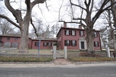
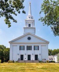
Photograph by Unknown photographer, Public domain. Via
Wikimedia Commons.
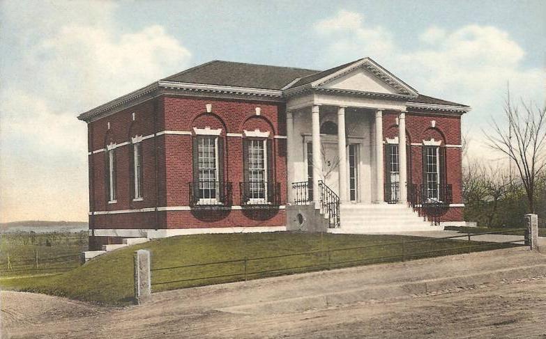
Adams, Frederic C., Public Library
Listed on the National Register of Historic Places in
2001. A historic map-sheet match is not published yet. The record needs a coordinate-quality review before it can be joined to a sheet boundary.
From the record
“Adams Public Library is a historic library building at 33 Summer Street in Kingston, Massachusetts. Designed by Joseph Everett Chandler (1864-1945), a major proponent of the Colonial Revival style, the library was built in 1898 and added to the National Register of Historic Places in 2001.”
Wikipedia article Frederic C. Adams Public Library, CC BY-SA 4.0.
one of 93 National Register listings in Plymouth County · listed in 2001 · category: Building · one of 1 National Historic Landmarks in Plymouth County.
National Register reference number.01000625- the number the National Park Service assigned this property when it was listed, and the key its nomination file is catalogued under at the National Archives.
I WISH to return my thanks to all who have assisted me in the preparation of this book. As a record, its value has been increased by those who have allowed photographs to be taken of their pictures of Kingston vessels, and also of the men who built or commanded them.
In connexion with the list of vessels built and owned in Kingston I have received most valuable assistance from my wife, Abby B. Jones, daughter of Edward Holmes, concerning the voyages made by vessels owned by the Holmes family, and also from Mr. Alexander Holmes, especially in regard to the ownership of the strip of land on the westerly bank of Jones River, called the Landing, and from Mr. Thomas W. Bailey as to plans of this property at different periods.
Regional context, not property-specific
evidence. The
federal wildfire occurrence database
lists 316 fires within 5 miles of Adams, Frederic C., Public Library between
2015 and 2020, burning about 104 acres in total. 1 started naturally. 3 were recorded as arson.
Distance is straight-line from the map coordinates, so a fire counted
here may appear on a neighbouring settlement's page as well.
Reported cause
Fires
Debris and open burning
207
Missing data/not specified/undetermined
69
Misuse of fire by a minor
23
Recreation and ceremony
7
Arson/incendiarism
3
Power generation/transmission/distribution
2
Smoking
2
Equipment and vehicle use
2
Natural
1
The most recent of
them, most recent first, with the day each was reported and the service
that recorded it.
Regional context, not property-specific
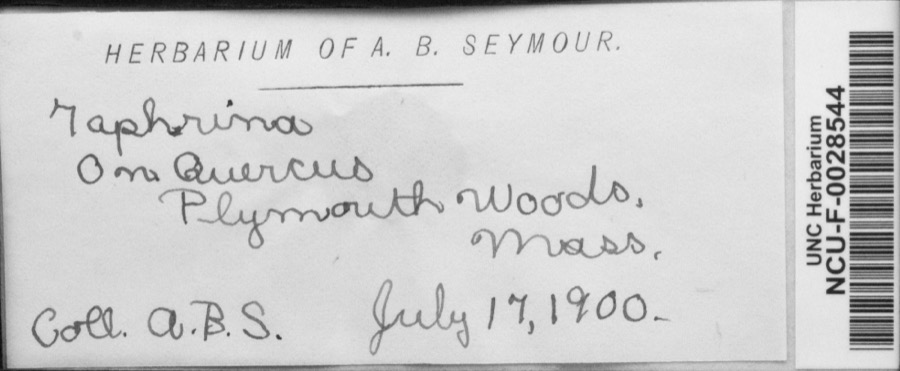
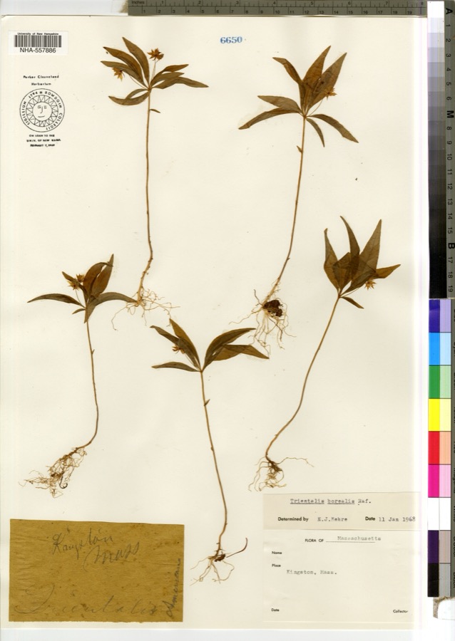
evidence. Museums hold 1,464 specimens
collected within 10 miles of Adams, Frederic C., Public Library between 1816 and
1975: 765 Animalia, 429 Plantae, 184 Fungi, 44 Unrecorded, 28 Chromista, 14 Protozoa. 12 distinct Species records are shown.
Collected by -- Russell, A., A. B. Seymour and others. Each is a
physical object with a catalogue
number, and each entry opens the museum's record. This is what was
collected and kept, not a survey of what lives here - nothing can be
concluded from a species being absent.
Regional context, not property-specific
evidence. The federal mineral resources record lists
2 workings within 5 miles of Adams, Frederic C., Public Library: 1 past producer, 1 producer.
1 still produces. What was taken out: Sand and Gravel, Construction. Distance is straight-line from the
map coordinates, so a quarry counted here may appear on a neighbouring
settlement's page as well.
Regional context, not property-specific
evidence. The National Weather Service names
Kingston, the town this property stands in, in 4 storm reports between 2006 and 2019: 3 flood, 1 lightning.
No death or injury is recorded in these reports. Each account below is quoted exactly as the forecast office
filed it, from the NOAA Storm Events Database, and each date
opens the federal record of that event.
No historic map-sheet match is published
for this property yet. That does not mean no map exists. This record needs
a coordinate-quality review before it can be joined to a sheet boundary.
Browse the county's mapped places while that work is
pending.
From the nomination file
6,724 words on record
When this property was proposed for the
National Register, someone wrote the case for it: what the building is,
and why it matters. That document is a federal record in the public domain.
It is quoted below word for word, never summarised. The text was read off the scanned case file by machine, so the
occasional stray character is the recogniser's and the 1970s
typewriter's.
Statement of significance
The Frederic C. Adams Public Library was, until its abandonment in 1994, the town library for the Town of Kingston, Massachusetts, and had been continuously used as such since its dedication on August 4, 1898. This Colonial Revival structure was designed in 1897 by Joseph Everett Chandler, a renowned Boston architect, and continues to retain its importance as an architectural and cultural landmark in the town center. Constructed with funds willed to the Town for the purpose by Frederic C. Adams on property donated by Adams family members, the Library was only recently abandoned in favor of a newly constructed, larger facility directly across the street. The building is located on a principal artery in the historical center of town. The Frederic C.
Adams Public Library meets criteria A and C of the National Register at the local level and retains integrity of location, setting, design, materials, feeling, association and craftsmanship. The Town of Kingston Immediately north of Plymouth, Massachusetts, Kingston was originally settled in 1620 by Mayflower passengers. It remained part of Plymouth until 1717, when residents were granted authority by the General Court to be set off as the North Precinct of Plymouth in 1717; the Town was finally separately incorporated in 1726. The "lands about Jones River," as the Town was first known, prospered on water-related industry, particularly shipbuilding, the iron industry, including the making of thread, shipping tools, tacks and rivets; the fishing industry; and mills.
Over 24 "water privileges" were awarded to provide power for some 80 industries in the earlier days, until steam power became prevalent. The Town occupies20.39 square miles on land largely provided by Major John Bradford, grandson of Governor William Bradford, who gave the land for the town woodlot, training green, burying ground and meetinghouse.
Quoted from the National Register nomination
for reference 01000625, 34 pages, held by the National Archives in Record
Group 79. See the
catalogue record.
Listed places nearby
6 within 8 miles
Other National Register properties close
enough to walk or drive between, ordered by distance from this one. Both
positions come from the same geocoding pass that matched these properties
to their map sheets.
Listing record. National Park Service National Register of Historic Places, listed-properties dataset, current to 2026-05-22.
Map join. Address geocoded through the United States Census geocoder, then tested against the published boundary of every sheet in the USGS Historical Topographic Map Collection.
How this page is made. Listing fields come from federal records; map-sheet coverage is a labelled coordinate-to-boundary calculation, not a source-field claim.
Wildfire. Short, Karen C. 2022. Spatial wildfire occurrence data for the United States, 1992-2020 [FPA_FOD_20221014]. 6th Edition. Fort Collins, CO: Forest Service Research Data Archive. https://doi.org/10.2737/RDS-2013-0009.6 Collected with United States Government funding and usable without additional permissions or fees.
Specimens. Global Biodiversity Information Facility (GBIF), https://www.gbif.org/. Only records licensed CC0 or CC BY are used. Records licensed CC BY-NC are excluded because this site carries advertising. Images are checked individually and any whose licence is non-commercial, no-derivatives or unreadable is refused.
Mines and quarries. USGS Mineral Resources Data System (MRDS) https://mrdata.usgs.gov/mrds/ A work of the United States government, no copyright under 17 U.S.C. 105.
Storms. NOAA National Centers for Environmental Information, Storm Events Database https://www.ncei.noaa.gov/stormevents/ A work of the United States government, no copyright under 17 U.S.C. 105. Narratives are quoted verbatim from the National Weather Service report and are not edited or summarised.
 Block
Block