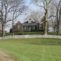
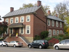
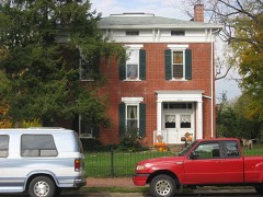
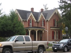
Listed on the National Register of Historic Places in
1982. A historic map-sheet match is not published yet. The record needs a coordinate-quality review before it can be joined to a sheet boundary.
From the record
“Seeing the need of more land, be bought eight3-five acres near Hayesville, and also improved sixty-eight and one-half acres in South Pickaway County. He has a fine farm, has it well improved, and is one of the substantial and prosperous men of the county.”
Portrait and Biographical Record of Fayette, Pickaway and Madison Counties, Ohio : Containing Biographical Sketches of Prominent and Representative Citizens, Together with Biographies and Portraits of All the Presidents of the United States (1892). Machine-read text.
one of 20 National Register listings in Pickaway County · listed in 1982 · category: Building.
National Register reference number.02001459- the number the National Park Service assigned this property when it was listed, and the key its nomination file is catalogued under at the National Archives.
What happened here
An account from the chapter on Pickaway township, The inset identifies its exact
source book and publication year.
the year 1806, two extraordinary men, twin brothers, of the Shawnese tribe, rose among them. One of these was called Tecumseh, or " The Crouching Panther;" the other, OlHwacheca, or "The Prophet." Tecumseh was not only an Indian warrior, but a man of great sagacity, far-reaching foresight and indomitable perseverance in any enterprise m which he might engage.
The gold stamped picture on the front cover of this book was of the first Pickaway County Court House built about 1812. The Court House was an octagonal shaped building and stood directly in the center of Circleville. This picture was created from a pen and ink drawing done by Lissa Yaple, a local artist.
B. Logan's cabin at Old Chillicothe, now Westfall, four miles below Circleville: from. this place a trail led through Grenadier Squaw town, and from thence up the Congo valley, and crossed to the opposite side of the creek, about 1.5 miles from its mouth.
Regional context, not property-specific
evidence. The
federal wildfire occurrence database
lists 2 fires within 5 miles of Black, Joseph, Farmhouse between
2007 and 2007, burning about 5 acres in total. None started naturally. None was recorded as arson.
Distance is straight-line from the map coordinates, so a fire counted
here may appear on a neighbouring settlement's page as well.
Reported cause
Fires
Debris and open burning
2
The most recent of
them, most recent first, with the day each was reported and the service
that recorded it.
Regional context, not property-specific
evidence. Museums hold 941 specimens
collected within 10 miles of Black, Joseph, Farmhouse between 1845 and
1975: 847 Animalia, 87 Plantae, 6 Fungi, 1 Protozoa. 12 distinct Species records are shown.
Collected by Adams, W.; Bartley, F., Andy White., Arden R. Gaufin and others. Each is a
physical object with a catalogue
number, and each entry opens the museum's record. This is what was
collected and kept, not a survey of what lives here - nothing can be
concluded from a species being absent.
Regional context, not property-specific
evidence. The National Weather Service names
Circleville, the town this property stands in, in 75 storm reports between 1994 and 2026: 29 thunderstorm wind, 21 hail, 14 flood, 7 flash flood.
The reports record 7 injuries. Each account below is quoted exactly as the forecast office
filed it, from the NOAA Storm Events Database, and each date
opens the federal record of that event.
A tornado touched down west of Circleville, pulling a small shed off of its foundation and destroying a section of a construction building. after this, the tornado lifted and then touched down in a more developed area in town. It destroyed a building housing two businesses and ripped the roof off of a section of a strip mall, ejecting furniture from inside the structure. A large sign weighing several hundred pounds was ripped from its foundation and blown twenty feet away. A tractor trailer with a load of 18 to 19 tons was blown over and dragged ten feet away from where it landed. The tornado then proceeded to a housing development where several homes were destroyed, several roofs ripped off, and garages either destroyed or moved from their foundations. Trees were twisted and broken off at their bases and carports were also torn from nearby houses.
A tornado touched down along State Route 361, causing damage to three buildings at the Pickaway Machine and Fabricating Company. Portions of the aluminum roofing and insulation were removed from these three buildings, and deposited throughout the complex and in a cornfield across Route 361. Corn stalks at six to eight feet in height were knocked over in a 150 foot wide swath across this cornfield, extending for a mile to the northeast to Boggs Road. Across Boggs Road, minor tree and limb damage occurred, with part of an open air aluminum shed being blown into a nearby tree line.
A small tornado moved across the south side of Circleville producing minor structural and roof damage to a few buildings, and some damage to nine cars at a dealership. Numerous trees and power lines were also knocked down.
No historic map-sheet match is published
for this property yet. That does not mean no map exists. This record needs
a coordinate-quality review before it can be joined to a sheet boundary.
Browse the county's mapped places while that work is
pending.
Named in the fire insurance atlases
Sanborn surveyors printed an index of the
town's establishments at the front of each atlas. This property is named in
one, read straight off the scanned sheet.
When this property was proposed for the
National Register, someone wrote the case for it: what the building is,
and why it matters. That document is a federal record in the public domain.
It is quoted below word for word, never summarised. The text was read off the scanned case file by machine, so the
occasional stray character is the recogniser's and the 1970s
typewriter's.
Description of the property
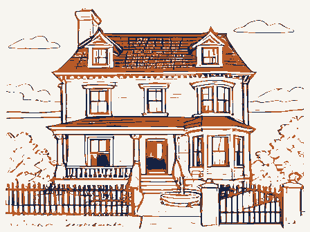
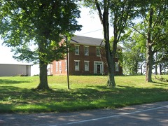
7. Description porch are supported by unusually large stone columns of very simple detail.An ornamental iron railing stretches between the house walls and the pillars. covered in the metal standing seam roofing(1969).There are2internal end chimneys Check one to replace all window openings with 9/6 style.Plain sand stone lentils and plain - original site with beautiful wood railing. Other details include random plank hardwood floors, stone lug sills adorn the openings.Right at the rooflineof the building is decorative porch and steps approach the entrance.The wooden boxed cornice and roof over the door is flanked by sidelights and topped with a multi-paned transom.
A limestone construction).There are 3 early 9/6 light double hung windows remaining in the The central main entrance is surrounded in stone.The paneled single walnut An enclosed back porch was added to the northeast side of the house at a later The Joseph Black Farm house is a two-story L-shaped 5 bay X 3 bay vernacular 8.
Statement of significance
(in one paragraph) porch in the vicinity similar to this property's was recently demolished. The attractive scalloped corbeling under the cornice and refined interior details.The -economics outstanding because cf the unusual amount of original interior fabric remaining in house is of a traditional design for rural architecture in Ohio at this time and is records indicate the entire structure was completed by 1840.Although Joseph later relocated in Fairfield County establishing himself in the cattle business there, the -art - archeology-prehistoric - community planning - science proportions of the house appear a bit odd, however physical evidence indicates that plans were laid for a large brick dwelling and outbuildings by 1818.
It is believed of much of Pickaway County's metropolis, including the first courthouse. It is likely Having come from Pennsylvania in 1811, Joseph Black purchased this land in 1814 and The Joseph Black farmhouse is significant among rural architecture in the he assisted Joseph in building this fine house which sits up on a knoll and is shaded the house was originally constructed this way.
Quoted from the National Register nomination
for reference 02001459, 21 pages, held by the National Archives in Record
Group 79. See the
catalogue record.
Listed places nearby
6 within 8 miles
Other National Register properties close
enough to walk or drive between, ordered by distance from this one. Both
positions come from the same geocoding pass that matched these properties
to their map sheets.
Listing record. National Park Service National Register of Historic Places, listed-properties dataset, current to 2026-05-22.
Map join. Address geocoded through the United States Census geocoder, then tested against the published boundary of every sheet in the USGS Historical Topographic Map Collection.
How this page is made. Listing fields come from federal records; map-sheet coverage is a labelled coordinate-to-boundary calculation, not a source-field claim.
Wildfire. Short, Karen C. 2022. Spatial wildfire occurrence data for the United States, 1992-2020 [FPA_FOD_20221014]. 6th Edition. Fort Collins, CO: Forest Service Research Data Archive. https://doi.org/10.2737/RDS-2013-0009.6 Collected with United States Government funding and usable without additional permissions or fees.
Specimens. Global Biodiversity Information Facility (GBIF), https://www.gbif.org/. Only records licensed CC0 or CC BY are used. Records licensed CC BY-NC are excluded because this site carries advertising. Images are checked individually and any whose licence is non-commercial, no-derivatives or unreadable is refused.
Storms. NOAA National Centers for Environmental Information, Storm Events Database https://www.ncei.noaa.gov/stormevents/ A work of the United States government, no copyright under 17 U.S.C. 105. Narratives are quoted verbatim from the National Weather Service report and are not edited or summarised.
 Block
Block