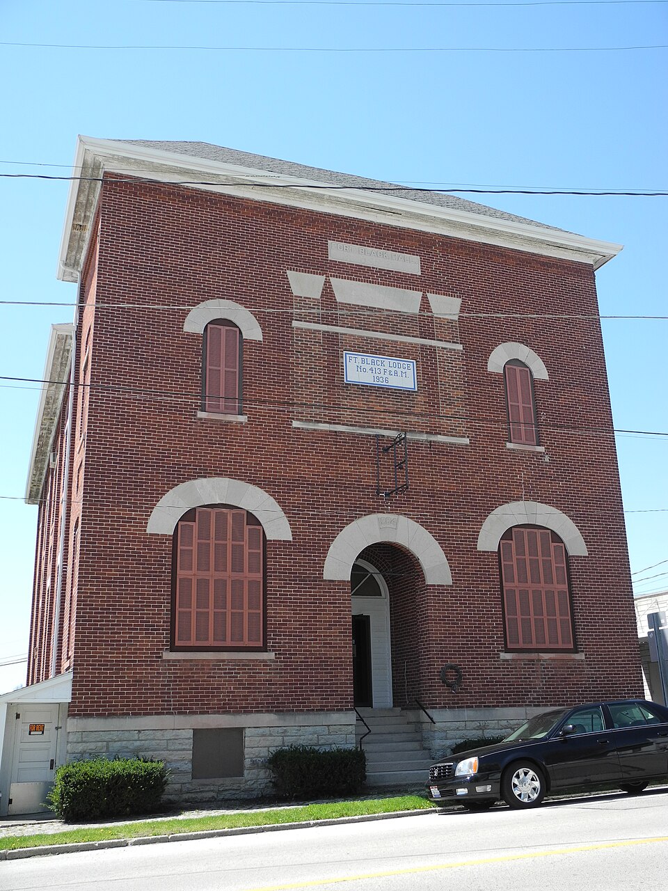
Listed on the National Register of Historic Places in
2018. A historic map-sheet match is not published yet. The record needs a coordinate-quality review before it can be joined to a sheet boundary.
From the record
“McClure, who was both preacher and teacher, conscientious and philanthropic - a ' good man. John Forster, Isaac Mains and William Polly were all early preachers of the Christian denomination.”
The History of Darke County, Ohio, Containing a History of the County; Its Cities, Towns, Etc.; General and Local Statistics; Portraits of Early Settlers and Prominent Men; (1880). Machine-read text.
one of 25 National Register listings in Darke County · listed in 2018 · category: Building.
McClure, who was both preacher and teacher, conscientious and philanthropic - a ' good man. John Forster, Isaac Mains and William Polly were all early preachers of the Christian denomination. The efforts of such families as the Tillsons, Har lands and Pollys and of Solomon Broderick, produced a wholesome moral and religious sentiment in the southern and western part of the township. At Fort Black, lived Ernestus Putnam, a strict Presbyterian, and there were John Rush, John Downing, Jiidson Jaqua, Hart, and others, who were men of good character and public spirited. Jacob Miller was of marked intelligence, but his moral influence was not of the best. The first house built for public worship was a log meeting-house, near where Friendship Church now stands. There are now eight churches in the township, viz.: one Presbyterian, one Methodist and one Universalist, at New Madison ; one Christian at Hollansburg. and one each of Christian, Presbyterian, New Light and United Brethren elsewhere in the township. It was also used as a schoolhouse, wherein John Purvianee taught the first school, supported by subscription. The first schoolhouse, intended as such, was built at Yankeetown, in 1819. and Moses Woods was the first teacher there. The second was built upon Section 16, and William Hill was the first to teach in it. The township now has six district schools, besides the school at Hollandsburg, which includes two districts, and the school at Madison, of which mention is later made. A brief sketch of New Madison will be read with interest in this connection. We have referred to the Christmas auction of lots and the few sales made. It seems that the attempted sale was made an occasion of a regular pioneer jollification, but its failure was disheartening to Smith, who, in 1819, sold his entire claim to Ernestus Putnam, who had entered the quarter-section just west of Smith. The purchaser bought up all lots sold, vacated the plat, and, in 1831, surveyed New Madison by laying off seventeen lots on each side of what is now Main street, beginning with the lot where the old tannery stands and running south on the east side of the street and back on the west side. Mr. Putnam kept the first store in the place, to which he transferred his stock from Fort Black. A Mr. Hyde was the first blacksmith. At the southeast corner of the new plat, a rectangularshaped piece of land remained, upon which Putnam placed a log house and donated both lot and house to the people for school purposes. This was the first schoolhouse within the limits of the present corporation. He and John Wade also gave a piece of ground for a cemetery, provided public ground for a militia parade, and, when a church was needed, he gave the ground, and he and others built the present brick church and gave it for the use of the public, with the restriction that it should be used by orthodox denominations only. Before the church was built, Mr. Putnam, who was the prime mover in the undertaking, made several propositions toward securing co-operation. Several gave sums ranging from $50 downward. The Foulkes and Hollingsheads gave t>50 ; Mrs. Wilson (now the only survivor) gave $50 ; Mrs. Carson, $50 ; Dr. Kilpatrick, $50, and the Lawrences, the Schribers, the Rittenours, etc., varying smaller amounts. The church was erected in 1847. Mr. Putnam superintended the work ; Jason Downing was one of the brickmasons ; William Biddle did a large part of the woodwork. It was not until several years after the church was built that funds were subscribed to purchase a bell, and the bell was not put up until after the German Reformed Church had possession of the building, which occurred in the latter part of 1857. After the church wras built, there was for some time no regular preaching by Presbyterian ministers, but frequent services by preachers of that and other ortho dox denominations. Rev. Benj. 0. Springer came here about two years after the church was built, and he was succeeded by Peter Crocker, who preached frequently, but did not occupy all the time, until 1855-5<>. In 1857, Rev. Voght, of the (4ernian Reformed Church, awakened a great interest here and organized a church, af. which time Mr. Putnam joined the new organization and the Presbyterian Church was turned over to its use. he himself appointing the following Trustees, viz., Elias Barter, Robert Snodgrass and Echard Worch. Mr. Snodgrass died, and
New Madison has a fine town hall, a brick structure, built in 1878, 70x40 feet, three stories, including basement. The middle story is used as a public assembly, lecture, concert, etc., room, also for festivals and dances. The basement, on the latter occasions, serves as culinary department, and a part of it is in general use for storage, etc. The upper story is the Odd Fellows' Hall. George Bacon was Chairman of the Committee on Construction and contractor. The building cost about $7,000. The lot was bought of Mrs. Matthew McWhinney for $600, and then sold for the same price, enough ground being retained for the erection of the town hall.
Regional context, not property-specific
evidence. The
federal wildfire occurrence database
lists 1 fire within 5 miles of Knights of Pythias Hall between
2002 and 2002, burning about 1 acres in total. None started naturally. None was recorded as arson.
Distance is straight-line from the map coordinates, so a fire counted
here may appear on a neighbouring settlement's page as well.
Reported cause
Fires
Equipment and vehicle use
1
The most recent of
them, most recent first, with the day each was reported and the service
that recorded it.
Regional context, not property-specific
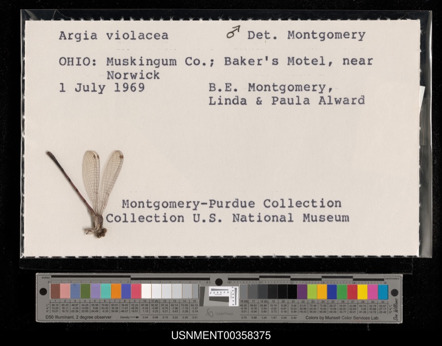
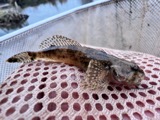
evidence. Museums hold 164 specimens
collected within 10 miles of Knights of Pythias Hall between 1883 and
1969: 151 Animalia, 12 Plantae, 1 Chromista. 12 distinct Species records are shown.
Collected by A VERWYST, B. Montgomery, L. Alward & P. Alward, Clark, C. F. (Clarence F.) and others. Each is a
physical object with a catalogue
number, and each entry opens the museum's record. This is what was
collected and kept, not a survey of what lives here - nothing can be
concluded from a species being absent.
Regional context, not property-specific
evidence. The federal mineral resources record lists
6 workings within 5 miles of Knights of Pythias Hall: 3 past producers, 2 producers, 1 plant.
3 still produce. What was taken out: Sand and Gravel, Construction, Stone, Crushed/Broken, Limestone, General. Distance is straight-line from the
map coordinates, so a quarry counted here may appear on a neighbouring
settlement's page as well.
Regional context, not property-specific
evidence. The National Weather Service names
New Madison, the town this property stands in, in 29 storm reports between 1996 and 2026: 18 thunderstorm wind, 7 hail, 2 flood, 1 flash flood.
No death or injury is recorded in these reports. Each account below is quoted exactly as the forecast office
filed it, from the NOAA Storm Events Database, and each date
opens the federal record of that event.
A tornado briefly touched down in and near the village of New Madison. Much of the damage was consistent with EF0 wind speeds, as numerous large tree branches were damaged and minor roof damage occurred to structures. There was some damage indicative of EF1 winds of around 90 mph, namely large sections of roof uplifted at a lumber yard barn storage building. Elsewhere through the village, there was brick damage to the front facade of a downtown business, in addition to broken windows and some uplift of roof material. Much of this damage was more indicative of EF0 winds.
A barn was destroyed and a camper was blown over due to damaging thunderstorm winds. In addition, a tree fell on a car which trapped a person. A 500 pound propane tank also was blown over.
No historic map-sheet match is published
for this property yet. That does not mean no map exists. This record needs
a coordinate-quality review before it can be joined to a sheet boundary.
Browse the county's mapped places while that work is
pending.
Listed places nearby
1 within 8 miles
Other National Register properties close
enough to walk or drive between, ordered by distance from this one. Both
positions come from the same geocoding pass that matched these properties
to their map sheets.
Listing record. National Park Service National Register of Historic Places, listed-properties dataset, current to 2026-05-22.
Map join. Address geocoded through the United States Census geocoder, then tested against the published boundary of every sheet in the USGS Historical Topographic Map Collection.
How this page is made. Listing fields come from federal records; map-sheet coverage is a labelled coordinate-to-boundary calculation, not a source-field claim.
Wildfire. Short, Karen C. 2022. Spatial wildfire occurrence data for the United States, 1992-2020 [FPA_FOD_20221014]. 6th Edition. Fort Collins, CO: Forest Service Research Data Archive. https://doi.org/10.2737/RDS-2013-0009.6 Collected with United States Government funding and usable without additional permissions or fees.
Specimens. Global Biodiversity Information Facility (GBIF), https://www.gbif.org/. Only records licensed CC0 or CC BY are used. Records licensed CC BY-NC are excluded because this site carries advertising. Images are checked individually and any whose licence is non-commercial, no-derivatives or unreadable is refused.
Mines and quarries. USGS Mineral Resources Data System (MRDS) https://mrdata.usgs.gov/mrds/ A work of the United States government, no copyright under 17 U.S.C. 105.
Storms. NOAA National Centers for Environmental Information, Storm Events Database https://www.ncei.noaa.gov/stormevents/ A work of the United States government, no copyright under 17 U.S.C. 105. Narratives are quoted verbatim from the National Weather Service report and are not edited or summarised.
 Block
Block