 Block
BlockFrom the record
one of 29 National Register listings in Fairfield County · listed in 2020 · category: District · one of 1 National Historic Landmarks in Fairfield County.
Sources: the National Register database, National Park Service

Listed on the National Register of Historic Places in 2020. A historic map-sheet match is not published yet. The record needs a coordinate-quality review before it can be joined to a sheet boundary.
one of 29 National Register listings in Fairfield County · listed in 2020 · category: District · one of 1 National Historic Landmarks in Fairfield County.
Sources: the National Register database, National Park Service
Regional context, not property-specific evidence. The federal wildfire occurrence database lists 8 fires within 5 miles of Fairfield County Infirmary between 2012 and 2020, burning about 12 acres in total. None started naturally. None was recorded as arson. Distance is straight-line from the map coordinates, so a fire counted here may appear on a neighbouring settlement's page as well.
| Reported cause | Fires |
|---|---|
| Debris and open burning | 4 |
| Power generation/transmission/distribution | 2 |
| Missing data/not specified/undetermined | 1 |
| Fireworks | 1 |
The most recent of them, most recent first, with the day each was reported and the service that recorded it.
| Date | Cause | Size | Reported by | Name on the report |
|---|---|---|---|---|
| 22 September 2019 | Debris and open burning | under an acre | Ohio Department of Natural Resources | 15338 |
| 5 July 2020 | Fireworks | 1.0 acres | Ohio Department of Natural Resources | 15801 |
| 16 June 2020 | Power generation/transmission/distribution | under an acre | Ohio Department of Natural Resources | 15761 |
| 5 April 2015 | Power generation/transmission/distribution | 7.0 acres | Ohio Department of Natural Resources | 742 |
| 9 March 2012 | Debris and open burning | under an acre | Ohio Department of Natural Resources | not named |
| 8 March 2020 | Debris and open burning | 2.0 acres | Ohio Department of Natural Resources | 15458 |
| 19 March 2015 | Debris and open burning | under an acre | Ohio Department of Natural Resources | 524 |
| 10 November 2020 | Missing data/not specified/undetermined | under an acre | Ohio Department of Natural Resources | 15998 |
Regional context, not property-specific evidence. Museums hold 2,251 specimens collected within 10 miles of Fairfield County Infirmary between 1839 and 1975: 1,621 Animalia, 394 Fungi, 222 Plantae, 7 Protozoa, 5 Unrecorded, 2 Chromista. 12 distinct Species records are shown. Collected by A. Schrader, Angerman, C. (Carl) & Triplehorn, C. A. (Charles A.), Asa Gray; W. S. Sullivant and others. Each is a physical object with a catalogue number, and each entry opens the museum's record. This is what was collected and kept, not a survey of what lives here - nothing can be concluded from a species being absent.
| Image | Species | Year | Collected by | Where, as recorded |
|---|---|---|---|---|
 | Diderma spumarioides (Fr. & Palmquist) Fr., 1829 | 1890 | Detmers, Freda | Sugar Grove |
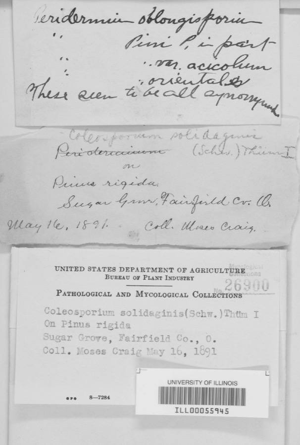 | Coleosporium solidaginis (Schwein.) Thüm. | 1891 | M. Craig | Sugar Grove |
 | Kuehneola uredinis (Link) Arthur | 1891 | Freda Detmers | Rock Mill |
| Coreopsis discoidea Torr. & A.Gray | 1839 | W. S. Sullivant | ||
 | Platanthera leucophaea (Nutt.) Lindl. | 1839 | W. S. Sullivant | |
 | Saxifraga sullivantii Torr. & A.Gray | 1839 | W. S. Sullivant | |
 | Trillium erectum var. declinatum A.Gray | 1839 | W. S. Sullivant | |
 | Ricciocarpos natans (L.) Corda | 1840 | W. S. Sullivant | |
 | Rudbeckia sullivantii C.L.Boynton & Beadle | 1840 | W. S. Sullivant | |
 | Amblystegium serpens var. juratzkanum (Schimp.) Rau & Herv. | 1841 | not recorded | |
 | Hamatocaulis vernicosus (Mitt.) Hedenäs | 1841 | W. S. Sullivant | |
 | Ceratodon purpureus (Hedw.) Brid. | 1842 | W. S. Sullivant |
All 2,251 specimens within 10 miles, at the Global Biodiversity Information Facility.
Regional context, not property-specific evidence. The federal mineral resources record lists 10 workings within 5 miles of Fairfield County Infirmary: 5 past producers, 5 producers. 5 still produce. What was taken out: Sand and Gravel, Construction. Distance is straight-line from the map coordinates, so a quarry counted here may appear on a neighbouring settlement's page as well.
| Where | Site | Commodity | Status | Recorded |
|---|---|---|---|---|
| Alley Pit | Sand and Gravel, Construction | Producer | ||
| Blazer Plant A-1 & Pit | Sand and Gravel, Construction | Producer | ||
| Brewer Sand and Gravel Pit | Sand and Gravel, Construction | Past Producer | Sedimentary | |
| Davis Sand and Gravel Pit | Sand and Gravel, Construction | Past Producer | Sedimentary | |
| Febus Gravel Pit | Sand and Gravel, Construction | Past Producer | Sedimentary | |
| Igel Pit | Sand and Gravel, Construction | Producer | ||
| Jimmys Pit | Sand and Gravel, Construction | Producer | ||
| Morris Sand and Gravel Pit | Sand and Gravel, Construction | Past Producer | Sedimentary | |
| Morris Sand and Gravel Pit | Sand and Gravel, Construction | Past Producer | ||
| Stump Hollow Pit | Sand and Gravel, Construction | Producer |
Regional context, not property-specific evidence. The National Weather Service names Lancaster, the town this property stands in, in 97 storm reports between 1994 and 2026: 48 thunderstorm wind, 32 hail, 9 flash flood, 4 flood. The reports record 1 injury. Each account below is quoted exactly as the forecast office filed it, from the NOAA Storm Events Database, and each date opens the federal record of that event.
| When | Event | Place named | Harm | What the report says |
|---|---|---|---|---|
| July 2017 | Lightning | Lancaster | 1 hurt | A person in a small metal shed was struck by lightning. |
| May 2022 | Hail | Lancaster | $200,000 | Numerous houses in the Lancaster area had siding and roof damage caused by the large hail. |
| July 2025 | Flash Flood | Lancaster | $100,000 | Flash flooding along Fetters Run near College Avenue caused damage to the roadway, as well as significant damage to the Lancaster Festival stages, equipment, and vehicles. |
| July 2025 | Flash Flood | Lancaster | $100,000 | Multiple water rescues occurred in the apartment complex along Sater Drive where water was over three feet deep. Additionally, over 30 vehicles were flooded in deep water. |
| September 2000 | Tornado (F0) | Lancaster | $30,000 | A tornado made a few brief touchdowns in Lancaster destroying a garage and knocking down some trees and power lines. |
| July 2025 | Flash Flood | Lancaster | $20,000 | Fetters Run Creek was out of its banks and overtopped the bridge along College Avenue, causing structural damage to the bridge. |
| July 2025 | Flash Flood | Lancaster | $20,000 | Multiple swift water rescues were needed for animals trapped inside of a building submerged with three to four feet of water on Granville Pike. The building backs up to Fetters Run stream. |
| June 2002 | Thunderstorm Wind | Lancaster | $20,000 | Numerous trees and power lines were blown down across the eastern part of the county. There was minor damage to siding and gutters on a few homes on Betz Road, to the west of Lancaster. |
| July 2023 | Thunderstorm Wind | Lancaster | $10,000 | Several trees were downed in the Lancaster area. |
| April 2018 | Thunderstorm Wind | Lancaster | $10,000 | Trees were reported down countywide. |
| June 2012 | Thunderstorm Wind | Lancaster | $10,000 | Multiple large tree limbs were downed and siding damage occurred to buildings due to thunderstorm winds. |
| June 2012 | Thunderstorm Wind | Lancaster | $10,000 | A large tree was downed on a pickup truck and siding damage occurred to a house due to thunderstorm winds. |
| August 2003 | Thunderstorm Wind | Lancaster | $10,000 | Several trees and large limbs were downed. Fallen trees caused minor damage to a house, and significant damage to a parked vehicle. |
| July 2002 | Thunderstorm Wind | Lancaster | $10,000 | A couple of houses sustained minor roof and siding damage along Sugar Grove Road. Trees were also downed. |
| June 2022 | Thunderstorm Wind | Lancaster | $6,000 | Several trees were snapped and a few large trees were uprooted. |
| July 2006 | Flash Flood | Lancaster | $6,000 | Several roads were flooded, and a few homes had basement flooding. |
| March 2026 | Thunderstorm Wind | Lancaster | $5,000 | A tree was blown down onto the roof of a home. |
| April 2025 | Thunderstorm Wind | Lancaster | $5,000 | A tree fell onto a house at the intersection of King Street and High Street. |
| June 2024 | Thunderstorm Wind | Lancaster | $5,000 | A tree was downed and fell onto a home. |
| April 2002 | Hail | Lancaster | $5,000 | High winds associated with the hail producing thunderstorm caused a 60 foot wall at a school construction site in Amanda to collapse. |
| May 2001 | Thunderstorm Wind | Lancaster | $5,000 | Several trees knocked down. |
| May 2001 | Flash Flood | Lancaster | $5,000 | Heavy rainfall caused several roads to be flooded including State Route 33. |
| May 2000 | Flash Flood | Lancaster | $5,000 | Heavy rainfall caused several roads to be flooded just south of Lancaster. |
| July 1997 | Thunderstorm Wind | Lancaster | $5,000 | Numerous trees and power lines downed. |
| July 1994 | Thunderstorm Wind | Lancaster | $5,000 | Trees were uprooted. |
| June 1994 | Thunderstorm Wind | Lancaster | $5,000 | A barn roof was blown off and trees were downed. |
| June 1994 | Thunderstorm Wind | Lancaster | $5,000 | Trees were downed. |
| July 1996 | Thunderstorm Wind | Lancaster | $5,000 | no account filed |
| July 2022 | Thunderstorm Wind | Lancaster | $4,000 | Several trees were downed. |
| June 2020 | Thunderstorm Wind | Lancaster | $4,000 | A tree was knocked down, which caused power outages in Lancaster. |
| June 2012 | Thunderstorm Wind | Lancaster | $4,000 | A tree fell into a house due to damaging thunderstorm winds. |
| June 2008 | Thunderstorm Wind | Lancaster | $4,000 | Several large trees were downed. |
| July 2003 | Thunderstorm Wind | Lancaster | $4,000 | Trees and powerlines were downed. |
| March 2002 | Thunderstorm Wind | Lancaster | $4,000 | Trees were blown down in town. |
| June 2015 | Tornado (EF0) | Lancaster | $3,000 | A ground survey with assistance form the Fairfield County EMA confirmed a brief and weak tornado touched down in the southwest part of Lancaster.||The survey revealed an eyewitness report of a very weak tornado on the ground near a residence at the west end of Mount Ida Avenue in Lancaster. No damage occurred at this residence. From there the weak tornado moved east through a wheat field with a narrow path of flattened wheat in a convergent pattern. From there the tornado moved between Tarhe Street and Twin Creek Way where minor tree damage occurred, including a couple of uprooted trees and snapped limbs. The tornado appears to have lifted as it approached south Broad Street. |
| July 2008 | Thunderstorm Wind | Lancaster | $3,000 | Trees were knocked down. |
| March 2007 | Flood | Lancaster | $3,000 | Three roads were flooded and closed. |
| April 2006 | Thunderstorm Wind | Lancaster | $3,000 | Roof shingles were peeled off of several homes. |
| August 2006 | Thunderstorm Wind | Lancaster | $3,000 | Large tree limbs were downed. |
| July 1999 | Thunderstorm Wind | Lancaster | $3,000 | Trees knocked down. |
| July 2019 | Thunderstorm Wind | Lancaster | $2,000 | A few trees were downed. |
| August 2011 | Thunderstorm Wind | Lancaster | $2,000 | A few trees were reported down due to damaging thunderstorm winds. |
| July 2011 | Thunderstorm Wind | Lancaster | $2,000 | Numerous large limbs were reported down due to damaging thunderstorm winds. |
| June 2011 | Thunderstorm Wind | Lancaster | $2,000 | A couple of trees were reported down due to damaging thunderstorm winds. |
| April 2010 | Thunderstorm Wind | Lancaster | $2,000 | A few trees were reported down in Hocking and Berne Townships due to damaging thunderstorm winds. |
| February 2009 | Thunderstorm Wind | Lancaster | $2,000 | Two trees were knocked down. |
| May 2007 | Thunderstorm Wind | Lancaster | $2,000 | Large tree limbs were downed. |
| August 2007 | Thunderstorm Wind | Lancaster | $2,000 | Large tree limbs were downed. |
| July 2007 | Thunderstorm Wind | Lancaster | $2,000 | Large tree limbs were downed. |
| June 2007 | Thunderstorm Wind | Lancaster | $2,000 | A few large tree limbs were knocked down. |
| June 2007 | Thunderstorm Wind | Lancaster | $2,000 | A few trees were downed at the intersection of State Route 188 and Amanda-Northern Road. |
| May 2003 | Hail | Lancaster | $2,000 | Large limbs were downed along with the large hail. |
| May 1999 | Thunderstorm Wind | Lancaster | $2,000 | A roof was blown off of a greenhouse. |
| July 1995 | Thunderstorm Wind | Lancaster | $2,000 | A few trees were blown down by winds measured at 60 mph. |
| April 2007 | Hail | Lancaster | $2,000 | no account filed |
| June 2022 | Thunderstorm Wind | Lancaster | $1,000 | A tree was uprooted. |
| March 2019 | Thunderstorm Wind | Lancaster | $1,000 | A power pole was snapped. |
| May 2011 | Thunderstorm Wind | Lancaster | $1,000 | Large tree limbs were reported down due to damaging thunderstorm winds. |
| August 2010 | Thunderstorm Wind | Lancaster | $1,000 | A tree was reported down due to damaging thunderstorm winds. |
| November 2007 | Hail | Lancaster | $1,000 | no account filed |
6 papers published in this town, digitised by the Library of Congress and free to read: 0 issues, 0 pages. Every page is searchable, so a name or a street can be looked for directly in what the town printed about itself at the time.
| Newspaper | Published |
|---|---|
| The Lancaster Gazette | 1863 to 1886 |
| American Lancaster Gazette | 1855 to 1860 |
| The Lancaster Gazette | 1846 to 1852 |
| The Weekly Lancaster Gazette | 1860 to 1863 |
| The Gazette and Democrat | 1860 to 1860 |
| The Weekly Lancaster Gazette | 1852 to 1855 |
No historic map-sheet match is published for this property yet. That does not mean no map exists. This record needs a coordinate-quality review before it can be joined to a sheet boundary. Browse the county's mapped places while that work is pending.
Other National Register properties close enough to walk or drive between, ordered by distance from this one. Both positions come from the same geocoding pass that matched these properties to their map sheets.
| Photograph | Property | Distance | Listed |
|---|---|---|---|
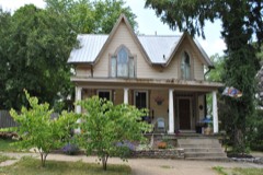 | Medill, William, House | 1.5 miles | 1978 |
 | St. Peter's Evangelical Lutheran Church | 1.6 miles | 1979 |
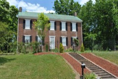 | Bush, Samuel, House | 1.6 miles | 1974 |
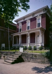 | Sherman, John, Birthplace | 1.7 miles | 1966 |
| Lancaster West Main Street Historic District | 1.8 miles | 1979 | |
| Fairfield County Children's Home | 1.9 miles | 2008 |
| National Archives record | The nomination case file for reference 100005128 in Record Group 79. |
| Fairfield County | All 29 listed properties in this county. |