Listed on the National Register of Historic Places in
1978. A historic map-sheet match is not published yet. The record needs a coordinate-quality review before it can be joined to a sheet boundary.
From the record
one of 29 National Register listings in Fairfield County · listed in 1978 · category: Building · one of 1 National Historic Landmarks in Fairfield County.
National Register reference number.78002061- the number the National Park Service assigned this property when it was listed, and the key its nomination file is catalogued under at the National Archives.
Fires near this property
8 since 2012
Regional context, not property-specific
evidence. The
federal wildfire occurrence database
lists 8 fires within 5 miles of Medill, William, House between
2012 and 2020, burning about 12 acres in total. None started naturally. None was recorded as arson.
Distance is straight-line from the map coordinates, so a fire counted
here may appear on a neighbouring settlement's page as well.
Reported cause
Fires
Debris and open burning
5
Missing data/not specified/undetermined
1
Power generation/transmission/distribution
1
Fireworks
1
The most recent of
them, most recent first, with the day each was reported and the service
that recorded it.
Regional context, not property-specific
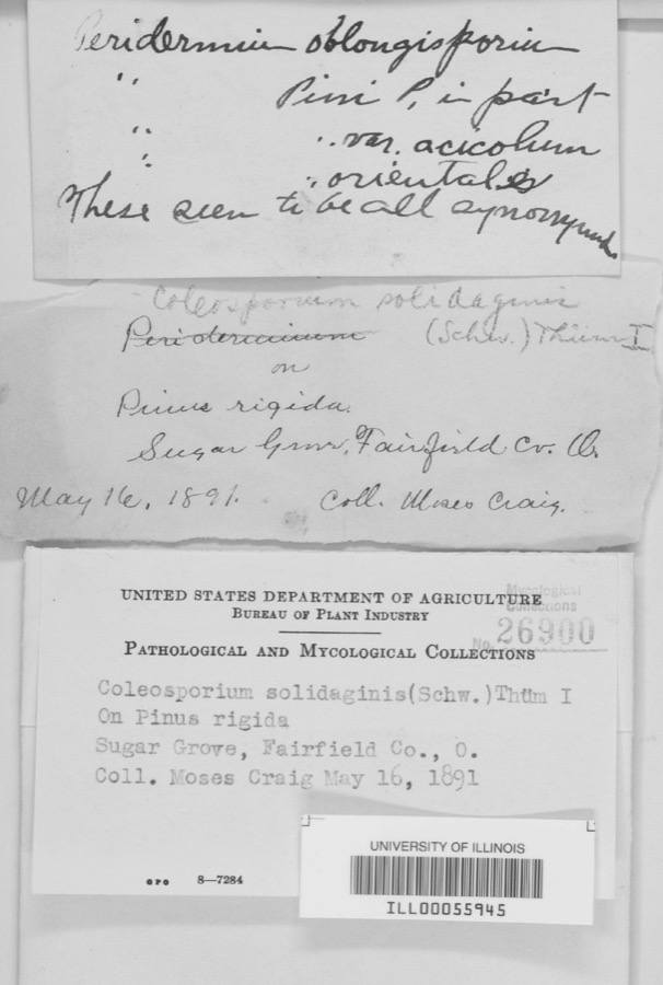
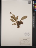
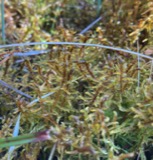
evidence. Museums hold 2,663 specimens
collected within 10 miles of Medill, William, House between 1839 and
1975: 1,881 Animalia, 528 Fungi, 239 Plantae, 7 Protozoa, 6 Unrecorded, 2 Chromista. 12 distinct Species records are shown.
Collected by A. Schrader, Angerman, C. (Carl) & Triplehorn, C. A. (Charles A.), Asa Gray; W. S. Sullivant and others. Each is a
physical object with a catalogue
number, and each entry opens the museum's record. This is what was
collected and kept, not a survey of what lives here - nothing can be
concluded from a species being absent.
Regional context, not property-specific
evidence. The federal mineral resources record lists
9 workings within 5 miles of Medill, William, House: 5 past producers, 4 producers.
4 still produce. What was taken out: Sand and Gravel, Construction. Distance is straight-line from the
map coordinates, so a quarry counted here may appear on a neighbouring
settlement's page as well.
Regional context, not property-specific
evidence. The National Weather Service names
Lancaster, the town this property stands in, in 97 storm reports between 1994 and 2026: 48 thunderstorm wind, 32 hail, 9 flash flood, 4 flood.
The reports record 1 injury. Each account below is quoted exactly as the forecast office
filed it, from the NOAA Storm Events Database, and each date
opens the federal record of that event.
Flash flooding along Fetters Run near College Avenue caused damage to the roadway, as well as significant damage to the Lancaster Festival stages, equipment, and vehicles.
Multiple water rescues occurred in the apartment complex along Sater Drive where water was over three feet deep. Additionally, over 30 vehicles were flooded in deep water.
Multiple swift water rescues were needed for animals trapped inside of a building submerged with three to four feet of water on Granville Pike. The building backs up to Fetters Run stream.
Numerous trees and power lines were blown down across the eastern part of the county. There was minor damage to siding and gutters on a few homes on Betz Road, to the west of Lancaster.
A ground survey with assistance form the Fairfield County EMA confirmed a brief and weak tornado touched down in the southwest part of Lancaster.||The survey revealed an eyewitness report of a very weak tornado on the ground near a residence at the west end of Mount Ida Avenue in Lancaster. No damage occurred at this residence. From there the weak tornado moved east through a wheat field with a narrow path of flattened wheat in a convergent pattern. From there the tornado moved between Tarhe Street and Twin Creek Way where minor tree damage occurred, including a couple of uprooted trees and snapped limbs. The tornado appears to have lifted as it approached south Broad Street.
6 papers published in this town,
digitised by the Library of Congress and free to read: 0 issues,
0 pages. Every page is searchable, so a name or a street can be
looked for directly in what the town printed about itself at the time.
No historic map-sheet match is published
for this property yet. That does not mean no map exists. This record needs
a coordinate-quality review before it can be joined to a sheet boundary.
Browse the county's mapped places while that work is
pending.
From the nomination file
1,681 words on record
When this property was proposed for the
National Register, someone wrote the case for it: what the building is,
and why it matters. That document is a federal record in the public domain.
It is quoted below word for word, never summarised. The text was read off the scanned case file by machine, so the
occasional stray character is the recogniser's and the 1970s
typewriter's.
Description of the property
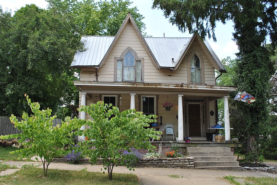
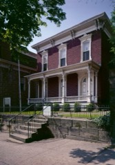
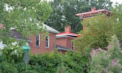
The two-story, frame house is composed of two rectangular, gable-roofed Windows and doors are framed with wide, plain boards which widen at the original, double panel, Gothic-arched window in the second story. cherry banister, carved oak framing around the stairs, and interior shutters CONDITION UNEXPOSED DETERIORATED UNALTERED FAIR XALTERED CHECK ONE for the Gothic-styled windows. The rear portion of the building has been changed.Fenestration of modern Above the entry is another Gothic arched window without the side panels. The facade has the entrance placed to the right.The doorway has a 6-pane window).This window is centered between the windows of the first floor. The interior retains its fine detailing: wide baseboards and door molding, of wood.
The south face of the front portion of the building has a single High Street around 1900. Both windows are framed with wide boards. street;the 1-l/2story rear section is at right angles to the front section. There is a single chimney at the intersection of the gable rooflines. window with plain glass panels to either side the manner of a Palladian -GOOD The roofline has a tall gable above the three-part window and a lesser gable side porch side)which is detailed the same as the front porch. -RUINS The house is on its original lot #8,Square 1l) Zane's original town) -ORIGINAL SITE transom and narrow sidelights. To the left are two 2/2 light windows Both portions are 32'wide. The house is 50' long and is on a stone foundation. top and bottom edges.
Ohio's 22nd Governor, Ist lieutenant governor in Ohio, Commissioner of It is the only remaining residence in Ohio associated with Medill, a colorful and important Ohio politician. William Medill, who came to Lancaster in 1832, was born in New Castle County, that he became a power in the Democratic Party, both locally and later as 1839. As a U.S. representative Medill made a name for himself, and this post, Medill instituted several reforms and increased his reputation as an resigned to become American consul in Valparaiso, Chile. Medill took over as governor and later that year won election to a full gubernatorial term defeated by Samuel Chase.
During his three-year administration, Medill pressed the state to sell its financail interests in canals, highways, and railroads- During his comptroller tenure, Congress threatened to impeach him for refusing follow through with its threat, however. a retreat from both Columbus and Washington, D.C. life. When not in Lancaster to them upon Medill's death in 1865. 1854 1800-1899 1400-1499 1700-1799 ART COMMERCE ARCHITECTURE LAW BUILDER/ARCHITECT PERIOD RELIGION PREHISTORIC MILITARY INDUSTRY SIGNIFICANCE AGRICULTURE EXPLORATION/SETTLEMENT 1900- TRANSPORTATION 1600-1699 LITERATURE SCULPTURE THEATER _COMMUNICATIONS MUSIC X_POLITICS/GOVERNMENT the first Comptroller of the United States Treasury by President Buchanan.
elected as governor for twenty years.After Medill the newly created Republican _ECONOMICS Indian Affairs and first Comptroller of the United States Treasury. _PHILOSOPHY to the influential post of Commissioner of Indian Affairs.In this latter Medill had his Lancaster home built in 1854,during his term as Governor. state constitutional convention that created the new post of lieutenant The house is nominated for its historic association with William Medill, to pay a $2 million claim Mediall considered unjustified.Congress did not thus continuing a trend of "laissez faire' toward business.
Quoted from the National Register nomination
for reference 78002061, 11 pages, held by the National Archives in Record
Group 79. See the
catalogue record.
Listed places nearby
6 within 8 miles
Other National Register properties close
enough to walk or drive between, ordered by distance from this one. Both
positions come from the same geocoding pass that matched these properties
to their map sheets.
Listing record. National Park Service National Register of Historic Places, listed-properties dataset, current to 2026-05-22.
Map join. Address geocoded through the United States Census geocoder, then tested against the published boundary of every sheet in the USGS Historical Topographic Map Collection.
How this page is made. Listing fields come from federal records; map-sheet coverage is a labelled coordinate-to-boundary calculation, not a source-field claim.
Wildfire. Short, Karen C. 2022. Spatial wildfire occurrence data for the United States, 1992-2020 [FPA_FOD_20221014]. 6th Edition. Fort Collins, CO: Forest Service Research Data Archive. https://doi.org/10.2737/RDS-2013-0009.6 Collected with United States Government funding and usable without additional permissions or fees.
Specimens. Global Biodiversity Information Facility (GBIF), https://www.gbif.org/. Only records licensed CC0 or CC BY are used. Records licensed CC BY-NC are excluded because this site carries advertising. Images are checked individually and any whose licence is non-commercial, no-derivatives or unreadable is refused.
Mines and quarries. USGS Mineral Resources Data System (MRDS) https://mrdata.usgs.gov/mrds/ A work of the United States government, no copyright under 17 U.S.C. 105.
Storms. NOAA National Centers for Environmental Information, Storm Events Database https://www.ncei.noaa.gov/stormevents/ A work of the United States government, no copyright under 17 U.S.C. 105. Narratives are quoted verbatim from the National Weather Service report and are not edited or summarised.
 Block
Block