 Block
BlockFrom the record
one of 18 National Register listings in Wayne County · listed in 2021 · category: Building.
Sources: the National Register database, National Park Service

Listed on the National Register of Historic Places in 2021. A historic map-sheet match is not published yet. The record needs a coordinate-quality review before it can be joined to a sheet boundary.
one of 18 National Register listings in Wayne County · listed in 2021 · category: Building.
Sources: the National Register database, National Park Service
Regional context, not property-specific evidence. The federal wildfire occurrence database lists 1 fire within 5 miles of Schantz Organ Company between 2002 and 2002, burning about 0 acres in total. None started naturally. None was recorded as arson. Distance is straight-line from the map coordinates, so a fire counted here may appear on a neighbouring settlement's page as well.
| Reported cause | Fires |
|---|---|
| Missing data/not specified/undetermined | 1 |
The most recent of them, most recent first, with the day each was reported and the service that recorded it.
| Date | Cause | Size | Reported by | Name on the report |
|---|---|---|---|---|
| 1 August 2002 | Missing data/not specified/undetermined | under an acre | Ohio State Fire Marshal's Office | not named |
Regional context, not property-specific evidence. Museums hold 2,034 specimens collected within 10 miles of Schantz Organ Company between 1877 and 1975: 1,655 Animalia, 192 Plantae, 148 Fungi, 38 Chromista, 1 Unrecorded. 12 distinct Species records are shown. Collected by A C ALLEN, A. D. Selby, A. E. Good and others. Each is a physical object with a catalogue number, and each entry opens the museum's record. This is what was collected and kept, not a survey of what lives here - nothing can be concluded from a species being absent.
| Image | Species | Year | Collected by | Where, as recorded |
|---|---|---|---|---|
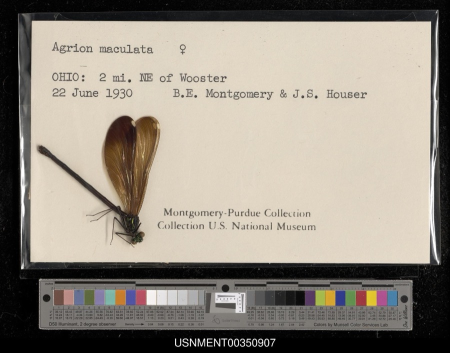 | Calopteryx maculata (Palisot de Beauvois, 1807) | 1930 | B. Montgomery & J. Houser | 2 miles northeast of Wooster |
 | Aster ciliolatus Lindl. | 1877 | Thorne, B.H. | Station Farm, Wooster |
 | Alasmidonta viridis (Rafinesque, 1820) | 1883 | Sterki, Victor | Burton City |
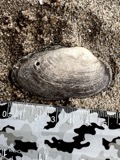 | Anodontoides ferussacianus (I.Lea, 1834) | 1883 | Sterki, Victor | Burton City(ditch in), Newman Creek & Tuscarawas River(ditch to) |
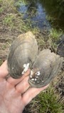 | Lampsilis radiata (Gmelin, 1791) | 1883 | Sterki, Victor | Burton City |
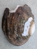 | Lasmigona complanata (Barnes, 1823) | 1883 | Sterki, Victor | Burton City(ditch in), Newman Creek & Tuscarawas River(ditch to) |
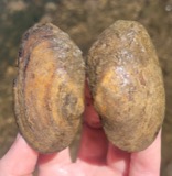 | Lasmigona compressa (I.Lea, 1829) | 1883 | Sterki, Victor | Burton City(ditch in) |
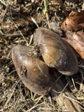 | Pyganodon grandis (Say, 1829) | 1883 | Sterki, Victor | Burton City(ditch in), Newman Creek & Tuscarawas River(ditch to) |
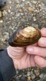 | Strophitus undulatus (Say, 1817) | 1883 | Sterki, Victor | Burton City(ditch in), Newman Creek & Tuscarawas River(ditch to) |
 | Chelidon Forster, 1817 | 1889 | Hine, J. S. (James Stewart) | Wooster, Wayne, Ohio, USA |
 | Agelaius phoeniceus phoeniceus (Linnaeus, 1766) | 1890 | Harry C. Oberholser | Wooster |
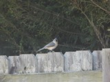 | Baeolophus bicolor (Linnaeus, 1766) | 1890 | Harry C. Oberholser | Wooster |
All 2,034 specimens within 10 miles, at the Global Biodiversity Information Facility.
Regional context, not property-specific evidence. The federal mineral resources record lists 1 working within 5 miles of Schantz Organ Company: 1 producer. All of them still produce. What was taken out: Clay. Distance is straight-line from the map coordinates, so a quarry counted here may appear on a neighbouring settlement's page as well.
| Where | Site | Commodity | Status | Recorded |
|---|---|---|---|---|
| Orrville Tile Co Pit | Clay | Producer |
Regional context, not property-specific evidence. The National Weather Service names Orrville, the town this property stands in, in 23 storm reports between 1997 and 2024: 14 thunderstorm wind, 6 hail, 3 flash flood. No death or injury is recorded in these reports. Each account below is quoted exactly as the forecast office filed it, from the NOAA Storm Events Database, and each date opens the federal record of that event.
| When | Event | Place named | Harm | What the report says |
|---|---|---|---|---|
| August 2024 | Flash Flood | Orrville | $250,000 | Reports of multiple basements flooded and street flooding with stranded vehicles in Orrville. |
| July 2018 | Thunderstorm Wind | Orrville | $50,000 | Thunderstorm winds downed at least 16 trees and many large limbs in the Orville area. One home had a window blown out as well. Scattered power outages were reported. |
| April 2002 | Thunderstorm Wind | Orrville | $35,000 | A large tree was blown down by strong thunderstorm winds. The tree landed on a home and caused significant roof and structural damage. |
| August 2024 | Flash Flood | Orrville | $25,000 | House flooding on Jefferson Street in Orrville, two residents were trapped requiring rescue. |
| June 2000 | Thunderstorm Wind | Orrville | $20,000 | Thunderstorm winds downed up to two dozen trees and snapped six power poles two miles south of Dalton. One of the fallen trees destroyed a garage and a second damaged a house. |
| August 2024 | Flash Flood | Orrville | $10,000 | Car stranded in flooded roadway on Pine Street in Orrville, requiring water rescue. |
| June 2014 | Thunderstorm Wind | Orrville | $8,000 | Thunderstorm winds downed several trees. |
| March 2017 | Thunderstorm Wind | Orrville | $5,000 | Thunderstorm winds tore some siding off of a residence. |
| July 2017 | Thunderstorm Wind | Orrville | $5,000 | Thunderstorm winds downed a few trees in Orrville. |
| June 2011 | Thunderstorm Wind | Orrville | $5,000 | Thunderstorm winds downed a few trees. |
| July 1997 | Thunderstorm Wind | Orrville | $5,000 | no account filed |
| August 2007 | Thunderstorm Wind | Orrville | $4,000 | Two trees were reported down. |
| July 1997 | Thunderstorm Wind | Orrville | $3,000 | no account filed |
| July 2005 | Thunderstorm Wind | Orrville | $2,000 | A few large limbs and power lines were reported down. |
| June 1998 | Thunderstorm Wind | Orrville | $2,000 | Several trees were downed. |
| May 2018 | Thunderstorm Wind | Orrville | $1,000 | Thunderstorm winds downed a tree and some large limbs. |
| August 2013 | Hail | Orrville | $1,000 | A trained spotter reported quarter size hail 1 mile north of Orrville. |
| August 2019 | Thunderstorm Wind | Orrville | - | There were several trees on power lines. |
| May 2014 | Hail | Orrville | - | Hail as large as quarters covered the ground. |
| May 2012 | Hail | Orrville | - | Nickel sized hail was observed. |
| May 2011 | Hail | Orrville | - | Thunderstorms produced nickel size hail. |
| July 2005 | Hail | Orrville | - | Penny size hail was observed. |
| August 2003 | Hail | Orrville | - | Quarter size hail was observed. |
No historic map-sheet match is published for this property yet. That does not mean no map exists. This record needs a coordinate-quality review before it can be joined to a sheet boundary. Browse the county's mapped places while that work is pending.
Other National Register properties close enough to walk or drive between, ordered by distance from this one. Both positions come from the same geocoding pass that matched these properties to their map sheets.
| Photograph | Property | Distance | Listed |
|---|---|---|---|
| Smith Orr Homestead | 0.6 miles | 2011 | |
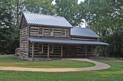 | Barnet-Hoover Log House | 2.3 miles | 1974 |
| Green Township High School | 5.3 miles | 2013 | |
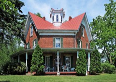 | Zimmerman, Ezekiel B., Octagon House | 6.1 miles | 1975 |
| National Archives record | The nomination case file for reference 100006818 in Record Group 79. |
| Wayne County | All 18 listed properties in this county. |