Listed on the National Register of Historic Places in
1975. A historic map-sheet match is not published yet. The record needs a coordinate-quality review before it can be joined to a sheet boundary.
From the record
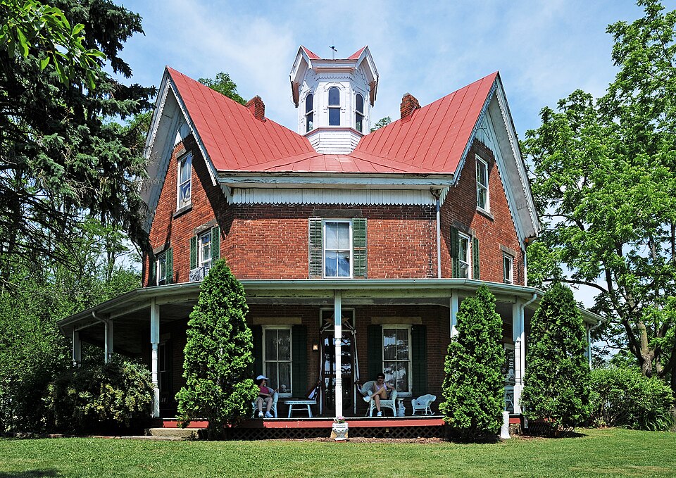
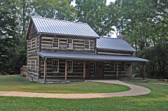
“The Zimmerman Bury Octagon House is an historic octagonal house located in Marshallville, Ohio.”
Wikipedia article Ezekiel B. Zimmerman Octagon House, CC BY-SA 4.0.
one of 18 National Register listings in Wayne County · listed in 1975 · category: Building.
National Register reference number.75001553- the number the National Park Service assigned this property when it was listed, and the key its nomination file is catalogued under at the National Archives.
Fires near this property
1 since 2002
Regional context, not property-specific
evidence. The
federal wildfire occurrence database
lists 1 fire within 5 miles of Zimmerman, Ezekiel B., Octagon House between
2002 and 2002, burning about 0 acres in total. None started naturally. None was recorded as arson.
Distance is straight-line from the map coordinates, so a fire counted
here may appear on a neighbouring settlement's page as well.
Reported cause
Fires
Missing data/not specified/undetermined
1
The most recent of
them, most recent first, with the day each was reported and the service
that recorded it.
Regional context, not property-specific
evidence. Museums hold 260 specimens
collected within 10 miles of Zimmerman, Ezekiel B., Octagon House between 1883 and
1975: 224 Animalia, 27 Plantae, 7 Fungi, 2 Chromista. 12 distinct Species records are shown.
Collected by A C ALLEN, Bruce Fink, Bruce, J. A. and others. Each is a
physical object with a catalogue
number, and each entry opens the museum's record. This is what was
collected and kept, not a survey of what lives here - nothing can be
concluded from a species being absent.
Regional context, not property-specific
evidence. The federal mineral resources record lists
1 working within 5 miles of Zimmerman, Ezekiel B., Octagon House: 1 plant.
All of them still produce. What was taken out: Sand and Gravel, Construction. Distance is straight-line from the
map coordinates, so a quarry counted here may appear on a neighbouring
settlement's page as well.
Regional context, not property-specific
evidence. The National Weather Service names
Marshallville, the town this property stands in, in 9 storm reports between 1996 and 2024: 7 thunderstorm wind, 2 hail.
No death or injury is recorded in these reports. Each account below is quoted exactly as the forecast office
filed it, from the NOAA Storm Events Database, and each date
opens the federal record of that event.
A trained weather spotter reported thunderstorm winds brought down a 1 to 2 foot diameter tree near Route 57 and Pleasant Home Road. Additional reports were received via social media of several large tree limbs down in Marshallville.
No historic map-sheet match is published
for this property yet. That does not mean no map exists. This record needs
a coordinate-quality review before it can be joined to a sheet boundary.
Browse the county's mapped places while that work is
pending.
From the nomination file
2,085 words on record
When this property was proposed for the
National Register, someone wrote the case for it: what the building is,
and why it matters. That document is a federal record in the public domain.
It is quoted below word for word, never summarised. The text was read off the scanned case file by machine, so the
occasional stray character is the recogniser's and the 1970s
typewriter's.
Description of the property
On the ground floor a wooden porch extends around four sides, with form of the main roof. Originally there were four chimneys, of which three remain. On the east side of the house is a wooden one-room letion of the house. The rooms of the first floor are arranged in a radiating plan leads, in a clockwise direction, to the front parlor (or library), a side a back parlor, and the dining room which connects again with the addition, and there is another kitchen entrance from the back parlor. The woodwork is cherry with late nineteenth century carved designs. added under the stairs on the first floor. The second floor has four bedrooms connected by the center hall, and a large triangular bathroom rooms, one on either side. The woodwork is some sort of fruit wood and very simple in design.
of the cupola can be seen between the chimneys which bend at an angle. central furnace was installed in 1896. With the exception of the lavatory CONDITION Excellent One chimney was removed at the floor level to support a large water The central stairwell is square in shape and has masonry bearing at the edges. At the center there is an octagonal cupola with a round- standing seams, and creates its own gutter system by curving upward addition, there have been no important alterations to the building.
dows have plain horizontal stone lintels.The roof has four gables, cupola.The exterior walls are three bricks thick, and more than This is an eight-sided red brick house in the Octagon mode, with walls.The spiral stairway goes up to the attic.A small lavatory was characteristic Eastlake incised ornament and brackets.The floor has There is wainscoting in the dining room. 99,0o0 bricks were used, all of which were made on the property. house.
The Zimmerman house is a rare and unusual variant of the Octagon mode. Built almost twenty years after the height of the to make it virtually unique. The builder Ezekiel B. Zimmerman was designed the house himself. his family from Pennsylvania to Chippewa Township in 1812 at the and attended Smithville Academy. He later received a certificate after completing a correspondence course from the Chautauqua owned approximately 320 acres at the location where the house was to be built, at the time of his death in 1876. It is believed that Zim- merman and a local carpenter planned the house, consulting only an architectural book. The floor plan is basically the one described in Section V of Orson Fowler's A Home for All. The "beautifully outbuildings shortly thereafter.
and planting rare and imported trees. He also served as a Chippewa electricity from a Delco Electric Plant. restoration by the present owners. 1883 Communications Architecture Transportation Commerce REGISTER Theater losophy SIGNIFICANCE Religion/Phi RECEIVED Aboriginal Conservation Zimmerman was a progressive farmer, building a greenhouse itarian Agriculture Music remained in the Zimmerman family until 1973.It is undergoing Sculpture Political age of four.
In 1843 he married his second wife Rachel (Rebecca fashion was past, its four steep gables and Eastlake ornament seem the first in the area to have central heating, installed in 1896,and Correspondence School.He married Frances Hessin 1877.His father Ezekiel B.was born in 1848.The son graduated from high school After passing to his second son Ernest in 1937,the house Social/Human Zimmerman's father, Ezekiel Zimmerman, was brought with Township trustee and as a school director, was a member of the Urban Plaming an unusually enterprising and well-educated man, and apparently according to the county marriage records) Ann McClellan, and Baptist Church and a Republican in politics.
Quoted from the National Register nomination
for reference 75001553, 11 pages, held by the National Archives in Record
Group 79. See the
catalogue record.
Listed places nearby
6 within 8 miles
Other National Register properties close
enough to walk or drive between, ordered by distance from this one. Both
positions come from the same geocoding pass that matched these properties
to their map sheets.
Listing record. National Park Service National Register of Historic Places, listed-properties dataset, current to 2026-05-22.
Map join. Address geocoded through the United States Census geocoder, then tested against the published boundary of every sheet in the USGS Historical Topographic Map Collection.
How this page is made. Listing fields come from federal records; map-sheet coverage is a labelled coordinate-to-boundary calculation, not a source-field claim.
Wildfire. Short, Karen C. 2022. Spatial wildfire occurrence data for the United States, 1992-2020 [FPA_FOD_20221014]. 6th Edition. Fort Collins, CO: Forest Service Research Data Archive. https://doi.org/10.2737/RDS-2013-0009.6 Collected with United States Government funding and usable without additional permissions or fees.
Specimens. Global Biodiversity Information Facility (GBIF), https://www.gbif.org/. Only records licensed CC0 or CC BY are used. Records licensed CC BY-NC are excluded because this site carries advertising. Images are checked individually and any whose licence is non-commercial, no-derivatives or unreadable is refused.
Mines and quarries. USGS Mineral Resources Data System (MRDS) https://mrdata.usgs.gov/mrds/ A work of the United States government, no copyright under 17 U.S.C. 105.
Storms. NOAA National Centers for Environmental Information, Storm Events Database https://www.ncei.noaa.gov/stormevents/ A work of the United States government, no copyright under 17 U.S.C. 105. Narratives are quoted verbatim from the National Weather Service report and are not edited or summarised.
 Block
Block