 Block
BlockFrom the record
one of 117 National Register listings in Montgomery County · listed in 2015 · category: Building · one of 4 National Historic Landmarks in Montgomery County.
Sources: the National Register database, National Park Service
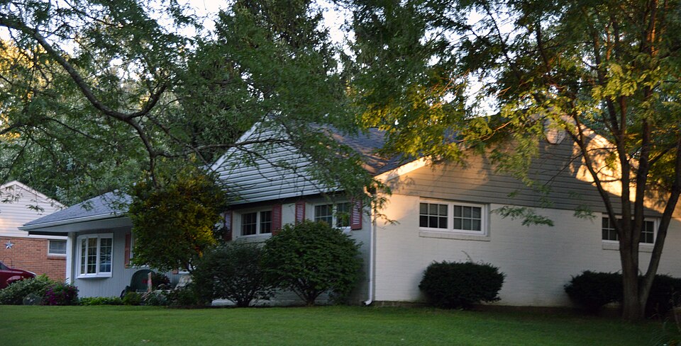
Listed on the National Register of Historic Places in 2015. A historic map-sheet match is not published yet. The record needs a coordinate-quality review before it can be joined to a sheet boundary.
one of 117 National Register listings in Montgomery County · listed in 2015 · category: Building · one of 4 National Historic Landmarks in Montgomery County.
Sources: the National Register database, National Park Service
The chapter on Washington Township in The History of Montgomery County, Ohio, Containing a History of the County;, published 1882 names Centerville. This is what it says, exactly as the scans read.
The settlement having been established in Washington Township, were soon others to recognize the fertility and advantages of the place, ai the course of a very few years, many families were located in the vicin: the present town of Centerville.
Passage source: The History of Montgomery County, Ohio, Containing a History of the County;, published 1882.
In October, 1815, a meeting of the respectable gentlemen of the con was called at the house of John Archer, Centerville, to discuss the feasihi of establishing a woolen and cotton factory on Hole' s Creek. Books for st subscription were opened immediately after the meeting, and, January 1816, the trustees met at the same place to elect a superintendent and let c tracts for building the factory, digging the race, making the dam and for ir wright work.
Passage source: The History of Montgomery County, Ohio, Containing a History of the County;, published 1882.
Machine-read from a century-old scan, so expect the errors a machine makes: misspelled names, dropped words, stray characters.
Read the whole chapter on Washington Township - 25,756 words on its settlement, mills, schools and churches.
Regional context, not property-specific evidence. Museums hold 305 specimens collected within 10 miles of Bombeck, Erma, House between 1836 and 1975: 164 Animalia, 84 Plantae, 52 Fungi, 4 Chromista, 1 Protozoa. 12 distinct Species records are shown. Collected by A JOHN, A JOHN AND W E DUELLMAN, A. E. Foeerste and others. Each is a physical object with a catalogue number, and each entry opens the museum's record. This is what was collected and kept, not a survey of what lives here - nothing can be concluded from a species being absent.
| Image | Species | Year | Collected by | Where, as recorded |
|---|---|---|---|---|
 | Ambrosia artemisiifolia L. | 1881 | Foerste AF | |
 | Geaster limbatus Fr. | 1883 | A. E. Foeerste | Dayton |
 | Platanthera leucophaea (Nutt.) Lindl. | 1836 | C. W. Short | Dayton |
 | Hydrophyllum macrophyllum Nutt. | 1838 | J. W. Van Cleve | Dayton |
 | Cardamine L. | 1839 | Sanders, Alfred; J.J. Nagel, J.G. Haupt. | Dayton. 1 mile east. |
 | Cassia marilandica L. | 1839 | Sanders, Alfred | Dayton |
 | Cynoglossum officinale L. | 1839 | not recorded | Dayton. Suburbs E. |
 | Iris versicolor L. | 1839 | not recorded | Dayton. 2 mi. south |
 | Nuphar advena (Aiton) Aiton | 1839 | Sanders, Mrs.; J.G. Haupt | Dayton |
 | Podophyllum peltatum L. | 1839 | Nagel, J.J.; J.G. Haupt | Dayton. 1 m. SE |
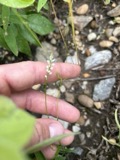 | Polygala verticillata L. | 1839 | Sanders, Alfred [?] | 1 mile SE of Dayton |
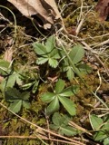 | Potentilla canadensis L. | 1839 | not recorded | Dayton. 1 mile south. |
All 305 specimens within 10 miles, at the Global Biodiversity Information Facility.
Regional context, not property-specific evidence. The federal mineral resources record lists 3 workings within 5 miles of Bombeck, Erma, House: 2 producers, 1 past producer. 2 still produce. What was taken out: Sand and Gravel, Construction. Distance is straight-line from the map coordinates, so a quarry counted here may appear on a neighbouring settlement's page as well.
| Where | Site | Commodity | Status | Recorded |
|---|---|---|---|---|
| Broadway Sand & Gravel Co. Pit #2 | Sand and Gravel, Construction | Producer | ||
| Pyper Pit | Sand and Gravel, Construction | Past Producer | Sedimentary | |
| Pyper Pit | Sand and Gravel, Construction | Producer |
Regional context, not property-specific evidence. The National Weather Service names Centerville, the town this property stands in, in 29 storm reports between 1995 and 2025: 15 thunderstorm wind, 11 hail, 2 flood, 1 tornado. No death or injury is recorded in these reports. Each account below is quoted exactly as the forecast office filed it, from the NOAA Storm Events Database, and each date opens the federal record of that event.
| When | Event | Place named | Harm | What the report says |
|---|---|---|---|---|
| April 2003 | Thunderstorm Wind | Centerville | $50,000 | A microburst producing winds of 70 to 75 mph did significant damage to a few trailers. Several homes sustained siding damage, and numerous trees were knocked down. A 30-foot tower was also downed. |
| April 2025 | Tornado (EF0) | Centerville | $20,000 | The tornado initially developed just east of State Route 48 in Warren County, at 2358EST, April 2nd. The tornado moved northeast and entered Montgomery County at 2359 EST, just south of Elk Creek Drive. As the tornado moved northeast across far southeast Montgomery County, it cause sporadic tree damage. More large trees were uprooted and damaged along a portion of East Social Row Road, east of Mount Holly Avenue. Tree damage was also noted farther to the northeast near and along Nutt Road and Clyo Road, where the tornado dissipated at 0001EST, April 3rd. |
| September 2000 | Thunderstorm Wind | Centerville | $15,000 | Thunderstorm winds gusted to 63 mph in Dayton knocking down many trees. Trees were also knocked down in Centerville. |
| April 2015 | Thunderstorm Wind | Centerville | $10,000 | About a dozen trees were downed and a flag pole bent. |
| July 2011 | Thunderstorm Wind | Centerville | $5,000 | Several large limbs, trees, and power lines were reported down due to damaging thunderstorm winds. The spotter estimated the wind gust. |
| July 2003 | Thunderstorm Wind | Centerville | $5,000 | Several large trees up to 15 inches in diameter were downed across the southern and eastern Dayton suburbs. A few homes sustained minor damage from falling trees near Farmersville. |
| July 1999 | Thunderstorm Wind | Centerville | $5,000 | Numerous trees knocked down. |
| April 2002 | Hail | Centerville | $5,000 | no account filed |
| May 2004 | Thunderstorm Wind | Centerville | $3,000 | Trees and power lines were knocked down. |
| July 2003 | Thunderstorm Wind | Centerville | $3,000 | Trees were downed. |
| July 1995 | Thunderstorm Wind | Centerville | $3,000 | Power lines and trees were blown down. |
| June 1996 | Thunderstorm Wind | Centerville | $3,000 | no account filed |
| June 2015 | Thunderstorm Wind | Centerville | $2,000 | A three foot diameter tree knocked down a power pole. |
| July 2015 | Thunderstorm Wind | Centerville | $2,000 | A tree fell onto a house. |
| March 2007 | Flood | Centerville | $2,000 | Diamond Hill and Social Row Roads were flooded. |
| June 2022 | Thunderstorm Wind | Centerville | $1,000 | A 13 to 14 inch diameter tree was downed. |
| July 2013 | Thunderstorm Wind | Centerville | $1,000 | Two trees were downed near Spring Valley Road and Clyo Road due to thunderstorm winds. |
| December 2013 | Thunderstorm Wind | Centerville | $1,000 | A tree was downed on State Route 48 near Nutt Road due to thunderstorm winds. |
| July 2007 | Hail | Centerville | $1,000 | no account filed |
| June 2009 | Hail | Centerville | - | Several reports of hail came in from spotters and a NWS employee. Hail of 2 inches fell south of Centerville. Seven minutes later, 1.5 inch hail was reported south of Miamisburg. |
| June 2006 | Flood | Centerville | - | Roads were flooded throughout Washington Township. |
| July 1995 | Hail | Centerville | - | Power lines and trees were blown down. |
| April 2025 | Hail | Centerville | - | no account filed |
| April 2025 | Hail | Centerville | - | no account filed |
| July 2015 | Hail | Centerville | - | no account filed |
| August 2012 | Hail | Centerville | - | no account filed |
| May 2011 | Hail | Centerville | - | no account filed |
| June 2009 | Hail | Centerville | - | no account filed |
| April 2006 | Hail | Centerville | - | no account filed |
No historic map-sheet match is published for this property yet. That does not mean no map exists. This record needs a coordinate-quality review before it can be joined to a sheet boundary. Browse the county's mapped places while that work is pending.
Other National Register properties close enough to walk or drive between, ordered by distance from this one. Both positions come from the same geocoding pass that matched these properties to their map sheets.
| Photograph | Property | Distance | Listed |
|---|---|---|---|
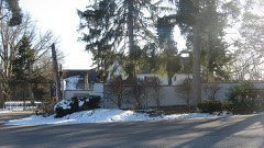 | Skywood Farms | 1.6 miles | 1996 |
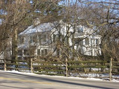 | Fox Hollow | 2.3 miles | 2006 |
| Kellog, Ethol, House | 2.7 miles | 1976 | |
 | Watkins House | 2.9 miles | 1974 |
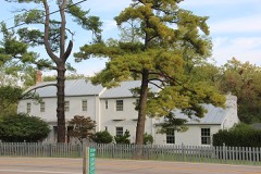 | Pease Homestead | 3.6 miles | 1980 |
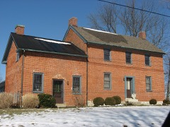 | Bradford, Robert, House | 3.8 miles | 1979 |
| National Archives record | The nomination case file for reference 15000043 in Record Group 79. |
| Montgomery County | All 117 listed properties in this county. |