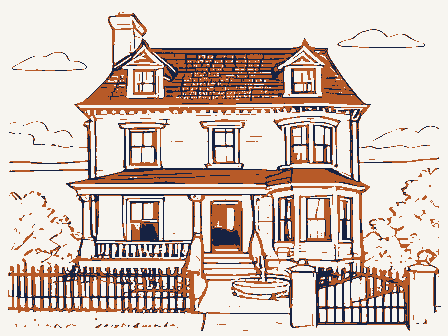
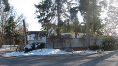
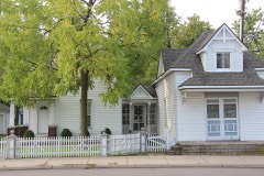
Listed on the National Register of Historic Places in
1976. A historic map-sheet match is not published yet. The record needs a coordinate-quality review before it can be joined to a sheet boundary.
From the record
one of 117 National Register listings in Montgomery County · listed in 1976 · category: Building · one of 4 National Historic Landmarks in Montgomery County.
National Register reference number.76001498- the number the National Park Service assigned this property when it was listed, and the key its nomination file is catalogued under at the National Archives.
The settlement having been established in Washington Township, were soon others to recognize the fertility and advantages of the place, ai the course of a very few years, many families were located in the vicin: the present town of Centerville.
In October, 1815, a meeting of the respectable gentlemen of the con was called at the house of John Archer, Centerville, to discuss the feasihi of establishing a woolen and cotton factory on Hole' s Creek. Books for st subscription were opened immediately after the meeting, and, January 1816, the trustees met at the same place to elect a superintendent and let c tracts for building the factory, digging the race, making the dam and for ir wright work.
Regional context, not property-specific
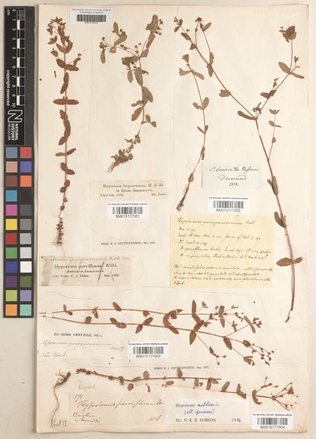
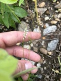
evidence. Museums hold 409 specimens
collected within 10 miles of Kellog, Ethol, House between 1835 and
1975: 254 Animalia, 86 Plantae, 60 Fungi, 4 Protozoa, 4 Chromista, 1 Unrecorded. 12 distinct Species records are shown.
Collected by A JOHN, A JOHN AND W E DUELLMAN, A. E. Foeerste and others. Each is a
physical object with a catalogue
number, and each entry opens the museum's record. This is what was
collected and kept, not a survey of what lives here - nothing can be
concluded from a species being absent.
Regional context, not property-specific
evidence. The federal mineral resources record lists
3 workings within 5 miles of Kellog, Ethol, House: 3 producers.
All of them still produce. What was taken out: Sand and Gravel, Construction. Distance is straight-line from the
map coordinates, so a quarry counted here may appear on a neighbouring
settlement's page as well.
Regional context, not property-specific
evidence. The National Weather Service names
Centerville, the town this property stands in, in 29 storm reports between 1995 and 2025: 15 thunderstorm wind, 11 hail, 2 flood, 1 tornado.
No death or injury is recorded in these reports. Each account below is quoted exactly as the forecast office
filed it, from the NOAA Storm Events Database, and each date
opens the federal record of that event.
A microburst producing winds of 70 to 75 mph did significant damage to a few trailers. Several homes sustained siding damage, and numerous trees were knocked down. A 30-foot tower was also downed.
The tornado initially developed just east of State Route 48 in Warren County, at 2358EST, April 2nd. The tornado moved northeast and entered Montgomery County at 2359 EST, just south of Elk Creek Drive. As the tornado moved northeast across far southeast Montgomery County, it cause sporadic tree damage. More large trees were uprooted and damaged along a portion of East Social Row Road, east of Mount Holly Avenue. Tree damage was also noted farther to the northeast near and along Nutt Road and Clyo Road, where the tornado dissipated at 0001EST, April 3rd.
Several large trees up to 15 inches in diameter were downed across the southern and eastern Dayton suburbs. A few homes sustained minor damage from falling trees near Farmersville.
Several reports of hail came in from spotters and a NWS employee. Hail of 2 inches fell south of Centerville. Seven minutes later, 1.5 inch hail was reported south of Miamisburg.
No historic map-sheet match is published
for this property yet. That does not mean no map exists. This record needs
a coordinate-quality review before it can be joined to a sheet boundary.
Browse the county's mapped places while that work is
pending.
From the nomination file
1,315 words on record
When this property was proposed for the
National Register, someone wrote the case for it: what the building is,
and why it matters. That document is a federal record in the public domain.
It is quoted below word for word, never summarised. The text was read off the scanned case file by machine, so the
occasional stray character is the recogniser's and the 1970s
typewriter's.
Description of the property
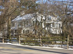
The rectangular windows are 1/1 double CONDITION square louvers in the gable, so typical of Ohio Federal buildings. sills. side lights, and transom. CHECK ONE verge project been demolished. hung sash with flat brick arches with radiating voussoirs and wood What remains of the trim is handsomely panelled Federal. left rear,a frame addition or porch in the reentrant angle has The six course American bond brick ends have the small The typical L plan Federal farmhouse sits on a rough cut The central hall plan interior has been heavily vandalized. _EXCELLENT _UNEXPOSED XUNALTERED _FAIR -RUINS coursed stone foundation. with frieze.
The asphalt shingle gable roof has brick faces east with a central doorway that has a panelled frame, wing with interior end chimney to the right (north) rear.To the The five bay facade of Flemish bond AREAS OF
Statement of significance
great-great-grandfather was a founder of Norwalk, Connecticut in Seth Kellog, a Revolutionary War veteran of the English raids Road (Yankee Street). Ethol, Seth's son, born in 1781, is listed supervisor of highways (1810, 1818 and 1826), judge (1814 and 1816), INVENTION ART ECONOMICS years. EDUCATION PERIOD BUILDER/ARCHITECT POLITICS/GOVERNMENT SIGNIFICANCE AGRICULTURE ARCHEOLOGY-HISTORIC LAW SCIENCE RELIGION INDUSTRY _PREHISTORIC MILITARY XEXPLORATION/SETTLEMENT LITERATURE _ENGINEERING -1700-1799 land is being held in speculation of rapidly encroaching suburban This Federal style farmhouse is a relic of the first settlers prestige to encourage preservation, it will soon be gone.
Ethol Kellog, he served the township on occasion and was the first _CONSERVATION _TRANSPORTATION _1500-1599 William Maxwell was already an experienced farmer in 1832.He _1400-1499 _COMMUNICATIONS and moved further west to Lafayette, Indiana. with his wife and five children in agriculture and manufacture(?) in _THEATER school district #8 (l830).The family sold out to Will Maxwell -MUSIC - 1900- SPECIFIC DATES development and the house was once offered to the Fire Department occupied this land for thirty-six years. While not as active as 1651. the Yankee Street intersection to be redesigned with ominous possibi- lities. for practice.
of Washington Township and Montgomery County.The untended farm chairman of the Centerville Cemetery Meeting in 1867.It is Unless this historic house is protected and given enough Heavy traffic on State Route 725 to the north is causing migrated to New England in the sixteenth century.Ethol Kellog's Two brothers of the Kellog Family of ancient English lineage the 1820 census.Ethol Kellog was very active in Washington Township C.1820
Quoted from the National Register nomination
for reference 76001498, 11 pages, held by the National Archives in Record
Group 79. See the
catalogue record.
Listed places nearby
6 within 8 miles
Other National Register properties close
enough to walk or drive between, ordered by distance from this one. Both
positions come from the same geocoding pass that matched these properties
to their map sheets.
Listing record. National Park Service National Register of Historic Places, listed-properties dataset, current to 2026-05-22.
Map join. Address geocoded through the United States Census geocoder, then tested against the published boundary of every sheet in the USGS Historical Topographic Map Collection.
How this page is made. Listing fields come from federal records; map-sheet coverage is a labelled coordinate-to-boundary calculation, not a source-field claim.
Specimens. Global Biodiversity Information Facility (GBIF), https://www.gbif.org/. Only records licensed CC0 or CC BY are used. Records licensed CC BY-NC are excluded because this site carries advertising. Images are checked individually and any whose licence is non-commercial, no-derivatives or unreadable is refused.
Mines and quarries. USGS Mineral Resources Data System (MRDS) https://mrdata.usgs.gov/mrds/ A work of the United States government, no copyright under 17 U.S.C. 105.
Storms. NOAA National Centers for Environmental Information, Storm Events Database https://www.ncei.noaa.gov/stormevents/ A work of the United States government, no copyright under 17 U.S.C. 105. Narratives are quoted verbatim from the National Weather Service report and are not edited or summarised.
 Block
Block