 Block
BlockFrom the record
one of 500 National Register listings in Worcester County · listed in 2016 · category: Building · one of 1 National Historic Landmarks in Worcester County.
Sources: the National Register database, National Park Service

Listed on the National Register of Historic Places in 2016. A historic map-sheet match is not published yet. The record needs a coordinate-quality review before it can be joined to a sheet boundary.
one of 500 National Register listings in Worcester County · listed in 2016 · category: Building · one of 1 National Historic Landmarks in Worcester County.
Sources: the National Register database, National Park Service
Regional context, not property-specific evidence. The federal wildfire occurrence database lists 67 fires within 5 miles of Barnes--Hill House between 2015 and 2020, burning about 42 acres in total. None started naturally. 8 were recorded as arson. Distance is straight-line from the map coordinates, so a fire counted here may appear on a neighbouring settlement's page as well.
| Reported cause | Fires |
|---|---|
| Debris and open burning | 23 |
| Recreation and ceremony | 18 |
| Arson/incendiarism | 8 |
| Equipment and vehicle use | 5 |
| Smoking | 5 |
| Missing data/not specified/undetermined | 4 |
| Railroad operations and maintenance | 2 |
| Power generation/transmission/distribution | 1 |
| Misuse of fire by a minor | 1 |
The most recent of them, most recent first, with the day each was reported and the service that recorded it.
| Date | Cause | Size | Reported by | Name on the report |
|---|---|---|---|---|
| 2 September 2015 | Recreation and ceremony | under an acre | Massachusetts Bureau of Forest Fire Control | not named |
| 1 September 2020 | Smoking | under an acre | Massachusetts Bureau of Forest Fire Control | not named |
| 1 September 2017 | Debris and open burning | under an acre | Massachusetts Bureau of Forest Fire Control | not named |
| 31 August 2015 | Equipment and vehicle use | under an acre | Massachusetts Bureau of Forest Fire Control | not named |
| 31 August 2015 | Equipment and vehicle use | under an acre | Massachusetts Bureau of Forest Fire Control | not named |
| 24 August 2018 | Debris and open burning | under an acre | Massachusetts Bureau of Forest Fire Control | not named |
| 2 August 2020 | Missing data/not specified/undetermined | under an acre | Massachusetts Bureau of Forest Fire Control | not named |
| 3 July 2016 | Debris and open burning | under an acre | Massachusetts Bureau of Forest Fire Control | not named |
Regional context, not property-specific evidence. Museums hold 1,079 specimens collected within 10 miles of Barnes--Hill House between 1839 and 1975: 669 Plantae, 201 Animalia, 193 Fungi, 14 Unrecorded, 2 Protozoa. 12 distinct Species records are shown. Collected by A. A. Eaton, A. B. Seymour, A. B. Seymour et al. and others. Each is a physical object with a catalogue number, and each entry opens the museum's record. This is what was collected and kept, not a survey of what lives here - nothing can be concluded from a species being absent.
| Image | Species | Year | Collected by | Where, as recorded |
|---|---|---|---|---|
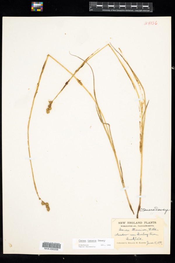 | Carex tenera var. tenera | 1899 | R. M. Harper | |
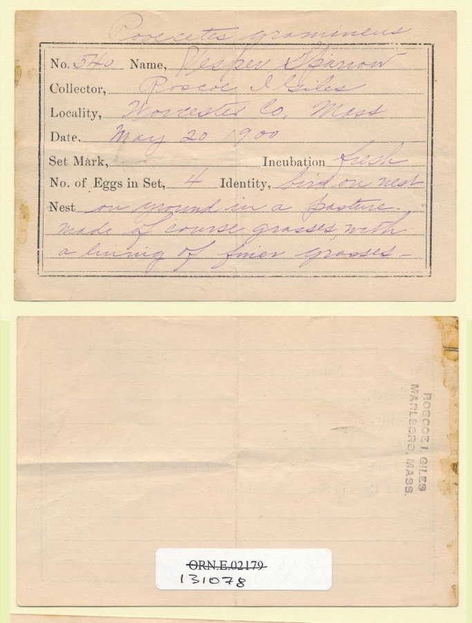 | Pooecetes gramineus gramineus (J.F.Gmelin, 1789) | 1900 | Roscoe I. Giles | |
 | Ochrolechia tartarea (L.) A.Massal. | 1839 | E. Tuckerman | |
 | Mycobilimbia hypnorum (Lib.) Kalb & Hafellner | 1848 | E. Tuckerman | |
 | Tamias striatus lysteri (Richardson, 1829) | 1848 | L Agassiz | PARSONS ISLAND |
 | Cladonia cornucopioides F.Wilson | 1850 | J. L. Russell | Leicester |
 | Carex aperta Boott | 1853 | W. Boott | Massachusetts |
 | Hygrophorus coccineus (Schaeff.) Fr. | 1856 | D. Murray; C. J. Sprague | [Presumably Massachusetts] |
| Opegrapha varia Pers. | 1856 | E. Tuckerman | ||
 | Aspidium acrostichoides (Michx.) Sw. | 1859 | M. S. Bebb | |
 | Acarospora schleicheri (Ach.) A.Massal. | 1862 | E. Hall | |
| Leucobryum vulgare Hampe | 1892 | unknown |
All 1,079 specimens within 10 miles, at the Global Biodiversity Information Facility.
Regional context, not property-specific evidence. The federal mineral resources record lists 6 workings within 5 miles of Barnes--Hill House: 6 past producers. None of them still produces. What was taken out: Sand and Gravel, Construction. Distance is straight-line from the map coordinates, so a quarry counted here may appear on a neighbouring settlement's page as well.
| Where | Site | Commodity | Status | Recorded |
|---|---|---|---|---|
| Highway Pit | Sand and Gravel, Construction | Past Producer | ||
| Highway Pit | Sand and Gravel, Construction | Past Producer | ||
| Kittredge Pit | Sand and Gravel, Construction | Past Producer | ||
| Lyford Road Pit | Sand and Gravel, Construction | Past Producer | ||
| Town of Spencer | Sand and Gravel, Construction | Past Producer | Sedimentary | |
| Vandale Pit | Sand and Gravel, Construction | Past Producer |
Regional context, not property-specific evidence. The National Weather Service names Spencer, the town this property stands in, in 28 storm reports between 1994 and 2025: 15 thunderstorm wind, 5 lightning, 5 hail, 2 flash flood. The reports record 2 injuries. Each account below is quoted exactly as the forecast office filed it, from the NOAA Storm Events Database, and each date opens the federal record of that event.
| When | Event | Place named | Harm | What the report says |
|---|---|---|---|---|
| September 2013 | Lightning | Spencer | 2 hurt | Lightning struck near a house on Bay Path Road. While several homeowners claimed to have experienced electrical problems with the lightning strike, firefighters found no damage within the houses. Two teenagers (one male, one female) outside manning a yard sale felt the lightning shock. One (male) declined transportation to the hospital, the other (female) was transported and kept overnight for observation. |
| June 2023 | Lightning | Spencer | $800,000 | Lightning caused a massive 6-alarm fire that destroyed a 160-year old church in Spencer, MA. The steeple of the First Congregational United Church came crashing down and this made national news. The rest of the building was destroyed. A detailed analysis of lightning strike data showed that one strike a little north of the church occurred at 2:24:47 PM EDT but a closer one occurred at 2:29:16 PM EDT. That was most likely the one that caused the blaze. No injuries were reported. Damage figure is estimated. |
| May 2006 | Lightning | Spencer | $100,000 | no account filed |
| June 2011 | Thunderstorm Wind | Spencer | $15,000 | A CoCoRaHS observer recorded a 60 mph wind gust on their home weather station. A trained spotter reported eight inch diameter limbs downed along Browning Pond Road at the same time. |
| May 2004 | Lightning | Spencer | $10,000 | no account filed |
| February 2016 | Thunderstorm Wind | Spencer | $5,000 | A two foot diameter tree and wires on Wilson Road in Spencer were downed by thunderstorm winds. |
| August 2016 | Thunderstorm Wind | Spencer | $5,000 | A tree on Chickering Road was downed onto wires by thunderstorm winds. |
| August 2015 | Thunderstorm Wind | Spencer | $5,000 | A tree on Chickering Road and Kingsbury Road was downed by thunderstorm winds. |
| June 2006 | Flash Flood | Spencer | $5,000 | no account filed |
| July 2020 | Thunderstorm Wind | Spencer | $3,800 | In Spencer, a tree was down on a house on Ash Street. Also, a tree was down on wires on School Street. |
| September 2018 | Thunderstorm Wind | North Spencer | $1,000 | At 2:37 PM EST, wind brought a large tree down on Browning Pond Road at the Oakham town line. |
| August 2009 | Thunderstorm Wind | Spencer | $1,000 | A piece of siding was blown off a house on Irving Street. |
| June 2008 | Thunderstorm Wind | Spencer | $1,000 | A one foot diameter tree on Greenville Street was downed by thunderstorm winds. |
| May 2025 | Thunderstorm Wind | Spencer | $800 | In Spencer, a tree was down on wires near Church St. |
| July 2019 | Flash Flood | South Spencer | - | More than three feet of street flooding occurred on South Spencer Road near the railroad overpass at Lyford Cross Road in Spencer, MA. The road was impassable. |
| July 2019 | Flood | Spencer | - | Pleasant Street in Spencer was flooded an impassable, with manhole covers popped off. |
| June 2017 | Hail | Spencer | - | At 256 PM EST, an amateur radio operator reported nickel-size hail at Spencer. |
| June 2017 | Hail | Spencer | - | At 258 PM EST, an amateur radio operator reported nickel-size hail covering the ground in Spencer. |
| August 2007 | Thunderstorm Wind | Spencer | - | Trees down in the North End of Spencer. |
| October 2007 | Thunderstorm Wind | Spencer | - | Wires were downed by thunderstorm winds in Spencer. |
| May 1994 | Thunderstorm Wind | Spencer | - | Several thunderstorms moved south-southeast through Franklin and Worcester Counties. These storms became severe in several communities. Large hail fell at scattered locations including one-inch diameter hail at the National Weather Service Office at the Worcester Municipal Airport. In some places, marble-size hail was reported covering the ground a half-hour after the storm had ended. A couple of school children reportedly received bruises on their arms from the hailstones. A National Weather Service damage survey in Spencer confirmed that trees one foot in diameter were uprooted by thunderstorm wind gusts. |
| May 2014 | Hail | Spencer | - | no account filed |
| June 2011 | Hail | Spencer | - | no account filed |
| June 2002 | Hail | Spencer | - | no account filed |
| July 1999 | Thunderstorm Wind | Spencer | - | no account filed |
| July 1999 | Lightning | Spencer | - | no account filed |
| July 1999 | Thunderstorm Wind | Spencer | - | no account filed |
| July 1998 | Thunderstorm Wind | Spencer | - | no account filed |
No historic map-sheet match is published for this property yet. That does not mean no map exists. This record needs a coordinate-quality review before it can be joined to a sheet boundary. Browse the county's mapped places while that work is pending.
Other National Register properties close enough to walk or drive between, ordered by distance from this one. Both positions come from the same geocoding pass that matched these properties to their map sheets.
| Photograph | Property | Distance | Listed |
|---|---|---|---|
| Pleasant Street School | 1.2 miles | 1996 | |
| Grove Street School | 1.5 miles | 1996 | |
| North Brookfield Town House | 3.7 miles | 2001 | |
| Foster, Jedediah, Homesite | 6.2 miles | 2013 | |
| Lumb, Thomas, Three-Decker | 6.8 miles | 1990 | |
| Quinsigamond Branch Library | 7.1 miles | 1980 |
| National Archives record | The nomination case file for reference 15001007 in Record Group 79. |
| Worcester County | All 500 listed properties in this county. |