BlockBefore
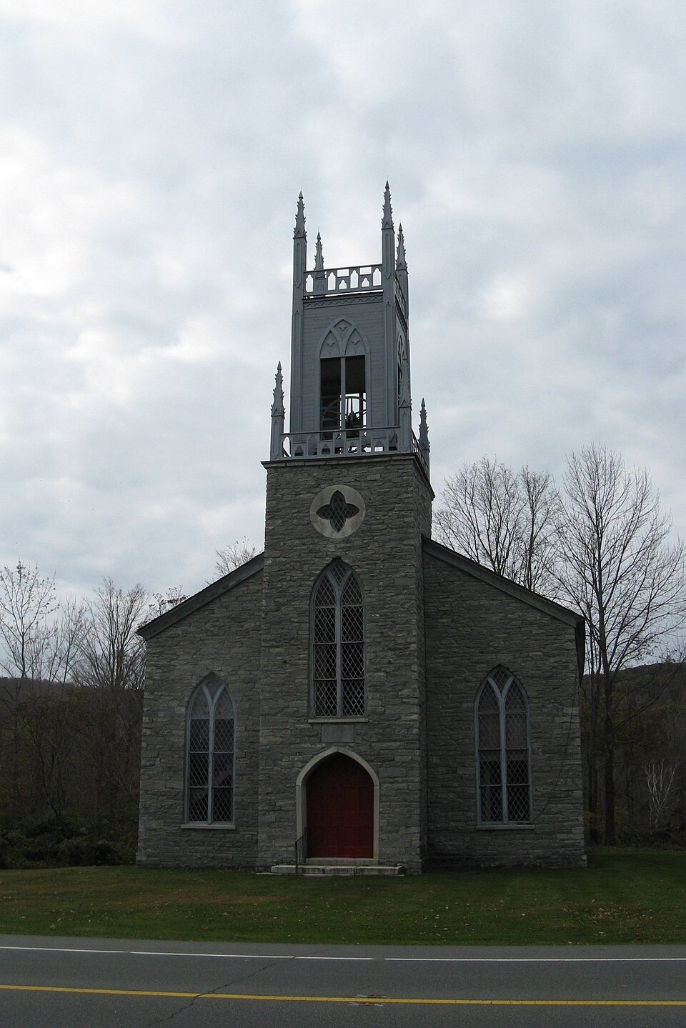
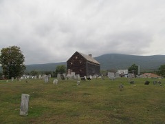
Photograph of St. Luke's Episcopal Church
Photograph by John Phelan, CC BY 3.0. Via Wikimedia Commons.

St. Luke's Episcopal Church

Listed on the National Register of Historic Places in 1972. A historic map-sheet match is not published yet. The record needs a coordinate-quality review before it can be joined to a sheet boundary.

From the record

“Luke's Episcopal Church is a historic church building on United States Route 7 in Lanesborough, Massachusetts. It is an early example of a stone Gothic Revival church, and only one of two surviving 19th century Gothic Revival church buildings in Berkshire County.”

Wikipedia article St. Luke's Episcopal Church (Lanesborough, Massachusetts), CC BY-SA 4.0.

one of 94 National Register listings in Berkshire County · listed in 1972 · category: Building · one of 1 National Historic Landmarks in Berkshire County.

Sources: the Wikipedia article · the case file at the National Archives · the National Register database, National Park Service · the Wikipedia article

The listing

  • What is counted as historic. The nomination lists 1 building as contributing to the listing.
  • Address. U.S. 7, Lanesborough, 01237
  • When was it listed? 1972-02-23
  • Category. building
  • Township. New Ashford town
  • Architectural style. Gothic Revival
  • National Register reference number. 72000127 - the number the National Park Service assigned this property when it was listed, and the key its nomination file is catalogued under at the National Archives.

Fires near this property

12 since 2008

Regional context, not property-specific evidence. The federal wildfire occurrence database lists 12 fires within 5 miles of St. Luke's Episcopal Church between 2008 and 2018, burning about 135 acres in total. 1 started naturally. None was recorded as arson. Distance is straight-line from the map coordinates, so a fire counted here may appear on a neighbouring settlement's page as well.

Reported cause Fires
Debris and open burning6
Missing data/not specified/undetermined2
Recreation and ceremony2
Equipment and vehicle use1
Natural1

The most recent of them, most recent first, with the day each was reported and the service that recorded it.

DateCause SizeReported by Name on the report
4 August 2017Naturalunder an acreMassachusetts Bureau of Forest Fire Controlnot named
13 June 2015Debris and open burningunder an acreMassachusetts Bureau of Forest Fire Controlnot named
22 May 2016Recreation and ceremony1.0 acresMassachusetts Bureau of Forest Fire Controlnot named
29 April 2015Debris and open burningunder an acreMassachusetts Bureau of Forest Fire Controlnot named
22 April 2018Equipment and vehicle useunder an acreMassachusetts Bureau of Forest Fire Controlnot named
19 April 2008Missing data/not specified/undetermined130 acresMassachusetts Bureau of Forest Fire ControlWIDOW WHITE PEAK
16 April 2016Recreation and ceremonyunder an acreMassachusetts Bureau of Forest Fire Controlnot named
14 April 2017Debris and open burningunder an acreMassachusetts Bureau of Forest Fire Controlnot named

Every fire recorded in Berkshire County

Specimens collected near this property

12 of 1,342 shown

Regional context, not property-specific evidence. Museums hold 1,342 specimens collected within 10 miles of St. Luke's Episcopal Church between 1828 and 1975: 580 Plantae, 531 Animalia, 214 Fungi, 9 Protozoa, 7 Unrecorded, 1 Chromista. 12 distinct Species records are shown. Collected by A K Harrison, A Schwartz, A. Cowee and others. Each is a physical object with a catalogue number, and each entry opens the museum's record. This is what was collected and kept, not a survey of what lives here - nothing can be concluded from a species being absent.

Image SpeciesYear Collected by Where, as recorded
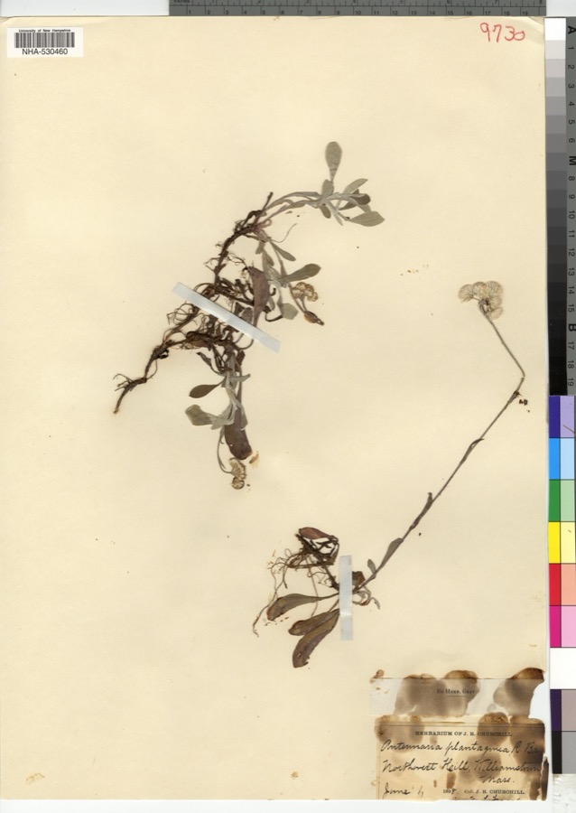
Specimen of Antennaria plantaginifolia (L.) Richardson, 1823Antennaria plantaginifolia (L.) Richardson, 18231898J. R. Churchill
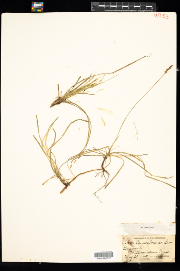
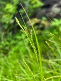
Specimen of Carex pensylvanica Lam.Carex pensylvanica Lam.1898J. R. Churchill
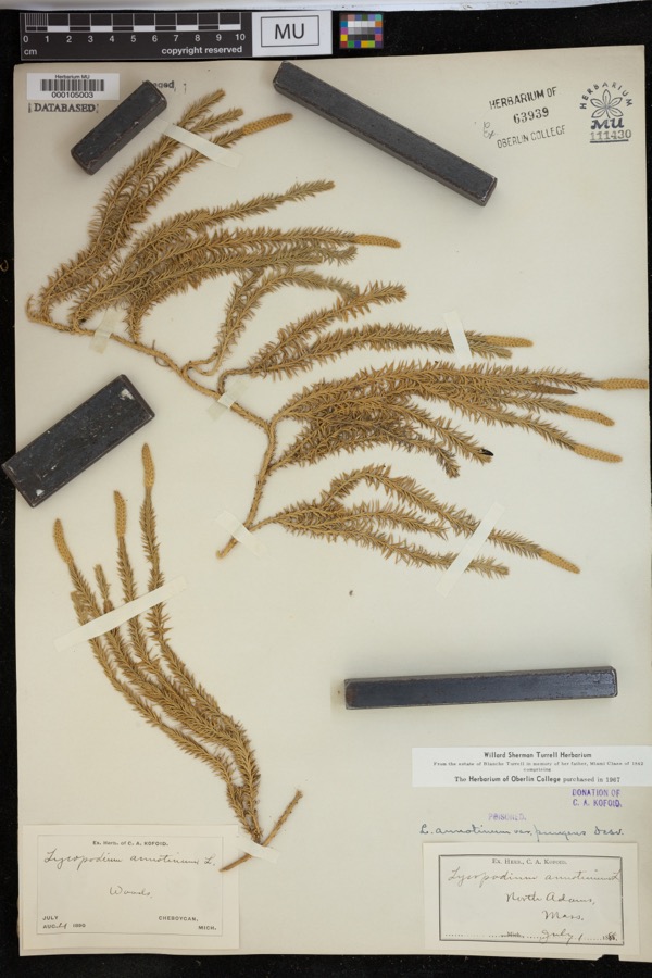
Specimen of Lycopodium annotinum var. pungens (Desv.) La Pylaie ex Desv.Lycopodium annotinum var. pungens (Desv.) La Pylaie ex Desv.1898Kofoid, C.A.North Adams.
A photograph of the species Carex aestivalis, not of this specimenCarex aestivalis M.A.Curtis ex A.Gray1828Collector unknownSaddle Mountain, near Williamstown.
A photograph of the species Carex emmonsii, not of this specimenCarex emmonsii var. muhlenbergii (A.Gray ex Torrey) Rettig1828Collector unspecifiedWilliamstown. [Inferred locality from precise loc.]
A photograph of the species Cystopteris bulbifera, not of this specimenCystopteris bulbifera (L.) Bernh.1828Collector unspecified
A photograph of the species Dryopteris goldiana, not of this specimenDryopteris goldiana (Hook. ex Goldie) A.Gray1828Collector unspecified
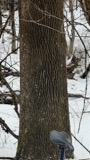
A photograph of the species Fraxinus americana, not of this specimenFraxinus americana L.1828J. Torrey
Jamesoniella autumnalis (DC.) Steph.1828Ebenezer Emmons
A photograph of the species Tilia americana, not of this specimenTilia americana L.1828Collector unspecified
A photograph of the species Scorzoneroides autumnalis, not of this specimenScorzoneroides autumnalis (L.) Moench1850not recorded
A photograph of the species Spiraea tomentosa, not of this specimenSpiraea tomentosa L.1850not recorded

All 1,342 specimens within 10 miles, at the Global Biodiversity Information Facility.

Mines and quarries near this property

9 within 5 miles

Regional context, not property-specific evidence. The federal mineral resources record lists 9 workings within 5 miles of St. Luke's Episcopal Church: 6 past producers, 3 producers. 3 still produce. What was taken out: Iron, Sand and Gravel, Construction, Limestone, General, Stone, Crushed/Broken. Distance is straight-line from the map coordinates, so a quarry counted here may appear on a neighbouring settlement's page as well.

Where SiteCommodity StatusRecorded
United States Gypsum Co QuarryStone, Crushed/BrokenPast Producer
United States Gypsum Company Marble QuarryLimestone, GeneralProducerStratabound
Cheshire PitSand and Gravel, ConstructionProducer
Frank Bushika Sand and GravelSand and Gravel, ConstructionPast ProducerSedimentary
Horn PitSand and Gravel, ConstructionPast Producer
Bliss MineIronProducer1782
Bliss MineIronPast Producer
Bliss Mine/Jagger MineIronPast ProducerResidual
Jagger MineIronPast Producer

Every working recorded in Berkshire County

Storms near this property

31 since 2000

Regional context, not property-specific evidence. The National Weather Service names Lanesborough, the town this property stands in, in 31 storm reports between 2000 and 2026: 28 thunderstorm wind, 2 flash flood, 1 hail. No death or injury is recorded in these reports. Each account below is quoted exactly as the forecast office filed it, from the NOAA Storm Events Database, and each date opens the federal record of that event.

WhenEvent Place namedHarm What the report says
July 2001Thunderstorm WindLanesborough$38,000no account filed
June 2000Flash FloodLanesborough$28,000no account filed
June 2001Thunderstorm WindLanesborough$15,000no account filed
August 2000Flash FloodLanesborough$15,000no account filed
May 2002Thunderstorm WindLanesborough$9,000no account filed
July 2003Thunderstorm WindLanesborough$3,000no account filed
June 2005Thunderstorm WindLanesborough$500Picnic table hurled through plate glass window.
April 2026Thunderstorm WindLanesborough-An amateur radio operator reported a tree down blocking Swamp Road in Lanesborough, MA.
May 2025Thunderstorm WindLanesborough-An amateur radio operator reported downed trees blocking Bailey Road in Lanesborough.
July 2024Thunderstorm WindLanesborough-An amateur radio operator reported multiple trees down at a residence on Lanesboro Road in the town of Lanesborough.
July 2024Thunderstorm WindLanesborough-An amateur radio operator reported trees down near a residence on Summer Street in Lanesborough.
July 2022Thunderstorm WindLanesborough-A tree was downed on Miner Road. A tree and wires were also downed on Narragansett Avenue in the Town of Lanesborough.
July 2022Thunderstorm WindLanesborough-A tree was downed on Stormview Road in the Town of Lanesborough.
July 2021Thunderstorm WindLanesborough-A tree was downed onto wires on North Main Street.
July 2021Thunderstorm WindLanesborough-Trees were downed in Lanesborough.
July 2021Thunderstorm WindLanesborough-A tree was downed on Balance Rock Road north of the City of Pittsfield.
July 2021Thunderstorm WindLanesborough-Wires were downed on Bridge Street near the Town of Lanesborough.
February 2017Thunderstorm WindLanesborough-A tree was reported down on South State Road.
September 2016Thunderstorm WindLanesborough-Trees were downed on wires in Lanesborough due to thunderstorm winds.
July 2016Thunderstorm WindLanesborough-Numerous trees and power lines were downed near Bailey Road in Lanesborough due to thunderstorm winds.
May 2013Thunderstorm WindLanesborough-Widespread trees were reported down in Lanesborough as a result of thunderstorm winds.
May 2012Thunderstorm WindLanesborough-One tree was reported down due to strong thunderstorm winds in Lanesborough.
July 2011Thunderstorm WindLanesborough-Several trees were reported down in Lanesborough due to strong thunderstorm winds with damage to a gazebo.
May 2010Thunderstorm WindLanesborough-Trees were reported down in Lanesborough due to strong thunderstorm winds.
July 2008Thunderstorm WindLanesborough-Numerous trees and wires were reported down in and near Lanesborough due to strong thunderstorm winds. Downed trees were reported on Kelly Lane, and also resulted in the closure of a portion of Route 8.
July 2007Thunderstorm WindLanesborough-Trees were reported down in Lanesborough due to strong thunderstorm winds.
June 2006HailLanesborough-A trained spotter reported that penny-sized hail occurred in Lanesborough.
December 2006Thunderstorm WindLanesborough-Trees were reported down due to strong thunderstorm winds in Lanesborough.
August 2005Thunderstorm WindLanesborough-Trees blown down.
August 2004Thunderstorm WindLanesborough-Trees down on Old Cheshire Road.
November 2004Thunderstorm WindLanesborough-Wires down.

Every storm recorded in Berkshire County

Map coverage status

No historic map-sheet match is published for this property yet. That does not mean no map exists. This record needs a coordinate-quality review before it can be joined to a sheet boundary. Browse the county's mapped places while that work is pending.

From the nomination file

2,472 words on record

When this property was proposed for the National Register, someone wrote the case for it: what the building is, and why it matters. That document is a federal record in the public domain. It is quoted below word for word, never summarised. The text was read off the scanned case file by machine, so the occasional stray character is the recogniser's and the 1970s typewriter's.

Statement of significance

St. Luke's Church, built in 1836, is among New England's few Gothic Revival churches which pre-date the Anglo-American "Ecclesiological Movement." It is not to be classified with the "castellated" style churches, such as the former Trinity Church, Boston, but with the equally rare Adamesque Gothic churches such as the Episcopal Cathedral at Providence, Rhode Island, in which details derived from the Adamesque style continue to appear. The buil- ding is also of special interest to New England because of its stone construc- tion. - The building is unusual architecturally because it is part of a fairly isolated religious movement: the early growth of the Episcopal Church north- ward from New Haven into western Connecticut and western Massachusetts in the late eighteenth century.

In this special region of Episcopalianism, a num- ber of Gothic Revival churches were built very early in the nineteenth cen- Trinity, New Haven (1815); Christ Church, Quaker's Farm, Connecticut (1813); Trinity Church, Milton, Connecticut (1802-1826); and a very few others. The records of the St' Luke's parish go back to 1767, making Lanesborough bhe eleventh oldest Episcopal parish in Massachusetts and only the second eighteenth century Episcopal parish in Massachusetts west-of the seacoast.

The whole case file for this property - 2,472 words, 11 pages, reproduced complete.

Quoted from the National Register nomination for reference 72000127, 11 pages, held by the National Archives in Record Group 79. See the catalogue record.

Listed places nearby

6 within 8 miles

Other National Register properties close enough to walk or drive between, ordered by distance from this one. Both positions come from the same geocoding pass that matched these properties to their map sheets.

Photograph PropertyDistance Listed
Hall's Tavern4.2 miles1983
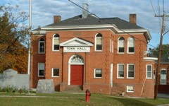
Cheshire Town Hall Complex4.4 miles2017
Phillips Woolen Mill4.9 miles1982
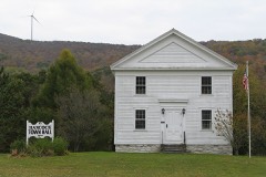
Hancock Town Hall5.5 miles1975
Old Churchyard Cemetery5.6 miles2012
Quaker Meetinghouse5.6 miles1976

Sources for this property

National Archives recordThe nomination case file for reference 72000127 in Record Group 79.
Wikipedia articleCommunity-written account of this property, licensed CC BY-SA.
Berkshire CountyAll 94 listed properties in this county.

Provenance

  • Listing record. National Park Service National Register of Historic Places, listed-properties dataset, current to 2026-05-22.
  • Map join. Address geocoded through the United States Census geocoder, then tested against the published boundary of every sheet in the USGS Historical Topographic Map Collection.
  • How this page is made. Listing fields come from federal records; map-sheet coverage is a labelled coordinate-to-boundary calculation, not a source-field claim.
  • Wildfire. Short, Karen C. 2022. Spatial wildfire occurrence data for the United States, 1992-2020 [FPA_FOD_20221014]. 6th Edition. Fort Collins, CO: Forest Service Research Data Archive. https://doi.org/10.2737/RDS-2013-0009.6 Collected with United States Government funding and usable without additional permissions or fees.
  • Specimens. Global Biodiversity Information Facility (GBIF), https://www.gbif.org/. Only records licensed CC0 or CC BY are used. Records licensed CC BY-NC are excluded because this site carries advertising. Images are checked individually and any whose licence is non-commercial, no-derivatives or unreadable is refused.
  • Mines and quarries. USGS Mineral Resources Data System (MRDS) https://mrdata.usgs.gov/mrds/ A work of the United States government, no copyright under 17 U.S.C. 105.
  • Storms. NOAA National Centers for Environmental Information, Storm Events Database https://www.ncei.noaa.gov/stormevents/ A work of the United States government, no copyright under 17 U.S.C. 105. Narratives are quoted verbatim from the National Weather Service report and are not edited or summarised.