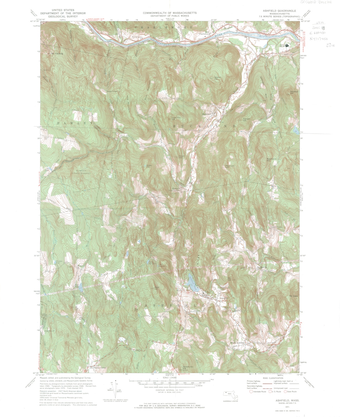
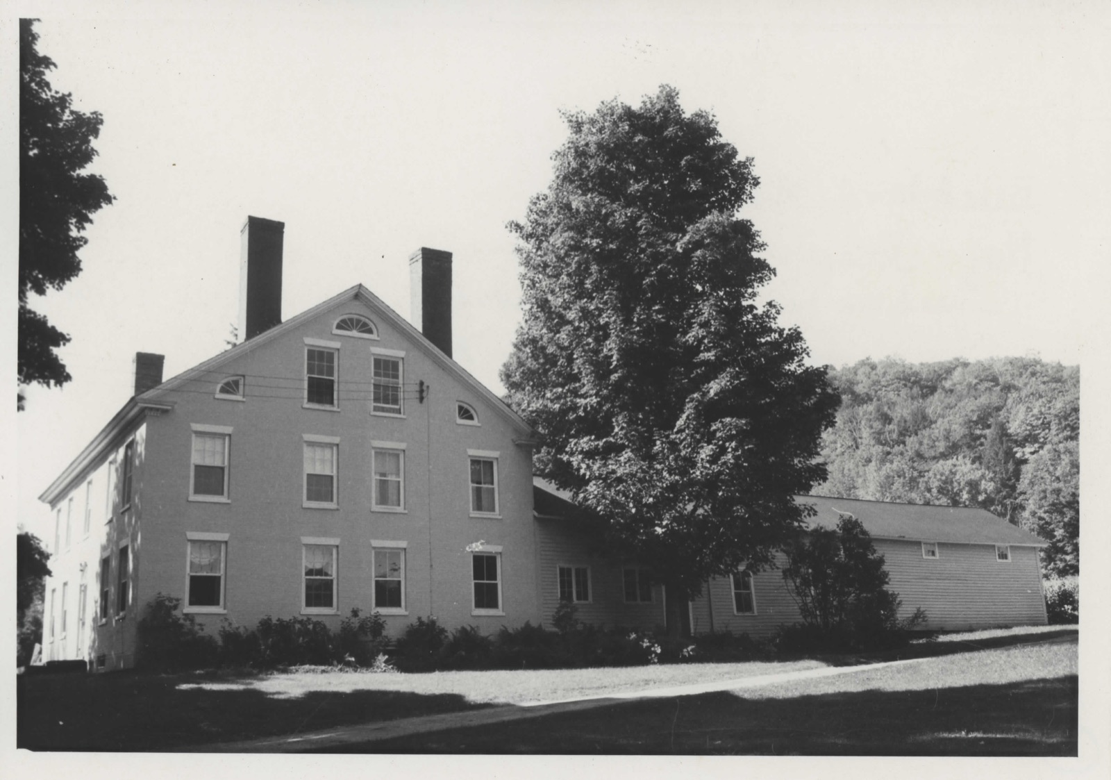
Photographs from the nomination case file, National Park Service records.
Griswold, Maj. Joseph, House
Listed on the National Register of Historic Places in
1972. A historic map-sheet match is not published yet. The record needs a coordinate-quality review before it can be joined to a sheet boundary.
From the record
one of 28 National Register listings in Franklin County · listed in 1972 · category: Building · one of 1 National Historic Landmarks in Franklin County.
National Register reference number.72000130- the number the National Park Service assigned this property when it was listed, and the key its nomination file is catalogued under at the National Archives.
Fires near this property
29 since 2002
Regional context, not property-specific
evidence. The
federal wildfire occurrence database
lists 29 fires within 5 miles of Griswold, Maj. Joseph, House between
2002 and 2020, burning about 34 acres in total. None started naturally. None was recorded as arson.
Distance is straight-line from the map coordinates, so a fire counted
here may appear on a neighbouring settlement's page as well.
Reported cause
Fires
Debris and open burning
25
Recreation and ceremony
2
Equipment and vehicle use
1
Missing data/not specified/undetermined
1
The most recent of
them, most recent first, with the day each was reported and the service
that recorded it.
Regional context, not property-specific
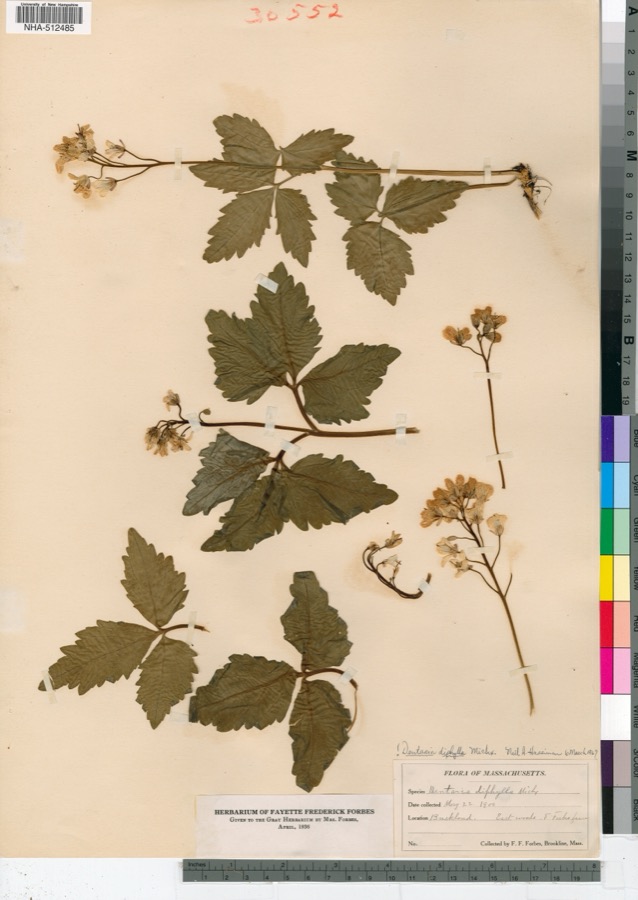
evidence. Museums hold 1,111 specimens
collected within 10 miles of Griswold, Maj. Joseph, House between 1825 and
1975: 542 Fungi, 486 Plantae, 57 Animalia, 24 Protozoa, 1 Unrecorded, 1 Chromista. 12 distinct Species records are shown.
Collected by A. R. Hodgdon; H. Bigelow;R. Livingstone, A. S. Goodale, A. T. Beals and others. Each is a
physical object with a catalogue
number, and each entry opens the museum's record. This is what was
collected and kept, not a survey of what lives here - nothing can be
concluded from a species being absent.
Regional context, not property-specific
evidence. The federal mineral resources record lists
8 workings within 5 miles of Griswold, Maj. Joseph, House: 4 occurrences, 2 producers, 2 past producers.
2 still produce. What was taken out: Stone, Dimension, Iron, Sulfur, Iron, Sulfur. Distance is straight-line from the
map coordinates, so a quarry counted here may appear on a neighbouring
settlement's page as well.
Regional context, not property-specific
evidence. The National Weather Service names
Buckland, the town this property stands in, in 8 storm reports between 1998 and 2023: 4 thunderstorm wind, 2 hail, 2 lightning.
No death or injury is recorded in these reports. Each account below is quoted exactly as the forecast office
filed it, from the NOAA Storm Events Database, and each date
opens the federal record of that event.
No historic map-sheet match is published
for this property yet. That does not mean no map exists. This record needs
a coordinate-quality review before it can be joined to a sheet boundary.
Browse the county's mapped places while that work is
pending.
From the nomination file
1,782 words on record
When this property was proposed for the
National Register, someone wrote the case for it: what the building is,
and why it matters. That document is a federal record in the public domain.
It is quoted below word for word, never summarised. The text was read off the scanned case file by machine, so the
occasional stray character is the recogniser's and the 1970s
typewriter's.
Description of the property
Moved - Unexposed (Check One) X] Origiral Site The Joseph Griswold Homestead is located on the top of a hill on the west side of Upper Street in Buckland, Massachusetts. Built in 1818, after designs in the pattern books of Asher Benjamin, this Federal style house is a simple, rectangular structure, with a one and one half story ell attached to the northwest corner. The main block of the building is brick; the ell is wooden. From this ell, Griswold sold cheese, rum and apples, as well as the furniture he made. The front (east) facade has five bays and is laid up in Flemish bond. Sash windows are placed at regular intervals across the facade; on the first floor, two pairs of windows flank the entrance.
The second story windows repeat the rhythm of the first floor, with a fifth window located over the doorway. These windows are all of the same dimensions, and are finished with flared marble lintels and lugsills. The doorway is adorned with a recessed fanlight, which is supported by two slender pilasters. A decorative boxed cornice, composed of delicate consoles and a narrow band of shields, runs under the eaves of the pitched roof. On the third floor,a pair of windows, identical to those of the front facade, is located in each gable end and is the only source of light for the floor. In the north gable, two quarter-round lights flank the third story sash windows at sill level. The outward curve of these quarter-round lights is repeated in a full fanlight just under the peak of the gable.
In the first and second stories there are windows under each pair on the third floor. This central pair of windows is set off by a single window placed roughly under the quarter-lights.
- 18th Century X] 19th Century 1818 Political Religion/Phi- losophy Science Sculpture Social/Human- itarian Theater - Transportation 20th Century - Urban Planning - Other (Specify) S E The Griswold Homestead was built for Major Joseph Griswold and is a fine example of the Federal style in rural Massachusetts; it is also, one of the earliest brick houses in the Buckland area. The primary significance of the house, however, comes from its association with Mary Lyon, pioneer in providing advanced education for women. Bricks for the Griswold Homestead were made from native clay found in an adjacent field. According to family tradition, Mary Lyon stopped to inquire into the brick-making procedure and helped to make a few bricks for the house.
Major Griswold built a ballroom on the third floor of the house which served as an assembly hall for the community. He offered the use of this room to Mary Lyon in 1824 when she was attempting to found a new type of school for girls. She offered a curriculum equal to that being taught in boys' schools instead of the music, drawing, needlework program of the usual female seminary. Miss Lyon held school here until 1829, when a larger hall was built for her to meet increased enrollment. She later offered the school to the town of Buckland but was refused. South Hadley accepted her offer and in 1837 Miss Lyon opened the Mount Holyoke Seminary, which was to become Mount Holyoke College. 9 110 Noy NATIONAL 197,
Quoted from the National Register nomination
for reference 72000130, 10 pages, held by the National Archives in Record
Group 79. See the
catalogue record.
Listed places nearby
6 within 8 miles
Other National Register properties close
enough to walk or drive between, ordered by distance from this one. Both
positions come from the same geocoding pass that matched these properties
to their map sheets.
Listing record. National Park Service National Register of Historic Places, listed-properties dataset, current to 2026-05-22.
Map join. Address geocoded through the United States Census geocoder, then tested against the published boundary of every sheet in the USGS Historical Topographic Map Collection.
How this page is made. Listing fields come from federal records; map-sheet coverage is a labelled coordinate-to-boundary calculation, not a source-field claim.
Wildfire. Short, Karen C. 2022. Spatial wildfire occurrence data for the United States, 1992-2020 [FPA_FOD_20221014]. 6th Edition. Fort Collins, CO: Forest Service Research Data Archive. https://doi.org/10.2737/RDS-2013-0009.6 Collected with United States Government funding and usable without additional permissions or fees.
Specimens. Global Biodiversity Information Facility (GBIF), https://www.gbif.org/. Only records licensed CC0 or CC BY are used. Records licensed CC BY-NC are excluded because this site carries advertising. Images are checked individually and any whose licence is non-commercial, no-derivatives or unreadable is refused.
Mines and quarries. USGS Mineral Resources Data System (MRDS) https://mrdata.usgs.gov/mrds/ A work of the United States government, no copyright under 17 U.S.C. 105.
Storms. NOAA National Centers for Environmental Information, Storm Events Database https://www.ncei.noaa.gov/stormevents/ A work of the United States government, no copyright under 17 U.S.C. 105. Narratives are quoted verbatim from the National Weather Service report and are not edited or summarised.
 Block
Block