Listed on the National Register of Historic Places in
1972. A historic map-sheet match is not published yet. The record needs a coordinate-quality review before it can be joined to a sheet boundary.
From the record
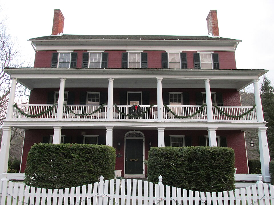
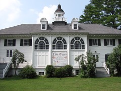
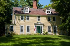
“The Merrell Tavern, known more recently as the Merrell Inn, is a historic tavern at 1565 Pleasant Street in South Lee, Massachusetts. Built in 1794 as a residence, it has served for most of two centuries as a local traveler's accommodation, and retains fine Federal period architectural details.”
Wikipedia article Merrell Tavern, CC BY-SA 4.0.
one of 94 National Register listings in Berkshire County · listed in 1972 · category: Building · one of 1 National Historic Landmarks in Berkshire County.
National Register reference number.72000136- the number the National Park Service assigned this property when it was listed, and the key its nomination file is catalogued under at the National Archives.
Fires near this property
21 since 2003
Regional context, not property-specific
evidence. The
federal wildfire occurrence database
lists 21 fires within 5 miles of Merrell Tavern between
2003 and 2020, burning about 14 acres in total. 1 started naturally. None was recorded as arson.
Distance is straight-line from the map coordinates, so a fire counted
here may appear on a neighbouring settlement's page as well.
Reported cause
Fires
Debris and open burning
9
Equipment and vehicle use
4
Missing data/not specified/undetermined
4
Other causes
2
Natural
1
Recreation and ceremony
1
The most recent of
them, most recent first, with the day each was reported and the service
that recorded it.
Regional context, not property-specific
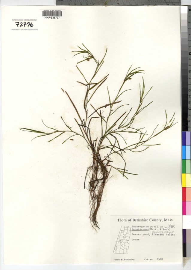
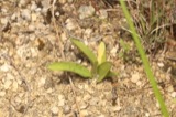
evidence. Museums hold 1,829 specimens
collected within 10 miles of Merrell Tavern between 1833 and
1975: 833 Animalia, 761 Plantae, 228 Fungi, 3 Protozoa, 2 Chromista, 2 Unrecorded. 12 distinct Species records are shown.
Collected by A W Evans, A. Brown, A. E. Treat and others. Each is a
physical object with a catalogue
number, and each entry opens the museum's record. This is what was
collected and kept, not a survey of what lives here - nothing can be
concluded from a species being absent.
Regional context, not property-specific
evidence. The federal mineral resources record lists
13 workings within 5 miles of Merrell Tavern: 6 past producers, 6 producers, 1 unknown.
6 still produce. What was taken out: Sand and Gravel, Construction, Marble, Dimension, Calcium, Stone, Crushed/Broken. Distance is straight-line from the
map coordinates, so a quarry counted here may appear on a neighbouring
settlement's page as well.
Regional context, not property-specific
evidence. The National Weather Service names
South Lee, the town this property stands in, in 2 storm reports between 1998 and 2016: 1 thunderstorm wind, 1 flash flood.
No death or injury is recorded in these reports. Each account below is quoted exactly as the forecast office
filed it, from the NOAA Storm Events Database, and each date
opens the federal record of that event.
Heavy rainfall from slow moving thunderstorms resulted in flash flooding in Lee. Fairview street was closed due to high water and a car was trapped within the flood waters on Fairview Street beneath the Massachusetts Turnpike overpass.
No historic map-sheet match is published
for this property yet. That does not mean no map exists. This record needs
a coordinate-quality review before it can be joined to a sheet boundary.
Browse the county's mapped places while that work is
pending.
From the nomination file
1,850 words on record
When this property was proposed for the
National Register, someone wrote the case for it: what the building is,
and why it matters. That document is a federal record in the public domain.
It is quoted below word for word, never summarised. The text was read off the scanned case file by machine, so the
occasional stray character is the recogniser's and the 1970s
typewriter's.
Description of the property
Original: Iwo-story Federal style brick house with rear kitchen wing; hip roof on front section of building. Built ca. 1812. Tavern bar of ca. 1815, with wooden grille, survives intact. Present: Iwo-story porch and wooden third story (ballroom) added ca. 1838. Front section of building has pitch roof. Added portions of building have details transitional between Federal and Greek Revival styles. Very few twentieth century alterations except for overpainting of early interior paints and graining, and removal of early wallpapers. Condition: The building requires structural repair and stabilization, including extensive work in the gable-end walls of the third story.
In order to be displayed to the public on a regular basis, the building requires restoration of its early paints and wallpapers except in the rooms where the early paints have not been overpainted during modern times. 1S NI RUCTIONS *grm 10-300g Jury 1969) UNITED STATES DEPARTMENT OF THE INTERIOR NATIONAL PARK SERVICE NATIONAL REGISTER OF HISTORIC PLACES INVENTORY - NOMINATION FORM (Continuation Sheet) (Number all entries) LEE, SOUTH, THE MERRELL TAVERN 6. Representation in existing surveys Berkshire County Survey of historia places 1970 Local Berkshire County Historical Society 113 East Housatonic Street Pittsfield, Massachusetts 025 STATE Mass. COUNTY Berkshire FOR NPS USE ONLY ENTRY NUMBER DATE -
Statement of significance
The original portions of the structuee were built as a house by Major General Joseph Whiton, Commander of the troops of the Western Massachusetts militia in the War of 1812. It was one of the first fine brick houses in the region, its details based on the Federal-period designs of Asher Benjamin. Its facade has the large windows and smooth planar brick walls, in Flemish bond, which the new fashion required. From 1815 until 1918 the building was owned by the Merrell family and by the Davises, who were heirs of the Merrells by marriage. The Merrells used it as a tavern from the beginning and their original tavern bar is perfectly preserved. The tavern thrived on the stagecoach travel between Springfield and Albany.
The addition of a two-story porch and third-story containing ballroom and small sleeping rooms about 1838 gave the building something of the grand and institutional character. of the new hotels which were everywhere replacing the old taverns. From that time on, it was called a hotel._ It is thus particularly valuable since it exemplifies in one building a fine house, a tavern of the old type that resembles a house, andaaehotel of a form specifically fashionable for the purpose. The early painted oak graining has survived in the bar-room, where there is also an early Franklin stove. The ballroom and small sleeping rooms still show their original paints and, in places, painted floor decoration.
The decline of the hotel's trade after 1850 has caused the architectural features to remain almost completely unchanged.
Quoted from the National Register nomination
for reference 72000136, 11 pages, held by the National Archives in Record
Group 79. See the
catalogue record.
Listed places nearby
6 within 8 miles
Other National Register properties close
enough to walk or drive between, ordered by distance from this one. Both
positions come from the same geocoding pass that matched these properties
to their map sheets.
Listing record. National Park Service National Register of Historic Places, listed-properties dataset, current to 2026-05-22.
Map join. Address geocoded through the United States Census geocoder, then tested against the published boundary of every sheet in the USGS Historical Topographic Map Collection.
How this page is made. Listing fields come from federal records; map-sheet coverage is a labelled coordinate-to-boundary calculation, not a source-field claim.
Wildfire. Short, Karen C. 2022. Spatial wildfire occurrence data for the United States, 1992-2020 [FPA_FOD_20221014]. 6th Edition. Fort Collins, CO: Forest Service Research Data Archive. https://doi.org/10.2737/RDS-2013-0009.6 Collected with United States Government funding and usable without additional permissions or fees.
Specimens. Global Biodiversity Information Facility (GBIF), https://www.gbif.org/. Only records licensed CC0 or CC BY are used. Records licensed CC BY-NC are excluded because this site carries advertising. Images are checked individually and any whose licence is non-commercial, no-derivatives or unreadable is refused.
Mines and quarries. USGS Mineral Resources Data System (MRDS) https://mrdata.usgs.gov/mrds/ A work of the United States government, no copyright under 17 U.S.C. 105.
Storms. NOAA National Centers for Environmental Information, Storm Events Database https://www.ncei.noaa.gov/stormevents/ A work of the United States government, no copyright under 17 U.S.C. 105. Narratives are quoted verbatim from the National Weather Service report and are not edited or summarised.
 Block
Block