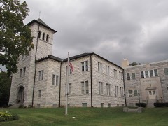
Listed on the National Register of Historic Places in
1976. A historic map-sheet match is not published yet. The record needs a coordinate-quality review before it can be joined to a sheet boundary.
From the record
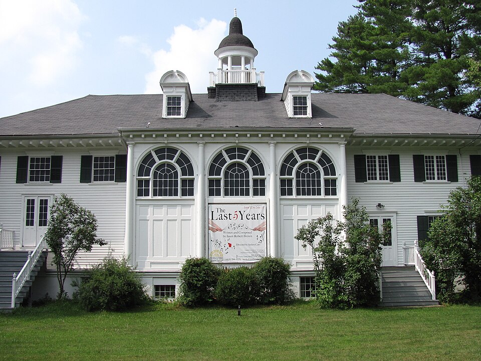
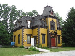
“The Stockbridge Casino is a historic building at the junction of East Main Street and Yale Hill Road in Stockbridge, Massachusetts. Built in 1887, it is a prominent local work of architect Stanford White, and has served as a cultural center in the community since its construction, despite being moved in 1928.”
Wikipedia article Stockbridge Casino, CC BY-SA 4.0.
one of 94 National Register listings in Berkshire County · listed in 1976 · category: Building · one of 1 National Historic Landmarks in Berkshire County.
Architectural style. Queen Anne style architecture in the United States
Architect. McKim, Mead & White
National Register reference number.76000249- the number the National Park Service assigned this property when it was listed, and the key its nomination file is catalogued under at the National Archives.
Fires near this property
26 since 2003
Regional context, not property-specific
evidence. The
federal wildfire occurrence database
lists 26 fires within 5 miles of Stockbridge Casino between
2003 and 2020, burning about 16 acres in total. 1 started naturally. None was recorded as arson.
Distance is straight-line from the map coordinates, so a fire counted
here may appear on a neighbouring settlement's page as well.
Reported cause
Fires
Debris and open burning
12
Equipment and vehicle use
4
Missing data/not specified/undetermined
4
Other causes
2
Recreation and ceremony
2
Smoking
1
Natural
1
The most recent of
them, most recent first, with the day each was reported and the service
that recorded it.
Regional context, not property-specific
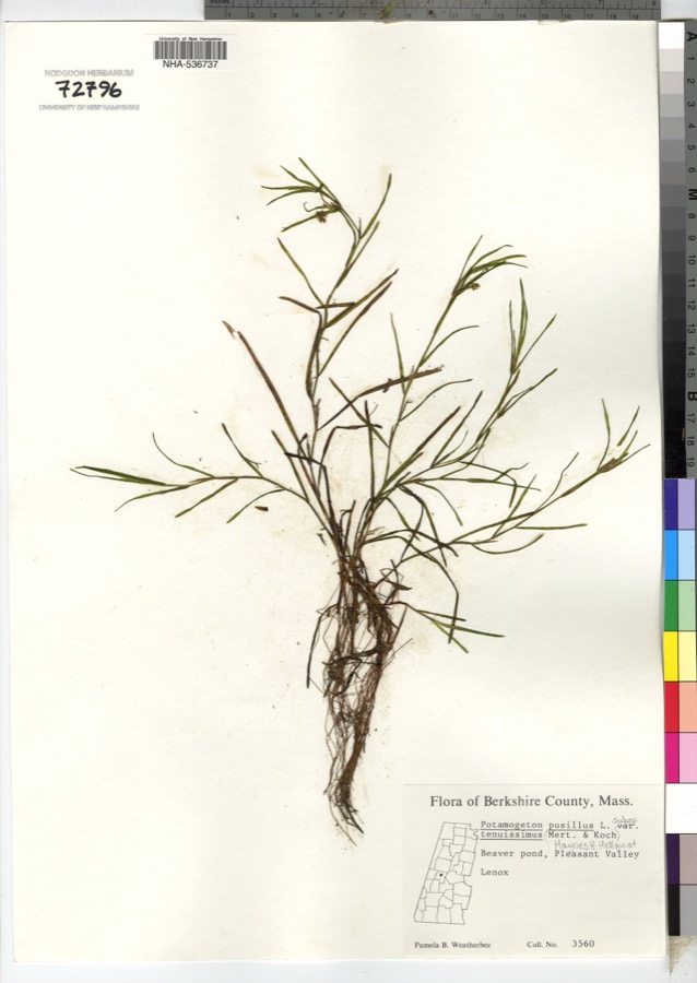
evidence. Museums hold 1,866 specimens
collected within 10 miles of Stockbridge Casino between 1833 and
1975: 837 Animalia, 785 Plantae, 237 Fungi, 3 Protozoa, 2 Chromista, 2 Unrecorded. 12 distinct Species records are shown.
Collected by A W Evans, A. Brown, A. E. Treat and others. Each is a
physical object with a catalogue
number, and each entry opens the museum's record. This is what was
collected and kept, not a survey of what lives here - nothing can be
concluded from a species being absent.
Regional context, not property-specific
evidence. The federal mineral resources record lists
16 workings within 5 miles of Stockbridge Casino: 8 producers, 7 past producers, 1 unknown.
8 still produce. What was taken out: Sand and Gravel, Construction, Stone, Crushed/Broken, Limestone, General, Marble, Dimension. Distance is straight-line from the
map coordinates, so a quarry counted here may appear on a neighbouring
settlement's page as well.
Regional context, not property-specific
evidence. The National Weather Service names
Stockbridge, the town this property stands in, in 50 storm reports between 1993 and 2025: 34 thunderstorm wind, 7 flash flood, 7 hail, 1 lightning.
The reports record 1 death. Each account below is quoted exactly as the forecast office
filed it, from the NOAA Storm Events Database, and each date
opens the federal record of that event.
Lenox Police reported that a 56 year old man was killed when a large tree came down in the travel line onto his pickup truck at the intersection of Route 7 and Old Stockbridge Road. Report was obtained via a local newspaper.
A cold front, moving into a very warm humid and unstable airmass, produced scattered thunderstorms across Berkshire County during the afternoon of August 3. One of the storms became severe, as wind gusts knocked trees down in the town of West Stockbridge.
Heavy rainfall from slow moving thunderstorms resulted in flash flooding in Stockbridge. Main street was impassable due to high water. The bottom floor of the town office building had standing water that was mopped up before it could do any damage to equipment in the offices. Some nearby homes on Church Street had water in their basements as well.
Slow moving thunderstorms resulted in flash flooding in Stockbridge at the police station on West Stockbridge Road. Also, a portion of Route 183 was closed due to flooding in the village of Interlaken, where flooding impacted an ongoing culvert project near the Massachusetts Turnpike overpass. A portion of Glendale road was closed as well.
Flash flooding was reported in West Stockbridge as a result of heavy rainfall from thunderstorms. Several roads in the town was reported to be impacted by the flooding.
Trees were reported down on houses in the vicinity of the Stockbridge Bowl in Stockbridge along Interlaken and Mahkeenac Roads due to strong thunderstorm winds.
A 40 year old male from New Jersey was struck by lightning at the Tanglewood Music Center in Lenox. He was running to seek shelter at a concert hall when he was struck. He was holding an umbrella at the time of the incident.
Emergency Management, state police and Skywarn observers reported trees and wires downed in many parts of Berkshire County. Some roads were blocked in Stockbridge. About 1,500 customers were without power.
No historic map-sheet match is published
for this property yet. That does not mean no map exists. This record needs
a coordinate-quality review before it can be joined to a sheet boundary.
Browse the county's mapped places while that work is
pending.
From the nomination file
3,238 words on record
When this property was proposed for the
National Register, someone wrote the case for it: what the building is,
and why it matters. That document is a federal record in the public domain.
It is quoted below word for word, never summarised. The text was read off the scanned case file by machine, so the
occasional stray character is the recogniser's and the 1970s
typewriter's.
Description of the property
Stockbridge Casino is located at the corner of East Main Street and Yale Hill Road in a residential section of Stockbridge just east of the town center. The front elevation faces Main Street, and a gravel driveway and parking area run to the west and north of the building. The Casino was built in 1887-1888 according to the design of McKim, Mead and White and is a two-story, wood frame structure with a hip roof. It sits on a concrete foundation which extends about four and one-half feet above grade and a full basement is below. Originally located at the opposite end of Main Street at the northwest corner of West Main and Sergeant Streets, the Casino was moved to its present site in 1928.
In its new location the building is situated in an identical relationship to its adjacent streets, with the long dimension of the basic rectangular plan continuing to face Main Street. In the original location two tennis courts separated the building from the street, whereas now a lawn stretches between the Casino and Main Street. At the time of its move in 1928, alterations were made to the building in order to enable it to serve more adequately as a playhouse. However, the concept of the front elevation is not dramatically different from the original Casino building. The hip roof, cupola, and two dormers are unchanged, although a masonry chimney, originally located to the right of the cupola was removed.
sits in the center of the roof ridge and is supported by eight round columns and surrounded at its base by wood balustrades. Halfway down the roof slope are Lts a baryetghaped sora d Satietra es rater ny coin Etn The elliptical cupola two dormers, each with a barrel-shaped roof and six over six sash.
/ARCHITECT McKim, Mead and White STATEMENT OF SIGNIFICANCE The Stockbridge Casino is significant as the work of McKim, Mead and White and as the center of Stockbridge culture and entertainment for nearly a century. The building was constructed in 1887-1888 and was designed by the outstanding architectural firm of McKim, Mead and White. Other works by the firm include the Casino at Newport (1888), the Boston Public Library (1895), the University Club in New York (1900), and Pennsylvania Station in New York (1906). The Stockbridge Casino displays the characteristic classic motifs employed by Mckim, Mead and White.
The handsome cupola, curved pedimented dormers, slender Doric columns, deep eaves, dentils and other features add a distinctive feeling to the building traceable to the Queen Anne style of the period. The Stockbridge Casino was owned by the Stockbridge Casino Company, a social club of the area's summer "cottagers." The club was organized by such prominent res- idents as David Dudley Field, Jr., lawyer; Henry Dwight Sedgwick, lawyer and writer; and Joseph Hodges Choate, jurist and diplomat.
The building was a ¡casino" in the older sense of the term, having been established as a "place for a reading-room, library, and social meetings." For forty years it offered its members tennis, billiards, dances, theatricals, and lectures throughout the summer seasons, and gained recognition for its outstanding art exhibitions. In 1926, after a period of decline in the years following the First World War, the Casino Company sold the property to Mabel Choate, who wished to move the Mission House (home of the first missionary to the Stockbridge Indians and now a National Historic Landmark) from Prospect Hill to Main Street.
Quoted from the National Register nomination
for reference 76000249, 18 pages, held by the National Archives in Record
Group 79. See the
catalogue record.
Listed places nearby
6 within 8 miles
Other National Register properties close
enough to walk or drive between, ordered by distance from this one. Both
positions come from the same geocoding pass that matched these properties
to their map sheets.
Listing record. National Park Service National Register of Historic Places, listed-properties dataset, current to 2026-05-22.
Map join. Address geocoded through the United States Census geocoder, then tested against the published boundary of every sheet in the USGS Historical Topographic Map Collection.
How this page is made. Listing fields come from federal records; map-sheet coverage is a labelled coordinate-to-boundary calculation, not a source-field claim.
Wildfire. Short, Karen C. 2022. Spatial wildfire occurrence data for the United States, 1992-2020 [FPA_FOD_20221014]. 6th Edition. Fort Collins, CO: Forest Service Research Data Archive. https://doi.org/10.2737/RDS-2013-0009.6 Collected with United States Government funding and usable without additional permissions or fees.
Specimens. Global Biodiversity Information Facility (GBIF), https://www.gbif.org/. Only records licensed CC0 or CC BY are used. Records licensed CC BY-NC are excluded because this site carries advertising. Images are checked individually and any whose licence is non-commercial, no-derivatives or unreadable is refused.
Mines and quarries. USGS Mineral Resources Data System (MRDS) https://mrdata.usgs.gov/mrds/ A work of the United States government, no copyright under 17 U.S.C. 105.
Storms. NOAA National Centers for Environmental Information, Storm Events Database https://www.ncei.noaa.gov/stormevents/ A work of the United States government, no copyright under 17 U.S.C. 105. Narratives are quoted verbatim from the National Weather Service report and are not edited or summarised.
 Block
Block