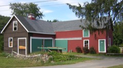
Listed on the National Register of Historic Places in
1972. A historic map-sheet match is not published yet. The record needs a coordinate-quality review before it can be joined to a sheet boundary.
From the record
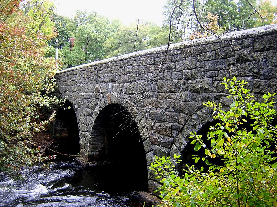
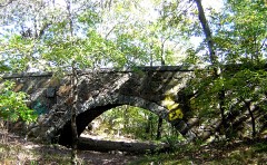
“Paul's Bridge is a stone bridge carrying the Neponset Valley Parkway over the Neponset River between Milton and southern Boston, Massachusetts. It was built in 1849 by Thomas Hollis, Jr., of Milton, but was later reconstructed using the original materials.”
Wikipedia article Paul's Bridge, CC BY-SA 4.0.
one of 249 National Register listings in Norfolk County · listed in 1972 · category: Structure · one of 2 National Historic Landmarks in Norfolk County.
National Register reference number.72000140- the number the National Park Service assigned this property when it was listed, and the key its nomination file is catalogued under at the National Archives.
Mr. Hunt was born in Scott's Woods, Milton. He is remembered with great affection as connected with the Sabbath School of the First Evangelical Church in his boyhood. The pastor of this church has followed him with the watchful interest of a sincere friend in his education and progress onward to the place he now occupies.
Since the above date a handsome church edifice has been erected on the Dorchester side, where the shepherd gathers his Milton and Dorchester flock. May the prophetic words come to pass : " There shall they lie in a good fold, and in a fat pasture shall they feed." - Ezekicl xxxiv. 14.
Regional context, not property-specific
evidence. The
federal wildfire occurrence database
lists 141 fires within 5 miles of Paul's Bridge between
2003 and 2020, burning about 418 acres in total. None started naturally. None was recorded as arson.
Distance is straight-line from the map coordinates, so a fire counted
here may appear on a neighbouring settlement's page as well.
Reported cause
Fires
Recreation and ceremony
64
Missing data/not specified/undetermined
41
Smoking
27
Equipment and vehicle use
5
Debris and open burning
3
Railroad operations and maintenance
1
The most recent of
them, most recent first, with the day each was reported and the service
that recorded it.
Regional context, not property-specific
evidence. Museums hold 14,876 specimens
collected within 10 miles of Paul's Bridge between 1810 and
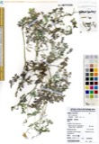
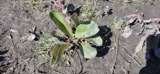
1975: 5,783 Plantae, 4,794 Fungi, 3,701 Animalia, 305 Protozoa, 192 Chromista, 64 Unrecorded, 37 Bacteria. 12 distinct Species records are shown.
Collected by (MARSDEN, H W), ?, ? ex Herb. W.G. Farlow and others. Each is a
physical object with a catalogue
number, and each entry opens the museum's record. This is what was
collected and kept, not a survey of what lives here - nothing can be
concluded from a species being absent.
Regional context, not property-specific
evidence. The federal mineral resources record lists
3 workings within 5 miles of Paul's Bridge: 2 unknowns, 1 producer.
1 still produces. What was taken out: Sand and Gravel, Construction, Stone, Crushed/Broken. Distance is straight-line from the
map coordinates, so a quarry counted here may appear on a neighbouring
settlement's page as well.
Regional context, not property-specific
evidence. The National Weather Service names
Milton, the town this property stands in, in 21 storm reports between 1996 and 2025: 9 thunderstorm wind, 5 lightning, 4 heavy rain, 1 hail.
The reports record 3 injuries. Each account below is quoted exactly as the forecast office
filed it, from the NOAA Storm Events Database, and each date
opens the federal record of that event.
Lightning struck a house on Augusta Road, causing a fire that engulfed the entire third floor of the house. No one was home at the time of the fire. Three firefighters were hospitalized for heat exhaustion but were released less than 24 hours later.
No historic map-sheet match is published
for this property yet. That does not mean no map exists. This record needs
a coordinate-quality review before it can be joined to a sheet boundary.
Browse the county's mapped places while that work is
pending.
From the nomination file
1,839 words on record
When this property was proposed for the
National Register, someone wrote the case for it: what the building is,
and why it matters. That document is a federal record in the public domain.
It is quoted below word for word, never summarised. The text was read off the scanned case file by machine, so the
occasional stray character is the recogniser's and the 1970s
typewriter's.
Description of the property
Paul's Bridge, extending approximately 88 feet, carriesthe Neponset Valley Parkway across the Neponset River between the town of Milton and the Readville section of Boston. As built in 1849, the three arch bridge was 23 feet wide and constructed of unmortared stone, coursed between the spandrels and filled with rubble at the embankments. Each round arch measures 20 feet at the ac: springline. The rough cut voussoirs were unmortared blocks which rose to the heavy rectangular coping. A fence of wooden siderails with iron stanchions extended from the, coping of each elevation. Between 1932 and 1935, the bridge was widened and, before completion of nore dao Nas xhi boldge wtth a goner to backio the project, solid stone parapets were constructed to replace the fence.
The north face of the bridge was kept intact, its joints pointed and raked. This face was reinforced with a concrete backing; its coping was removed and reset with smaller blocks. The south elevation was rebuilt approximately 17 feet to the south using the same blocks. Sidewalks were added to each side. No further alterations have been made. 18 RECÊiVED NOV 20 1972 NATIONAL REGISTER Ta :c). DO323. TICH SE1E tr d.. ao fasd aeh so INSTRUCTIONS ,1E...
Statement of significance
Paul's Bridge is the third bridge to stand on this site, one of the three Milton crossings over the Neponset River in the 18th century and, at thet time, the only link between the towns of Milton and Dedham. The bridge is located within the Neponset River Reservation which forms an essential green link between the Stoney Brook and Blue Hills Reservations, planned and developed by Olmsted, Olmsted and Eliot, the famous architectural firm founded by Frederick Law O1msted. The Neponset Valley Parkway, running over the bridge, was designed to connect these two reservations. The redesign of the bridge in 1932-5 was made by Arthur A. Shurcliff, FASLA and founder of the AIP.
He studied and wored in the office of Olmsted Brothers until 1905 and was the chief landscape consultant to the Metropolitan Parks (District) Commission and landscape architect for the Restoration of Williamsburg from 1928-1944. Although the present bridge was constructed in 1849, an early bridge, known as "Hubbard's bridge" was located here prior to 1759, at which time it was rebuilt, the cost to be met in proportion to the province tax oi each town. It served as an early river crossing for local farmers. By its 1807 reconstruction, the bridge had been renamed "Paul's bridge" for the owner of the adjacent land in Dedham. 9 FECEVED NOV 20 1972 NATIONAL REGISTER
Quoted from the National Register nomination
for reference 72000140, 10 pages, held by the National Archives in Record
Group 79. See the
catalogue record.
Listed places nearby
6 within 8 miles
Other National Register properties close
enough to walk or drive between, ordered by distance from this one. Both
positions come from the same geocoding pass that matched these properties
to their map sheets.
Listing record. National Park Service National Register of Historic Places, listed-properties dataset, current to 2026-05-22.
Map join. Address geocoded through the United States Census geocoder, then tested against the published boundary of every sheet in the USGS Historical Topographic Map Collection.
How this page is made. Listing fields come from federal records; map-sheet coverage is a labelled coordinate-to-boundary calculation, not a source-field claim.
Wildfire. Short, Karen C. 2022. Spatial wildfire occurrence data for the United States, 1992-2020 [FPA_FOD_20221014]. 6th Edition. Fort Collins, CO: Forest Service Research Data Archive. https://doi.org/10.2737/RDS-2013-0009.6 Collected with United States Government funding and usable without additional permissions or fees.
Specimens. Global Biodiversity Information Facility (GBIF), https://www.gbif.org/. Only records licensed CC0 or CC BY are used. Records licensed CC BY-NC are excluded because this site carries advertising. Images are checked individually and any whose licence is non-commercial, no-derivatives or unreadable is refused.
Mines and quarries. USGS Mineral Resources Data System (MRDS) https://mrdata.usgs.gov/mrds/ A work of the United States government, no copyright under 17 U.S.C. 105.
Storms. NOAA National Centers for Environmental Information, Storm Events Database https://www.ncei.noaa.gov/stormevents/ A work of the United States government, no copyright under 17 U.S.C. 105. Narratives are quoted verbatim from the National Weather Service report and are not edited or summarised.
 Block
Block