Listed on the National Register of Historic Places in
1972. A historic map-sheet match is not published yet. The record needs a coordinate-quality review before it can be joined to a sheet boundary.
From the record
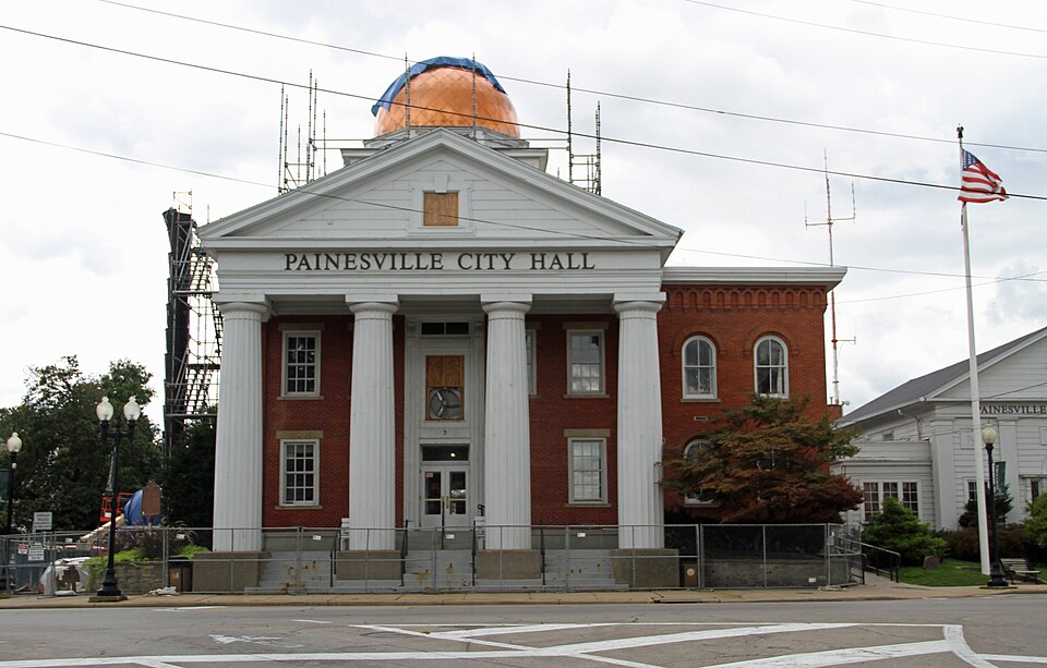
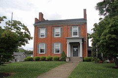
“The Painesville City Hall is the seat of the municipal government for the city of Painesville in the U.S. state of Ohio. The building is also referred to as the Old Lake County Courthouse due to its initial construction as the county courthouse for Lake County.”
Wikipedia article Painesville City Hall, CC BY-SA 4.0.
one of 75 National Register listings in Lake County · listed in 1972 · category: Building · one of 2 National Historic Landmarks in Lake County.
National Register reference number.72001028- the number the National Park Service assigned this property when it was listed, and the key its nomination file is catalogued under at the National Archives.
Fires near this property
1 since 2002
Regional context, not property-specific
evidence. The
federal wildfire occurrence database
lists 1 fire within 5 miles of Painesville City Hall between
2002 and 2002, burning about 0 acres in total. None started naturally. 1 was recorded as arson.
Distance is straight-line from the map coordinates, so a fire counted
here may appear on a neighbouring settlement's page as well.
Reported cause
Fires
Arson/incendiarism
1
The most recent of
them, most recent first, with the day each was reported and the service
that recorded it.
Regional context, not property-specific
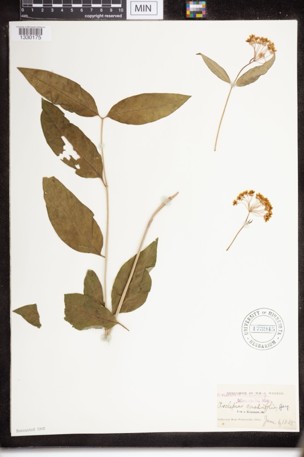
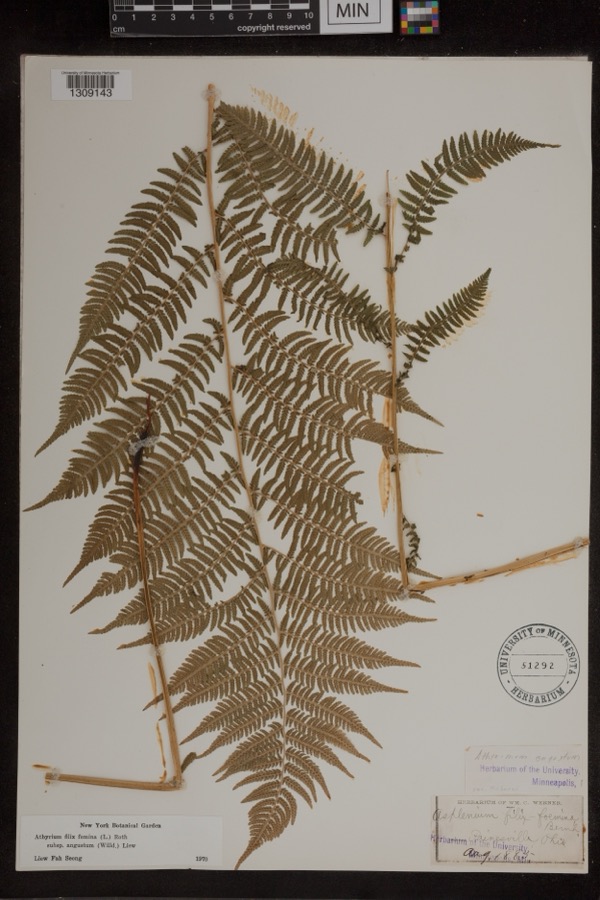
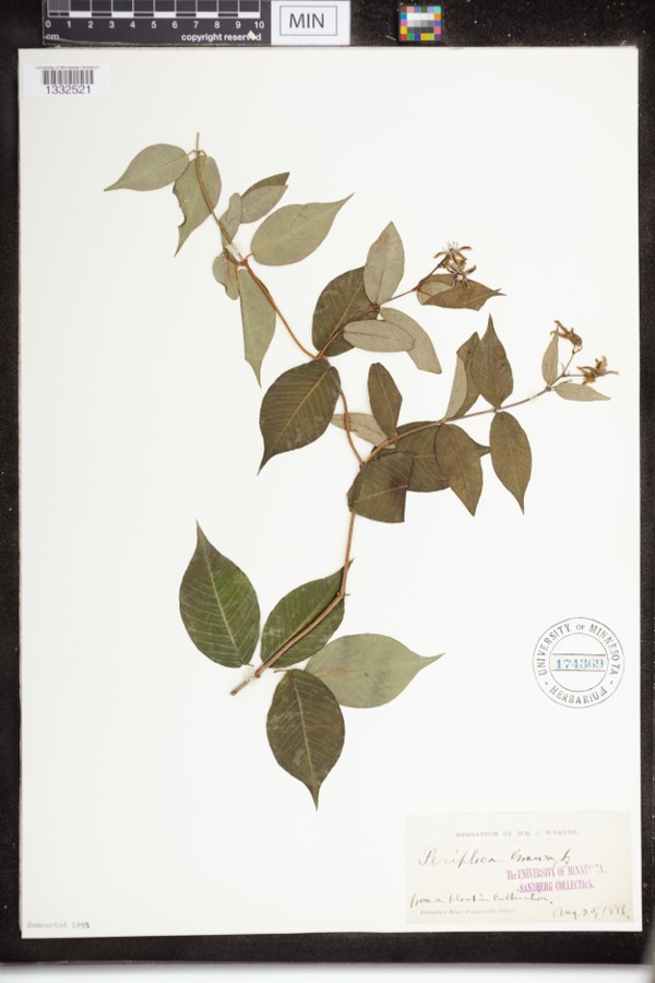
evidence. Museums hold 1,323 specimens
collected within 10 miles of Painesville City Hall between 1864 and
1975: 1,062 Animalia, 142 Plantae, 100 Fungi, 10 Chromista, 6 Protozoa, 3 Unrecorded. 12 distinct Species records are shown.
Collected by A. Doolittle, A. F. Clewell, A. Woolman and others. Each is a
physical object with a catalogue
number, and each entry opens the museum's record. This is what was
collected and kept, not a survey of what lives here - nothing can be
concluded from a species being absent.
Regional context, not property-specific
evidence. The federal mineral resources record lists
6 workings within 5 miles of Painesville City Hall: 4 producers, 2 past producers.
4 still produce. What was taken out: Sand and Gravel, Construction, Halite, Salt, Calcium. Distance is straight-line from the
map coordinates, so a quarry counted here may appear on a neighbouring
settlement's page as well.
Regional context, not property-specific
evidence. The National Weather Service names
Painesville, the town this property stands in, in 41 storm reports between 1996 and 2023: 25 thunderstorm wind, 11 hail, 2 flash flood, 2 flood.
No death or injury is recorded in these reports. Each account below is quoted exactly as the forecast office
filed it, from the NOAA Storm Events Database, and each date
opens the federal record of that event.
A thunderstorm downburst downed dozens of trees and damaged several homes. The damage path began near Liberty Street in Painesville and continued east along Prouty Road to near State Route 44 in Concord. A mobile home was crushed by a fallen tree in Concord.
Many large trees downed in Painesville. One tree pierced the roof of a nursing home with branches ending up less than a foot away from an elderly woman laying in bed. Three classic cars were severely damaged when the garage they were in was destroyed by a fallen tree. A brand new sport utility vehicle was also destroyed by a fallen tree. An additional dozen trees were downed to the east of Painesville in North Perry.
Around noon on January 23rd, local officials reported the jam at the mouth of the river at Lake Erie extending as far south (upstream) as the Route 2 bridge near Painesville. The resulting backwater caused flooding of outbuildings along the river on Richmond Street and Ram Island, and flooded the Fairport Harbor Marina. Some storage equipment was flushed out into the lake. The Coast Guard ice cutter was sent in to remove the jam on the night of the 23rd.
2 papers published in this town,
digitised by the Library of Congress and free to read: 0 issues,
0 pages. Every page is searchable, so a name or a street can be
looked for directly in what the town printed about itself at the time.
No historic map-sheet match is published
for this property yet. That does not mean no map exists. This record needs
a coordinate-quality review before it can be joined to a sheet boundary.
Browse the county's mapped places while that work is
pending.
From the nomination file
1,394 words on record
When this property was proposed for the
National Register, someone wrote the case for it: what the building is,
and why it matters. That document is a federal record in the public domain.
It is quoted below word for word, never summarised. The text was read off the scanned case file by machine, so the
occasional stray character is the recogniser's and the 1970s
typewriter's.
Description of the property
the cupola, but by 1840 cupolas had become common for Ohio courthouses, Interior: The interior of this structure has been considerably altered perhaps because they helped give public buildings some degree of monumental- Moved Exterior:This is a two-story brick building with cupola and two-story a change in the building's use from courthouse to city hall in 1909,and since the building was erected in l840. Part of the changes were due to
Statement of significance
Widely, but probably erroneously, attributed to the well-known architect of this County, Jonathan Goldsmith, the building was constructed rapidly Erie, a move was launched to break off and form a new County. Temporarily stymied by a large acreage requirement to form a County, the separation- was selected as the county seat, and the enthusiastic citizens raised order to construct a suitable courthouse.
The contractor, Henry scribed funds, thus beginning a lamentable tradition that persists to this Courthouse to the northwest side of the public square, the 1840 building Architecture Commerce Communications Transportation Engineering Military Science losophy Religion/Phi Conservation REGIST Theater Landscape itarian Education Industry Agriculture Music Prehistoric Literature Aboriginal Pre-Columbian Social/Human- Sculpture The structure is an outstanding example of the Greek Revival architecture Urban Planning from the then-existing Geauga County The historical material at hand across Richmond Street. then flourishing at the time of the establishment of Lake County. ists shrewdly decided to claim the acreage of Lake Erie to its center- Invention NATIONA!
was converted into the Painesville City Hall. immediately following the separation of the present Lake County area The ploy was successful, and in 1840 Lake County was formed, complementedbya public square,deeded in perpetuity asa park,directly Following the completion in 1909 of the new present)Lake County Other the northern parts of Geauga County, along the southern shore of Lake $5,000 by public subscription even before the results were official, in Wigglesworth, was reportedly unable to keep his costs within the sub- JUN 29 1972 very day in Lake County. From the start, the structure has been 1840 Art line. notes that as a result of differing interests on the part of residents of becoming the newest and the smallest of all Ohio counties.Painesville RECEIVED
Quoted from the National Register nomination
for reference 72001028, 14 pages, held by the National Archives in Record
Group 79. See the
catalogue record.
Listed places nearby
6 within 8 miles
Other National Register properties close
enough to walk or drive between, ordered by distance from this one. Both
positions come from the same geocoding pass that matched these properties
to their map sheets.
Listing record. National Park Service National Register of Historic Places, listed-properties dataset, current to 2026-05-22.
Map join. Address geocoded through the United States Census geocoder, then tested against the published boundary of every sheet in the USGS Historical Topographic Map Collection.
How this page is made. Listing fields come from federal records; map-sheet coverage is a labelled coordinate-to-boundary calculation, not a source-field claim.
Wildfire. Short, Karen C. 2022. Spatial wildfire occurrence data for the United States, 1992-2020 [FPA_FOD_20221014]. 6th Edition. Fort Collins, CO: Forest Service Research Data Archive. https://doi.org/10.2737/RDS-2013-0009.6 Collected with United States Government funding and usable without additional permissions or fees.
Specimens. Global Biodiversity Information Facility (GBIF), https://www.gbif.org/. Only records licensed CC0 or CC BY are used. Records licensed CC BY-NC are excluded because this site carries advertising. Images are checked individually and any whose licence is non-commercial, no-derivatives or unreadable is refused.
Mines and quarries. USGS Mineral Resources Data System (MRDS) https://mrdata.usgs.gov/mrds/ A work of the United States government, no copyright under 17 U.S.C. 105.
Storms. NOAA National Centers for Environmental Information, Storm Events Database https://www.ncei.noaa.gov/stormevents/ A work of the United States government, no copyright under 17 U.S.C. 105. Narratives are quoted verbatim from the National Weather Service report and are not edited or summarised.
 Block
Block