Photographs from the nomination case file, National Park Service records.
Barrett, Col. James, Farm
Listed on the National Register of Historic Places in
1973. A historic map-sheet match is not published yet. The record needs a coordinate-quality review before it can be joined to a sheet boundary.
From the record
“About the 21st of Feb., says Gookin in the manuscript before quoted, " there befel another great trouble to the Christian Indians of Nashobah, who sojourned in Concord. The Council had by several orders empowered a committee, who, with consent of the selectmen of Concord, settled those Indians at that town, under the government and tuition of Mr.”
A History of the Town of Concord, Middlesex County, Massachusetts : from Its Earliest Settlement to 1832; and of the Adjoining Towns, Bedford, Acton, Lincoln, and Carlisle; Containing Various Notices of County and State History Not Before Published. (1835). Machine-read text.
one of 1100 National Register listings in Middlesex County · listed in 1973 · category: Building · one of 3 National Historic Landmarks in Middlesex County.
National Register reference number.73000290- the number the National Park Service assigned this property when it was listed, and the key its nomination file is catalogued under at the National Archives.
What happened here
An account from the chapter on Concord town, The inset identifies its exact
source book and publication year.
Philip's War. - State of the Country. - Garrison Houses. - Expedition to Brookfield. - Proceedings of Government} and of the Town. - Lancaster burnt. - Christian Indians in Concord. - Feelings towards the Indians. - Abraham and Isaac Shepherd killed. - Groton burnt. - People remove to Concord. - Proceedings of Government.
The author of the following History, having had occasion several years since to consult some of the earlier town records in Concord, discovered many important facts and documents which were wholly unknown to the public, and very imperfectly to the inhabitants of the town itself; and it occurred to him that a series of communications in a periodical work, embracing them, would be interesting and valuable, and he immediately began to collect materials for this purpose. But, in the progress of his investigation, the quantity of interesting matter increased so much, that it was thought best it should be published in some other form than that originally intended. The result of his inquiries appears in the following volume. It has been compiled at such intervals of time as could be conveniently abstracted from the almost constant engagements of business.
Those only, who have been engaged in similar works, can be aware of the great labor required to collect the materials for a volume like this, and arrange them for the press. And the difficulty and labor have been much increased in this instance by the imperfections of the town and church records. The first volume of the records of the town, containing its proceedings prior to 1696, about sixty years after its first settlement, is lost ; and likewise the proceedings of the church prior to 1738, more than one hundred years after its organization. There is however in the clerk's office an old volume, containing an imperfect record of several grants of land, and a few unconnected proceedings of the town ; with an incomplete list of marriages, births, and deaths, prior to 1696. This renders the early history of the town, less perfect than it would have been, had the records been preserved, though from other sources much important information has been obtained. The early records and documents in the offices of the Secretary of the Commonwealth and of the county of Middlesex, and the private papers of individuals, and various other scattered fragments of traditionary, manuscript, and printed history have, with great labor and no little expense, been consulted, which, though they do not furnish a complete history, have been found interesting and important, and in some respects supply the place of town records. Traditions, however, are often contradictory, tending to embarrass rather than to elucidate. They should be depended upon only as leading the investigator towards the truth, which, on further inquiry and comparison of different traditions with records, may be discovered. I have seldom been willing to state a fact positively, unless verified in this way. A tradition has prevailed in Concord, that the early records of the town were burnt ; and this is said to have taken place when part of the first settlers removed to Connecticut. If this were true, it could not apply to the town records from 1650 to 1696, nor to any part of the church records prior to 1738. This tradition is undoubtedly incorrect. The town records were destroyed in some other way, and, if burnt, it must have occurred subsequently to 1696. The loss of the church records was probably occasioned by the difficulty in the church detailed in the following History.
Regional context, not property-specific
evidence. The
federal wildfire occurrence database
lists 33 fires within 5 miles of Barrett, Col. James, Farm between
2003 and 2020, burning about 14 acres in total. None started naturally. 1 was recorded as arson.
Distance is straight-line from the map coordinates, so a fire counted
here may appear on a neighbouring settlement's page as well.
Reported cause
Fires
Debris and open burning
17
Missing data/not specified/undetermined
8
Power generation/transmission/distribution
3
Railroad operations and maintenance
2
Arson/incendiarism
1
Equipment and vehicle use
1
Recreation and ceremony
1
The most recent of
them, most recent first, with the day each was reported and the service
that recorded it.
Regional context, not property-specific
evidence. Museums hold 684 specimens
collected within 10 miles of Barrett, Col. James, Farm between 1898 and
1975: 374 Animalia, 182 Plantae, 120 Fungi, 4 Protozoa, 3 Chromista, 1 Unrecorded. 12 distinct Species records are shown.
Collected by A. B. Seymour, A. B. Seymour & M. D. Feigley, A. E. Feldman and others. Each is a
physical object with a catalogue
number, and each entry opens the museum's record. This is what was
collected and kept, not a survey of what lives here - nothing can be
concluded from a species being absent.
Regional context, not property-specific
evidence. The federal mineral resources record lists
11 workings within 5 miles of Barrett, Col. James, Farm: 7 past producers, 3 producers, 1 occurrence.
3 still produce. What was taken out: Sand and Gravel, Construction, Copper. Distance is straight-line from the
map coordinates, so a quarry counted here may appear on a neighbouring
settlement's page as well.
Regional context, not property-specific
evidence. The National Weather Service names
Concord, the town this property stands in, in 36 storm reports between 1997 and 2024: 26 thunderstorm wind, 4 flood, 3 lightning, 1 hail.
The reports record 12 injuries. Each account below is quoted exactly as the forecast office
filed it, from the NOAA Storm Events Database, and each date
opens the federal record of that event.
A tornado developed within an area of showers and thunderstorms moving through southern New England. This tornado touched down near the Cambridge Turnpike and headed northeast. Most of the damage was concentrated in an area beginning near the intersection of Lexington Road and Alcott Road and continuing up to the neighborhood of Alcott and Independence Roads. Numerous trees were uprooted or had the tops sheared off. These subsequently blocked roads, damaged homes, and downed power lines, cutting off power to the neighborhood. In addition, utility poles were downed either from the wind or from the downed power lines. Thirty-nine houses in this area were damaged to some degree. Only one house suffered significant structural damage. The tornado continued for a short distance beyond this neighborhood before lifting. The historical home of Louisa May Alcott and her family was right next to the tornado path but was not damaged.
Trees, wires, and poles were downed throughout Concord, closing several roads, including: Elm Street, Crescent Street, MacArthur Road, and Ornac Road near Route 2.
Sudbury Road in Concord was flooded at Heath's Bridge. The Cambridge Turnpike was also flooded. In Framingham, the intersection of Routes 126 and 9 was flooded. A car was stranded in flood waters on Bent Road in Sudbury.
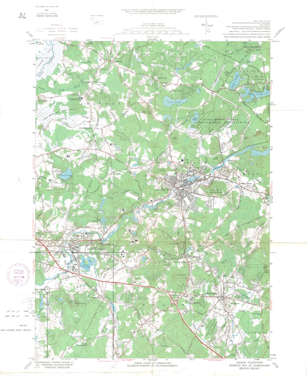
No historic map-sheet match is published
for this property yet. That does not mean no map exists. This record needs
a coordinate-quality review before it can be joined to a sheet boundary.
Browse the county's mapped places while that work is
pending.
From the nomination file
2,273 words on record
When this property was proposed for the
National Register, someone wrote the case for it: what the building is,
and why it matters. That document is a federal record in the public domain.
It is quoted below word for word, never summarised. The text was read off the scanned case file by machine, so the
occasional stray character is the recogniser's and the 1970s
typewriter's.
Description of the property
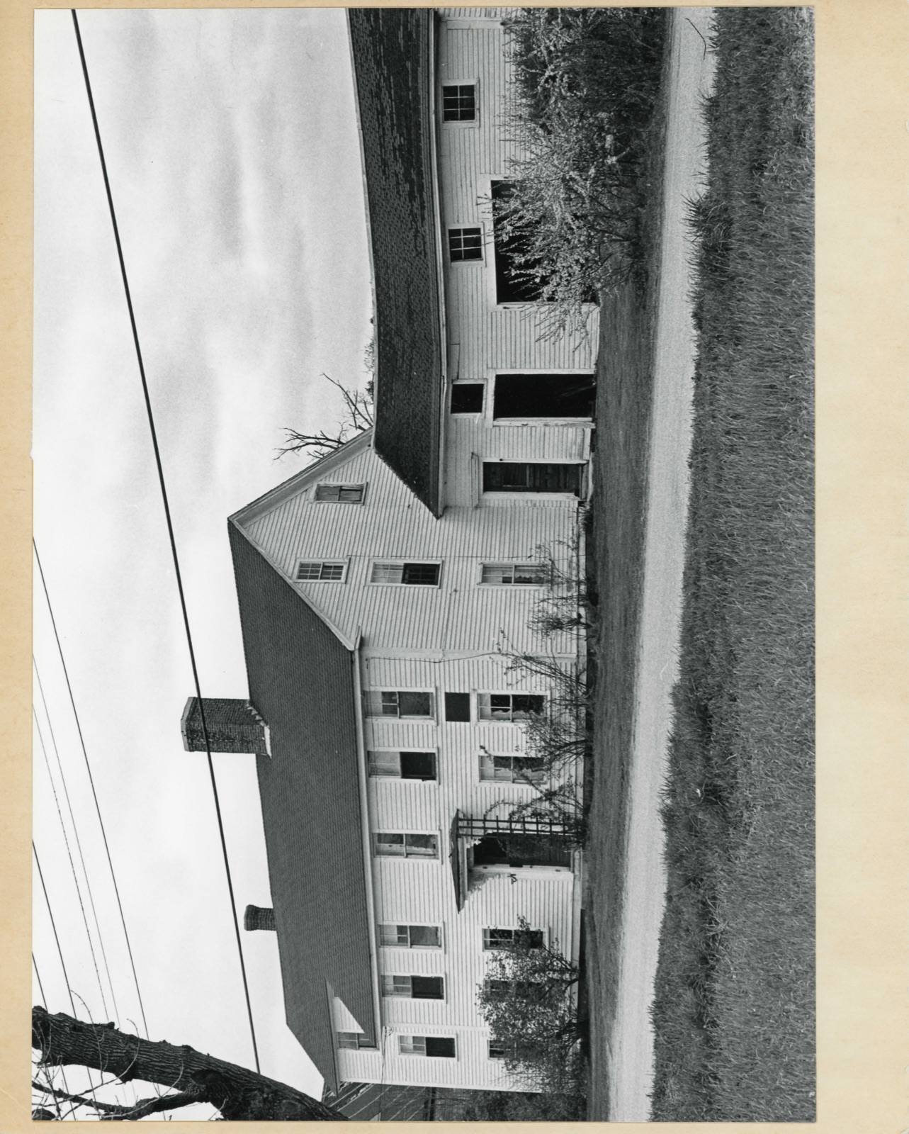
- Moved Ruins - Unexposed (Check One) * Original Site The Colonel James Barrett Farm is located at no. 448 Barrett's Mill Road, two miles from Concord Center. The house faces south at a distance of fifteen feet from the street and is a typical New England farmhouse, of frame construction, two and one half stories high with a gable roof. Its present appearance is the result of various constructions, alterations, and additions dating from 1705 to the early twentieth century. The central portion of the house is the oldest. Its eastern end dates from 1705 and was originally a one-story, one room house. About 1720 the western end was built and a second story added to both sides.
The result was essentially what we see now, a five bay wide, two and one half story facade with center entrance and large central chimney. To the west of the main house is a three story wing, set back about eight feet from the main facade. It was built c. 1760 and is two bays wide with an entrance on the east side of the south front. Beyond this wing are two large, detached barns of apparent eighteenth century origin. They are in original, but very poor, condition. From the time of the addition of the wing, the appearance of the house did not change substantially until the mid-nineteenth century. At that time a long woodshed of one and one half stories was added to the east side and set back, like the 1760 wing, from the main facade of the house; this wing is presently in poor condition.
Near the end of the nineteenth century various alterations wére made to the house.
Z - The Barrett House in Concord was the home of Colonel James Barrett, Revolutionary War patriot and one of the primary figures in the events leading up to and surrounding the British march on Concord and Lexington in April, 1775. Colonel Barrett was born in this house, built by his father in 1705; it was operated as a farm by both father and son for many years prior to the Revolution. Aside from farming, Col. Barrett was well known in the area for his membership in many of the county and state conventions and his participation in the Provincial Congresses. He was representative to the Massachusetts General Court every year from 1768 to 1777.
In local affairs, Barrett commanded the militia regiment and super- intended the collection and deposit of military stores for the Massa- chusetts Committee of Public Safety. He used his own barn and outbuild. ings as well as those of other Concord residents to store powder, flour, cannon, and other supplies necessary for military operations. The main objective of the British march on Concord, April 19, 1775gag was to arrest Col. Barrett and search his property. However, day before the British march, the Colonel received word of their plans and thus, the four companies that reached his farm on the nineteenth?
found neither the arms, which had been carried off or well hidden on the property, nor the Colonel, who had gone to command the provincials then engaging the remainder of the British forces at the North Bridge. The British foray did net some cannon carriages and much time was spent in burning and otherwise destroying them. Col. Barret's wife, Rebecca, further detained the four companies searching the farm by offering them drink.
Quoted from the National Register nomination
for reference 73000290, 11 pages, held by the National Archives in Record
Group 79. See the
catalogue record.
Listed places nearby
6 within 8 miles
Other National Register properties close
enough to walk or drive between, ordered by distance from this one. Both
positions come from the same geocoding pass that matched these properties
to their map sheets.
Listing record. National Park Service National Register of Historic Places, listed-properties dataset, current to 2026-05-22.
Map join. Address geocoded through the United States Census geocoder, then tested against the published boundary of every sheet in the USGS Historical Topographic Map Collection.
How this page is made. Listing fields come from federal records; map-sheet coverage is a labelled coordinate-to-boundary calculation, not a source-field claim.
Wildfire. Short, Karen C. 2022. Spatial wildfire occurrence data for the United States, 1992-2020 [FPA_FOD_20221014]. 6th Edition. Fort Collins, CO: Forest Service Research Data Archive. https://doi.org/10.2737/RDS-2013-0009.6 Collected with United States Government funding and usable without additional permissions or fees.
Specimens. Global Biodiversity Information Facility (GBIF), https://www.gbif.org/. Only records licensed CC0 or CC BY are used. Records licensed CC BY-NC are excluded because this site carries advertising. Images are checked individually and any whose licence is non-commercial, no-derivatives or unreadable is refused.
Mines and quarries. USGS Mineral Resources Data System (MRDS) https://mrdata.usgs.gov/mrds/ A work of the United States government, no copyright under 17 U.S.C. 105.
Storms. NOAA National Centers for Environmental Information, Storm Events Database https://www.ncei.noaa.gov/stormevents/ A work of the United States government, no copyright under 17 U.S.C. 105. Narratives are quoted verbatim from the National Weather Service report and are not edited or summarised.
 Block
Block