Listed on the National Register of Historic Places in
1973. A historic map-sheet match is not published yet. The record needs a coordinate-quality review before it can be joined to a sheet boundary.
From the record
one of 338 National Register listings in Cuyahoga County · listed in 1973 · category: Building · one of 3 National Historic Landmarks in Cuyahoga County.
National Register reference number.73001427- the number the National Park Service assigned this property when it was listed, and the key its nomination file is catalogued under at the National Archives.
Specimens collected near this property
12 of 2,704 shown
Regional context, not property-specific
evidence. Museums hold 2,704 specimens
collected within 10 miles of Old District 10 Schoolhouse between 1849 and
1975: 2,262 Animalia, 225 Fungi, 134 Plantae, 77 Protozoa, 5 Unrecorded, 1 Chromista. 12 distinct Species records are shown.
Collected by A. D. Huryn, A. D. Selby, A. G. Newhall and others. Each is a
physical object with a catalogue
number, and each entry opens the museum's record. This is what was
collected and kept, not a survey of what lives here - nothing can be
concluded from a species being absent.
Regional context, not property-specific
evidence. The federal mineral resources record lists
1 working within 5 miles of Old District 10 Schoolhouse: 1 past producer.
None of them still produces. What was taken out: Limestone, General. Distance is straight-line from the
map coordinates, so a quarry counted here may appear on a neighbouring
settlement's page as well.
Regional context, not property-specific
evidence. The National Weather Service names
Middleburg Heights, the town this property stands in, in 1 storm report between 1994 and 1994: 1 thunderstorm wind.
No death or injury is recorded in these reports. Each account below is quoted exactly as the forecast office
filed it, from the NOAA Storm Events Database, and each date
opens the federal record of that event.
No historic map-sheet match is published
for this property yet. That does not mean no map exists. This record needs
a coordinate-quality review before it can be joined to a sheet boundary.
Browse the county's mapped places while that work is
pending.
From the nomination file
1,610 words on record
When this property was proposed for the
National Register, someone wrote the case for it: what the building is,
and why it matters. That document is a federal record in the public domain.
It is quoted below word for word, never summarised. The text was read off the scanned case file by machine, so the
occasional stray character is the recogniser's and the 1970s
typewriter's.
Description of the property
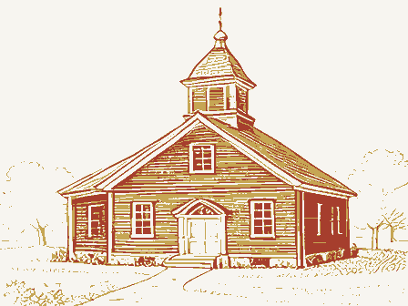
One and one half stories high with a raised basement, this brick were made on the building. SEP 1 9 1973 CONDITION Excellent NATIONAL REGISTER walls. the east and west sides of the building are six connected rectangular arched windows with stone hoodmolds and bracketed stone sills.On These windows were originally longer but were shortened when alterations present door is set lower than the original.The doorway is recessed jecting vestibule with a gable roof and a plain cornice which returns are shorter than the original windows.They have stone sills.The tangular double-hung sash window with stone sill and lintel.
The front vestibule originally was the traditional cloak room with alteration is poorly constructed and interior will have to be gutted square nine-pane window above the doorway.A stone lintel bears the The front vestibule was originally a grand entranceway with a large building measures approximately 1600 square feet.The rather steep single windows and one pair just east of center and all five windows to make proper restoration.
On the south facade there were originally four sets of paired rec- clothes racks on either side of the four steps leading up to the main To either side of the vestibule on the north facade are paired round- Entrances lead directly into the basement level and a full set of stairs name of the school--District No.10.There isa fanlight in the gable hipped roof is of slate.On the front (north) facade there is a pro- door with an overhang was added. (Check One) with a stone sill anda stone hoodmold with the date 1912 etched in Original Site - Unexposed in the center of the building lead to living quarters composed of two X Fair impressive front door.
The District 10 Schoolhouse, built in 1912, was the area school for Brookpark and Middleburg.The school was closed down in the early In addition to housing the district school, the building was the mayor of Middleburg Heights, C.O. Grissom, and the first council were elected. For a short time, the schoolhouse was Middleburg The schoolhouse, which has had a most colorful past, is very im- Conservation Commerce Engineering Communications Transportation Architecture Military losophy Science Education Aboriginal NATIONAL Landscape Religion/Phi Literature REGISTER Pre-Columbian Agriculture Political Theater itarian Invention Industry Music Urban Planning schoolhouse has been escheated to the city of Middleburg Heights.
it was sold to Harvey Cross who remodeled the building and converted During Prohibition the schoolhouse became a speakeasy..About 1940 birthplace of the town of Middleburg Heights.In August of 1927,the portant to the citizens of Middleburg Heights and to those in Berea and Brookpark as well.There is a great deal of interest in restoring Social/Human- 18th Century annexation of the area called East Middleburg (now Middleburg Heights). More than 1o0 citizens crowded into the old schoolhouse to discuss Sculpture testors began to wage a hunger strike in the District 10 Schoolhouse.
it into a home.Cross died in 1970 and since he had no heirs, the the formation of anew village tobe called Middleburg Heights.An election was held in the schoolhouse in January of 1928 and the first Heights' city hall. Other 1920's. SPECIFIC DATE(S) (If Applicable and Known) 1912 Council of the city of Berea passed an ordinance providing for the The formerly placid neighborhood was roused into action and pro- the building for use as a cultural arts center and community center. 1973 Art children of grades one to twelve.Students came from Berea, AREAs OF SIGNIFICANCE (Check One or More as Appropriate)
Quoted from the National Register nomination
for reference 73001427, 11 pages, held by the National Archives in Record
Group 79. See the
catalogue record.
Listed places nearby
6 within 8 miles
Other National Register properties close
enough to walk or drive between, ordered by distance from this one. Both
positions come from the same geocoding pass that matched these properties
to their map sheets.
Listing record. National Park Service National Register of Historic Places, listed-properties dataset, current to 2026-05-22.
Map join. Address geocoded through the United States Census geocoder, then tested against the published boundary of every sheet in the USGS Historical Topographic Map Collection.
How this page is made. Listing fields come from federal records; map-sheet coverage is a labelled coordinate-to-boundary calculation, not a source-field claim.
Specimens. Global Biodiversity Information Facility (GBIF), https://www.gbif.org/. Only records licensed CC0 or CC BY are used. Records licensed CC BY-NC are excluded because this site carries advertising. Images are checked individually and any whose licence is non-commercial, no-derivatives or unreadable is refused.
Mines and quarries. USGS Mineral Resources Data System (MRDS) https://mrdata.usgs.gov/mrds/ A work of the United States government, no copyright under 17 U.S.C. 105.
Storms. NOAA National Centers for Environmental Information, Storm Events Database https://www.ncei.noaa.gov/stormevents/ A work of the United States government, no copyright under 17 U.S.C. 105. Narratives are quoted verbatim from the National Weather Service report and are not edited or summarised.
 Block
Block