BlockBefore
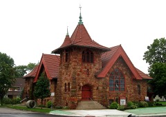
Photograph of Henry County Courthouse
Photograph by Christopher L. Riley, CC BY-SA 4.0. Via Wikimedia Commons.

Henry County Courthouse

Listed on the National Register of Historic Places in 1973. A historic map-sheet match is not published yet. The record needs a coordinate-quality review before it can be joined to a sheet boundary.

From the record

“The Henry County Courthouse is a historic courthouse building in Napoleon, Ohio, United States. Designed in the Second Empire style by architect David W.”

Wikipedia article Henry County Courthouse (Ohio), CC BY-SA 4.0.

one of 4 National Register listings in Henry County · listed in 1973 · category: Building.

Sources: the Wikipedia article · the case file at the National Archives · the National Register database, National Park Service

The listing

  • What is counted as historic. The nomination lists 1 building as contributing to the listing.
  • Address. N. Perry and E. Washington Sts., Napoleon, 43545
  • When was it listed? 1973-02-28
  • Category. building
  • Township. Napoleon township
  • National Register reference number. 73001477 - the number the National Park Service assigned this property when it was listed, and the key its nomination file is catalogued under at the National Archives.

The ground it stands on

1,008 words

The chapter on Napoleon Township in Fall of Napoleon, published 1907 names Napoleon. This is what it says, exactly as the scans read.

World. - "The story of Napoleon's childhood . . . could not have had an abler or more sympathetic narrator than the author of this very fascinating work ... to be welcomed as an extremely valuable contribution to the study of a superlatively great historic figure."

Passage source: Fall of Napoleon, published 1907.

Machine-read from a century-old scan, so expect the errors a machine makes: misspelled names, dropped words, stray characters.

Read the whole chapter on Napoleon Township - 1,008 words on its settlement, mills, schools and churches.

Fires near this property

11 since 2020

Regional context, not property-specific evidence. The federal wildfire occurrence database lists 11 fires within 5 miles of Henry County Courthouse between 2020 and 2020, burning about 13 acres in total. None started naturally. None was recorded as arson. Distance is straight-line from the map coordinates, so a fire counted here may appear on a neighbouring settlement's page as well.

Reported cause Fires
Debris and open burning6
Missing data/not specified/undetermined3
Smoking2

The most recent of them, most recent first, with the day each was reported and the service that recorded it.

DateCause SizeReported by Name on the report
27 September 2020Missing data/not specified/undeterminedunder an acreOhio Department of Natural Resources15834
26 September 2020Debris and open burningunder an acreOhio Department of Natural Resources15847
6 July 2020Smokingunder an acreOhio Department of Natural Resources15775
5 July 2020Missing data/not specified/undetermined3.0 acresOhio Department of Natural Resources15820
19 June 2020Debris and open burningunder an acreOhio Department of Natural Resources15766
10 May 2020Missing data/not specified/undeterminedunder an acreOhio Department of Natural Resources15734
8 November 2020Debris and open burningunder an acreOhio Department of Natural Resources15903
5 November 2020Debris and open burningunder an acreOhio Department of Natural Resources15888

Every fire recorded in Henry County

Specimens collected near this property

12 of 131 shown

Regional context, not property-specific evidence. Museums hold 131 specimens collected within 10 miles of Henry County Courthouse between 1898 and 1974: 113 Animalia, 9 Plantae, 7 Fungi, 2 Bacteria. 12 distinct Species records are shown. Collected by Adler, K. K., C.R. Neiswander, Claud Revere Neiswander and others. Each is a physical object with a catalogue number, and each entry opens the museum's record. This is what was collected and kept, not a survey of what lives here - nothing can be concluded from a species being absent.

Image SpeciesYear Collected by Where, as recorded
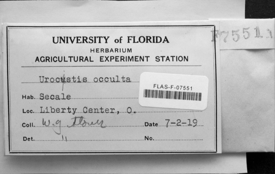
Specimen of Urocystis occulta (Wallr.) Rabenh.Urocystis occulta (Wallr.) Rabenh.1919W.G. StoverLiberty Center
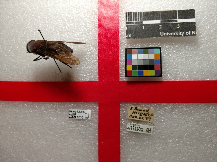
Specimen of Tabanus atratus Fabricius, 1775Tabanus atratus Fabricius, 17751937F. Bower
Specimen of Ceraclea cancellata (Betten, 1934)Ceraclea cancellata (Betten, 1934)1939Claud Revere Neiswander
A photograph of the species Dromogomphus spinosus, not of this specimenDromogomphus spinosus Selys, 18541898J. HineNapoleon
A photograph of the species Dromogomphus spoliatus, not of this specimenDromogomphus spoliatus (Hagen, 1858)1898J. HineNapoleon
A photograph of the species Libellula luctuosa, not of this specimenLibellula luctuosa Burmeister, 18391898J. HineNapoleon
A photograph of the species Perithemis tenera, not of this specimenPerithemis tenera (Say, 1840)1898J. HineNapoleon
A photograph of the species Fusarium culmorum, not of this specimenFusarium culmorum (Wm.G.Sm.) Sacc.1919Lewis H. L.Holgate
Helminthosporium gramineum Rabenh. ex Schltdl.1919Lewis H. L.Ridgeville Corners
A photograph of the species Puccinia graminis, not of this specimenPuccinia graminis Pers.1919Lewis H. L.Holgate
A photograph of the species Carpiodes velifer, not of this specimenCarpiodes velifer (Rafinesque, 1820)1927Trautman, M. B. (Milton Bernard) & Foster, R. (Robert)Bad Creek, Washington Township, near Liberty Center, Washington township
A photograph of the species Roccus chrysops, not of this specimenRoccus chrysops (Rafinesque, 1820)1927Trautman, M. B. (Milton Bernard) & Foster, R. (Robert)Maumee River, within Henry Co, Henry County, township n/a

All 131 specimens within 10 miles, at the Global Biodiversity Information Facility.

Mines and quarries near this property

3 within 5 miles

Regional context, not property-specific evidence. The federal mineral resources record lists 3 workings within 5 miles of Henry County Courthouse: 1 past producer, 1 plant, 1 producer. 2 still produce. What was taken out: Clay, Stone, Crushed/Broken. Distance is straight-line from the map coordinates, so a quarry counted here may appear on a neighbouring settlement's page as well.

Where SiteCommodity StatusRecorded
Own Crews QuarryStone, Crushed/BrokenProducer
Napoleon Brick & Tile WorksClayPlant
Napoleon Brick and Tile PitClayPast ProducerSedimentary

Every working recorded in Henry County

Storms near this property

49 since 1995

Regional context, not property-specific evidence. The National Weather Service names Napoleon, the town this property stands in, in 49 storm reports between 1995 and 2026: 37 thunderstorm wind, 10 hail, 2 flash flood. No death or injury is recorded in these reports. Each account below is quoted exactly as the forecast office filed it, from the NOAA Storm Events Database, and each date opens the federal record of that event.

WhenEvent Place namedHarm What the report says
August 1998Flash FloodNapoleon$150,000SOUTHERN HALF OF THE COUNTY SUSTAINED THE WORST FLOODING. MANY RURAL COUNTY ROADS WERE WASHED OUT TO SOME DEGREE WITH EXTENSIVE DAMAGE TO LOWLAND AGRICULTURAL FARM FIELDS.
May 1998Thunderstorm WindNapoleon$35,000no account filed
July 2011Thunderstorm WindNapoleon$15,000Emergency management officials reported uprooted trees and power lines down in and around Napoleon. A work trailer flipped over and was blown onto Scott Street. A tree fell onto a house on Oakwood Avenue.
March 2023Thunderstorm WindNapoleon$10,000Emergency manager reports two large trees were downed.
August 2022Thunderstorm WindNapoleon$10,000A private weather station recorded a 56 knot wind gust. Shingles were blown off the roof.
April 2010Thunderstorm WindNapoleon$10,000A local television station reported several trees were uprooted in the Glenwood Cemetery. Some of the grave markers were moved.
July 2008Thunderstorm WindNapoleon$10,000Law enforcement officials reported trees and power lines down in and around Napoleon.
August 1998Thunderstorm WindNapoleon$10,000HIGH WINDS BROKE SEVEN UTILITY POLES ALONG COUNTY ROAD 12. THE CITY WAS ALSO HIT WITH DIME SIZE HAIL FOR ABOUT 10 MINUTES.
April 2003Thunderstorm WindNapoleon$5,000A roof was ripped off a horse bard and trees and power lines were down north and northeast of Napoleon. .
April 2023Thunderstorm WindNapoleon$2,000EM reported tree down on power lines at the intersection of CR M2 and 424. Time estimated from radar.
July 1995Thunderstorm WindNapoleon$2,000Several trees were downed. Large hail fell but no property damage was reported from it.
April 2026HailNapoleon$1,000Range of hail sizes, largest stones nickel to quarter sized.
June 2021Thunderstorm WindNapoleon-Emergency management officials reported a tree was blown down onto power lines, with the road being blocked.
July 2020Thunderstorm WindNapoleon-A healthy tree one foot in diameter snapped approximately four feet above ground, and part of another tree fell onto a neighboring house.
June 2019Flash FloodNapoleon-Trained spotters reported water flowing over the road between Grand Rapids and Napoleon along Old US 24.
August 2019Thunderstorm WindNapoleon-Emergency management officials reported a tree was blown down, blocking a local road.
August 2019Thunderstorm WindNapoleon-Emergency management officials reported trees were blown down onto power lines in the area.
August 2019Thunderstorm WindNapoleon-Emergency management officials reported a large tree was blown down.
May 2019Thunderstorm WindNapoleon-Amateur radio operators reported a one foot diameter tree limb was blown down.
May 2019Thunderstorm WindNapoleon-Emergency management officials reported several trees and tree limbs were blown down across Henry county.
May 2017Thunderstorm WindNapoleon-The public estimated wind gusts to 60 mph.
November 2017Thunderstorm WindNapoleon-Emergency management officials reported a large road sign was knocked down along US 24.
July 2017Thunderstorm WindNapoleon-A trained spotter reported eight inch tree limbs ripped off a healthy tree.
July 2017Thunderstorm WindNapoleon-A trained spotter reported roof fascia ripped off, as well as shingles off a store front roof. Some minor structural damage was noted to the roof as well.
July 2017Thunderstorm WindNapoleon-Emergency management officials reported six utility poles were snapped along State Route 108 and County Road N.
July 2016Thunderstorm WindNapoleon-The public reported a large tree, approximately 1 foot in diameter was blown down across 2 different yards.
June 2015Thunderstorm WindNapoleon-Emergency management officials reported a large tree down onto a local road. In addition, a tree fell onto an unoccupied car on Beckham Street.
July 2014HailNapoleon-The public reported hail to the size of quarters.
July 2013Thunderstorm WindNapoleon-Emergency management officials reported multiple trees were blown down in the city of Napoleon.
July 2013Thunderstorm WindNapoleon-Emergency management officials reported widespread, significant wind damage across the county. Three utility trailers were pushed across the parking lot at the Emergency Operations Center.
June 2013Thunderstorm WindNapoleon-A trained spotter estimated a 70 mph wind gust at the intersection of County Road M and State Route 108.
June 2012Thunderstorm WindNapoleon-A trained spotter recorded a 73 mph wind gust. Tree limbs were noted down in the area.
August 2012Thunderstorm WindNapoleon-Emergency management officials reported power lines and numerous tree limbs down across the county.
July 2011Thunderstorm WindNapoleon-A trained spotter reported large tree limbs down from wind gusts estimated around 70 mph.
July 2011Thunderstorm WindNapoleon-Trained spotters estimated wind gusts of 55 to 65 mph.
June 2010Thunderstorm WindNapoleon-Tree down on Riverview.
May 2004Thunderstorm WindNapoleon-Emergency management reported trees and power lines down east of Napoleon.
July 2002Thunderstorm WindNapoleon-Power lines and a pole reported down north of Napoleon.
August 2000Thunderstorm WindNapoleon-Power lines down.
November 1998Thunderstorm WindNapoleon-A FEW TREES WERE BLOWN DOWN IN TOWN.
July 1995HailNapoleon-Several trees were downed. Large hail fell but no property damage was reported from it.
October 2020HailNapoleon-no account filed
June 2019HailNapoleon-no account filed
May 2002HailNapoleon-no account filed
August 1998HailNapoleon-no account filed
July 1996Thunderstorm WindNapoleon-no account filed

Every storm recorded in Henry County

Newspapers printed here

0 digitised pages

2 papers published in this town, digitised by the Library of Congress and free to read: 0 issues, 0 pages. Every page is searchable, so a name or a street can be looked for directly in what the town printed about itself at the time.

NewspaperPublished
Democratic Northwest and Henry County News1894 to 1905
Democratic Northwest1869 to 1894

Map coverage status

No historic map-sheet match is published for this property yet. That does not mean no map exists. This record needs a coordinate-quality review before it can be joined to a sheet boundary. Browse the county's mapped places while that work is pending.

From the nomination file

1,505 words on record

When this property was proposed for the National Register, someone wrote the case for it: what the building is, and why it matters. That document is a federal record in the public domain. It is quoted below word for word, never summarised. The text was read off the scanned case file by machine, so the occasional stray character is the recogniser's and the 1970s typewriter's.

Statement of significance

necessary public offices. This was not until 1834. Its county seat was fixed at Napoleon. The 1st courthouse was in the second floor of a log addition to to the county. By 1844 there was sufficient funds to build a frame courthouse at the corner of Perry & Washington Streets. It was built at a cost of $2,000 and, unfortunately, burned to the ground in 1847. All county records were lost. The donation of land in 1849 lead to the building of a new courthouse and a separate building to house the jail. The small brick structure with its impressive entrance of white pillars, bell tower and spire, was also destroyed by fire about 1878. Karst and William Woodruff completed the building in 1882.

"It stands on the corner of Perry and Washington Street, the site of the first frame courthouse.y The cost was $79,825. Henry County, once covered by the almost impassable Black Swamp, can The Henry County Courthouse today still houses all the offices for It is a familiar landmark to local residents and a most impressive building to all who pass through the city. Commerce Conservation Architecture Communications Military Engineering Aboriginal Theater losophy Education Science Landscape REGISTER Literature Prehistoric Industry NATIONAL Invention itarian Sculpture Agriculture Music county business and is the depository of all county governmental records.

Social/Human- Urban Planning In March of 1880,the present courthouse was contracted for.Jacob claim Robert K.Scott as one of its illustrious citizens.Mr.Scott, trial in 1882.Thus was coined the phrase,'He went Scott free FEB 15 1973 It was Other (Specify) PERIOD (Check One or More as Appropriate) SPECIFIC DATE(S) (If Applicable and Known) Henry County was founded in 1820 and named after Patrick Henty. affixed to the county of Wood until it was populated enough to fill the George Stout's Tavern. Mr.

Read the complete 1,505-word case file.

The whole case file for this property - 1,505 words, 13 pages, reproduced complete.

Quoted from the National Register nomination for reference 73001477, 13 pages, held by the National Archives in Record Group 79. See the catalogue record.

Listed places nearby

3 within 8 miles

Other National Register properties close enough to walk or drive between, ordered by distance from this one. Both positions come from the same geocoding pass that matched these properties to their map sheets.

Photograph PropertyDistance Listed
Henry County Sheriff's Residence and Jailunder 500 feet1981
St. Augustine's Catholic Church0.1 miles1982
First Presbyterian Church0.2 miles1990

Sources for this property

National Archives recordThe nomination case file for reference 73001477 in Record Group 79.
Wikipedia articleCommunity-written account of this property, licensed CC BY-SA.
Henry CountyAll 4 listed properties in this county.

Provenance

  • Listing record. National Park Service National Register of Historic Places, listed-properties dataset, current to 2026-05-22.
  • Map join. Address geocoded through the United States Census geocoder, then tested against the published boundary of every sheet in the USGS Historical Topographic Map Collection.
  • How this page is made. Listing fields come from federal records; map-sheet coverage is a labelled coordinate-to-boundary calculation, not a source-field claim.
  • Wildfire. Short, Karen C. 2022. Spatial wildfire occurrence data for the United States, 1992-2020 [FPA_FOD_20221014]. 6th Edition. Fort Collins, CO: Forest Service Research Data Archive. https://doi.org/10.2737/RDS-2013-0009.6 Collected with United States Government funding and usable without additional permissions or fees.
  • Specimens. Global Biodiversity Information Facility (GBIF), https://www.gbif.org/. Only records licensed CC0 or CC BY are used. Records licensed CC BY-NC are excluded because this site carries advertising. Images are checked individually and any whose licence is non-commercial, no-derivatives or unreadable is refused.
  • Mines and quarries. USGS Mineral Resources Data System (MRDS) https://mrdata.usgs.gov/mrds/ A work of the United States government, no copyright under 17 U.S.C. 105.
  • Storms. NOAA National Centers for Environmental Information, Storm Events Database https://www.ncei.noaa.gov/stormevents/ A work of the United States government, no copyright under 17 U.S.C. 105. Narratives are quoted verbatim from the National Weather Service report and are not edited or summarised.