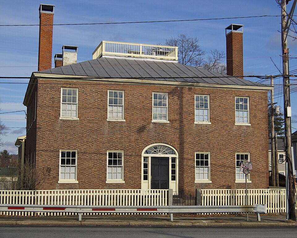
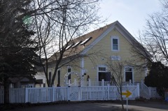
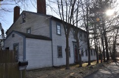
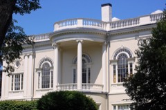
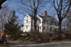
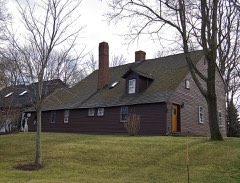
Built in 1810. Listed on the National Register of Historic Places in
1974. A historic map-sheet match is not published yet. The record needs a coordinate-quality review before it can be joined to a sheet boundary.
From the record
“The Fowler House is a historic house at 166 High Street in the Danversport section of Danvers, Massachusetts. Built in 1810, the brick structure is notable as a well-preserved example of Federal-style architecture in the area, and for its role in the early history of the Society for the Preservation of New England Antiquities.”
Wikipedia article Fowler House (Danvers, Massachusetts), CC BY-SA 4.0.
one of 350 National Register listings in Essex County · listed in 1974 · category: Building · built in 1810 · one of 2 National Historic Landmarks in Essex County.
National Register reference number.74000367- the number the National Park Service assigned this property when it was listed, and the key its nomination file is catalogued under at the National Archives.
The ground it stands on
190,092 words
The chapter on Danvers Town in Danvers, Massachusetts, published 1899 names Danversport. This is what it says, exactly as the scans read.
As the first grantee of land within the present limits of Danvers, Governor Endicott has well been called the " father of the town." Of the many grants - several by the General Court and the rest by Salem - made to others during the first twentyfive or thirty years and within the Danvers of the past or today, the following, as indicated by name and place, may be enough to show how and by whom most of the land was covered ; John Humphrey, partly in South Danvers and partly in Lynnfield, with Humphrey's pond and its island; Thomas Read, on whose estate is now the fine residence, in Peabody, of the late Hon. Richard S. Rogers, and of his son, Jacob C. Rogers, Esq. ; Emanuel Downing, west of the Read grant ; and the celebrated Hugh Peters, north of the Plains and east of Frost-fish Brook. But Read, Downing and Peters returned to England and came not back. Grants were also made to Rev. Samuel Skelton (worthy associate pastor with Rev. Francis Higginson, of blessed memory, in the First church of Salem), "Skelton's Neck," afterward New Mills, and now Danversport, lying between Crane and Porter's rivers ; Francis Weston, a little distance west of the site of the First church ot Danvers ; Townsend Bishop, his house still standing west of the Plains and in Tapleyville, and noted as the home of Rebecca Nurse, sainted martyr of the witchcraft persecution : Richard Waterman, on the Wenham road leading from Putnamville, his habitation occupying the spot where lived the late Joel Wilkins ; and William Alford, Cherry Hill, on the Beverly side, sold to Henry Herrick. Weston, Bishop, Waterman, and Alford, however, were driven into exile on account of their obnoxious political and religious opinions. Grants also to Richard IngersoU, on the east side of Porter's river, o])i)osite Danversport ; Robert Cole, south of Felton's hill and including Proctor's corner in Peabody ; Ellas Stileman, north of Townsend Bishop ; Thomas Gardner, in the western part of the town ; Daniel Rea, near the northern line of the Plains ;Richard Hutchinson, Whipple's hill and land around it ; John Putnam and his three sons, Thomas, Nathaniel and John, along or near Beaver Brook, and in another direction from Hathorne hill to the Wenham line ; William Hathorne, who was greatly distinguished and who lived on Asylum hill, which his grant included ; Richard Davenport, also of great prominence and reputation, Davenj)ort hill, now Putnam's hill, in Putnamville ; Samuel Sharpe, at the Plains, later called Porter's Plains from John Porter, who was the next proprietor, though Judge Timothy Lindall early owned the northerly part ; Job Swinnerton, west of Townsend Bishop ; Robert (ioodell.
Though this territory of Salem Village was substantially the same as that of North Danvers at a later time, or of Danvers in our own, yet the boundaries of the two were quite different. Thus Danvers now includes, as the Village did not, Endicott's Orchard Farm, Skelton's Neck or Danversport, and a considerable tract on the Beverly side of Porter's River, while a remote northwestern portion of the Village area, formerly known as the " Bellingham Grant" and constituting a large, scpiare and somewhat isolated projection, was afterward set off to Topsfield. Moreover, a certain section of the southwestern part of the Village was subsequently included in the town of South Danvers and now belongs to Peabody. At this time the Village population probably numbered somewhat more than five hundred.
Regional context, not property-specific
evidence. The
federal wildfire occurrence database
lists 82 fires within 5 miles of Fowler House between
2006 and 2020, burning about 250 acres in total. 1 started naturally. 1 was recorded as arson.
Distance is straight-line from the map coordinates, so a fire counted
here may appear on a neighbouring settlement's page as well.
Reported cause
Fires
Recreation and ceremony
20
Smoking
18
Debris and open burning
11
Equipment and vehicle use
9
Missing data/not specified/undetermined
8
Fireworks
5
Misuse of fire by a minor
5
Power generation/transmission/distribution
2
Natural
1
Railroad operations and maintenance
1
Other causes
1
Arson/incendiarism
1
The most recent of
them, most recent first, with the day each was reported and the service
that recorded it.
Regional context, not property-specific
evidence. Museums hold 8,996 specimens
collected within 10 miles of Fowler House between 1800 and
1975: 3,432 Plantae, 3,028 Animalia, 1,172 Fungi, 743 Chromista, 435 Unrecorded, 140 Bacteria, 46 Protozoa. 12 distinct Species records are shown.
Collected by A B. Proper, A H HIGGINSON, A. A. Eaton and others. Each is a
physical object with a catalogue
number, and each entry opens the museum's record. This is what was
collected and kept, not a survey of what lives here - nothing can be
concluded from a species being absent.
Regional context, not property-specific
evidence. The federal mineral resources record lists
13 workings within 5 miles of Fowler House: 5 plants, 4 past producers, 3 producers, 1 unknown.
8 still produce. What was taken out: Stone, Crushed/Broken, Sand and Gravel, Construction, Zirconium, Thorium. Distance is straight-line from the
map coordinates, so a quarry counted here may appear on a neighbouring
settlement's page as well.
Regional context, not property-specific
evidence. The National Weather Service names
Danversport, the town this property stands in, in 2 storm reports between 2021 and 2022: 1 thunderstorm wind, 1 lightning.
No death or injury is recorded in these reports. Each account below is quoted exactly as the forecast office
filed it, from the NOAA Storm Events Database, and each date
opens the federal record of that event.
In Danvers at 334 AM EDT (234 AM EST), there was a photo from the media of a large tree limb downed on Fowler Street, which damaged a pickup truck. In addition, amateur radio operators reported a large tree limb down blocking part of nearby Ash Street.
No historic map-sheet match is published
for this property yet. That does not mean no map exists. This record needs
a coordinate-quality review before it can be joined to a sheet boundary.
Browse the county's mapped places while that work is
pending.
From the nomination file
2,227 words on record
When this property was proposed for the
National Register, someone wrote the case for it: what the building is,
and why it matters. That document is a federal record in the public domain.
It is quoted below word for word, never summarised. The text was read off the scanned case file by machine, so the
occasional stray character is the recogniser's and the 1970s
typewriter's.
Statement of significance
The Fowler House is architecturally significant since it has remained sub- stantially unaltéred since its construction in 1810, and it is a good example of Country Federal period architecture. The house served as the homestead for Samuel Fowler,Jr., an important commercial figure in Danvers during the first half of the 19th c. The civic involvements of Fowler and his children make the property an important one in local history and government. Documentation relating to the construction of the house, including Fowler's contract with Stephen Whipple and Levi Preston, the builders, as well as Fow- ler's own accounts, are included in the collection of Fowler's papers located at the Essex Institute.
Original and unusual wallpapers exist in the house today, the prime example being the hand-blocked "Pompeian Medallion" design in the front hall. Hand carving worthy of note includes egg-and-dart mouldings, scrolls, reeding, finger flufing, and spiral carvings in the first floor rooms. Some of the original Fowler family furnishings are on view at the house today; of note are family portraits and needlework examples. Samuel Fowler Jr. (1776-1854) began his commercial ventures in 1799, in that area of Danversport then known as New Mills, with the purchase of 1/36 part pI two corn mills, an old saw mill,and a dam. Bycke mht and Poied by 1821, he applied for insurance on his currier's shop, his grist mill, his bark mill and house, his large building for sawing marble, and his pulverizing mill.
He was one of eight men who financed the construction of the Liberty Bridge across Porter's River. Fowler is also credited with the introduction of the tanning industry into this part of Danvers.
Quoted from the National Register nomination
for reference 74000367, 10 pages, held by the National Archives in Record
Group 79. See the
catalogue record.
Listed places nearby
6 within 8 miles
Other National Register properties close
enough to walk or drive between, ordered by distance from this one. Both
positions come from the same geocoding pass that matched these properties
to their map sheets.
Listing record. National Park Service National Register of Historic Places, listed-properties dataset, current to 2026-05-22.
Map join. Address geocoded through the United States Census geocoder, then tested against the published boundary of every sheet in the USGS Historical Topographic Map Collection.
How this page is made. Listing fields come from federal records; map-sheet coverage is a labelled coordinate-to-boundary calculation, not a source-field claim.
Wildfire. Short, Karen C. 2022. Spatial wildfire occurrence data for the United States, 1992-2020 [FPA_FOD_20221014]. 6th Edition. Fort Collins, CO: Forest Service Research Data Archive. https://doi.org/10.2737/RDS-2013-0009.6 Collected with United States Government funding and usable without additional permissions or fees.
Specimens. Global Biodiversity Information Facility (GBIF), https://www.gbif.org/. Only records licensed CC0 or CC BY are used. Records licensed CC BY-NC are excluded because this site carries advertising. Images are checked individually and any whose licence is non-commercial, no-derivatives or unreadable is refused.
Mines and quarries. USGS Mineral Resources Data System (MRDS) https://mrdata.usgs.gov/mrds/ A work of the United States government, no copyright under 17 U.S.C. 105.
Storms. NOAA National Centers for Environmental Information, Storm Events Database https://www.ncei.noaa.gov/stormevents/ A work of the United States government, no copyright under 17 U.S.C. 105. Narratives are quoted verbatim from the National Weather Service report and are not edited or summarised.
 Block
Block