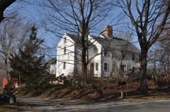
Listed on the National Register of Historic Places in
1987. A historic map-sheet match is not published yet. The record needs a coordinate-quality review before it can be joined to a sheet boundary.
From the record
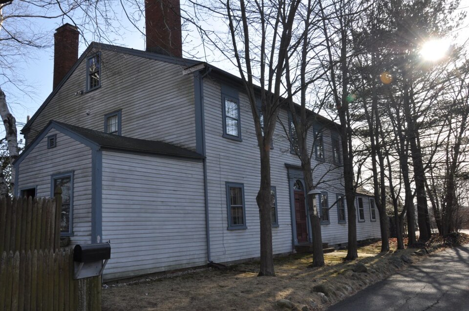
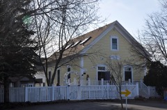
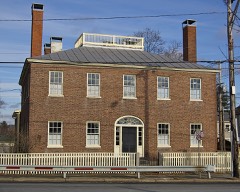
“The Sprague House is a historic house in Danvers, Massachusetts. It is a wood-frame structure, five bays wide, with a side-gable roof, end chimneys, and clapboard siding.”
Wikipedia article Sprague House (Danvers, Massachusetts), CC BY-SA 4.0.
one of 350 National Register listings in Essex County · listed in 1987 · category: Building · one of 2 National Historic Landmarks in Essex County.
National Register reference number.87001108- the number the National Park Service assigned this property when it was listed, and the key its nomination file is catalogued under at the National Archives.
The ground it stands on
190,092 words
The chapter on Danvers Town in South Danvers Wizard Newspaper, 1865, published 1865 names Danvers. This is what it says, exactly as the scans read.
Whereas, works are now being commenced ; by the Salem and Danvers Aqueduct Company that will, if allowed to be completed, divert ; from the inhabitants of this town a supply of water that was the origin, and is now one of the principal supports of our moet important i and flourishing manufactures, i
Reeolved, That a committee of five persons j be appointed, with full power* to take such j measures as they shall consider expedient to ; prevent the further diversion of water from the . sources of Tapley's Brook ; and also to do all i in their power to protect the inhabitants of the j town from the encroachments of all parties in their attempts to benefit the Salem and Dan¬ vers Aqueduct Company at the expense of, and to the detriment of the business of South Danvers.
Regional context, not property-specific
evidence. The
federal wildfire occurrence database
lists 86 fires within 5 miles of Sprague House between
2006 and 2020, burning about 283 acres in total. 1 started naturally. 2 were recorded as arson.
Distance is straight-line from the map coordinates, so a fire counted
here may appear on a neighbouring settlement's page as well.
Reported cause
Fires
Recreation and ceremony
23
Smoking
18
Debris and open burning
11
Equipment and vehicle use
9
Missing data/not specified/undetermined
8
Fireworks
5
Misuse of fire by a minor
5
Arson/incendiarism
2
Power generation/transmission/distribution
2
Natural
1
Railroad operations and maintenance
1
Other causes
1
The most recent of
them, most recent first, with the day each was reported and the service
that recorded it.
Regional context, not property-specific
evidence. Museums hold 8,947 specimens
collected within 10 miles of Sprague House between 1800 and
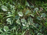
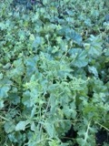
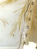
1975: 3,370 Plantae, 3,028 Animalia, 1,173 Fungi, 748 Chromista, 439 Unrecorded, 143 Bacteria, 46 Protozoa. 12 distinct Species records are shown.
Collected by A B. Proper, A H HIGGINSON, A. A. Eaton and others. Each is a
physical object with a catalogue
number, and each entry opens the museum's record. This is what was
collected and kept, not a survey of what lives here - nothing can be
concluded from a species being absent.
Regional context, not property-specific
evidence. The federal mineral resources record lists
14 workings within 5 miles of Sprague House: 5 plants, 4 past producers, 3 producers, 1 unknown.
8 still produce. What was taken out: Stone, Crushed/Broken, Sand and Gravel, Construction, Zirconium, Iron. Distance is straight-line from the
map coordinates, so a quarry counted here may appear on a neighbouring
settlement's page as well.
Regional context, not property-specific
evidence. The National Weather Service names
Danvers, the town this property stands in, in 9 storm reports between 1993 and 2018: 5 thunderstorm wind, 2 hail, 1 lightning, 1 flood.
No death or injury is recorded in these reports. Each account below is quoted exactly as the forecast office
filed it, from the NOAA Storm Events Database, and each date
opens the federal record of that event.
No historic map-sheet match is published
for this property yet. That does not mean no map exists. This record needs
a coordinate-quality review before it can be joined to a sheet boundary.
Browse the county's mapped places while that work is
pending.
From the nomination file
3,390 words on record
When this property was proposed for the
National Register, someone wrote the case for it: what the building is,
and why it matters. That document is a federal record in the public domain.
It is quoted below word for word, never summarised. The text was read off the scanned case file by machine, so the
occasional stray character is the recogniser's and the 1970s
typewriter's.
Description of the property
The Sprague House, built in the Danversport section of Danvers in 1810, 1s Tocated on asmall, trlangular corner lot at the intersection of Endicott Street and Needham Road. The property is located upland from the Waters River with the Cranes River to the east; both are tributaries of the Danvers River. Endicott Street today is a busy main road, while Needham Road, the original Endicott Road, is a lane running along the north side of the house. The Federal-style house faces south and overlooks the Waters River. It sits elevated approximately 30 feet from Endicott Street on its south side and approximately 14 feet from Needham Road to the north. The property is fronted by a stone wall and is framed by deciduous and evergreen trees, as well as Tow plantings.
The 1/3-acre lot is slightly sloping. The surrounding area 15 highly developed commercial and industrial property, with only a very small 20th century residential section located to the east. The main section of the house is 2 1/2 stories tall, while two wings, extending from the east and west sides, are only one story high. The malr block is five bays wide, with a centra entrance. Three chimeys are located at the end walls, two just in front of the gable ridge and one just to the rear of the ridge. The clapboard-sheathed building rests on a foundation of granite blocks, which has not been rebuilt. Only the main section of the house has a full basement. The shallow gable roof with narrow returns,originally covered with wooden shingles, is now sheathed with fiberglass shingles.
The house is trimmed with simple corner boards and a narrow cornice throughout. Windows have simple architraves. Several retain their original blinds. Double-hung 6/6 sash survives as well.
(in one paragraph) Builder/Architect unknown The Sprague House, Danvers, possesses integrity of location, design, materials and workmanship as well as associations with the Sprague family, a wealthy and influential family in nearby Salem who built the nominated property as a summer house in 1810. This well-preserved country residence is one of the few surviving Federal-style houses in Danvers. Its particularly well-detailed interior finishes are especially notable. The property therefore meets Criterion C of the National Register of Historic Places on the local level. The Sprague farmhouse is one of the earliest and most notable structures in Danversport, in the southeastern section of Danvers.
This area saw development from farmland to shipbuilding to, in the 20th century, industrialization and suburbanization. (Today the house stands essentially isolatedby 20th century highway and commercial construction.) Its location on a slight rise between two tributaries of the Danvers River made it an ideal site for a summer residence. The land on which the farm, eventually totaling 112 acres, stood was originally part of Governor John Endicott's estate. The most prominent owners of the property were its original owners, Major Joseph Sprague and his son, Joseph Jr. Joseph Sprague was born in Medford in 1739 and in the late 1760s, moved to Salem from Newburyport.
A successful merchant, distillery owner, and citizen, Sprague was a member of the Salem Committee of Safety and distinguished himself dur ing the Revolutionary War. Partial owner of a number of ships, Sprague also owned a large estate in In 1787, he purchased a 96-acre farm in Danvers from the estate of John Felt, and dur ing the next few years purchased an additional 19 adjoining acres from Joseph Endicott, the land being part of the original 1632 land grant of Gov. John Endicott between the Crane and Waters Rivers.
Quoted from the National Register nomination
for reference 87001108, 14 pages, held by the National Archives in Record
Group 79. See the
catalogue record.
Listed places nearby
6 within 8 miles
Other National Register properties close
enough to walk or drive between, ordered by distance from this one. Both
positions come from the same geocoding pass that matched these properties
to their map sheets.
Listing record. National Park Service National Register of Historic Places, listed-properties dataset, current to 2026-05-22.
Map join. Address geocoded through the United States Census geocoder, then tested against the published boundary of every sheet in the USGS Historical Topographic Map Collection.
How this page is made. Listing fields come from federal records; map-sheet coverage is a labelled coordinate-to-boundary calculation, not a source-field claim.
Wildfire. Short, Karen C. 2022. Spatial wildfire occurrence data for the United States, 1992-2020 [FPA_FOD_20221014]. 6th Edition. Fort Collins, CO: Forest Service Research Data Archive. https://doi.org/10.2737/RDS-2013-0009.6 Collected with United States Government funding and usable without additional permissions or fees.
Specimens. Global Biodiversity Information Facility (GBIF), https://www.gbif.org/. Only records licensed CC0 or CC BY are used. Records licensed CC BY-NC are excluded because this site carries advertising. Images are checked individually and any whose licence is non-commercial, no-derivatives or unreadable is refused.
Mines and quarries. USGS Mineral Resources Data System (MRDS) https://mrdata.usgs.gov/mrds/ A work of the United States government, no copyright under 17 U.S.C. 105.
Storms. NOAA National Centers for Environmental Information, Storm Events Database https://www.ncei.noaa.gov/stormevents/ A work of the United States government, no copyright under 17 U.S.C. 105. Narratives are quoted verbatim from the National Weather Service report and are not edited or summarised.
 Block
Block