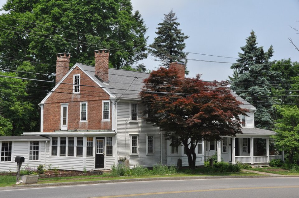
Built in 1740 in the colonial architecture. Listed on the National Register of Historic Places in
1974. A historic map-sheet match is not published yet. The record needs a coordinate-quality review before it can be joined to a sheet boundary.
From the record
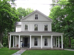
“Cobb's Tavern is a historic colonial tavern building in Sharon, Massachusetts. It is a wood-frame building, with brick end walls, a central chimney, and a pair of chimneys near the left wall.”
Wikipedia article Cobb's Tavern, CC BY-SA 4.0.
one of 249 National Register listings in Norfolk County · listed in 1974 · category: Building · built in 1740, colonial architecture · one of 2 National Historic Landmarks in Norfolk County.
National Register reference number.74000383- the number the National Park Service assigned this property when it was listed, and the key its nomination file is catalogued under at the National Archives.
Fires near this property
169 since 2015
Regional context, not property-specific
evidence. The
federal wildfire occurrence database
lists 169 fires within 5 miles of Cobb's Tavern between
2015 and 2020, burning about 66 acres in total. 1 started naturally. 1 was recorded as arson.
Distance is straight-line from the map coordinates, so a fire counted
here may appear on a neighbouring settlement's page as well.
Reported cause
Fires
Recreation and ceremony
77
Smoking
43
Missing data/not specified/undetermined
38
Debris and open burning
8
Natural
1
Arson/incendiarism
1
Other causes
1
The most recent of
them, most recent first, with the day each was reported and the service
that recorded it.
Regional context, not property-specific
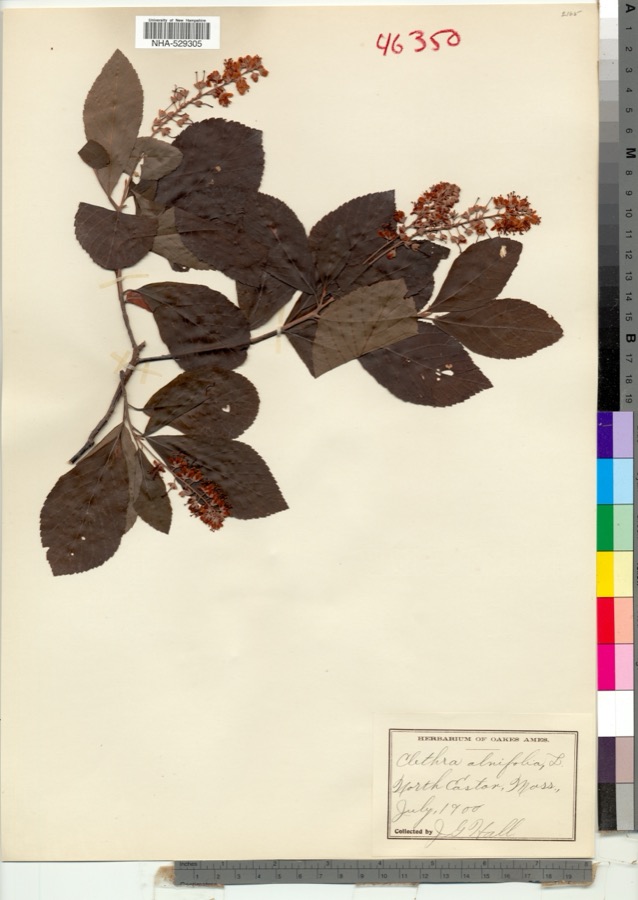
evidence. Museums hold 6,062 specimens
collected within 10 miles of Cobb's Tavern between 1832 and
1975: 2,645 Plantae, 1,658 Animalia, 1,587 Fungi, 132 Protozoa, 20 Chromista, 15 Unrecorded, 5 Bacteria. 12 distinct Species records are shown.
Collected by (MARSDEN, H W), ?, A W Cheever and others. Each is a
physical object with a catalogue
number, and each entry opens the museum's record. This is what was
collected and kept, not a survey of what lives here - nothing can be
concluded from a species being absent.
Regional context, not property-specific
evidence. The federal mineral resources record lists
13 workings within 5 miles of Cobb's Tavern: 8 past producers, 2 producers, 1 unknown, 1 occurrence.
3 still produce. What was taken out: Sand and Gravel, Construction, Iron, Stone, Crushed/Broken. Distance is straight-line from the
map coordinates, so a quarry counted here may appear on a neighbouring
settlement's page as well.
Regional context, not property-specific
evidence. The National Weather Service names
Sharon, the town this property stands in, in 12 storm reports between 2002 and 2025: 4 thunderstorm wind, 4 lightning, 2 flood, 1 hail.
No death or injury is recorded in these reports. Each account below is quoted exactly as the forecast office
filed it, from the NOAA Storm Events Database, and each date
opens the federal record of that event.
In Sharon, significant street flooding was reported on Canton St, Norwood St, Hampton Rd by Oak Hill Dr, and on Dean St at the railroad bridge. A car was stuck in flooding on Commercial St.
No historic map-sheet match is published
for this property yet. That does not mean no map exists. This record needs
a coordinate-quality review before it can be joined to a sheet boundary.
Browse the county's mapped places while that work is
pending.
From the nomination file
2,065 words on record
When this property was proposed for the
National Register, someone wrote the case for it: what the building is,
and why it matters. That document is a federal record in the public domain.
It is quoted below word for word, never summarised. The text was read off the scanned case file by machine, so the
occasional stray character is the recogniser's and the 1970s
typewriter's.
Description of the property
Situated close to the road on 3/4 of an acre of land, Cobb's Tavern,c.1740, is the last structure remaining from an original complex which included barns, a blacksmith shop, and other outbuildings. Granite hitching posts, each with a wrought iron pin in the top, still stand along the roadway. The structure consists of the original building, a 2-story addition on the = south side, and a 2-story carriage shed connected to the addition by an enclosed passageway. The structure is typical of New England Colonial construction, with a ridge roof, clapboard walls, corner boards and a dry stone foundation. There is a generous cornice return on the end and front pavillion gables. The structure, 7 bays wide, consists of five rooms built around a central chimney.
They include the tap room, kitchen and living room on the first floor, and two rooms on the second floor, all with fire- places. Entrance to the tap room is through a double leaf door, each leaf 2 inches thick, whose exterior boards run horizontally and interior boards run vertically. One leaf is fitted with a wood astragal. The doors are hung with wrought iron strap hinges. Within the tap room; the 15' pine bar is still intact and a small writing desk for the Post Office patrons is attached to one of the walls. The floor joists are logs with the top side flattened to receive the floor, which consists of rough sawn oak boards topped by a pine floor running in the same direction as the sub-floor.
In this section, the windows have 6/6 sash and the front entrance has narrow lights halfway up on each side, with panelling below.
Cobb's Tavern is located on the Old Bay Road, one of the country's most ancient highways, halfway between Boston and the Taunton Green. The Old Bay Road was a throughway for the entire locality for more than a century before the Revolution and a half century after it. The tavern has been a focal point of 'town activities throughout its history, serving, at various times, as a stage coach stop, Masonic Lodge, circus location, and meeting place for various societies. The original house was built in 1740. It was enlarged in the early 1800's, probably when Jonathan Cobb bought it for use as a stage coach stop and store. Cobb's Tavern became the first United States Post Ofiice in Sharon when Jonathan Cobb was appointed postmaster in 1819.
Jeremiah Gould, in his Annals of Sharon,Mass., published in 1830, says "Cobb's Tavern was the post office to which the daily mail was brought by stage over the Boston-to- Taunton Turnpike. Once a week the mail was sent from here to the center of the town". Sharon had 1,000 residents in 1819 when the post office was established. The Boston Globe of August 6, 1905, in an article concerning the tavern, said, "Among the historic roadside inns in New England, none have a more interesting history than has Cobb's Tavern in East Sharon. In 1819 Jonathan Cobb was appointed Postmaster for Sharon, the mail at that time being brought to his office in stagecoaches.
In the distribution of the mail among the people of the town, the school children were given letters being broughe ta as ointed Postnaster to deliver on their way to school.
Quoted from the National Register nomination
for reference 74000383, 8 pages, held by the National Archives in Record
Group 79. See the
catalogue record.
Listed places nearby
6 within 8 miles
Other National Register properties close
enough to walk or drive between, ordered by distance from this one. Both
positions come from the same geocoding pass that matched these properties
to their map sheets.
Listing record. National Park Service National Register of Historic Places, listed-properties dataset, current to 2026-05-22.
Map join. Address geocoded through the United States Census geocoder, then tested against the published boundary of every sheet in the USGS Historical Topographic Map Collection.
How this page is made. Listing fields come from federal records; map-sheet coverage is a labelled coordinate-to-boundary calculation, not a source-field claim.
Wildfire. Short, Karen C. 2022. Spatial wildfire occurrence data for the United States, 1992-2020 [FPA_FOD_20221014]. 6th Edition. Fort Collins, CO: Forest Service Research Data Archive. https://doi.org/10.2737/RDS-2013-0009.6 Collected with United States Government funding and usable without additional permissions or fees.
Specimens. Global Biodiversity Information Facility (GBIF), https://www.gbif.org/. Only records licensed CC0 or CC BY are used. Records licensed CC BY-NC are excluded because this site carries advertising. Images are checked individually and any whose licence is non-commercial, no-derivatives or unreadable is refused.
Mines and quarries. USGS Mineral Resources Data System (MRDS) https://mrdata.usgs.gov/mrds/ A work of the United States government, no copyright under 17 U.S.C. 105.
Storms. NOAA National Centers for Environmental Information, Storm Events Database https://www.ncei.noaa.gov/stormevents/ A work of the United States government, no copyright under 17 U.S.C. 105. Narratives are quoted verbatim from the National Weather Service report and are not edited or summarised.
 Block
Block