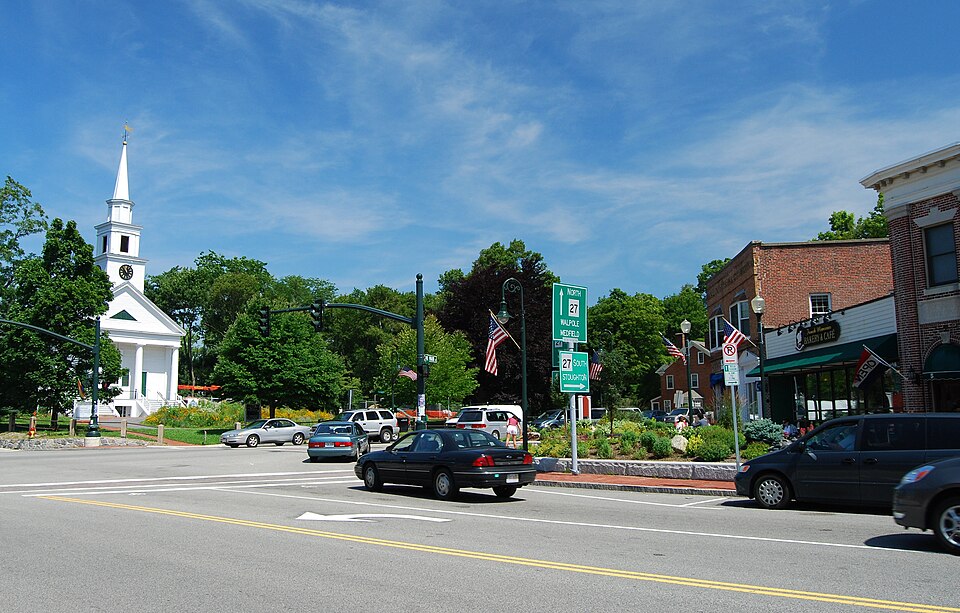
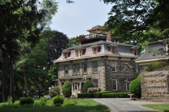
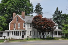
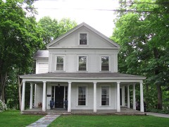
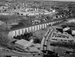
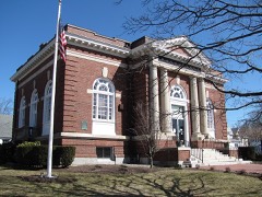
Photograph by Marcbela (Marc N. Belanger), Public domain. Via
Wikimedia Commons.
Sharon Historic District
Listed on the National Register of Historic Places in
1975. A historic map-sheet match is not published yet. The record needs a coordinate-quality review before it can be joined to a sheet boundary.
From the record
“The Sharon Historic District is a historic district on both sides of N. Main Street from Post Office Square to School Street in Sharon, Massachusetts.”
Wikipedia article Sharon Historic District (Sharon, Massachusetts), CC BY-SA 4.0.
one of 249 National Register listings in Norfolk County · listed in 1975 · category: District · one of 2 National Historic Landmarks in Norfolk County.
National Register reference number.75000296- the number the National Park Service assigned this property when it was listed, and the key its nomination file is catalogued under at the National Archives.
Sharon is seventeen miles from Boston and twenty-five from Providence, on the Providence Division of the Old Colony Railroad. There are eleven trains from Boston each week day, including a theatre train, and two trains out on Sunday. Time of trains from Boston, thirty to forty minutes. This road is one of the oldest, best equipped and most carefully managed roads in the country. It crosses no drawbridge, the trains are almost invariably on time and have plenty of cars, so each passenger can have a seat. It is double tracked with steel rails it? entire length.
Its Boston station on Columbus Avenue and Park Square is convenient and comfortable, and architecturally, the most beautiful in the United States. It is said by those who have travelled extensively, to be unequalled in the world, when convenience, comfort, looks and surroundings are taken into account. Single fares from Boston to Sharon, forty cents ; five tickets, one dollar and seventy-five cents, or thirty-five cents each. Season tickets for three months, twentythree dollars, or about fourteen cents a trip. Single fare from Sharon to Providence, sixty cents. One thousand-mile tickets, good on any portion of the Old Colony sj'-stem, 820.00. Passengers from New York can reach Sharon by the all rail Shore line, or bv the Providence
Regional context, not property-specific
evidence. The
federal wildfire occurrence database
lists 162 fires within 5 miles of Sharon Historic District between
2015 and 2020, burning about 50 acres in total. 1 started naturally. 1 was recorded as arson.
Distance is straight-line from the map coordinates, so a fire counted
here may appear on a neighbouring settlement's page as well.
Reported cause
Fires
Recreation and ceremony
62
Smoking
44
Missing data/not specified/undetermined
41
Debris and open burning
8
Equipment and vehicle use
2
Railroad operations and maintenance
2
Natural
1
Arson/incendiarism
1
Other causes
1
The most recent of
them, most recent first, with the day each was reported and the service
that recorded it.
Regional context, not property-specific
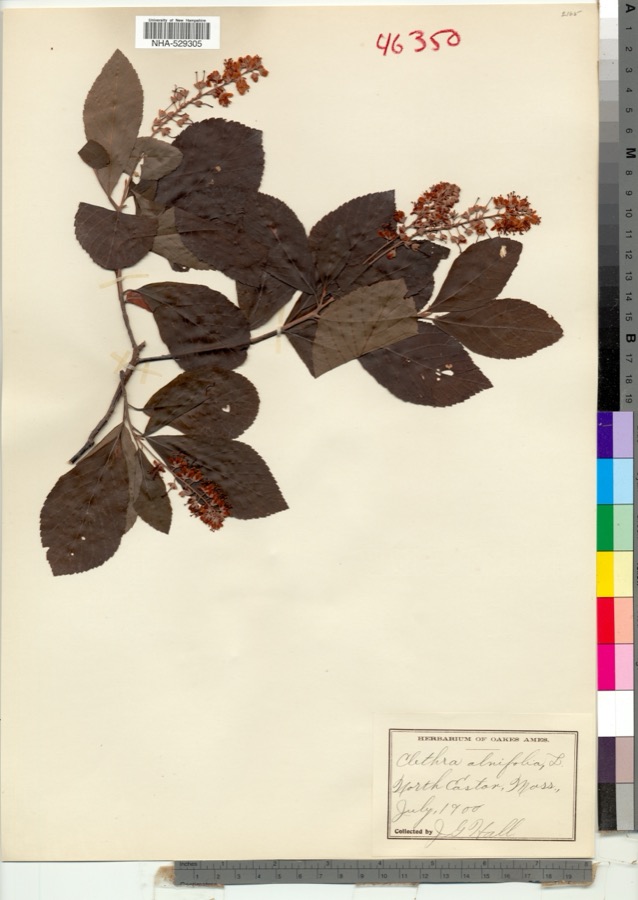
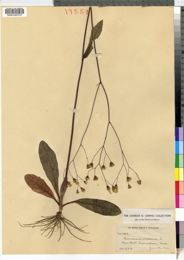
evidence. Museums hold 4,967 specimens
collected within 10 miles of Sharon Historic District between 1846 and
1975: 2,043 Plantae, 1,408 Fungi, 1,338 Animalia, 132 Protozoa, 22 Chromista, 19 Unrecorded, 5 Bacteria. 12 distinct Species records are shown.
Collected by ?, A W Cheever, A. A. Eaton and others. Each is a
physical object with a catalogue
number, and each entry opens the museum's record. This is what was
collected and kept, not a survey of what lives here - nothing can be
concluded from a species being absent.
Regional context, not property-specific
evidence. The federal mineral resources record lists
12 workings within 5 miles of Sharon Historic District: 7 past producers, 3 producers, 1 unknown, 1 occurrence.
3 still produce. What was taken out: Sand and Gravel, Construction, Iron. Distance is straight-line from the
map coordinates, so a quarry counted here may appear on a neighbouring
settlement's page as well.
Regional context, not property-specific
evidence. The National Weather Service names
Sharon, the town this property stands in, in 12 storm reports between 2002 and 2025: 4 thunderstorm wind, 4 lightning, 2 flood, 1 hail.
No death or injury is recorded in these reports. Each account below is quoted exactly as the forecast office
filed it, from the NOAA Storm Events Database, and each date
opens the federal record of that event.
In Sharon, significant street flooding was reported on Canton St, Norwood St, Hampton Rd by Oak Hill Dr, and on Dean St at the railroad bridge. A car was stuck in flooding on Commercial St.
No historic map-sheet match is published
for this property yet. That does not mean no map exists. This record needs
a coordinate-quality review before it can be joined to a sheet boundary.
Browse the county's mapped places while that work is
pending.
From the nomination file
4,707 words on record
When this property was proposed for the
National Register, someone wrote the case for it: what the building is,
and why it matters. That document is a federal record in the public domain.
It is quoted below word for word, never summarised. The text was read off the scanned case file by machine, so the
occasional stray character is the recogniser's and the 1970s
typewriter's.
Description of the property
The Sharon Historic District contains six residences dating from the mid-eighteenth century to the ear_y twentieth century, two Greek Revival churches, and an early twentieth century libgary. These nine bulldings are located on a one block stretch of North Main Street in the Town Center. The buildings form a cohesive visual group, set back from the street with well landscaped lawns. To the south is Post Office Square, surrounded by altered and modern commercial buildings. Directly north is a modern Church and School, and farther north on Main Street are a nixture of a few nineteenth and many twentieth century houses, not related historically to the District. The Unitarian Church and the First Congregational Church are the visual focal points of the district.
The Unitarian Church (1), a story white clapboard Greek Revival buiiding, was constructed in 1842. The three bay facade has a pediment supported by four Greek Doric columns, with a plain entablature. Iwin Ilights of stairs lead up to the two outer bays of the porch, and between them a third flight descends to the partially sunken vestry under the church. In the portico a pair of paneled doors flank a large 20/20 central window, with shutters on the lower half. This fenestration and shutter pattern is repeated onthe side elevations, each side having three identical windows on the main story. The vestry windows onthe side elevations are directly beneath the main floor bays, and are 10/10 sash.
A square bell tower rises in three tiers from the ridge roof, diminishing in size and terminating in a spire, and a clock face embellishes three sides of the base of the tower. The First Congregational Church (8), similar in style to the Unitarian Church, was built in 1839.
/ARCHITECT STATEMENT OF SIGNIFICANCE Located on North Main Street in the midst of modern commercial and residential. development, the Sharon Historic District contains the only contiguous, cohesive group of buildings representing the historic development of Sharon, Architecturally, the nine buildings, some which replace earlier structures, display a variety. of eighteenth, nineteenth and early twentieth century styles. The buildings directly north of the district are modern, and do not relate to the district. To the south is Post Office Square, commercially developed, with a few altered late nineteenth century buildings, and many modern intrusions. The Square is not included in the district because it has lost, through modern development, whatever sense of time and plkace it once had.
Sharon was originally part of a 1637 "New Grant" given by the Dorchester Proprietors to encourage new settlement. In 1726 the present towns of Sharon, Canton and Stoughton, were separated from Dorchester and called the Stoughton Territory. Settlers in the southern part of the Stoughton Territory (now Sharon), finding it difficult to attend public worship in the northern part of the territory, petitioned the General Court in 1739 to be set off as a separate precinct. request was granted and. in 1740 the Second Precinct of Stoughton was established. It was incorporated in 1765 as the independent town of Stoughtonham, and in 1783 changed its name to Sharon.
The Second Precinct was first developed where the Sharon Historic District stands today, half way between the two major thoroughfares in Sharon, the Bay Road on the eastern edge of town and the O1d Post Road on the western edge. The Unitarian Church(-) stands on the site of the first Parish Church of the Second Precinct, built c. 1740. The original meetinghouse was razed c. 1785 and a new one built in 1787.
Quoted from the National Register nomination
for reference 75000296, 27 pages, held by the National Archives in Record
Group 79. See the
catalogue record.
Listed places nearby
6 within 8 miles
Other National Register properties close
enough to walk or drive between, ordered by distance from this one. Both
positions come from the same geocoding pass that matched these properties
to their map sheets.
Listing record. National Park Service National Register of Historic Places, listed-properties dataset, current to 2026-05-22.
Map join. Address geocoded through the United States Census geocoder, then tested against the published boundary of every sheet in the USGS Historical Topographic Map Collection.
How this page is made. Listing fields come from federal records; map-sheet coverage is a labelled coordinate-to-boundary calculation, not a source-field claim.
Wildfire. Short, Karen C. 2022. Spatial wildfire occurrence data for the United States, 1992-2020 [FPA_FOD_20221014]. 6th Edition. Fort Collins, CO: Forest Service Research Data Archive. https://doi.org/10.2737/RDS-2013-0009.6 Collected with United States Government funding and usable without additional permissions or fees.
Specimens. Global Biodiversity Information Facility (GBIF), https://www.gbif.org/. Only records licensed CC0 or CC BY are used. Records licensed CC BY-NC are excluded because this site carries advertising. Images are checked individually and any whose licence is non-commercial, no-derivatives or unreadable is refused.
Mines and quarries. USGS Mineral Resources Data System (MRDS) https://mrdata.usgs.gov/mrds/ A work of the United States government, no copyright under 17 U.S.C. 105.
Storms. NOAA National Centers for Environmental Information, Storm Events Database https://www.ncei.noaa.gov/stormevents/ A work of the United States government, no copyright under 17 U.S.C. 105. Narratives are quoted verbatim from the National Weather Service report and are not edited or summarised.
 Block
Block