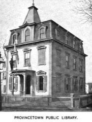
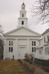
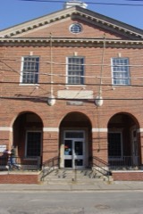
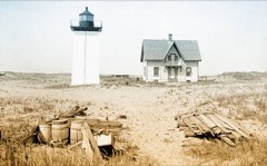
Photograph by Cape cod naturalist at en.wikipedia, Public domain. Via
Wikimedia Commons.
Center Methodist Church
Built in 1861 in the Neoclassical architecture. Listed on the National Register of Historic Places in
1975. A historic map-sheet match is not published yet. The record needs a coordinate-quality review before it can be joined to a sheet boundary.
From the record
“The Center Methodist Church or Center Methodist Episcopal Church is located in Provincetown, Massachusetts at 356 Commercial Street. It is listed on the National Register of Historic Places.”
Wikipedia article Center Methodist Church, CC BY-SA 4.0.
one of 145 National Register listings in Barnstable County · listed in 1975 · category: Building · built in 1861, Neoclassical architecture.
National Register reference number.75000247- the number the National Park Service assigned this property when it was listed, and the key its nomination file is catalogued under at the National Archives.
Regional context, not property-specific
evidence. The
federal wildfire occurrence database
lists 23 fires within 5 miles of Center Methodist Church between
1992 and 2020, burning about 12 acres in total. None started naturally. 1 was recorded as arson.
Distance is straight-line from the map coordinates, so a fire counted
here may appear on a neighbouring settlement's page as well.
Reported cause
Fires
Missing data/not specified/undetermined
11
Recreation and ceremony
4
Smoking
4
Arson/incendiarism
1
Debris and open burning
1
Misuse of fire by a minor
1
Fireworks
1
The most recent of
them, most recent first, with the day each was reported and the service
that recorded it.
Regional context, not property-specific
evidence. Museums hold 3,802 specimens
collected within 10 miles of Center Methodist Church between 1827 and
1975: 3,490 Animalia, 128 Plantae, 99 Unrecorded, 58 Chromista, 27 Fungi. 12 distinct Species records are shown.
Collected by A. K. Harrison, A. K. Harrison, G.C.H., A. M. Ottley and others. Each is a
physical object with a catalogue
number, and each entry opens the museum's record. This is what was
collected and kept, not a survey of what lives here - nothing can be
concluded from a species being absent.
Regional context, not property-specific
evidence. The National Weather Service names
Provincetown, the town this property stands in, in 8 storm reports between 1996 and 2020: 4 thunderstorm wind, 3 flood, 1 lightning.
No death or injury is recorded in these reports. Each account below is quoted exactly as the forecast office
filed it, from the NOAA Storm Events Database, and each date
opens the federal record of that event.
At 4:05 PM EST, the basement flooded at the Provincetown Fire Department. Water rose almost to the electrical panel. The flooding was aggravated by a failed water pump.
At 4:50 PM EST, Bradford Street in Provincetown was flooded near the old High School. Flooding was able to remove a crosswalk sign and have it float down the road.
No historic map-sheet match is published
for this property yet. That does not mean no map exists. This record needs
a coordinate-quality review before it can be joined to a sheet boundary.
Browse the county's mapped places while that work is
pending.
From the nomination file
2,734 words on record
When this property was proposed for the
National Register, someone wrote the case for it: what the building is,
and why it matters. That document is a federal record in the public domain.
It is quoted below word for word, never summarised. The text was read off the scanned case file by machine, so the
occasional stray character is the recogniser's and the 1970s
typewriter's.
Description of the property
The Center Methodist Church is a white clapboard 2 story structure whose bell tower design was based on the pattern established by the English baroque architect, Sir Christopher Wren. The church faces south on Commercial Street towards Provincetown Harbor and is surrounded by small one and two story residential and commercial buildings. It is situated on one of the highest points of land in the town, and this topographical advantage, combined with the height of the tower, make the church an important visual landmark from the harbor. A two story projecting pavilion, one bay deep and three bays wide, is the focus of attention on the facade. The first floor of the center pavilion is of wood made to look like smooth faced rusticated stone.
The bays are articulated by round headed wall arches, with rusticated voysoirs and keystones. A thick stringcourse marking the springing point of the arches runs across the sides and front of the first floor. The second floor of the pavilion, the building's principal story, has a tall slender round headed wall arch flanked by ionic pilasters in each elevation. A balustrade above the full entablature and modillioned cornice completes the central pavilion. The main body of the church is rectangular in shape and also demonstrates the im- portance of the second floor as the main meeting room story. The windows on the side elevations were altered when the building was converted into a museum, but the hood moldings over the windows on the second story were retained.
The string course between the first and second floors on the center pavilion, as well as the full entablature and cornice extend from the pavilion onto the facade and continue around the building. 22E1 85.
/ARCHITECT STATEMENT OF SIGNIFICANCE The Center Methodist Church,, a significant architectural landmark in Provincetown, is important for its historical and cultural contributions to the development of the community. The church was built in 1861, the fourth structure to be constructed by the Methodists in Provincetown, who used it for religious purposes until 1961 when the building was sold to Walter P. Chrysler to house an art collection. The Methodist congregation included many members of Provincetown's artistic community, and as the second oldest church extant in the village, was important in developing the community's image. The Center Methodist Church, clearly visible from Provincetown Harbor, was also an important visual landmark from the sea.
It was portrayed in/innumerable paintings, sketches, and etchings as a dominant part of the skyline of Provincetown, and the church tower was the first building that was visible to fishermen returning from sea. The building is an outstanding architectural landmark in a community which is largely composed of small scale, unostentatious structures. The detailing on the facade and the magnificent tower (even without its steeple) are a definite statement of community pride. The architectural significance of this building with its massive scale and elaborate Wren-baroque ornamentation and the building's importance to the community cannot be underestimated. Future plans for the structure are uncertain.
After the Walter Chrysler Museum was closed in 1974 the building was converted into a Center for the Arts to house various functions related to the arts, but funding ran out and plans are now awaiting further financial developments.
Quoted from the National Register nomination
for reference 75000247, 12 pages, held by the National Archives in Record
Group 79. See the
catalogue record.
Listed places nearby
6 within 8 miles
Other National Register properties close
enough to walk or drive between, ordered by distance from this one. Both
positions come from the same geocoding pass that matched these properties
to their map sheets.
Listing record. National Park Service National Register of Historic Places, listed-properties dataset, current to 2026-05-22.
Map join. Address geocoded through the United States Census geocoder, then tested against the published boundary of every sheet in the USGS Historical Topographic Map Collection.
How this page is made. Listing fields come from federal records; map-sheet coverage is a labelled coordinate-to-boundary calculation, not a source-field claim.
Wildfire. Short, Karen C. 2022. Spatial wildfire occurrence data for the United States, 1992-2020 [FPA_FOD_20221014]. 6th Edition. Fort Collins, CO: Forest Service Research Data Archive. https://doi.org/10.2737/RDS-2013-0009.6 Collected with United States Government funding and usable without additional permissions or fees.
Specimens. Global Biodiversity Information Facility (GBIF), https://www.gbif.org/. Only records licensed CC0 or CC BY are used. Records licensed CC BY-NC are excluded because this site carries advertising. Images are checked individually and any whose licence is non-commercial, no-derivatives or unreadable is refused.
Storms. NOAA National Centers for Environmental Information, Storm Events Database https://www.ncei.noaa.gov/stormevents/ A work of the United States government, no copyright under 17 U.S.C. 105. Narratives are quoted verbatim from the National Weather Service report and are not edited or summarised.
 Block
Block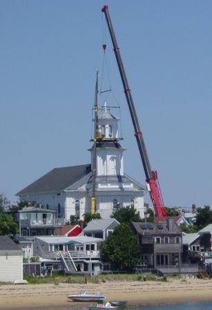




_native_range.jpg)