Photographs from the nomination case file, National Park Service records.
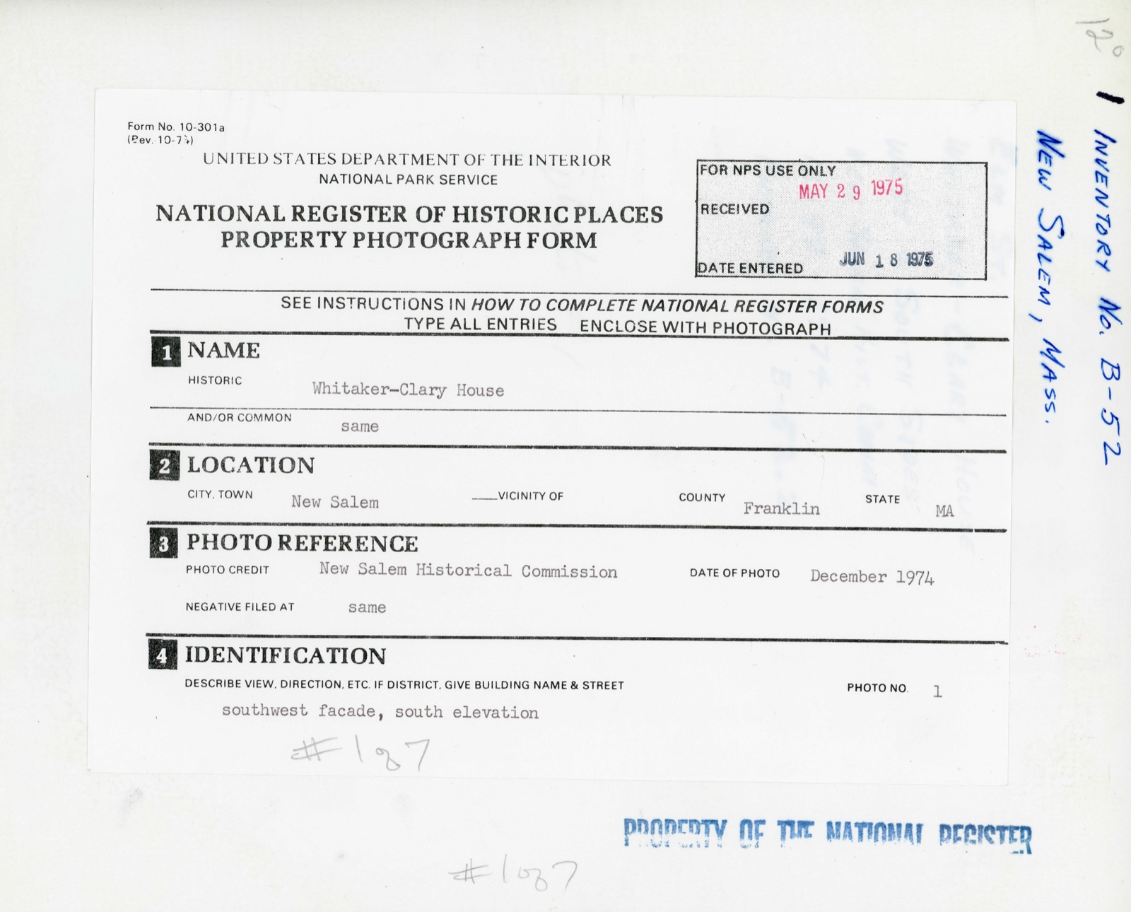
Whitaker-Clary House
Listed on the National Register of Historic Places in
1975. A historic map-sheet match is not published yet. The record needs a coordinate-quality review before it can be joined to a sheet boundary.
From the record
one of 28 National Register listings in Franklin County · listed in 1975 · category: Building · one of 1 National Historic Landmarks in Franklin County.
National Register reference number.75000257- the number the National Park Service assigned this property when it was listed, and the key its nomination file is catalogued under at the National Archives.
Fires near this property
27 since 2015
Regional context, not property-specific
evidence. The
federal wildfire occurrence database
lists 27 fires within 5 miles of Whitaker-Clary House between
2015 and 2020, burning about 11 acres in total. 1 started naturally. None was recorded as arson.
Distance is straight-line from the map coordinates, so a fire counted
here may appear on a neighbouring settlement's page as well.
Reported cause
Fires
Debris and open burning
18
Smoking
4
Power generation/transmission/distribution
1
Misuse of fire by a minor
1
Natural
1
Equipment and vehicle use
1
Recreation and ceremony
1
The most recent of
them, most recent first, with the day each was reported and the service
that recorded it.
Regional context, not property-specific
evidence. Museums hold 580 specimens
collected within 10 miles of Whitaker-Clary House between 1856 and
1975: 245 Animalia, 192 Plantae, 143 Fungi. 12 distinct Species records are shown.
Collected by A. Cronquist, A. M. Ottley, A. R. Hodgdon; H. Bigelow;R. Livingstone and others. Each is a
physical object with a catalogue
number, and each entry opens the museum's record. This is what was
collected and kept, not a survey of what lives here - nothing can be
concluded from a species being absent.
Regional context, not property-specific
evidence. The federal mineral resources record lists
4 workings within 5 miles of Whitaker-Clary House: 2 occurrences, 1 past producer, 1 producer.
1 still produces. What was taken out: Sand and Gravel, Construction, Gemstone, Garnet, Garnet. Distance is straight-line from the
map coordinates, so a quarry counted here may appear on a neighbouring
settlement's page as well.
Regional context, not property-specific
evidence. The National Weather Service names
New Salem, the town this property stands in, in 14 storm reports between 1994 and 2021: 7 hail, 6 thunderstorm wind, 1 lightning.
No death or injury is recorded in these reports. Each account below is quoted exactly as the forecast office
filed it, from the NOAA Storm Events Database, and each date
opens the federal record of that event.
A spotter reported dime-size hail in southeast Franklin County. As the storm moved east, there were numerous reports of small hail and wind gusts to 30 to 40 mph from near the Quabbin Reservoir, Templeton, Stoneham, Wakefield, and Lowell.
No historic map-sheet match is published
for this property yet. That does not mean no map exists. This record needs
a coordinate-quality review before it can be joined to a sheet boundary.
Browse the county's mapped places while that work is
pending.
From the nomination file
2,984 words on record
When this property was proposed for the
National Register, someone wrote the case for it: what the building is,
and why it matters. That document is a federal record in the public domain.
It is quoted below word for word, never summarised. The text was read off the scanned case file by machine, so the
occasional stray character is the recogniser's and the 1970s
typewriter's.
Description of the property
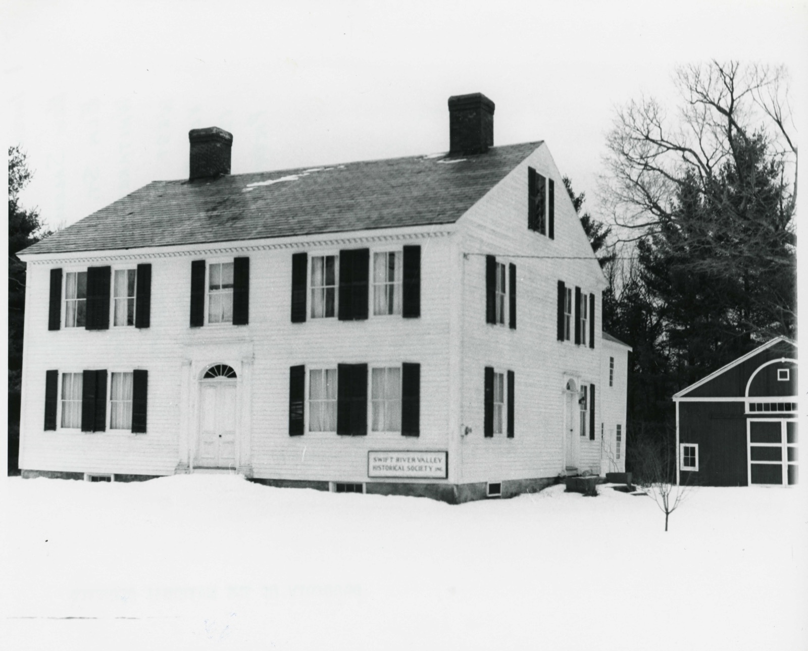
The Whitaker - Clary House, c. 1816, is one of the most impressive houses in the village of North New Salem. Situated on a slight knoll, it is set well back from the street. The front entrance has a door divided longitudinally that originally had glass panels. Although these have been replaced by wooden panels, the original panels are still stored in the house. This door possibly replaces an earlier one. The doorway, with its fluted pilasters and fan light, faces the street. The steps are of finished granite. The side door is also distinquished by a fan light, and finished granite steps lead up to it. The house is five bays wide, covered with white painted clap- boards on all sides. It is topped by a slate covered ridge roof, with cornice and dentils typical of this type of architecture.
There are two brick chimneys, each set in from the gable ends of the house, to accommodate three and four fireplaces respectively. The foundation of the house is made of finished granite slabs. The frame is all of hand hewn timbers, eight by eight inches in cross section, in excellent condition. The heavy bracing is mortised and tenoned into the main frame. The exterior of the main building remains in its original configuration, except for the twelve over twelve windows which were changed to two over two. The three bay ell, originally a single story high, was later raised to two stories. It has the same ridge roof and white clapboarding of the main house. The windows of the second story are six over six.
On the first floor, the center of one side is dominated by a double arched opening into an enclosed porch.
/ARCHITECT STATEMENT OF SIGNIFICANCE The significance of the Whitaker-Clary House is primarily architectural, although the architect is upknown, as are the craftsmen who actually built the house. It has retained almost all of its original details, thus remaining an outstanding example of Federal architecture in the localarea. A particularly noteworthy feature is the divided door of the front entrance, with its fan light and fluted pilasters, and the design of the dentils and cornice. Of major significance are the details of the finish of the interior that are in their original form and condition.
These include the intricately and delicately carved mantels in the four front rooms, the fireboards, the fine scroll pattern along the front stairway, and the stair treads and risers stencilled to resemble stair carpet. Nina Fletcher Little, author of the book American Decorative Wall Painting, stated that she had never before heard of stencilling used in the manner of this "stair carpet." A narrow back stairway leading from the kitchen to the bedchambers was probably used to reduce the wear and tear on this stair carpet design. The five fireboards, used to block off the fireplaces when not in use, are hand painted and grained in the manner of Moses taion, who was an itinerant painter of the Connecticut River Valley area at that time.
It is believed that he might have ot tosee Ba to 1s bo painted these fireboards. Each fireboard was individually fitted to the fireplace for which it was intended.
Quoted from the National Register nomination
for reference 75000257, 19 pages, held by the National Archives in Record
Group 79. See the
catalogue record.
Listed places nearby
2 within 8 miles
Other National Register properties close
enough to walk or drive between, ordered by distance from this one. Both
positions come from the same geocoding pass that matched these properties
to their map sheets.
Listing record. National Park Service National Register of Historic Places, listed-properties dataset, current to 2026-05-22.
Map join. Address geocoded through the United States Census geocoder, then tested against the published boundary of every sheet in the USGS Historical Topographic Map Collection.
How this page is made. Listing fields come from federal records; map-sheet coverage is a labelled coordinate-to-boundary calculation, not a source-field claim.
Wildfire. Short, Karen C. 2022. Spatial wildfire occurrence data for the United States, 1992-2020 [FPA_FOD_20221014]. 6th Edition. Fort Collins, CO: Forest Service Research Data Archive. https://doi.org/10.2737/RDS-2013-0009.6 Collected with United States Government funding and usable without additional permissions or fees.
Specimens. Global Biodiversity Information Facility (GBIF), https://www.gbif.org/. Only records licensed CC0 or CC BY are used. Records licensed CC BY-NC are excluded because this site carries advertising. Images are checked individually and any whose licence is non-commercial, no-derivatives or unreadable is refused.
Mines and quarries. USGS Mineral Resources Data System (MRDS) https://mrdata.usgs.gov/mrds/ A work of the United States government, no copyright under 17 U.S.C. 105.
Storms. NOAA National Centers for Environmental Information, Storm Events Database https://www.ncei.noaa.gov/stormevents/ A work of the United States government, no copyright under 17 U.S.C. 105. Narratives are quoted verbatim from the National Weather Service report and are not edited or summarised.
 Block
Block