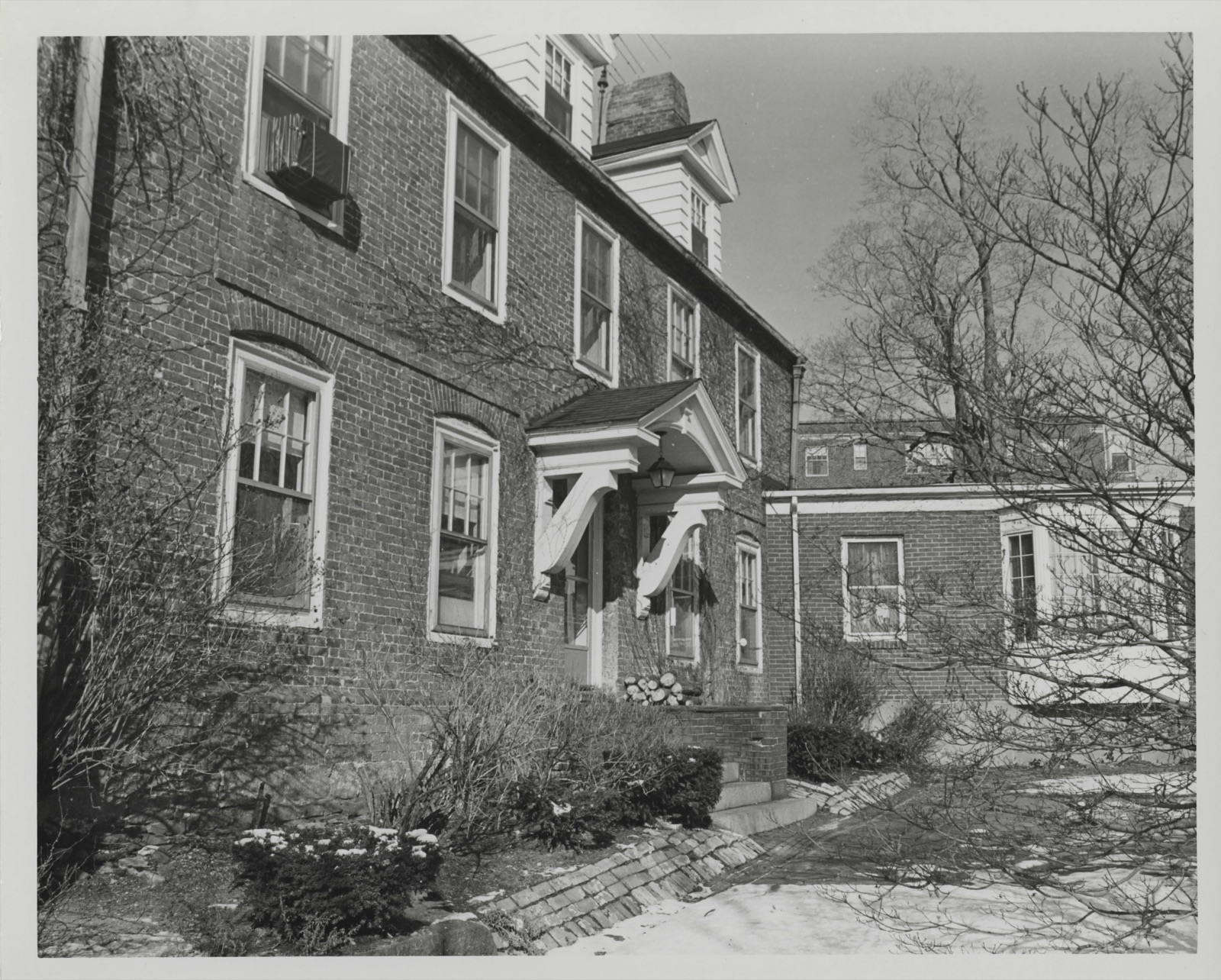
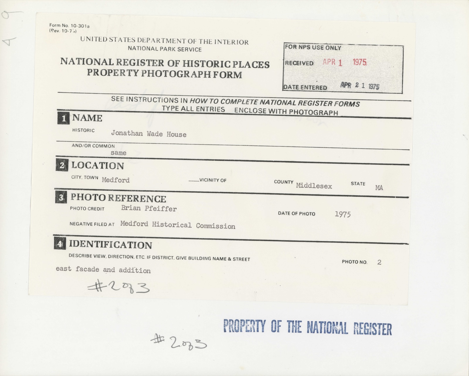
Photographs from the nomination case file, National Park Service records.
Wade, Jonathan, House
Listed on the National Register of Historic Places in
1975. A historic map-sheet match is not published yet. The record needs a coordinate-quality review before it can be joined to a sheet boundary.
From the record
“Medford owes its first settlement to the influence of Governor Cradock and Governor Winthrop. The first gentleman was the richest individual attached to the New England Company; and he gave his money with the freedom of an enthusiast.”
History of the Town of Medford, Middlesex County, Massachusetts : from Its First Settlement, in 1630, to the Present Time, 1855 (1855). Machine-read text.
one of 1100 National Register listings in Middlesex County · listed in 1975 · category: Building · one of 3 National Historic Landmarks in Middlesex County.
National Register reference number.75000283- the number the National Park Service assigned this property when it was listed, and the key its nomination file is catalogued under at the National Archives.
In writing this History, it has been my -wish to secure Medford such territory in time as its acres are territory in space. The gathering of these annals has been too long delayed. Time, moth, and rust have done thenfatal work on many valuable materials ; and some gentlemen, who felt a deep interest in their native town, have died without leaving any manuscript testimonies. When the history of New England shall be written, the true data will be drawn from the records of its towns. Now, therefore, in humble imitation of those States in our Union which have contributed each its block of granite, marble, or copper to the National Monument at Washington, I ask leave to offer Medford's historical contribution to the undecaying pyramidic monument which justice and genius will hereafter raise to the character and institutions of New England.
The records of the first forty years are lost. I have reproduced them, as far as I could, from documents in the General Court relating to our earliest history ; from several monuments of the first settlers, which are yet standing among us ; from authentic traditions which were early recorded ; and from collateral histories of the neighboring towns. To find the lost, and remember the forgotten, seems to be the province of the local annalist. From the moment I reached the first town-records of Medford (1674), I implicitly followed those excellent guides. Where I could save space by abbreviations, without altering the sense, I have occasionally done so in my quotations, and have used our modern orthography. The spirit of antiquarian research, now beginning to show itself, will lead to the discovery of many facts concerning the early history of Medford which are beyond my reach. These may soon render necessary a new history of the town ; and I hope it may be undertaken by a person whose ability and leisure will enable him to do far greater justice to the subject than has been within my power.
Regional context, not property-specific
evidence. The
federal wildfire occurrence database
lists 82 fires within 5 miles of Wade, Jonathan, House between
2015 and 2020, burning about 107 acres in total. None started naturally. 30 were recorded as arson.
Distance is straight-line from the map coordinates, so a fire counted
here may appear on a neighbouring settlement's page as well.
Reported cause
Fires
Arson/incendiarism
30
Missing data/not specified/undetermined
22
Debris and open burning
13
Recreation and ceremony
11
Smoking
3
Misuse of fire by a minor
2
Equipment and vehicle use
1
The most recent of
them, most recent first, with the day each was reported and the service
that recorded it.
Regional context, not property-specific
evidence. Museums hold 1,789 specimens
collected within 10 miles of Wade, Jonathan, House between 1898 and
1975: 797 Animalia, 542 Plantae, 384 Fungi, 28 Protozoa, 17 Bacteria, 12 Chromista, 9 Unrecorded. 12 distinct Species records are shown.
Collected by ?, A B Seymour, A B. Proper and others. Each is a
physical object with a catalogue
number, and each entry opens the museum's record. This is what was
collected and kept, not a survey of what lives here - nothing can be
concluded from a species being absent.
Regional context, not property-specific
evidence. The federal mineral resources record lists
18 workings within 5 miles of Wade, Jonathan, House: 10 plants, 5 past producers, 2 producers, 1 unknown.
12 still produce. What was taken out: Iron, Stone, Crushed/Broken, Lead, Gypsum-Anhydrite. Distance is straight-line from the
map coordinates, so a quarry counted here may appear on a neighbouring
settlement's page as well.
Regional context, not property-specific
evidence. The National Weather Service names
Medford, the town this property stands in, in 20 storm reports between 1994 and 2025: 14 thunderstorm wind, 3 flood, 1 flash flood, 1 hail.
No death or injury is recorded in these reports. Each account below is quoted exactly as the forecast office
filed it, from the NOAA Storm Events Database, and each date
opens the federal record of that event.
Trees were downed on Corey Street and Riverside Avenue. A telephone pole was downed onto Massachusetts Avenue and wires on Lawrence Street were downed, all by thunderstorm winds.
At 12:52 AM EST, a large tree was down on a car and laying across Auburn Street in Medford. At the same time, a tree was reported down on Summer Street and a large tree was down on George Street.
In Winchester, a large tree was down on a house, which took the chimney off the house on Alden Lane. A tree was down on Cambridge Street by the boat club. A tree was down on wires on wires on the 30 block of Allen Road. Trees and wires were down on Ledyard Road. A tree was down on the 70 block of Lawson Road.
In Medford, multiple trees were reported downed. In Somerville, a tree was down on a house on Vernon Street and a large branch was down on power lines on Walker Street.
No historic map-sheet match is published
for this property yet. That does not mean no map exists. This record needs
a coordinate-quality review before it can be joined to a sheet boundary.
Browse the county's mapped places while that work is
pending.
From the nomination file
2,519 words on record
When this property was proposed for the
National Register, someone wrote the case for it: what the building is,
and why it matters. That document is a federal record in the public domain.
It is quoted below word for word, never summarised. The text was read off the scanned case file by machine, so the
occasional stray character is the recogniser's and the 1970s
typewriter's.
Description of the property
The Jonathan Wade House, located at the corner of Bradlee Road and Brooks Lane near Medford Square, is a 22 story ridge roof brick building, constructed c. 1683-1689. The house has two inside chimneys at both gable ends, and a modern irregularly shaped 1 story addition on the north gable end. The house rests on a stone foundation and has a half cellar on the norther side. The eastern facade, five bays wide and laid in Flemish bond, hasja molded brick water table and three plain brick string courses between the first and second floors. The central door and the two windows on either side are topped by brick segmental arches. A1l the windows, including the three added dormers, have plain trim and modern 6/1 glass panes.
Both the design of this facade and its the house is laid in common bond) suggest that this wall dates from a major renovation in the first half of the eighteenth century. The resemblance of this facade to the Seccomb House (1756, now demolished) which stood nearby in Medford Square and was photographed before its demolition, gives support to this hypothesis. Alterations made to this facade around 1900 include the stairway to the front door, the bracketed hood with triangular pediment over the doorway, and the three pedimented dormers now covered in aluminum imitation clapboarding- An inscription reading "1650" over the front door also seems to date from this renovation.
The western elevation, laid in common bond, has the same window treatments as the eastern facade and has two string courses between the first and second floors. No dormers have been added here but the original central door was lowered and the first floor window on the north end was madé into a door c. 1900.
/ARCHITECT STATEMENT OF SIGNIFICANCE The Jonathan Wade House with its surviving seventeenth and eithteenth century facades is a rare example of early New England brick architecture. The Wade House, along with the Peter Tufts House and the earliest section of the Isaac Royall House are the only extant brick houses of the six or more built in Medford in the seventeenth century- Born in 1637, the son of Jonathan Wade of Ipswich, Major Jonathan Wade, Jr. is known to have been living in Medford as early as 1676 when he and his brother Nathaniel were on the Board of Selectmen. Jonathan also served as the first recorded town clerk of Medford and as the Captain of the "Three County Troop"; from an early date, both he and his brother held titles of "Major" for reasons which remain unclear.
It seems likely that both brothers had settled in Medford prior to the 1670's as their father had purchased between 900 and 1200 acres of the original Craddock grant in 1656 from Richard Russell (the deed was recorded in 1661). At the death of Jonathan Wade, Sr. in 1683, his land and buildings in Medford were divided equally between Nathaniel and Jonathan, the buildings on Jonathan's portion being valued at £ 200.. At the death of Jonathan, Jr. in 1689, specific mention is made of the brick house and the buildings on his farm which were then valued at£350. The increase of value in the land, as well as the notation of a brick house in court records suggest a construction date between 1683 and 1689 for the brick house.
Having died intestate, Jonathan, Jr.'s estate was divided among his heirs by court appointed administrators.
Quoted from the National Register nomination
for reference 75000283, 13 pages, held by the National Archives in Record
Group 79. See the
catalogue record.
Listed places nearby
6 within 8 miles
Other National Register properties close
enough to walk or drive between, ordered by distance from this one. Both
positions come from the same geocoding pass that matched these properties
to their map sheets.
Listing record. National Park Service National Register of Historic Places, listed-properties dataset, current to 2026-05-22.
Map join. Address geocoded through the United States Census geocoder, then tested against the published boundary of every sheet in the USGS Historical Topographic Map Collection.
How this page is made. Listing fields come from federal records; map-sheet coverage is a labelled coordinate-to-boundary calculation, not a source-field claim.
Wildfire. Short, Karen C. 2022. Spatial wildfire occurrence data for the United States, 1992-2020 [FPA_FOD_20221014]. 6th Edition. Fort Collins, CO: Forest Service Research Data Archive. https://doi.org/10.2737/RDS-2013-0009.6 Collected with United States Government funding and usable without additional permissions or fees.
Specimens. Global Biodiversity Information Facility (GBIF), https://www.gbif.org/. Only records licensed CC0 or CC BY are used. Records licensed CC BY-NC are excluded because this site carries advertising. Images are checked individually and any whose licence is non-commercial, no-derivatives or unreadable is refused.
Mines and quarries. USGS Mineral Resources Data System (MRDS) https://mrdata.usgs.gov/mrds/ A work of the United States government, no copyright under 17 U.S.C. 105.
Storms. NOAA National Centers for Environmental Information, Storm Events Database https://www.ncei.noaa.gov/stormevents/ A work of the United States government, no copyright under 17 U.S.C. 105. Narratives are quoted verbatim from the National Weather Service report and are not edited or summarised.
 Block
Block