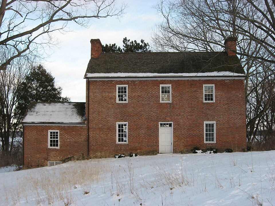
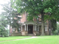
Built in 1830 in the Federal architecture. Listed on the National Register of Historic Places in
1975. A historic map-sheet match is not published yet. The record needs a coordinate-quality review before it can be joined to a sheet boundary.
From the record
“The David Crabill House is a historic house in Moorefield Township, Ohio, built c. 1825-30 with Federal-style elements adapted to the frontier.”
Wikipedia article David Crabill House, CC BY-SA 4.0.
one of 32 National Register listings in Clark County · listed in 1975 · category: Building · built in 1830, Federal architecture.
National Register reference number.75001341- the number the National Park Service assigned this property when it was listed, and the key its nomination file is catalogued under at the National Archives.
The ground it stands on
85,358 words
The chapter on Moorefield Township in The History of Clark County Ohio,, published 1881 names Springfield. This is what it says, exactly as the scans read.
Springfield at a very early date, and, in 1816, he completed the old two-story se Sues on the aut eee of Main street, west of the Run. While finishing the walls of this building, he also built a small one-story addition, where, in 1817, he began the manufacture of cut nails by hand, and the citizens were then supplied with the useful and much needed article of domestic manufacture. The nails used in the erection of Dr. Needham's house were made by Mr. Johnston. He afterward became a farmer, and erected a saw-mill on Donnel's Creek, in Pike Township, where he died Jan. 5, 1847, and his wife followed him Jan. 18, 1805. When John was 12 years old, entered a dry goods store in New Carlslie as clerk. After clerking some eight years, started a store in his own name, and continued in the dry goods business about twenty-eight years; he moved to Springfield in 1868, and went into the tobacco trade, and at present is the senior partner of the firm of Johnston & Son, wholesale dealers in tobacco and cigars. He was married, Nov. 21, 1848, to Mary Garst, to whom three children were born. But two, M. D. and Charles E. are now living. This wife departed this life Feb. 25, 1863. He was again married, March 9, 1869. This time to Mrs. Elizabeth Serviss, widow of George Serviss, deceased. Both wives daughters of John Garst. Mr. Johnston is one of the leading members; also one of the Trustees of the Center Street Methodist Epsicopal Church.
MELVINA M. McCLINTICK, Springfield; she is the widow of John McClintick, deceased; she lives on Mill Creek farm, three miles southwest of the city of Springfield. Mr. McC. was born in Pennsylvania Feb. 28, 1802; he came to Ohio in 1829, and settled in Columbus, where he followed " wagoning," transporting merchandise from place to place. He drove the team of horses in 1840, referred to in the history of Harmony Township. Mrs. McC. is a daughter of Joseph V. and Roxia (Savage) Melvin, and was born in Madison Co., Ohio, Jan. 26, 1821. Was married to Mr. McC. July 4, 1841, and in January, 1842, they removed to Clark Co., Ohio, and settled on the above-mentioned farm. He died Aug. 31, 1869, respected by all who knew him. Her father was a native of Tennessee, and came to Ohio in 1811, and settled in Madison County. Her mother was a native of Vermont, and came (with her parents) to Ohio in 1816, and settled in Champaign County, near the headwaters of the " Little Darby." Of Mr. and Mrs. McC.'s nine children, eight are still living, viz, John O., Edwin R., Roxia E., Eliza T. and Amanda M. (who have taken unto themselves wives and husbands respectively, and have left the parental roof), Samuel J., Mollie E. and William G. are still at home with their mother. John O. was a member of the 44th O. V. L, and while in
Regional context, not property-specific
evidence. The
federal wildfire occurrence database
lists 2 fires within 5 miles of Crabill, David, House between
2002 and 2002, burning about 16 acres in total. None started naturally. 1 was recorded as arson.
Distance is straight-line from the map coordinates, so a fire counted
here may appear on a neighbouring settlement's page as well.
Reported cause
Fires
Missing data/not specified/undetermined
1
Arson/incendiarism
1
The most recent of
them, most recent first, with the day each was reported and the service
that recorded it.
Regional context, not property-specific
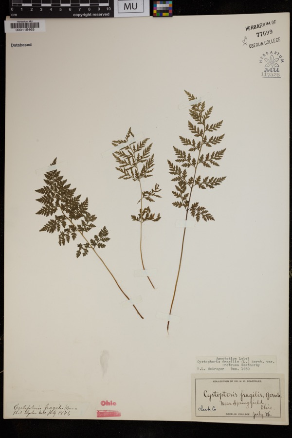
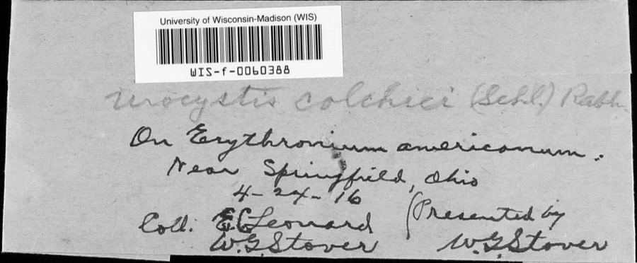
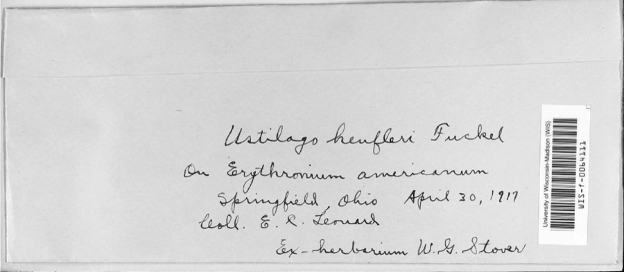
evidence. Museums hold 744 specimens
collected within 10 miles of Crabill, David, House between 1840 and
1974: 488 Animalia, 211 Plantae, 44 Fungi, 1 Chromista. 12 distinct Species records are shown.
Collected by 73.7; J.H., A. Barron, A. N. Leeds and others. Each is a
physical object with a catalogue
number, and each entry opens the museum's record. This is what was
collected and kept, not a survey of what lives here - nothing can be
concluded from a species being absent.
Regional context, not property-specific
evidence. The federal mineral resources record lists
7 workings within 5 miles of Crabill, David, House: 5 past producers, 2 producers.
2 still produce. What was taken out: Sand and Gravel, Construction. Distance is straight-line from the
map coordinates, so a quarry counted here may appear on a neighbouring
settlement's page as well.
Regional context, not property-specific
evidence. The National Weather Service names
Springfield, the town this property stands in, in 107 storm reports between 1994 and 2023: 56 thunderstorm wind, 31 hail, 10 flash flood, 4 flood.
The reports record 2 injuries. Each account below is quoted exactly as the forecast office
filed it, from the NOAA Storm Events Database, and each date
opens the federal record of that event.
Several utility poles were down, a barn was blown off of its foundation, and minor damage occurred to a house and an apartment due to damaging thunderstorm winds.
A tornado touched down along Moorefield Road, just to the east of State Route 4. Trees were either uprooted or snapped off towards their tops with additional large limbs down from other trees. Some minor structural damage occured as well along the 250 yard damage path. The tornado was rated EF-0 with top wind speeds of 70 mph.
A barn was blown over on Victory Road. Several trees and power lines were down on Sintz Road. In another location, a roof was peeled back due to damaging thunderstorm winds.
There was scattered damage at a mobile home park affecting four mobile homes. A metal carport was heavily damaged. Three evergreen trees were also downed.
Numerous 12 to 15 inch diameter trees were downed in Snyder Park. A tree fell on a house on Upper Valley Pike. Part of the roof was removed as a result.
Three to four inches of rain fell across southern Clark County as thunderstorms pushed slowly east during the late evening. A car was washed into a flooded ditch near the Springfield Airport along US 68. High water caused several road closures across the southern part of the county, with basements flooded on the south side of Springfield.
2 papers published in this town,
digitised by the Library of Congress and free to read: 0 issues,
0 pages. Every page is searchable, so a name or a street can be
looked for directly in what the town printed about itself at the time.
No historic map-sheet match is published
for this property yet. That does not mean no map exists. This record needs
a coordinate-quality review before it can be joined to a sheet boundary.
Browse the county's mapped places while that work is
pending.
From the nomination file
2,287 words on record
When this property was proposed for the
National Register, someone wrote the case for it: what the building is,
and why it matters. That document is a federal record in the public domain.
It is quoted below word for word, never summarised. The text was read off the scanned case file by machine, so the
occasional stray character is the recogniser's and the 1970s
typewriter's.
Description of the property
wing, constructed of locally fired brick. Originally, there was no direct second floor and a rear door. To the left there is a door leading into a interior walls, coated with several layers of plaster and fitted with decoratove In both rooms, the fireplaces and hearths required complete debricking, mantel installed, copying the details of those found in other, contemporary had rotted and sunk. These have been leveled, a cement footer installed and new, reproduction flooring laid. were destroyed by vandals, but reproductions have been made and await installation.
The second floor also has two main rooms, with a small storage room above the right, vertical wood siding encloses a small closet and the very narrow north bedroom is utterly plain, having neither fireplace nor cupboards, onlyr the projection of the chimney flue, into which a stove could be attached. The attic has flooring which is not nailed down and two windows at each end, CONDITION UNEXPOSED EXCELLENT UNALTERED RUINS FAIR XXDETERIORATED was also damaged. cabinets constructed between the projection of the fireplace and the exterior dining room wall allowing direct access from one room to the other. A continuous chair rail encircles the entire floor.
The David Crabill House, architecturally, is perhaps not unique, but it merits and primitive, it combined the grace and symmetry of the Federal design with an out a side door of the dining room, along a porch and then enter the kitchen. In another sphere, the David Crabill House is significant for its place in local 1400-1499 1600-1699 INVENTION 1500-1599 1700-1799 fireplace. ARCHEOLOGY-HISTORIC SIGNIFICANCE ART EDUCATION LAW AGRICULTURE PERIOD RELIGION TRANSPORTATION THEATER EXPLORATION/SETTLEMENT ECONOMICS SCIENCE BUILDER/ARCHITECT INDUSTRY SCULPTURE XXRCHITECTURE LITERATURE is receiving),but also recognition by inclusion in the National Register.
respected today.The David Crabill House is representative of their struggles _COMMUNICATIONS local history In short, the Crabill House is an interesting combination of the earlier designs containing three flues which are reminiscent of the earlier designs found in 18th finally the establishment of a fine farm and home are paradigmatic of the American of Pennsylvania and Virginia transpianted to Ohio. course, in extremely cold weather the cooking could be done on the dining room -COMMERCE 1900- Pioneer of the first quarter of the 19th century.As such, they have achieved a massive effect, as well as an upward thrust it would otherwise lack.Equally of _PHILOSOPHY - MILITARY -MUSIC -COMMUNITY PLANNING SPECIFIC DATES Ca.
1830 Their early privations, hard work, service in the War of 1812 and great credit as a splendid example of the late Federal style as adapted to the western frontier. Constructed about 1825-30 in an area which was still fairly raw 1808, David Crabill and his wife Barbara belong to one of the earliest strata of history.
Quoted from the National Register nomination
for reference 75001341, 14 pages, held by the National Archives in Record
Group 79. See the
catalogue record.
Listed places nearby
6 within 8 miles
Other National Register properties close
enough to walk or drive between, ordered by distance from this one. Both
positions come from the same geocoding pass that matched these properties
to their map sheets.
Listing record. National Park Service National Register of Historic Places, listed-properties dataset, current to 2026-05-22.
Map join. Address geocoded through the United States Census geocoder, then tested against the published boundary of every sheet in the USGS Historical Topographic Map Collection.
How this page is made. Listing fields come from federal records; map-sheet coverage is a labelled coordinate-to-boundary calculation, not a source-field claim.
Wildfire. Short, Karen C. 2022. Spatial wildfire occurrence data for the United States, 1992-2020 [FPA_FOD_20221014]. 6th Edition. Fort Collins, CO: Forest Service Research Data Archive. https://doi.org/10.2737/RDS-2013-0009.6 Collected with United States Government funding and usable without additional permissions or fees.
Specimens. Global Biodiversity Information Facility (GBIF), https://www.gbif.org/. Only records licensed CC0 or CC BY are used. Records licensed CC BY-NC are excluded because this site carries advertising. Images are checked individually and any whose licence is non-commercial, no-derivatives or unreadable is refused.
Mines and quarries. USGS Mineral Resources Data System (MRDS) https://mrdata.usgs.gov/mrds/ A work of the United States government, no copyright under 17 U.S.C. 105.
Storms. NOAA National Centers for Environmental Information, Storm Events Database https://www.ncei.noaa.gov/stormevents/ A work of the United States government, no copyright under 17 U.S.C. 105. Narratives are quoted verbatim from the National Weather Service report and are not edited or summarised.
 Block
Block