Listed on the National Register of Historic Places in
1975. A historic map-sheet match is not published yet. The record needs a coordinate-quality review before it can be joined to a sheet boundary.
From the record
“The wild beasts still roamed with great freedom close to the houses of the settlers, and numerous were the fatal shots fired at the deer, not only in their forest retreats but even in the edge of the clearings. Stowe speaks of killing thirty or forty in a year.”
History of Cuyahoga County Ohio (1870). Machine-read text.
one of 338 National Register listings in Cuyahoga County · listed in 1975 · category: Building · one of 3 National Historic Landmarks in Cuyahoga County.
National Register reference number.75001371- the number the National Park Service assigned this property when it was listed, and the key its nomination file is catalogued under at the National Archives.
The ground it stands on
6,580 words
The chapter on Strongsville City in History of Cuyahoga County Ohio, published 1870 names Strongsville. This is what it says, exactly as the scans read.
To that cabin in the forepart of March, 1816, came John Hilliard, accompanied by his wife (the first white woman who ever resided in Strongsville township), and his young daughter, Eliza. Mrs. Hillard took up her residence in the log mansion and became the housekeeper of the party. A surveyor was obtained from Newburg, and the work of subdividing the township into lots was speedily begun. Whitney, Goodell, Church and Fuller acted as chain-men. The lots were made half a mile square, thus containing a hundred and sixty acres each. Had the townships been just five miles square, as was originally intended, there would have been just a hundred lots of that size. A hundred lots were actually surveyed, but the five miles east and west did not quite hold out, and the lots in the westernmost tier were only about a third of a mile wide. They were numbered, beginning with number one in the southwestern corner, thence running north to number ten, in the north_ western corner, thence baek in the next tier on the east to number twenty, and so on forth and back, closing with number one hundred in the northeastern corner.
Not only was there no grain in the new settlement, but it was extremely scarce in the older localities around, owing to the cold summer of 1816. Mr. Abial Haines mentions that in January, 1817, he was compelled to go as far as Harrisville, (now on the south line of Medina county) some thirty miles distant from Strongsville, to. obtain wheat. The road could with difficulty be traveled by a yoke of oxen with a sled; the wolves came in sight after dusk, showing their angry teeth, but declining to come in reach of young Haines stout club, and after he arrived in Harrisville he had to thresh his wheat and winnow it with a "'hand-fan" before he could get it. The price was a dollar a bushel.
Regional context, not property-specific
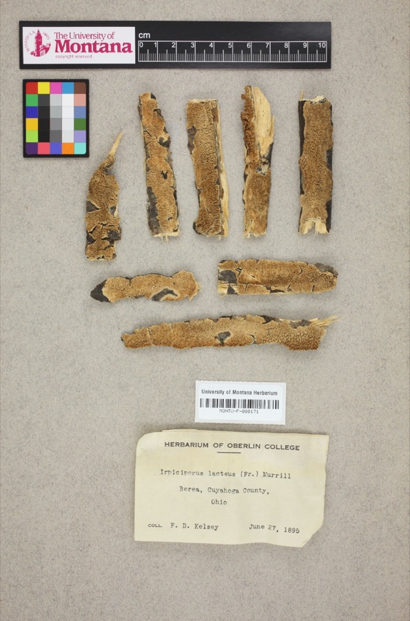
evidence. Museums hold 734 specimens
collected within 10 miles of Pomeroy, Alanson, House between 1883 and
1975: 675 Animalia, 41 Plantae, 14 Fungi, 4 Protozoa. 12 distinct Species records are shown.
Collected by A. D. Huryn, A. Woolman, Allen, John and others. Each is a
physical object with a catalogue
number, and each entry opens the museum's record. This is what was
collected and kept, not a survey of what lives here - nothing can be
concluded from a species being absent.
Regional context, not property-specific
evidence. The National Weather Service names
Strongsville, the town this property stands in, in 22 storm reports between 1996 and 2023: 13 hail, 7 thunderstorm wind, 2 flash flood.
No death or injury is recorded in these reports. Each account below is quoted exactly as the forecast office
filed it, from the NOAA Storm Events Database, and each date
opens the federal record of that event.
Thunderstorm winds downed a couple trees and some power lines in Strongsville. A house along Deerfield Drive was damaged by a fallen tree. At least 3000 electric customers in Strongsville lost power during this event.
Several reports came in via social media and broadcast media of thunderstorm winds causing several trees down near the Stillbrooke residential development in Strongsville.
No historic map-sheet match is published
for this property yet. That does not mean no map exists. This record needs
a coordinate-quality review before it can be joined to a sheet boundary.
Browse the county's mapped places while that work is
pending.
From the nomination file
4,763 words on record
When this property was proposed for the
National Register, someone wrote the case for it: what the building is,
and why it matters. That document is a federal record in the public domain.
It is quoted below word for word, never summarised. The text was read off the scanned case file by machine, so the
occasional stray character is the recogniser's and the 1970s
typewriter's.
Statement of significance
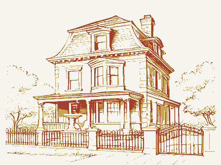
brick Greek Revival house still standing in Cuyahoga County, in in Strongsville in 1820. After the Pomeroys' arrival, Alanson University, Berea College, Kentucky, and Oberlin. The county industry, skill and integrity, by dint of perseverance and good 1848 Conservation Commerce losophy Engineering Architecture Transportation SIGNIFICANCE Aboriginal Communications Landscape Theater Agriculture Invention Music Industry The Pomeroy is probably the most architecturally significant Sculpture Social/Human- Congregational Church building. He was a justice of the peace and Pre-Columbian spite of its neglected condition. Its builder was the most prominent citizen in the town of Strongsville.
setts.In 1822 his parents moved to Strongsville.The township Religion/Phi made substantial donations to Western Reserve College, Baldwin Prehistoric management he gradually acquired a considerable property." home.The elder Pomeroy died in 1835,and Alanson continued to ous farmers.Pomeroy was extremely active and beloved in this farm and also engaged in the mercantile business at Strongsville and detail is one of the finest Greek Revival dwellings in the region. helped to clear his father's land and make the farm a comfortable one of the incorporators of the First National Bank of Berea.He but is not occupied and is for sale. community.Next to his house on the south stood his store and had been settled in 18l6 by John S.
Strong and a handful of other Political Alanson Pomeroy was born in 1805 in Northampton, Massachu- post office, now gone.South of the store he donated land for the age of 72.The property is still owned by the Pomeroy family settlers.
Quoted from the National Register nomination
for reference 75001371, 20 pages, held by the National Archives in Record
Group 79. See the
catalogue record.
Listed places nearby
6 within 8 miles
Other National Register properties close
enough to walk or drive between, ordered by distance from this one. Both
positions come from the same geocoding pass that matched these properties
to their map sheets.
Listing record. National Park Service National Register of Historic Places, listed-properties dataset, current to 2026-05-22.
Map join. Address geocoded through the United States Census geocoder, then tested against the published boundary of every sheet in the USGS Historical Topographic Map Collection.
How this page is made. Listing fields come from federal records; map-sheet coverage is a labelled coordinate-to-boundary calculation, not a source-field claim.
Specimens. Global Biodiversity Information Facility (GBIF), https://www.gbif.org/. Only records licensed CC0 or CC BY are used. Records licensed CC BY-NC are excluded because this site carries advertising. Images are checked individually and any whose licence is non-commercial, no-derivatives or unreadable is refused.
Storms. NOAA National Centers for Environmental Information, Storm Events Database https://www.ncei.noaa.gov/stormevents/ A work of the United States government, no copyright under 17 U.S.C. 105. Narratives are quoted verbatim from the National Weather Service report and are not edited or summarised.
 Block
Block